Geophysical Survey Systems Inc (GSSI) is the world’s leading manufacturer of ground penetrating radar (GPR) equipment as featured in the video above, which is used for a range of applications such as archaeology, geology and environmental, utility detection, concrete inspection and bridge and road condition assessment.
GSSI’s New PaveScan RDM Asphalt Density Assessment Tool
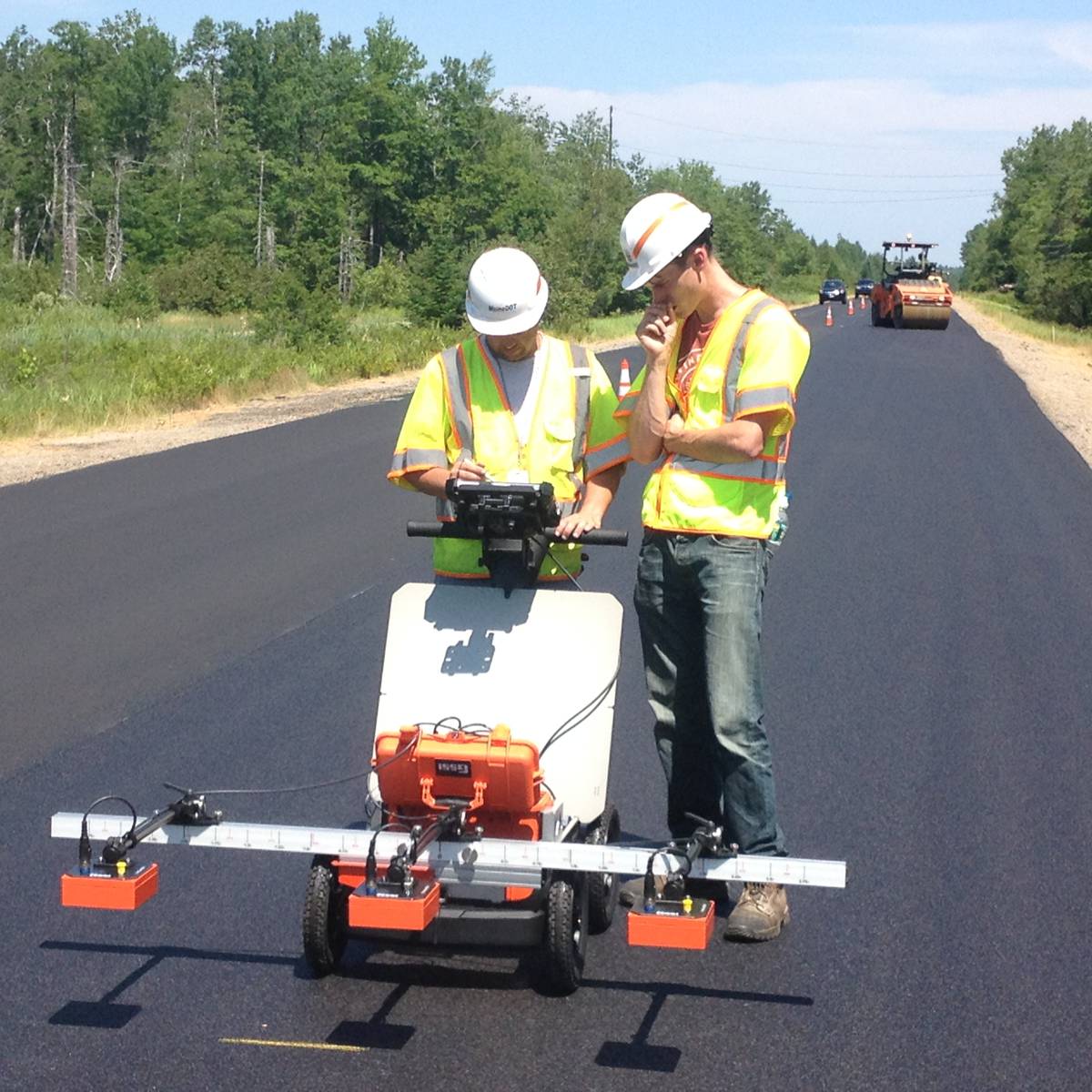
For testing asphalt density in real-time and non-destructively, GSSI has just announced its new PaveScan RDM asphalt density assessment tool, which provides accurate real-time measurements to ensure pavement life and quality.
First unveiled at the 2016 Transportation Research Board (TRB) Annual Meeting, PaveScan is already generating excitement and interest among those seeking an easy and affordable assessment tool to non-destructively determine asphalt integrity during application.
The PaveScan RDM system is ideal for uncovering problems that occur during the paving process, including poor uniformity and significant variations in density. By avoiding these problems, PaveScan RDM helps avoid such premature failures as road raveling, cracking, and deterioration along joints.
PaveScan automatically measures the dielectric value to identify anomalies in real-time. In addition, the dielectric values can be used to as a means to correlate percent voids and density in new pavement. The innovative technology enables users to obtain critical density data for QA/QC of new pavements. Unlike other options like nuclear density gauges or radioactive alternatives, PaveScan does not result in any site hazards or require closing off work areas.
Seamlessly integrating with GPS systems, PaveScan features a flexible, modular design that facilitates easy and efficient operation and data collection.
It is available as a small, portable single sensor cart-based system or a three-sensor configuration using an extended cart or vehicle configuration. The entire system is composed of a cart or vehicle mount, one to three sensors, a customized Panasonic FZ-G1 ToughBook, a concentrator box and a variety of system accessories. A survey wheel encoder is also mounted.