Optimizing Traffic Challenges
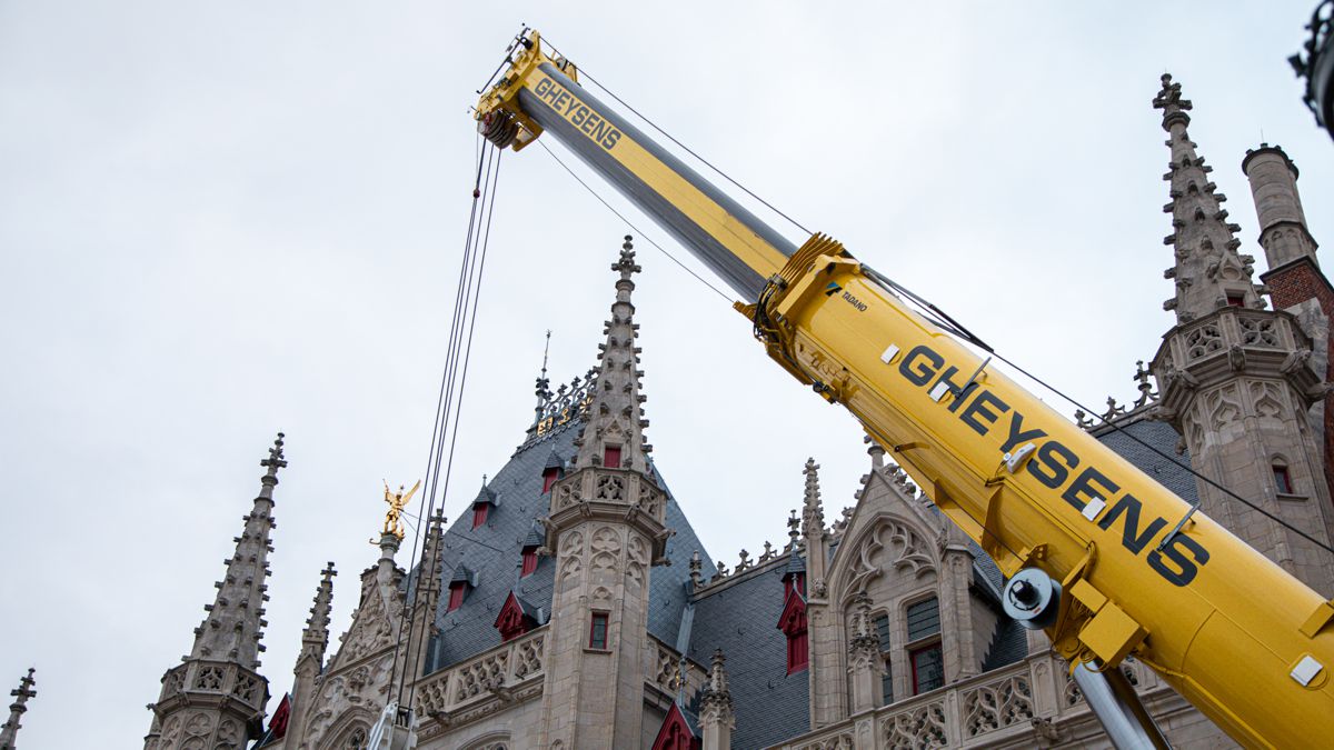
In a ground-breaking move towards smarter traffic management, the Agency for Roads and Traffic in Belgium recently took to the skies by deploying drones to investigate the traffic dynamics at the renovated Tiensepoort intersection in Leuven.
This week, during the annual Polis conference, xyzt.ai, a leading Belgian technology company specializing in advanced data processing with offices in Leuven and Hasselt, questions the use of drone-based traffic analysis.
Tiensepoort Transformation Reveals Traffic Issues
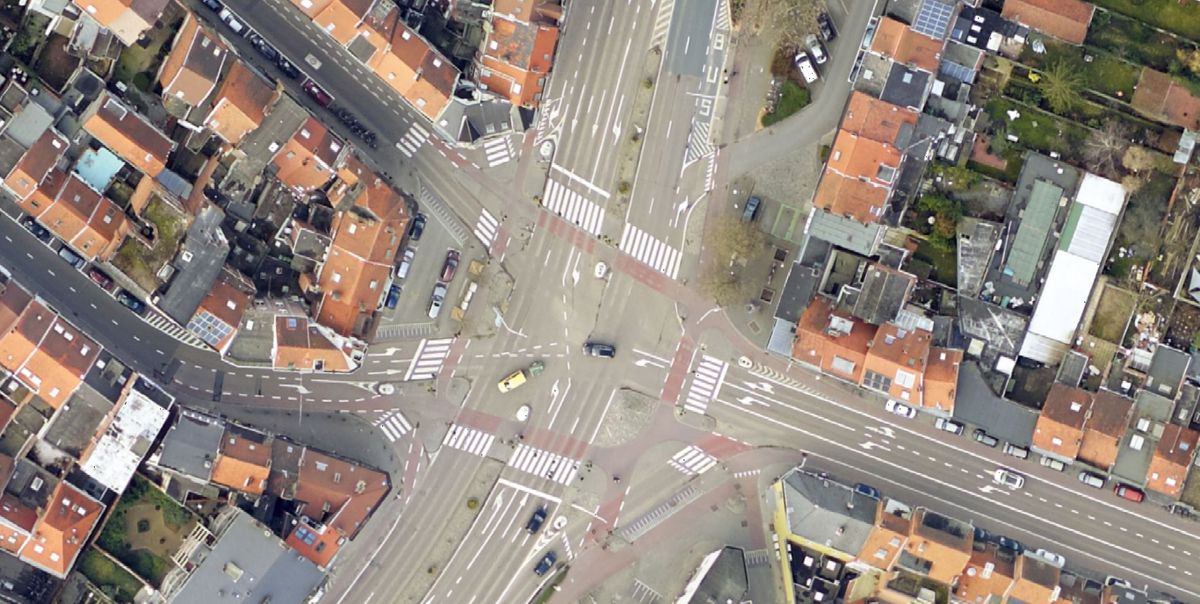
The Tiensepoort intersection, one of the busiest junctions in Leuven, has recently undergone significant changes, including the removal of bypasses and the introduction of a green signal for pedestrians and cyclists in all directions (square green formula). However, these well-intentioned changes did not yield the desired results and resulted in considerable public frustration.
Drones Take Flight, but Is This the Most Efficient Solution?
In response to increasing traffic challenges, the agency opted for a high-tech solution: deploying drones during peak hours to capture an aerial perspective of the situation.
The question now arises whether this is the best solution for such comprehensive traffic analysis. As reported on the VRT news site, the use of drones has some drawbacks. In addition to the cost of deployment, they provide only a snapshot and cannot be used in adverse weather conditions.
Fast Insights: Floating Vehicle Data Surpasses Drones
This is where xyzt.ai came in. In a quick and insightful 30-minute analysis conducted by xyzt.ai in collaboration with their data partner INRIX, it quickly became apparent that drones are not always the key to rapidly, efficiently, and budget-friendly unlocking traffic insights.
The necessary data for a thorough analysis is already immediately available as so-called floating vehicle data. This data is collected from connected vehicles, where the movement trajectory of vehicles (a sequence of data points with location and time) is accurately and reliably gathered and aggregated.
The data is uploaded to the xyzt.ai platform, and within 30 minutes, insights into the traffic situation at any time of day, regardless of weather conditions, can be obtained. Additionally, quick comparisons can be made between the situation before and after traffic changes over significantly longer time periods than possible with drones.
For this analysis, two months of floating vehicle data were used: October 2022 before the changes and October 2023 after the adjustments. This allows the team to go beyond snapshots and compare the current situation with that before the changes.
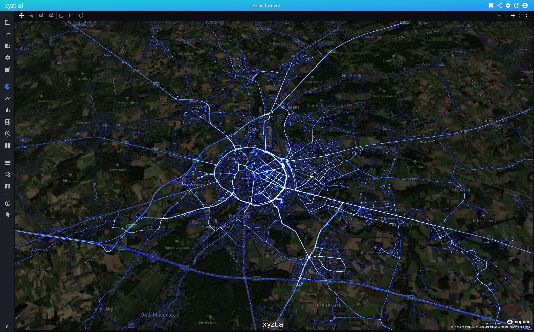
“The xyzt.ai platform brings order to that chaos and makes it easier to conduct analyses based on data. Cities can map where speeding occurs, where cars most frequently brake in turns or at intersections, analyse new traffic situations, conduct road surface analyses, etc. This enables them to efficiently take concrete and informed actions“, explains Bart Adams, CTO of xyzt.ai.
Lunchtime Reveals Traffic Hotspots
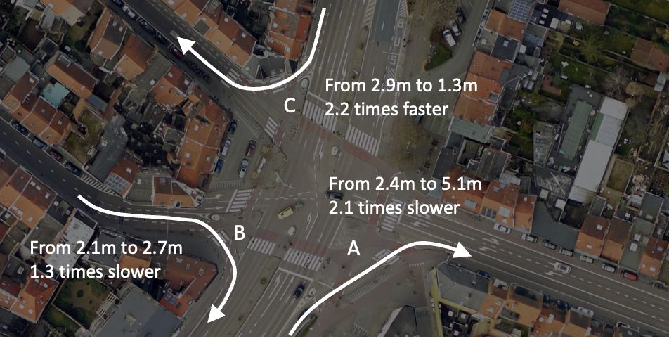
Analyses with the xyzt.ai platform and INRIX floating vehicle data confirm the frustrations. Traffic flows up to 4 times (!) slower than before the intersection modifications.
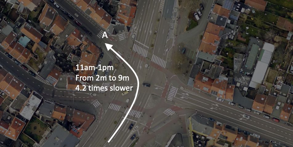
Interestingly, the xyzt.ai analysis revealed that the most critical traffic challenges do not occur during traditional commuting hours but rather during lunch breaks. Despite this crucial insight, the agency chose not to use drones during this important period.
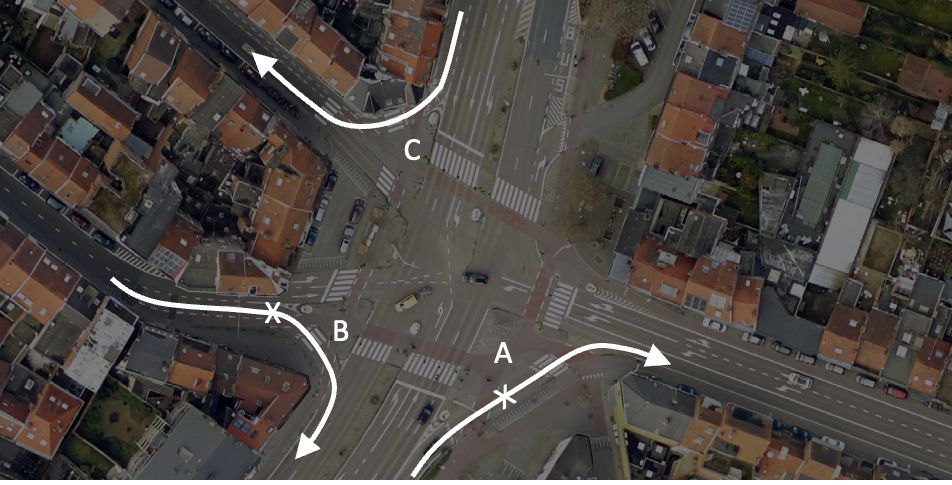
Below is a summary of the analysis and insights:
1. Traffic turning left or right from the south experiences an average delay factor of two, with lunchtime delays more than four times as high.
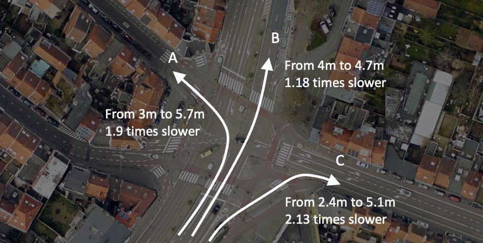
2. Traffic entering the city from the east experiences only a marginal increase in average travel time, but lunchtime delays reflect a fourfold trend.
3. The removal of the two southern bypasses significantly impacts traffic speed, with vehicles still able to use the remaining northern bypass moving twice as fast as the previous year.
Return on investment
The return on investment (ROI) of using data-driven analyses based on floating vehicle data is enormous. Knowing that deploying drones to collect data has a significant cost in man-hours and that the cost of installing and maintaining measurement infrastructure can reach up to 1M EUR per kilometre, a data-driven software solution like xyzt.ai is easily 10 to 100 times more efficient.
Are Drones Really Necessary?
In the quest for optimizing traffic management, governments and traffic organizations are increasingly looking to innovative solutions. Drones can certainly play a role in this. However, we must not lose sight of the fact that much data is readily available that can be deployed more simply, inexpensively, and quickly. This includes floating vehicle data.
So, do drones add any value? Drones can also map non-connected traffic, such as pedestrians and cyclists, and detect (almost) incidents between, for example, cyclists and motorists. However, for in-depth traffic flow analyses spanning long periods, floating vehicle data is the best alternative to quickly gain insights.
More insights can be found in this blog post.
“The visionary technology of xyzt.ai helps private and public decision-makers quickly and efficiently address the increasingly important global mobility and environmental issues,” says Simon Alexandre, General Partner & Co-Founder of The Faktory Fund.
xyzt.ai: A Global Partner for Mobility Experts
Meanwhile, xyzt.ai is trusted globally by governments, including the city of Hamburg, Auto-bahn GmbH, State of North Rhine-Westphalia, and Texas A&M Transportation Institute, among others. They effortlessly extract profound insights from floating vehicle data, ushering in a new era where cumbersome investments in infrastructure are a thing of the past.
“The combination of the right data and technology allows for more efficient and safer movement, while also reducing greenhouse gas emissions. INRIX is delighted to collaborate with like-minded companies such as xyzt.ai to improve mobility from the first to the last mile,” says Holger Hochguertel, Director of Sales and Business Development at INRIX.
Visit xyzt.ai at the Polis Conference, November 29-30, 2023, Brabanthal in Leuven, booth S33.