Enhancing accuracy in Landslide Monitoring with GNSS
In a new study published on 13 November 2023, in the journal Satellite Navigation, researchers from Chang’an University have developed a novel approach using the Precise Point Positioning (PPP) technique combined with a cumulative sum control chart (CUSUM) method.
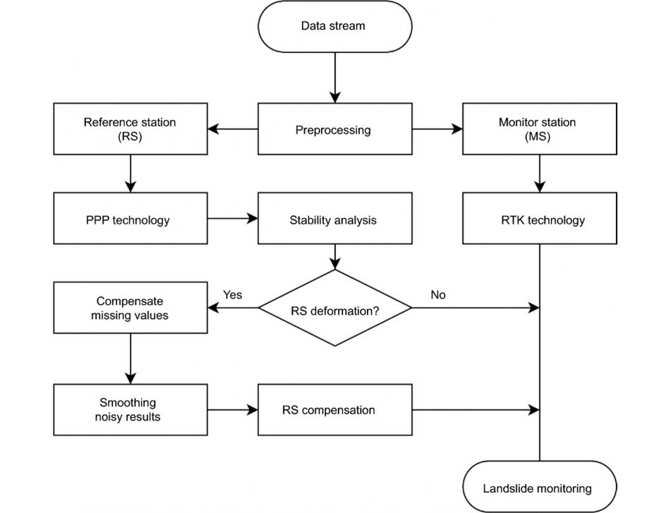
This method enables the analysis of reference station stability and compensates for deformation at monitoring stations.
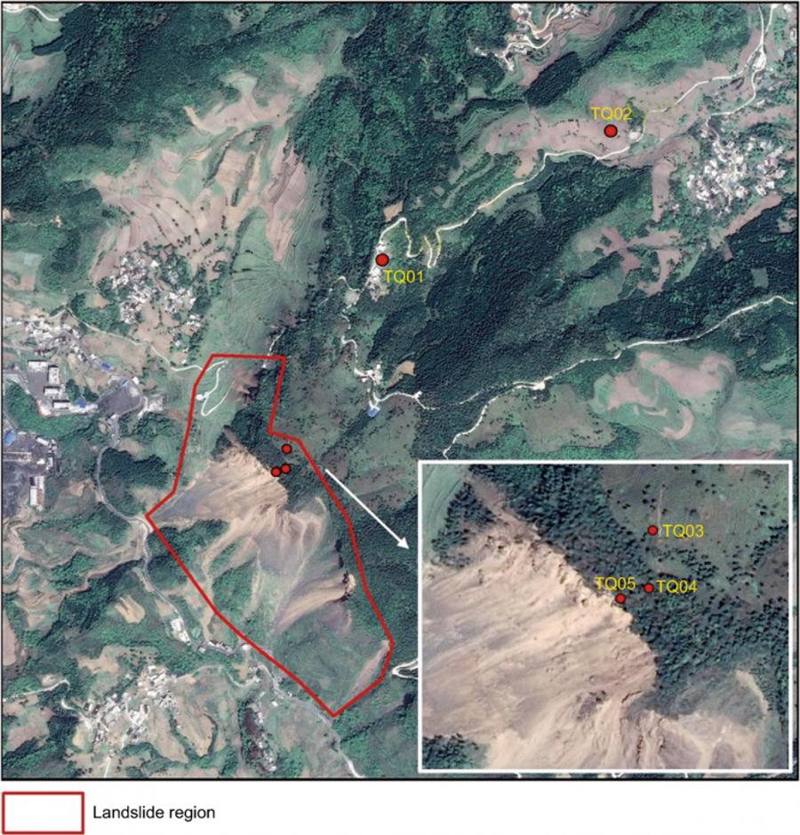
In the study conducted at the Tengqing landslide in Liupanshui, Guizhou Province, Southwest China, an innovative method was applied, showcasing a significant leap in landslide monitoring using GNSS PPP technology. This research, conducted from October 2019 to October 2020, utilized advanced GNSS monitoring data, processed through sophisticated software specifically developed by the research team.
At the core of this method was the Precise Point Positioning (PPP) technique, essential for obtaining highly accurate coordinates of the reference station, and the Cumulative Sum Control Chart (CUSUM) method, adept at detecting any shifts in position. This dual approach ensured a high level of accuracy and reliability in the data obtained. Upon detecting any instability in the reference stations, the system was designed to make precise adjustments to the displacements at the monitoring stations.
This methodology not only enhanced the precision in tracking the movements of the landslide but also significantly improved the overall reliability of the monitoring results.
The study stands out as a pivotal contribution to the field of geological disaster monitoring, demonstrating the effectiveness and potential for wider implementation of GNSS technology in landslide monitoring.
The success of this approach holds promise for its application in various other geological monitoring scenarios, particularly where reference station stability is a concern. This technique can be adapted to monitor different types of landslides and geological movements, providing accurate, reliable data crucial for early warning systems and disaster management strategies.