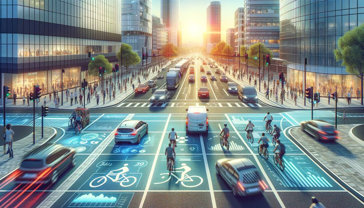
Analysing Road User Interactions to make the Right Call on Close Calls
Vision Zero is a global mission to eliminate all traffic fatalities and severe injuries from our roads by 2041. It’s an ambitious but absolutely achievable goal. However, while casualties have been gradually declining over the last decade, data recently released by the DfT shows that killed and seriously injured (KSI) casualties on UK roads have only fallen by 3% since 2019. Moreover, it’s widely known that improving perceptions of cyclist safety is a key route to unlocking more cycling, which is also critical to council, government and global environmental goals.
If we are to achieve Vision Zero, the rate of decline needs to accelerate dramatically. Why is road safety not keeping up?
Why near miss data is limited
There is a major need to understand traffic behaviour in a much more precise and nuanced way. We need far greater detail on how different modes of transport cohabit the road space and interact with each other to understand how hazardous scenarios come about. Only then can we take tangible steps to increase the safety of our roads – thereby encouraging active travel – and get on the path to achieving Vision Zero.
Many authorities aren’t set up or incentivised to act pre-emptively. Instead, they react to KSI and STATS19 data that is published retrospectively. But while technology in the past may not have had the capability to accrue the level of insight and data needed for a proactive approach, this is no longer the case.
How do you determine what a ‘near miss’ is?
Several aspects feed into classifying a near miss, but one that is perhaps the most relevant for this piece is spatial precision: the unique ability to understand each road user’s dimensions and their relative proximity to one another in the road space. Why does this matter?
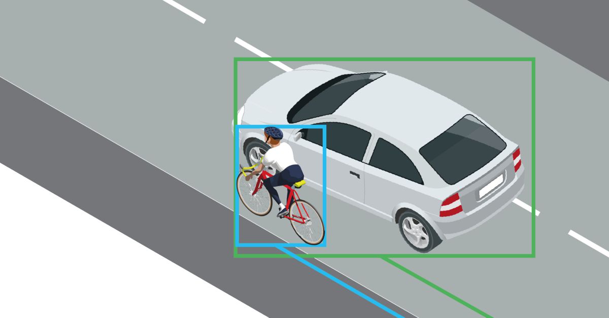
The importance of this is illustrated in the limitations of 2D detection technology vs 3D detection. The lack of depth in 2D images means that the technology cannot precisely pinpoint the proximity between two road users. As the picture shows, 2D detection tracks road user movement from the baseline centre point of each detection box and is unable to accurately position objects in the road space. This could lead to safe behaviours being interpreted as dangerous, or worse, real near-miss scenarios not being classed as dangerous.
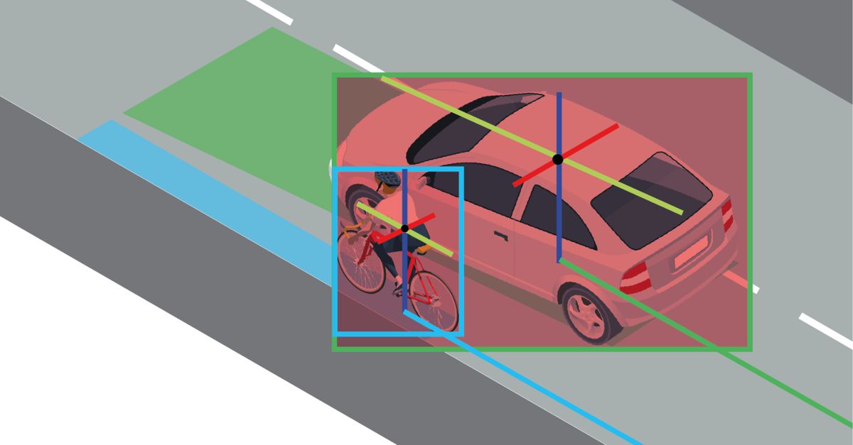
Key to identifying a near miss is a precise understanding of the shape and size of road users and their geolocation. This level of accuracy can only be achieved with 3D detection. Tracking road users as 3D objects provides precise movement, dimension and speed data to ascertain the true proximity between road users.
This is vital for analysing levels of near-miss accidents at a location and avoiding any false positives. This proximity can then be assessed against a range of other factors captured, including the encroachment time between the two road users and estimating the time to collision by factoring their speed and direction (if they were to continue their pathway).
How do you turn data into action?
The latest AI-powered computer vision technology can gather a vast range of data on near-miss incidents. With access to this real-time data, councils, decision-makers and analysts can implement targeted strategies and put this data into action. We believe that this needs to take a three-step approach:
- Data: verify issues
- Analysis: diagnose the root cause
- Action: identify and evaluate countermeasures
Through data, authorities can see the number of near-miss events at different locations by the hour, during the day, and over multiple days and months. These can be explored further by filtering for severity metrics such as speed or proximity, and the near miss rates for different vehicle classes can be compared (eg “how many cyclist / HGV near misses were there, vs cyclist/car?”)
With these insights at their fingertips, Active Travel Officers, Transport Planners and Road Safety Engineers can analyse the rate of near misses, explore heatmaps of near miss events, and view blurred videos to better understand how these incidents occur. For instance, data might show how speeding vehicles overtake cyclists without leaving a suitable passing distance or pull out across a cyclist’s path when making a turn. Or it could show whether incidents are occurring where pedestrians don’t make use of pedestrian crossings to cross roads. They can then instantly diagnose and assess hazardous locations and spot the areas where most near misses occur (or don’t).
Authorities are then well-positioned to use this insight to take pre-emptive action. They can decide if and where to implement an intervention, such as a new segregated lane or crossing. Once implemented, councils can conduct a before & after comparison using baseline and post-intervention data, as well as a long-term analysis of an intervention’s effectiveness. This can also take place in real-time to prioritise and instantly assess interventions.
Sometimes it can be really clear as to where road safety interventions are needed. But crucially, analysing near-miss data can also identify where intervention isn’t needed, helping to save on costs and avoid a potential public backlash to an unnecessary scheme.
The Road to Vision Zero
It is up to decision-makers to use the data and tools to determine the criticality of near misses. But as more data is collected, both on the roads and from authorities, the clearer this will become. The more collective an approach we can take to road safety, the better we can accelerate the journey to reaching Vision Zero, and with it, the road to promoting cycling and thus achieving Net Zero goals as well
AI-driven 3D detection can help us achieve Vision Zero more rapidly. Armed with this innovative technology, authorities can adopt a pre-emptive strategy that harnesses detailed data to spot and understand near misses. That way, they can make the right – targeted, precise and cost-effective – call on close calls.
Article by Mark Nicholson, CEO, VivaCity.