Next-Gen GNSS Centimetre-Level Accuracy is Transforming Real-Time Positioning
In an increasingly connected world, where autonomous systems and smart technologies demand split-second accuracy, traditional positioning systems simply aren’t cutting it. For years, Precise Point Positioning (PPP) has been hailed as a game-changer for delivering high-accuracy results without a network of ground stations. However, slow convergence times and difficulty resolving signal ambiguities have kept it on the fringes of real-world adoption. That, it seems, is about to change.
A recent breakthrough from Wuhan University and its collaborators has pushed the frontier. Published in Satellite Navigation, the study showcases a reimagined PPP and PPP-RTK framework built on modern Global Navigation Satellite System (GNSS) signals and satellite augmentation services. The findings could very well redefine how we think about real-time positioning.
Harnessing the Power of Multi-Frequency GNSS
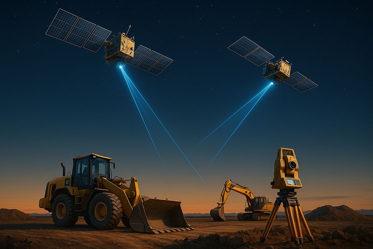
Over the past decade, GNSS modernisation has been nothing short of transformative. Upgraded systems like GPS, Galileo, and BeiDou have begun broadcasting multi-frequency, high-precision signals. This, in turn, has opened the door to a new era of centimetre-level positioning, with wide-ranging implications for fields like robotics, intelligent transport, surveying, agriculture, and disaster response.
Still, challenges persist. Urban canyons, obstructed satellite views, and rapidly shifting motion environments often render traditional PPP slow or ineffective. That’s where next-gen GNSS comes into play. The Wuhan-led research team focused on testing enhancements like BeiDou’s PPP-B2b and Galileo’s High Accuracy Service (HAS), and the results speak volumes.
Real-Time Performance Meets Real-World Testing
The researchers developed a cutting-edge PPP-RTK solution by integrating:
- Real-time atmospheric corrections
- Observable-specific bias (OSB) products
- Multi-constellation GNSS signals
Through rigorous experimentation—both static and dynamic—they proved the system’s mettle. In static positioning scenarios, a combined GPS/Galileo/BeiDou configuration slashed convergence times to under five minutes while delivering horizontal accuracy under two centimetres. But where things really get interesting is on the move.
In live vehicular tests conducted in Wuhan, PPP-RTK demonstrated remarkable robustness, delivering accuracy within 5 cm and achieving nearly instantaneous convergence, even in dynamic or obstructed environments. Such performance is no small feat and suggests real-world readiness across several high-stakes domains.
Atmospheric Corrections
One of the standout features of the framework was its use of Kriging and distance interpolation techniques to model atmospheric effects. These strategies, typically associated with geostatistical mapping, proved highly effective in refining satellite signal accuracy.
What’s more, the fix rates achieved were nothing short of impressive. In dynamic conditions, the system boasted success rates exceeding 98%. This level of reliability places it firmly in the realm of mission-critical applications such as autonomous vehicles, drone navigation, and emergency response systems.
Faster Convergence with Satellite Augmentation
To bolster performance even further, the team evaluated augmentation services, specifically BeiDou’s PPP-B2b and Galileo’s HAS. Each service brought its own advantages to the table:
- PPP-B2b: Convergence times dropped below 15 minutes with decimetre-level accuracy
- HAS: Delivered sub-metre precision in dynamic settings with convergence in under 100 seconds
These enhancements don’t just add speed—they significantly reduce infrastructure dependency. With minimal need for dense ground station networks, global scalability suddenly looks a lot more achievable.
A Look at the Bigger Picture
From automated machinery in agriculture to route-optimised delivery fleets in urban logistics, centimetre-level positioning is quickly becoming a foundational requirement. As GNSS-based systems mature, the need for flexible, reliable, and precise frameworks grows more urgent.
Dr. Xiaodong Ren, lead researcher on the project, summed up the significance: “This study marks a turning point in the quest for real-time, high-accuracy positioning. By merging advanced GNSS signals, atmospheric corrections, and real-world testing, we’ve demonstrated that PPP-RTK can deliver fast, stable, and highly accurate results—even in the most demanding environments. These capabilities are essential for the next generation of autonomous systems, from self-driving cars to drones and beyond.”
Let’s break it down by potential use case:
- Autonomous Vehicles: Real-time positioning ensures safe navigation in crowded urban environments.
- Disaster Relief: Precise drone mapping aids in search-and-rescue operations.
- Surveying: Eliminates dependency on base stations in remote or rugged areas.
- Agriculture: Enables precision planting, harvesting, and soil monitoring.
In all these scenarios, accuracy and speed are non-negotiables. This new PPP-RTK approach delivers both, wrapped up in a scalable package ready for deployment.
A Springboard for Future Innovation
What makes this study truly compelling is its forward-looking framework. The team didn’t just test a solution—they built a blueprint. As satellite constellations evolve and newer services come online, the foundational work laid out in this research will act as a springboard for innovation.
The potential doesn’t stop with land-based applications either. High-accuracy GNSS is already being explored for:
- Maritime navigation in congested ports
- Aerial corridor management for drones
- Spacecraft positioning during docking and exploration
As capabilities expand, the boundaries between different industries will blur. PPP-RTK is poised to be a unifying thread in the tapestry of smart, autonomous systems.
On the Horizon
The study’s publication couldn’t be more timely. With global investment in smart mobility, autonomous logistics, and remote monitoring on the rise, the demand for plug-and-play accuracy is only going to grow.
Supported by grants from China’s National Science Fund for Distinguished Young Scholars, National Natural Science Foundation, and the Fundamental Research Funds for Central Universities, this work represents not just a technological achievement but a strategic leap forward.
Whether you’re a policymaker drafting transport infrastructure blueprints or an investor eyeing the next big thing in autonomous systems, this research provides a clear signal: the future of positioning is already here—and it’s sharper, faster, and more scalable than ever.
Charting a New Course for Global Positioning
With fix rates nearing perfection, convergence times plummeting, and centimetre-level accuracy within reach, PPP-RTK is no longer just an academic curiosity. It’s a fully-fledged contender for global adoption.
More than anything, this research reaffirms what the tech world has long suspected: when next-generation GNSS capabilities are matched with intelligent correction strategies and rigorous real-world testing, the result isn’t just better positioning—it’s positioning redefined.