Cesium Expanded with Reality Modelling and Immersive Digital Twins
Bentley Systems announced a major milestone with their Cesium platform, marking a significant step forward in reality modelling, geospatial integration, and digital twin engagement.
The new services empower infrastructure professionals with unparalleled real-time, spatially accurate insights that bridge the gap between the physical and digital worlds.
Since acquiring Cesium a year ago, Bentley has wasted no time weaving its technologies into a cohesive platform that transforms how engineers visualise, analyse, and manage infrastructure data. The integration now powers both Bentley’s flagship products and the wider developer ecosystem through an open environment designed for innovation and interoperability.
Patrick Cozzi, Bentley’s Chief Platform Officer, highlighted the company’s strategic vision: “Our vision for infrastructure engineering is built on openness. With the integration of iTwin and Cesium capabilities, we are creating the open platform for the built and natural environment, providing all the necessary data for infrastructure professionals to design, build, and operate in a real-world context.”
Adding Reality Modelling and AI-Driven Insights
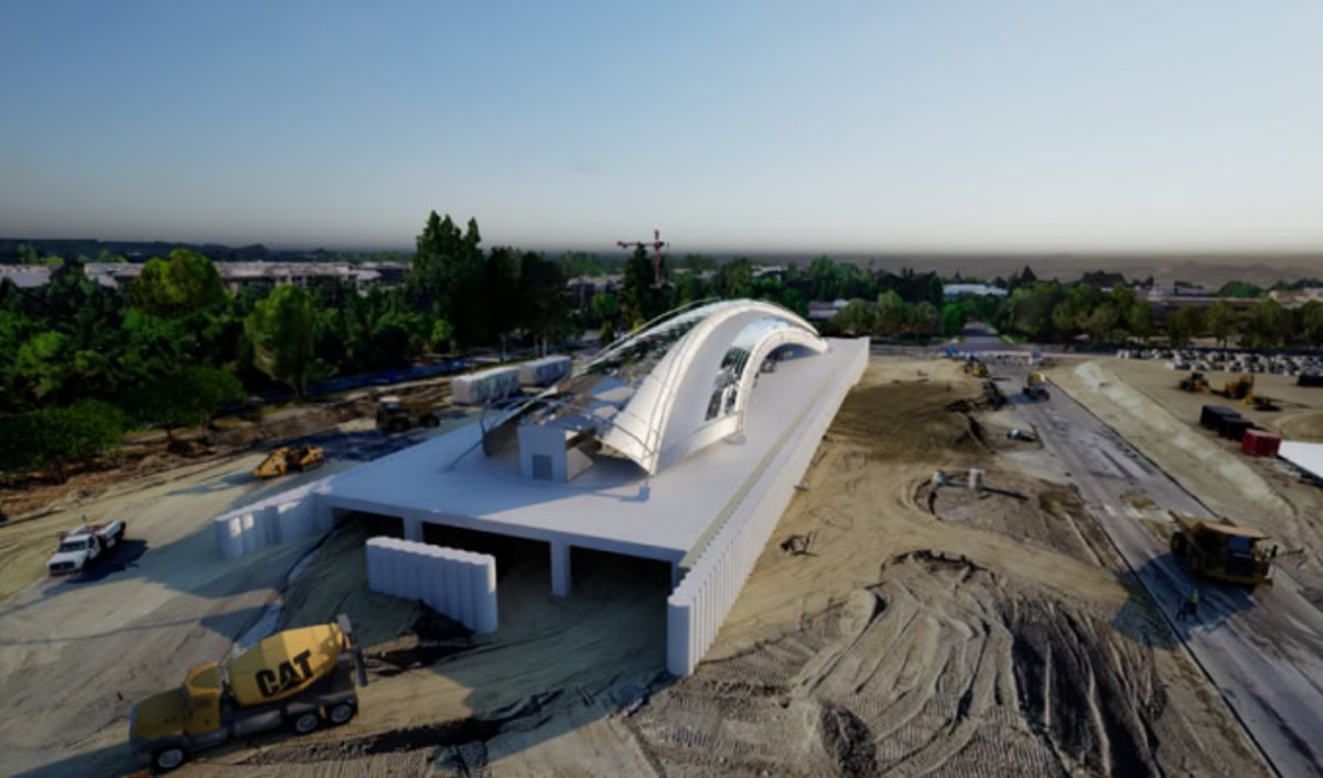
Bentley has now embedded its iTwin Capture reality modelling services into Cesium ion, creating a fully automated pipeline that converts raw imagery into highly detailed 3D geospatial visualisations. iTwin Capture processes images into engineering-grade reality models, enhanced by AI-driven feature detection. These models can then be seamlessly streamed through Cesium ion using open standards, ensuring compatibility and accessibility across multiple platforms.
The result is a revolutionary capability that allows users to produce photorealistic digital twins, complete with reality meshes, point clouds, and Gaussian splats, directly from drone or satellite imagery. The AI annotation further accelerates workflows by automating the identification of key features and assets, significantly reducing the time spent on manual data preparation.
Osarodion Victory Igbinobaro, Co-founder and CEO of AERO AI, praised the innovation: “Being able to generate photogrammetry, point clouds, and Gaussian splats as 3D Tiles from drone imagery, stream them seamlessly to the web, and analyse the point clouds is a major milestone. This release brings end-to-end 3D reality modelling into one accessible, high-performance pipeline.”
This new reality modelling functionality in Cesium ion is expected to become generally available before the end of 2025, positioning Bentley at the forefront of the digital twin revolution.
Enhancing Project Delivery with Geospatial Precision
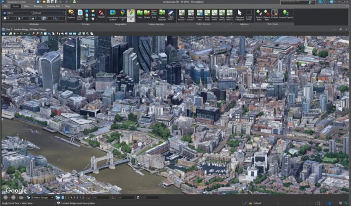
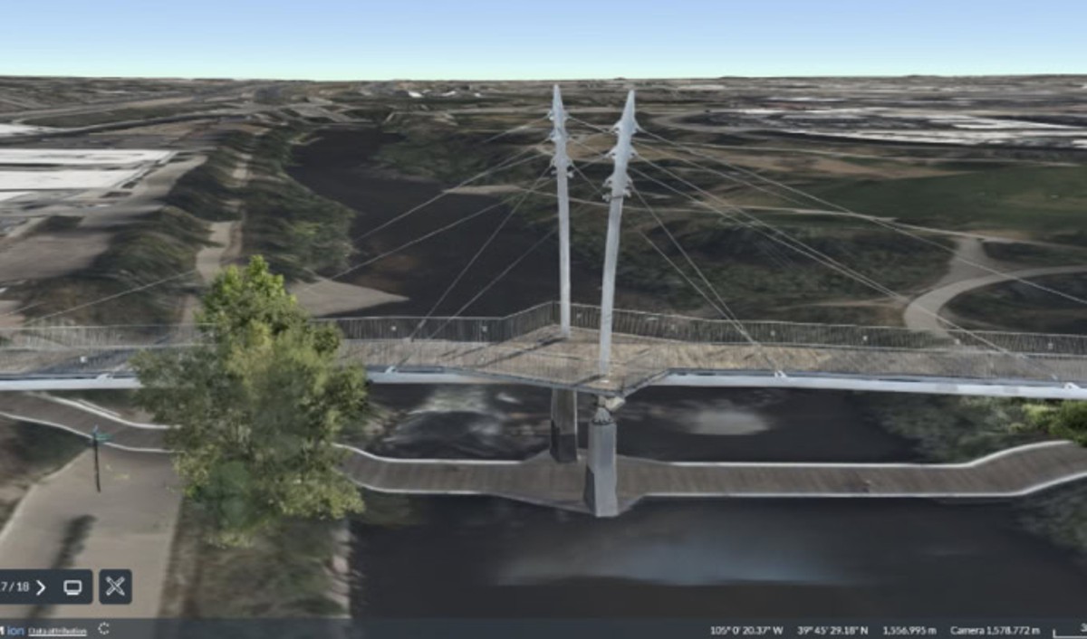
The integration of Cesium’s geospatial capabilities extends far beyond visualisation. It enhances Bentley’s broader product portfolio, embedding location intelligence into every phase of infrastructure design and delivery. The 2025 release of MicroStation, Bentley’s renowned CAD platform, introduces native support for 3D Tiles via Cesium, enabling engineers to incorporate real-world context directly into their design environments.
By importing Google Photorealistic 3D Tiles or their own captured data, engineers can instantly visualise existing site conditions without laborious manual modelling. This speeds up project initiation and lets teams focus on creative design and performance optimisation rather than repetitive groundwork.
Bentley Open Applications, covering roads, rail, bridges, and utilities, are also adopting these capabilities. Each will benefit from the same real-time geospatial context, improving coordination and communication between stakeholders and across disciplines.
Powering Bentley Infrastructure Cloud with Geospatial Context
Cesium’s integration is also driving innovation within Bentley Infrastructure Cloud Connect, a centralised digital ecosystem designed to unify data and teams throughout an asset’s lifecycle. By embedding Google Photorealistic 3D Tiles and Cesium-powered visualisation tools, Bentley is enabling intuitive navigation across project portfolios and assets, transforming how infrastructure professionals interact with complex data.
With these enhancements, engineers, planners, and operators can move effortlessly between asset-level views and regional overviews, all within a single connected environment. This evolution underscores Bentley’s commitment to providing interoperable, open-standard solutions that empower collaboration and insight across the entire infrastructure chain.
Immersive Collaboration for the Future
Bentley has also unveiled iTwin Engage, a cutting-edge application that enables project teams and stakeholders to explore and present digital twins of existing and future infrastructure in immersive, interactive environments.
Traditionally, producing photorealistic project renderings has required specialist skills and significant time investments. iTwin Engage transforms this process, allowing any team member to generate dynamic, narrative-driven visual experiences powered by Cesium’s geospatial engine and advanced game technology. The platform maintains a live connection to the digital twin, ensuring every visualisation reflects the most up-to-date design data.
From virtual design reviews and construction rehearsals to remote asset inspections, iTwin Engage opens the door to a more engaging and informed project experience.
Simon Beards, Principal Planner at Laing O’Rourke and an early access participant, shared his perspective: “The opportunity to present and communicate the project plan through iTwin Engage, in such an appealing manner, is fantastic. The greater the involvement the team has on the plan, the more likely there is a chance of success, as it supports a more collaborative way of engineering improvements.”
Accelerating the Digital Twin Ecosystem
The launch of these new features represents more than a product update, it’s a clear signal of Bentley’s commitment to advancing digital twins as a core pillar of modern infrastructure management. The convergence of AI, geospatial technology, and reality modelling within the Cesium platform allows for a comprehensive understanding of infrastructure assets throughout their lifecycle.
By integrating reality capture and geospatial intelligence, Bentley empowers engineers and asset managers to:
- Make data-driven decisions grounded in real-world context
- Streamline workflows across planning, design, and maintenance
- Improve safety, efficiency, and sustainability
- Reduce project costs and delivery times
These capabilities are already reshaping how infrastructure is conceived, constructed, and operated globally.
Building the Future of Connected Infrastructure
Since its founding in 1984, Bentley Systems has been a trusted partner for engineers and asset owners worldwide. Its software solutions span transportation, energy, water, and urban infrastructure, driving digital transformation through every project phase. The integration with Cesium enhances Bentley’s reputation for delivering open, future-ready technologies that enable collaboration, transparency, and performance.
Through digital twins, Bentley continues to unlock the power of data, transforming static information into actionable intelligence that supports resilience and sustainability across the built environment. As reality modelling, AI, and geospatial visualisation converge, Bentley’s vision of a truly connected world edges ever closer to reality.
A Connected Vision for Tomorrow
Bentley’s deep integration with Cesium marks a defining moment in the evolution of infrastructure technology. By combining openness, automation, and immersive engagement, the company is setting a new benchmark for what’s possible in infrastructure engineering.
Whether it’s through faster design cycles, smarter asset management, or enhanced collaboration, these innovations are paving the way for a more connected, sustainable, and intelligent world.