Digitising the Last Major Bottleneck in Geotechnical Investigation
Across the global construction and infrastructure sector, ground investigation remains one of the most risk-laden phases of project delivery. Despite advances in digital engineering, laboratory testing workflows have often lagged behind, relying on fragmented systems, spreadsheets, emailed files and repeated manual data entry. The result is predictable: delays, inconsistencies, avoidable errors and an erosion of confidence in datasets that underpin multi-million-dollar design decisions.
That gap is now narrowing. Seequent, the subsurface software specialist and part of Bentley Systems, has expanded the capabilities of OpenGround to create a fully connected engineering-to-laboratory workflow. The new OpenGround Labs functionality directly links field data capture, laboratory testing and reporting, delivering results straight back to engineers without the traditional hand-offs that have slowed projects for decades.
For an industry facing mounting pressure to deliver faster, safer and more cost-effective infrastructure, the significance goes well beyond a software update. It speaks to a structural shift in how geotechnical data is managed, shared and trusted across increasingly complex project ecosystems.
Why Laboratory Data Has Become a Strategic Risk
Laboratory testing sits at the heart of geotechnical decision-making. Soil classification, strength testing, permeability analysis and rock mechanics data all inform foundation design, slope stability, pavement performance and tunnel construction strategies. When that data is delayed or compromised, downstream impacts ripple quickly through design programmes and construction schedules.
Large infrastructure schemes now routinely involve multiple contractors, laboratories and consultants operating across jurisdictions. In many cases, laboratory data arrives as disconnected files that require checking, reformatting and re-entry into engineering systems. Each step introduces friction and risk. Studies published by organisations such as the Institution of Civil Engineers and the Federal Highway Administration have repeatedly highlighted that data handling errors and incomplete ground models are among the leading contributors to cost overruns and claims in major civil projects.
Digitisation efforts have addressed field data capture and design coordination, yet laboratory workflows have remained stubbornly analogue by comparison. That imbalance has left geotechnical teams with powerful modelling tools at one end of the process and manual data reconciliation at the other.
Closing the Loop from Borehole to Report
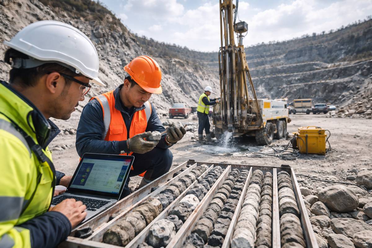
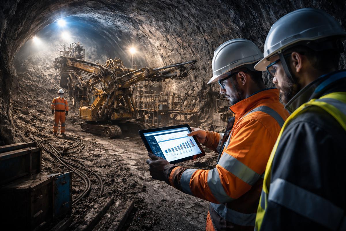
OpenGround Labs is designed to remove that disconnect. The new capability enables soil and rock sample data collected in the field to flow directly into laboratory testing workflows and back into engineering datasets, without duplication or re-keying. Engineers receive test results in near-real time, already structured within the same digital environment used for interpretation and reporting.
According to Seequent, the approach establishes a single source of truth across the investigation lifecycle, aligning with broader industry moves toward digital twins and model-based delivery. By embedding laboratory data into the same system that houses borehole logs, geological models and geotechnical interpretations, teams gain continuity that has historically been difficult to achieve.
Carl Grice, Seequent’s Director of Geotechnical Information Management, framed the change in practical terms rather than technological ambition: “Trusted Lab testing data is vital for developing our understanding of ground conditions and for the creation of robust geotechnical reports on major infrastructure projects. By eliminating fragmented processes and manual data re-entry, these enhancements enable organisations to digitise lab operations — improving data quality, saving time, improving collaboration and accelerating project delivery.”
That emphasis on trust is telling. In an era where infrastructure clients increasingly demand auditability and traceability, the ability to track data from sample collection through testing and interpretation is no longer optional.
Early Adoption Signals a Broader Shift
The value of integrated workflows is already resonating with practitioners. Multi-discipline geoscience consultancy Inosys participated in an early access programme for OpenGround Labs, bringing real-world operational pressures into the development process.
Inosys Associate Director Andy Wood described a familiar challenge for large consultancies managing high test volumes across multiple laboratories. Errors, omissions and conflicting data are not edge cases but routine issues that demand costly remedial work before engineering teams can proceed with confidence.
Wood was candid about the potential impact of the new approach: “Inosys deals with high volumes of laboratory data, commissioning and managing thousands of tests each year. In many cases the supplied files frequently contain errors, omissions and conflicts, requiring significant remedial works.
“I will be encouraging our partner laboratories to adopt this new capability in OpenGround. If fully adopted, this software has the potential to revolutionise the way multi-stakeholder geotechnical projects are delivered. It is set to fundamentally change the way laboratories and engineering clients work together, increasing efficiency and creating transparency between client, engineer and laboratory.”
The language reflects a shift in expectations. Laboratories are no longer viewed as standalone service providers but as integral nodes within a shared digital delivery chain.
Implications for Major Infrastructure Programmes
For transport authorities, utilities and federal agencies, the implications are substantial. Ground investigation programmes for highways, rail corridors, airports and energy infrastructure often span years and involve phased procurement. Data continuity across those phases has historically been difficult to maintain, particularly when teams or suppliers change.
By enabling independent engineering and laboratory projects to operate within aligned workflows, OpenGround allows organisations to retain oversight and governance regardless of who is performing individual tasks. Role-based access, structured permissions and controlled data exchange support collaboration without sacrificing accountability.
This approach mirrors trends seen in BIM-enabled design and construction, where common data environments have become the norm. Extending that philosophy into the subsurface domain reduces the disconnect between what is designed above ground and what is understood below it.
Enterprise-Grade Data Governance for Subsurface Information
Beyond workflow efficiency, OpenGround’s latest release reinforces the importance of data governance. As geotechnical datasets grow in scale and strategic value, concerns around security, compliance and long-term accessibility have moved up the agenda.
OpenGround provides enterprise-grade security features including role-based access control, automated backups and service-level agreements designed to meet the expectations of public sector clients and regulated industries. For global consultancies operating across multiple regions, these safeguards help address data sovereignty requirements and internal audit standards.
The platform’s extensive APIs also enable integration with in-house tools, third-party applications and enterprise reporting systems. That flexibility allows organisations to automate routine processes, develop custom workflows and apply advanced analytics without locking data into proprietary silos. In practice, it positions geotechnical data as an asset that can inform wider risk management and asset lifecycle strategies.
Rebuilding Field Data Capture for Modern Site Conditions
Laboratory integration is only part of the story. Seequent has also rebuilt the OpenGround Data Collector app, which captures borehole data directly in the field. Now available on both iOS and Android, the updated app reflects the reality of modern site operations, where teams expect to use their preferred devices under demanding conditions.
The redesigned experience prioritises speed, usability and offline capability, ensuring that critical information can be captured accurately at source and synchronised when connectivity allows. For organisations operating across remote or infrastructure-dense environments, that consistency reduces the lag between fieldwork and decision-making.
Grice underscored the practical intent behind the rebuild: “This update underlines our ongoing commitment to meet user needs — ground investigation teams now have the flexibility to capture quality digital data at source — no matter what device or workflow they choose to deploy on site.”
A Quiet but Significant Step Forward
Taken together, the OpenGround Labs capability and the rebuilt Data Collector app represent a quiet but meaningful evolution in geotechnical practice. Rather than introducing new analytical complexity, the focus is on removing friction, improving trust and aligning workflows that have long operated in parallel.
As infrastructure projects grow in scale and scrutiny, the ability to demonstrate data integrity from borehole to boardroom is becoming a competitive differentiator. For engineers, investors and policymakers alike, that transparency reduces uncertainty and supports better-informed decisions at every stage of delivery.
In a sector where the ground beneath a project can make or break its success, strengthening the digital foundations of geotechnical investigation may prove to be one of the most impactful upgrades of all.