Esri and RoboGarden Expand Global Geospatial Education
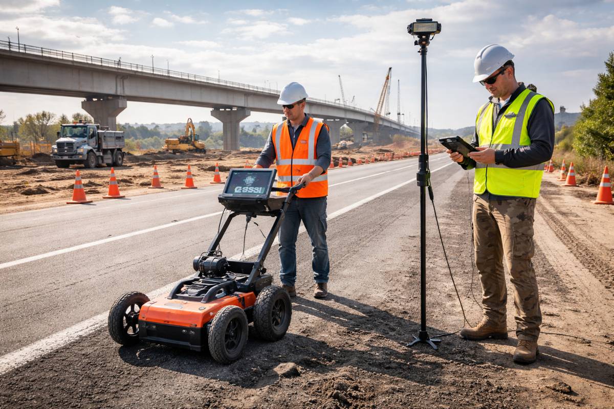
The global infrastructure sector is undergoing a quiet but profound transformation. From digital twins and smart highways to climate resilience planning and urban mobility systems, geospatial intelligence now sits at the heart of decision-making. Against this backdrop, the newly signed Memorandum of Understanding between Esri and RoboGarden Inc. signals a deliberate move to tackle one of the industry’s most pressing constraints: access to skilled geospatial professionals.
Rather than focusing on technology alone, the agreement centres on education, scalability, and workforce readiness. It outlines a framework to explore how modern digital learning models can be expanded globally, ensuring that industries relying on Geographic Information Systems are supported by a pipeline of capable, job-ready talent. For construction, transport, and infrastructure stakeholders, that pipeline is no longer optional. It’s fundamental to delivering projects on time, on budget, and with greater resilience.
The collaboration comes at a time when demand for geospatial expertise is accelerating. According to industry analyses, GIS capabilities are increasingly embedded in infrastructure planning, asset management, and environmental monitoring. Whether mapping transport corridors, modelling flood risks, or optimising logistics networks, geospatial tools are becoming indispensable. Yet, despite this surge in adoption, education systems have struggled to keep pace, particularly in emerging markets where access to specialised training remains uneven.
Briefing
- Strategic MOU between Esri and RoboGarden targets global expansion of GIS and geomatics education
- Plans include exploring a Geospatial and Geomatics Virtual Academy for scalable learning
- Focus on localised e-learning, academic pathways, and regional collaboration
- Aims to address global skills shortages impacting infrastructure and digital transformation
- Supports workforce readiness across government, industry, and academia
Building a Scalable Model for Geospatial Learning
At the core of the agreement lies an ambition to rethink how geospatial education is delivered. Traditional academic pathways, while valuable, often lack the flexibility and speed required to respond to rapidly evolving industry needs. By contrast, digital platforms offer the ability to scale learning, personalise content, and reach geographically dispersed audiences.
RoboGarden’s experience in gamified and structured digital learning provides a foundation for this shift. Its platform is designed to make complex technical skills more accessible, particularly for younger learners and professionals transitioning into new roles. When paired with Esri’s globally recognised GIS ecosystem, the potential for a more integrated and practical learning experience becomes evident.
The proposed exploration of a Geospatial and Geomatics Virtual Academy reflects this thinking. While still conceptual, such an initiative would aim to bring together curriculum design, industry relevance, and digital delivery into a unified framework. It could provide learners with structured pathways from foundational knowledge through to advanced, job-ready competencies.
This approach aligns with broader trends in education technology, where modular learning, micro-credentials, and industry-aligned certifications are gaining traction. For infrastructure sectors, where project timelines are tight and skill gaps can delay delivery, these models offer a pragmatic solution.
Strengthening Workforce Readiness for Infrastructure Delivery
The implications of this collaboration extend well beyond education providers. For infrastructure developers, contractors, and public agencies, workforce readiness has become a critical risk factor. Projects increasingly depend on digital workflows, data integration, and real-time decision-making, all of which require specialised skills.
Geospatial technology plays a central role in these workflows. It underpins everything from site selection and environmental impact assessments to construction monitoring and asset lifecycle management. As such, a shortage of skilled professionals can directly affect project outcomes.
By focusing on job-ready skills, the Esri and RoboGarden initiative aims to bridge this gap. The emphasis is not just on theoretical knowledge, but on practical application. Learners are expected to engage with real-world scenarios, developing competencies that can be immediately applied in professional contexts.
This aligns with comments from Esri leadership. “Esri’s MOU with RoboGarden creates an important opportunity to explore new models for academic collaboration, digital learning delivery, and regional access that can help prepare the next generation of geospatial professionals,” said Jack Dangermond.
This also signals a shift towards more outcome-focused education strategies. Rather than relying solely on traditional degree programmes, there is growing recognition of the need for flexible, continuous learning pathways that evolve alongside technology.
Localising Learning for Global Impact
One of the more nuanced aspects of the agreement is its focus on localisation. While geospatial technology is inherently global, its application is often highly context-specific. Infrastructure challenges in Southeast Asia differ significantly from those in Europe or North America, requiring tailored approaches to training and implementation.
The MOU highlights the importance of regional responsiveness and localised e-learning opportunities. This suggests an intention to adapt content to local languages, regulatory environments, and industry needs. For learners, this could mean more relevant training that directly aligns with their professional context.
Localisation also plays a role in expanding access. In many regions, barriers such as cost, language, and limited institutional capacity have restricted participation in advanced technical education. Digital platforms, when combined with local partnerships, offer a way to overcome these challenges.
RoboGarden’s global footprint and experience working with governments and educational institutions position it well to support this effort. By leveraging local networks, the collaboration could enable more inclusive participation in geospatial education, particularly in underserved markets.
Academic Pathways and Industry Collaboration
Another key pillar of the agreement is the exploration of academic partnership pathways. This reflects a broader trend towards closer alignment between education providers and industry requirements. Universities and training institutions are increasingly expected to deliver graduates who are not only knowledgeable but also immediately employable.
Through this collaboration, Esri and RoboGarden aim to strengthen these connections. By working with academic institutions, they can help integrate GIS and geomatics into existing curricula, ensuring that students gain exposure to relevant tools and methodologies.
At the same time, industry stakeholders stand to benefit from a more consistent and reliable talent pipeline. For sectors such as construction and transport, where digital transformation is accelerating, access to skilled professionals is a competitive advantage.
RoboGarden’s leadership emphasised this point. “This MOU represents a strategic step toward reimagining how hands on and practical geospatial/geomatics skills are developed and delivered at scale,” said Mohamed Elhabiby. “By exploring a virtual academy on the RoboGarden platform, deeper academic collaboration, and localized digital learning pathways, we are laying the foundation for accessible, practical, and globally relevant GIS education that better serves institutions, industries, and learners worldwide.”
Such collaboration also supports lifelong learning. As technologies evolve, professionals must continuously update their skills. Flexible learning models, supported by industry partnerships, can facilitate this ongoing development.
Aligning with the Digital Infrastructure Agenda
The timing of this initiative is notable. Governments and industry bodies worldwide are investing heavily in digital infrastructure, recognising its role in economic growth and sustainability. From smart cities to connected transport systems, digitalisation is reshaping how infrastructure is planned, built, and managed.
Geospatial technology is a cornerstone of this transformation. It enables the integration of diverse data sources, supports predictive analytics, and enhances decision-making. As such, the demand for GIS skills is expected to continue growing.
In this context, the Esri and RoboGarden collaboration can be seen as part of a broader effort to align education with the needs of a digital economy. By focusing on scalability, accessibility, and practical application, it addresses key challenges that have historically limited the reach of specialised training.
For the construction and infrastructure sectors, this alignment is particularly important. Projects are becoming more complex, stakeholders more diverse, and expectations higher. Access to skilled professionals is essential to navigating this landscape.
A Practical Step Towards a More Connected Workforce
While the MOU does not represent a finalised programme, it establishes a clear direction of travel. It signals a commitment to exploring new models of education that are better suited to the demands of a digital, interconnected world.
For industry stakeholders, the potential benefits are tangible. Improved access to training can enhance workforce capabilities, reduce project risks, and support innovation. For learners, it offers new opportunities to acquire valuable skills and participate in a growing global market.
The collaboration also reflects a broader shift in how education is perceived. Rather than a one-time investment, it is increasingly seen as a continuous process, closely linked to industry needs and technological developments.
In the end, the success of this initiative will depend on its ability to translate ambition into action. If it delivers on its objectives, it could play a meaningful role in shaping the future of geospatial education and, by extension, the infrastructure sector itself.