Building Intelligence Into Infrastructure Through LiDAR
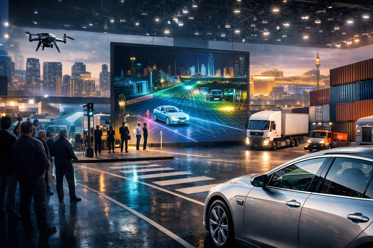
AEye is preparing to make a confident statement at CES 2026, positioning long range perception not as a future ambition but as a deployable, scalable reality. From 6 to 9 January 2026, visitors to the Las Vegas Convention Center West Hall will be able to see the company’s Apollo lidar sensor in live demonstration, offering a clear view of how software defined sensing is reshaping mobility, infrastructure, and logistics.
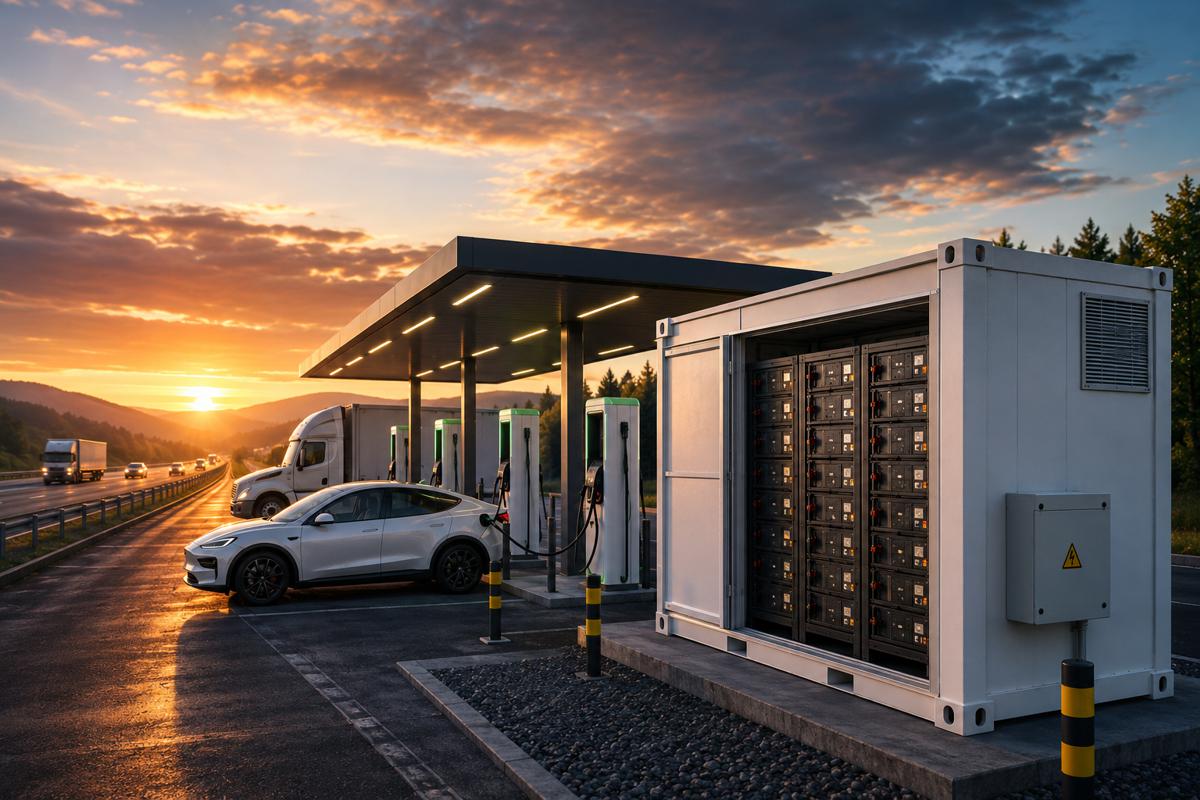
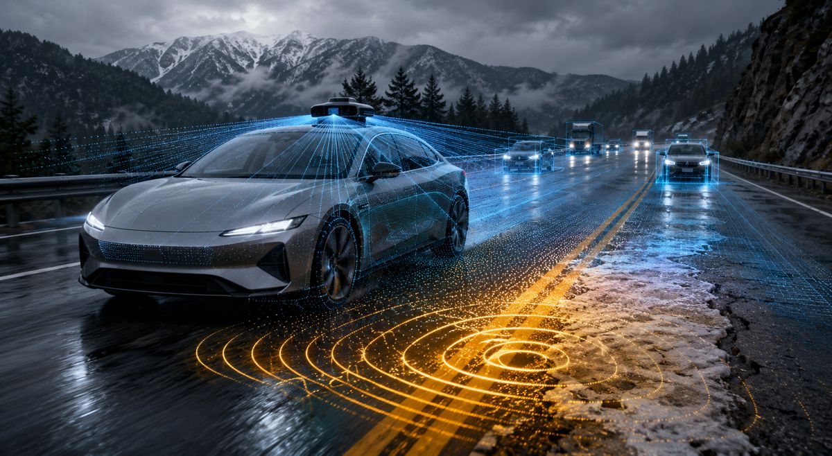
As transportation systems grow more complex and interconnected, perception technology has quietly become the backbone of safety, automation, and operational efficiency. AEye’s presence at CES is less about spectacle and more about substance, showing how a compact, behind the windscreen lidar sensor with up to one kilometre of range can unlock new possibilities across road networks, intelligent infrastructure, and automated logistics.
AEye and the Rise of Software Defined Lidar
AEye has steadily built a reputation as a specialist in software defined lidar, a category that prioritises adaptability, intelligence, and real time performance over fixed hardware limitations. Rather than treating lidar as a static sensor, the company has approached perception as a living system that can evolve through software, algorithms, and compute.
This philosophy is increasingly resonant with automotive manufacturers, infrastructure operators, and logistics providers who are under pressure to future proof investments. Sensors embedded today must still be relevant a decade from now, capable of supporting new use cases without wholesale replacement. Software defined lidar offers that flexibility, allowing performance to be tuned and expanded as operational needs change.
Apollo Lidar Takes Centre Stage at CES 2026
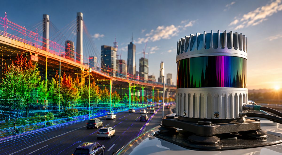
At the heart of AEye’s CES showcase is the Apollo lidar sensor, a compact long range solution designed for real world deployment rather than laboratory conditions. Apollo is capable of detecting objects at distances of up to one kilometre, a threshold that has become increasingly important for high speed environments such as motorways, freight corridors, and automated driving scenarios.
Unlike bulkier roof mounted systems, Apollo’s small form factor enables discreet behind the windscreen integration. This design choice is more than cosmetic. It reduces drag, protects the sensor from environmental exposure, and aligns with OEM requirements for vehicle aesthetics and aerodynamics. For infrastructure deployments, the same compactness simplifies installation on gantries, poles, and roadside cabinets.
Live demonstrations at CES will allow attendees to observe how Apollo captures high resolution 3D data in real time, maintaining accuracy and consistency across long distances. This capability is particularly relevant for applications where reaction time is critical, including collision avoidance, hazard detection, and early warning systems.
Beyond Vehicles: Infrastructure and Logistics in Focus
While Apollo has clear relevance for advanced driver assistance and autonomous vehicles, AEye is deliberately broadening the conversation at CES. Transportation no longer begins and ends with the vehicle. It extends into intersections, depots, ports, and corridors that must all operate as a coordinated system.
AEye will demonstrate how Apollo can be deployed across smart infrastructure and logistics environments, where long range perception enables better situational awareness and decision making. From intelligent intersections that detect vulnerable road users earlier, to logistics hubs that track vehicle and asset movement with centimetre level precision, lidar is becoming a foundational layer of digital infrastructure.
These use cases reflect a wider shift within the construction and infrastructure sectors, where digital twins, predictive analytics, and AI driven operations are increasingly standard. High quality perception data is what makes these systems reliable, actionable, and safe.
OPTIS Full Stack Perception in Action
Complementing Apollo is AEye’s OPTIS full stack solution, which integrates the lidar sensor with advanced computing and perception software. OPTIS is designed to move beyond raw data capture, delivering real time 3D perception and analytics that can be acted upon immediately.
In practical terms, OPTIS captures a detailed three dimensional view of complex environments, interprets that data using AI driven algorithms, and provides actionable insights to downstream systems. This could mean triggering traffic signal changes at an intersection, alerting operators to anomalies in a logistics yard, or guiding autonomous drones through congested airspace.
At CES, AEye will highlight OPTIS applications across drones, intelligent intersections, shipping corridors, and logistics hubs. These environments share a common challenge: dynamic conditions, multiple moving assets, and high consequences if perception fails. OPTIS is positioned as a scalable solution capable of operating reliably in all of them.
Long Range Perception as a Safety Enabler
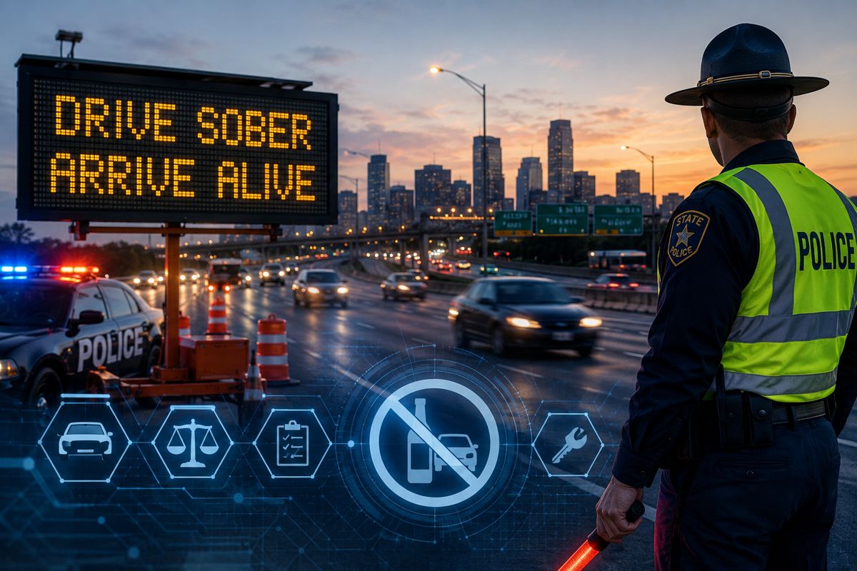
One of the most compelling arguments for long range lidar is safety. The ability to see further ahead translates directly into more time to react, whether that reaction is automated or human led. In road environments, early detection of stalled vehicles, debris, or pedestrians can prevent serious incidents. In logistics and industrial settings, it can reduce collisions between vehicles, equipment, and people.
AEye’s focus on long and ultra long range perception aligns with emerging regulatory and policy discussions around road safety and automation. As governments invest in smart highways and connected infrastructure, sensors that can deliver reliable performance at scale will be essential. Lidar systems capable of one kilometre range provide a margin of safety that shorter range sensors simply cannot match.
Leadership Perspective on Real World Deployment
AEye’s leadership has been clear that the company’s technology is designed for deployment, not experimentation. Speaking ahead of CES, Matt Fisch, Chief Executive Officer of AEye, framed the event as an opportunity to engage directly with the transportation and mobility ecosystem: “CES brings together the most important players in transportation and mobility, making it an ideal venue for us to demonstrate how Apollo and OPTIS are redefining what’s possible with lidar. With unmatched range and real time AI driven perception, we’re helping our customers tackle complex transportation and infrastructure challenges with scalable solutions built for real world deployment. We are also looking forward to announcing our next generation lidar, with range capabilities extending beyond one kilometre, underscoring the company’s continued leadership in long range and ultra long range perception.”
This emphasis on scalability and deployment reflects broader industry lessons. Pilot projects and demonstrations are no longer enough. Infrastructure owners and OEMs are looking for technologies that can be rolled out reliably, maintained efficiently, and upgraded over time.
Preparing for the Next Generation of Lidar
Perhaps the most forward looking element of AEye’s CES presence is the planned announcement of its next generation lidar, with range capabilities extending beyond one kilometre. While details remain under wraps, the signal is clear. The company sees ultra long range perception as a critical enabler for future mobility and infrastructure systems.
Extended range opens new use cases, including higher speed autonomous driving, earlier hazard detection on highways, and expanded coverage for large scale logistics facilities. It also supports emerging concepts such as connected corridors, where vehicles and infrastructure share perception data to create a unified view of the environment.
Industry analysts increasingly point to sensor performance at range as a differentiator between experimental autonomy and production ready systems. AEye’s roadmap suggests a strategic bet on this trend, backed by software defined architectures that can evolve alongside hardware.
Lidar’s Expanding Role in Smart Infrastructure
Beyond mobility, lidar is gaining traction across the built environment. Smart cities initiatives, often supported by public funding and policy mandates, rely on accurate data to optimise traffic flow, improve safety, and reduce emissions. Lidar offers advantages over camera only systems, including performance in low light and challenging weather conditions.
AEye’s OPTIS platform aligns well with these priorities, offering infrastructure operators a way to deploy perception systems that integrate seamlessly with traffic management, asset monitoring, and analytics platforms. For construction and infrastructure professionals, this convergence of sensing and software represents a new layer of digital capability.
As infrastructure investment increasingly targets resilience and efficiency, technologies that deliver measurable operational benefits are more likely to gain traction. Long range lidar supports proactive management rather than reactive response, a shift that resonates with both policymakers and asset owners.
What CES 2026 Signals for the Industry
AEye’s demonstrations at CES 2026 are indicative of a broader maturation within the lidar sector. The conversation is moving away from whether lidar is viable, towards how it can be deployed at scale, integrated with existing systems, and justified through return on investment.
For automotive OEMs, infrastructure authorities, and logistics operators, the implications are significant. Sensors like Apollo, combined with full stack platforms such as OPTIS, offer a pathway to safer, more efficient operations without radical changes to physical infrastructure. Software defined architectures further reduce risk by allowing systems to adapt as requirements evolve.
CES has long been a bellwether for technology trends. AEye’s presence suggests that long range, software defined lidar is moving firmly into the mainstream, with applications extending far beyond the vehicle itself.