Cities Without Blind Spots
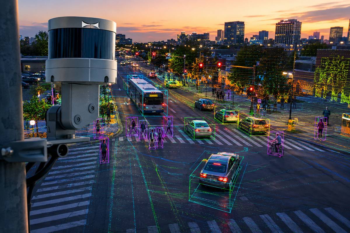
Global navigation satellite systems sit quietly behind almost every modern positioning service, from smartphones and fleet tracking to surveying and construction automation. Their limits, however, are well known. Dense city centres, high-rise developments, tunnels, flyovers, and tree-lined streets all conspire to weaken satellite visibility. Signals bounce, diffract, or vanish altogether. Under such conditions, even advanced receivers struggle to maintain stable fixes, and accuracy can drop from metres to tens of metres in a heartbeat.
Over the past decade, engineers have attempted to plug these gaps using inertial measurement units, cameras, LiDAR, and other sensors. While effective in controlled environments, these approaches often introduce cost, calibration challenges, power consumption, and sensitivity to weather or lighting. At the same time, a parallel revolution has been unfolding above street level. Commercial 5G networks are rolling out at scale, bringing dense base station deployments, wide bandwidths, and precise timing capabilities into urban fabric. Taken together, this raises an obvious question. Can communication signals do more than carry data and step in where satellites fall short?
Why 5G Has Been a Difficult Fit for Navigation
The appeal of 5G for positioning is undeniable. Unlike satellites orbiting thousands of kilometres above the Earth, cellular base stations sit close to users and blanket cities with overlapping coverage. Their signals are strong, frequent, and already paid for. In theory, this should make them ideal complements to satellite navigation.
In practice, real-world deployment has been far from straightforward. Commercial 5G New Radio signals were never designed with navigation as a primary objective. They employ complex multi-beam transmissions, dynamic scheduling, and synchronisation mechanisms optimised for data throughput rather than ranging precision. Multipath interference remains a persistent problem, particularly in narrow streets and reflective environments. Clock bias between base stations and user equipment introduces further uncertainty, while signal interruptions during handovers can destabilise tracking loops.
As a result, many early attempts at 5G-based positioning relied on loosely coupled solutions, treating cellular measurements as occasional corrections rather than integral components of the navigation engine. These methods improved availability but rarely delivered the robustness or accuracy needed for safety-critical or high-precision applications.
A Case for Deep Integration
Against this backdrop, a research team from Wuhan University, The Chinese University of Hong Kong in Shenzhen, and Shandong University of Science and Technology set out to rethink how satellite and cellular signals should work together. Their study, published in Satellite Navigation, proposes a tightly integrated framework that treats 5G and GNSS as equal partners rather than independent aids.
Instead of bolting cellular measurements onto an existing satellite solution, the researchers designed a deep fusion architecture. In this approach, signal tracking and positioning estimation are intertwined. Errors detected at the positioning level feed back into signal processing in real time, stabilising both systems simultaneously. The goal is not just improved accuracy, but continuity. A positioning solution that keeps working when one source becomes unreliable.
Stabilising 5G Signals in the Real World
At the heart of the framework lies a novel 5G signal tracking strategy. The researchers focused on jointly exploiting 5G synchronisation signals and reference signals, allowing the receiver to maintain lock even in the presence of strong multipath interference. This combined use of signal components reduces ranging errors compared with conventional 5G-only tracking approaches, particularly in cluttered outdoor environments.
To push performance further, the team introduced a phase-stabilised Kalman filter into the tracking loop. Carrier phase estimation is notoriously sensitive to noise and signal degradation, yet it plays a crucial role in high-precision ranging. By stabilising the phase estimates under weak signal conditions, the filter helps preserve measurement quality during momentary fades, blockages, or reflections. In effect, the receiver becomes more resilient, able to ride out brief disruptions without losing coherence.
Fusing 5G and GNSS at the Estimation Level
Signal processing alone does not solve the urban navigation puzzle. The real breakthrough comes from how 5G and satellite measurements are combined at the positioning stage. The study employs an extended Kalman filter to fuse pseudorange and carrier phase data from both systems into a single estimation process.
Unlike loosely or traditionally tightly coupled methods, this deep integration feeds the estimated position and clock states back into the 5G tracking module. Errors identified during positioning are used immediately to refine signal tracking, closing the loop between measurement and estimation. This feedback mechanism allows the system to adapt dynamically as environmental conditions change, whether satellites disappear behind buildings or cellular signals suffer from interference.
Putting the System to the Test
Theory only goes so far without validation, and the researchers were keen to demonstrate practical performance. Field experiments were conducted in complex outdoor environments designed to mimic the challenges of real cities. Satellite visibility was deliberately constrained, and signal conditions varied to test robustness under stress.
The results were telling. Horizontal and vertical positioning accuracy improved significantly compared with satellite-only solutions and conventional fusion approaches. More importantly, the integrated system continued to deliver stable position estimates even when GNSS availability dropped to levels that would normally cause navigation failure. In scenarios where satellite-only receivers lost lock or produced erratic outputs, the deeply integrated framework maintained continuity.
These findings underline a key advantage of the approach. Rather than treating degraded conditions as exceptional cases, the system is built to operate within them. Urban complexity is not an anomaly. It is the norm.
From Research to Practical Deployment
One of the most compelling aspects of the framework is its reliance on existing infrastructure. Because it leverages commercial 5G networks, deployment does not require bespoke transmitters or changes to base station hardware. This significantly lowers the barrier to adoption and accelerates the path from laboratory to street.
From a construction and infrastructure perspective, this opens up a range of opportunities. Surveying in dense urban environments, automated machinery guidance, asset monitoring, and smart site logistics all depend on reliable positioning. As cities push towards digital twins and connected infrastructure, dependable location data becomes a foundation rather than a feature.
Implications for Autonomous and Connected Systems
Beyond construction, the implications extend across the wider mobility ecosystem. Autonomous vehicles, delivery robots, and intelligent transport systems all suffer when positioning falters. Lane-level accuracy, vertical positioning for multi-storey roads, and seamless transitions between open sky and covered areas remain persistent challenges.
By combining the global reach of satellites with the local density of 5G, deeply integrated solutions offer a pathway to continuous positioning. The research demonstrates that communication networks can actively contribute to navigation resilience, rather than acting as passive aids. This shift in perspective could reshape how future systems are designed.
A Step Towards Urban-Ready Navigation
Reflecting on the work, one of the study’s authors noted: “This work shows that commercial 5G signals can do much more than support communication. By deeply integrating 5G with GNSS and addressing real-world challenges such as multipath and clock errors, we demonstrate a practical pathway toward reliable urban positioning. The key advantage is robustness. Our system continues to work when satellite-only solutions struggle. This opens new possibilities for navigation in cities, where reliable positioning is often the hardest to achieve.”
That emphasis on robustness is hard to ignore. Urban navigation has long been defined by its weakest moments. Lost fixes, degraded accuracy, and intermittent outages undermine trust in automated systems. Research like this suggests those limitations are not insurmountable.
Intelligent Integration
As 5G networks continue to densify and evolve, their role in positioning is likely to grow. Future releases promise tighter synchronisation, improved timing accuracy, and enhanced support for positioning services. Combined with ongoing advances in satellite navigation, the foundations are being laid for truly resilient urban positioning.
For construction professionals, policymakers, and technology providers, the message is clear. Navigation is no longer just a satellite problem. It is a systems challenge, best addressed through intelligent integration. Deeply fused 5G and GNSS solutions represent a pragmatic step towards cities without blind spots.