British Antarctic Survey puts Geotab Telematics Fleet Management solution to work
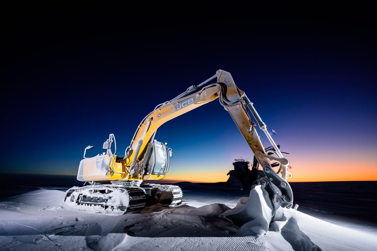
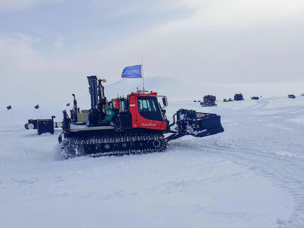
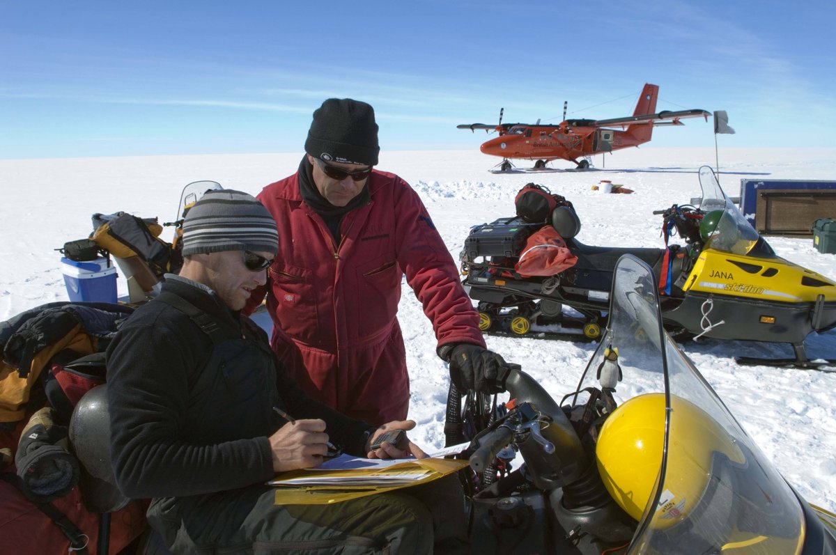
Geotab Inc., a global leader in IoT and connected transportation today announced it is implementing a fleet management platform for British Antarctic Survey (BAS), an interdisciplinary research organisation with research stations in the world’s polar regions. Geotab is providing in-depth vehicle telematic data analysis for BAS’s diverse fleet of Antarctic vehicles, including snowmobiles, snow groomers and tractors, for their latest arduous research expedition to the Antarctic this month.
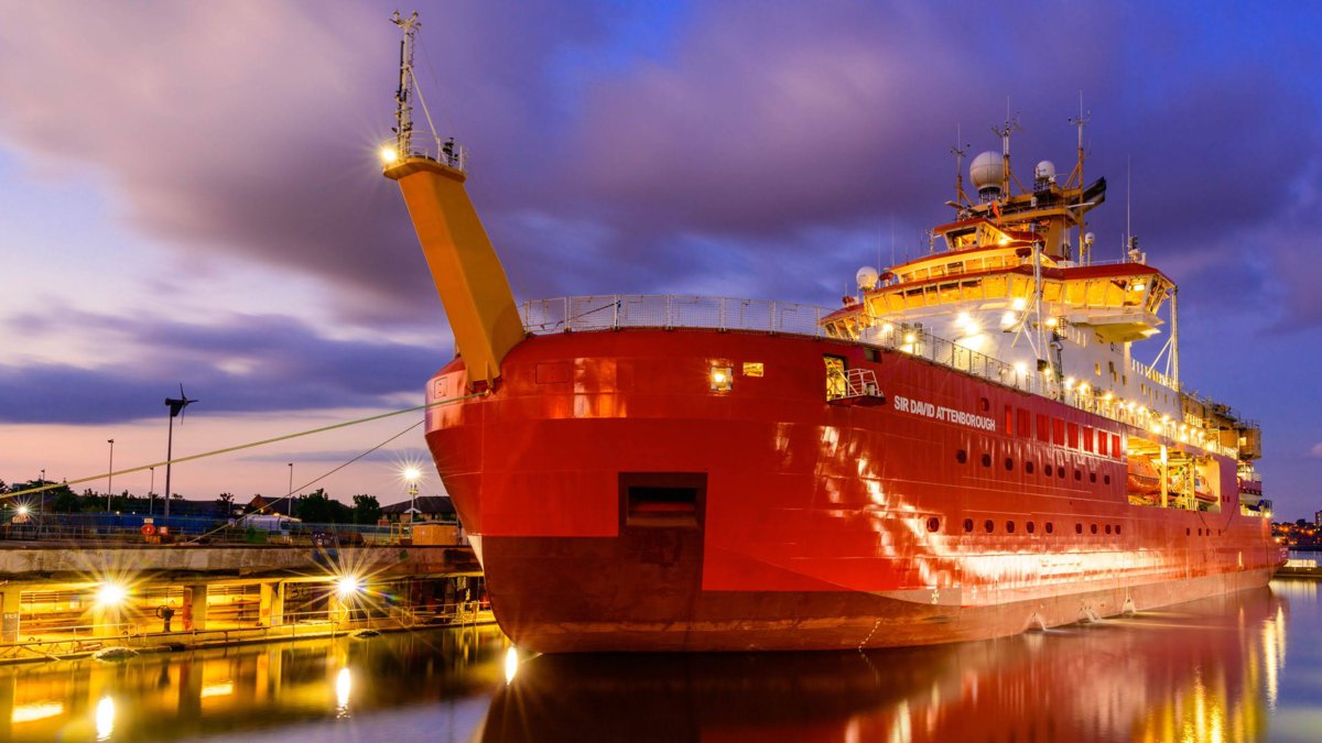
A Geotab GO device has also been fitted to Britain’s new polar research ship, the RRS Sir David Attenborough, and will be used to plan, track and manage the progress of all of the ship’s upcoming polar research expeditions. You can track the ship’s progress through its time-lapsed webcam as it makes its journey through the Antarctic.
Often located thousands of miles away from the main research stations, the team is reliant on efficient communications to ensure safety and to promote the most sustainable use of fleet machinery during their research. On one of the most pristine, untouched continents on the planet, Antarctic research is instrumental in discovering the primary causes and effects of climate change.
In the past, scientists and support teams relied on a high frequency (HF) radio in emergencies. Every time teams stopped, they would have to erect a rig to maintain communication with research stations, a complex task when faced with sub-zero temperatures, rough terrain and unpredictable weather conditions.
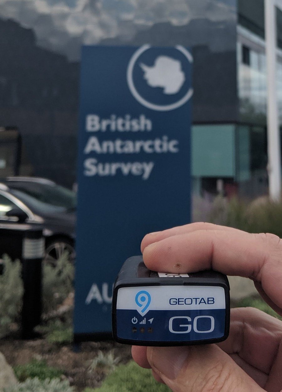
Now, the BAS team is collaborating with Geotab to provide a tailored solution to address their unique challenges and leverage the power of deriving powerful vehicle information data. The Geotab solution, with a modified GO9 telematics plug-in device, will be housed in a custom-built mounting box, ruggedized to protect it from extreme temperatures and conditions. Used in millions of vehicles every day, it includes a variety of real-time telematics functions such as monitoring and diagnostics, operator management, fuel management, staff health and safety management and dynamic vehicle scheduling for the entire expedition.
The work of the BAS team helps governments and businesses set policies that shape their environmental commitments for the future of our planet, and forms the essential groundwork for the science behind climate conference discussions, such as the recently held COP26 in Glasgow.
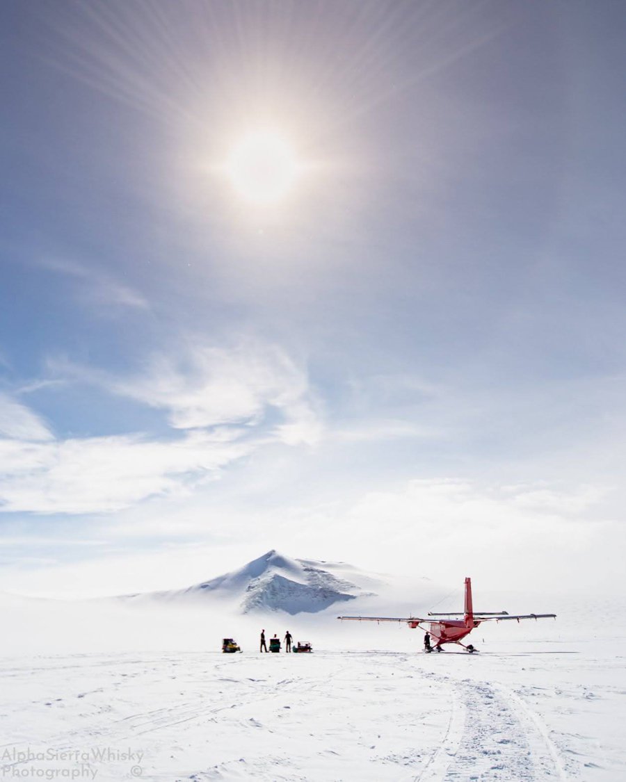
With five research stations across the Antarctic and sub-Antarctic and research teams that frequently travel on deep-field expeditions for weeks at a time, it presents enormous connectivity challenges in areas that are ‘off grid’ – without any cell infrastructure and hundreds, if not thousands, of miles away from the nearest sign of civilisation.
By integrating the MyGeotab fleet management software with BAS’s mapping system, every single vehicle journey can be tracked accurately, pinpointing the estimated time of departure and arrival, real-time latitude and longitude coordinates, and stops made along the way. Most importantly, the tracking tool can also function as a distress beacon via the simple push of a button, ensuring the safety of the scientific teams in some of the harshest and remote areas of the planet.
David Savage, Vice President, UK & Ireland at Geotab, said: “BAS’s commitment to excellence in science is unparalleled, and this collaboration presents an opportunity to support greater research and development across polar regions. We are aligned with BAS on their sustainability efforts and their research into climate change will undoubtedly benefit governmental bodies, policy-makers, and business leaders around the world.”
As an organisation focused on environmental science, the solution has addressed issues surrounding fuel efficiency and refill locations to encourage more sustainable operations for the BAS. It has also enabled the organisation to better plan and monitor their trips, to further minimise their environmental impact in the polar region.
Ben Norrish, Head of Vehicle Engineering at BAS, said: “It’s our primary goal to make working remotely, deep-field in the Antarctic safer, more efficient and carbon accountable going forward. Using this technology allows us to achieve all three.
“Having the ability to live track teams on the ice is a huge asset to route planning and safety of the teams with an added benefit of peace of mind to each person on the ice knowing that if they get into trouble, a search and rescue can be deployed fast and accurately to save lives.”