
Skydio and Trimble evolve precision Surveying with Drone Tech
Skydio, the premier U.S. drone manufacturer, recognized for its autonomous flight technology, has announced a pioneering partnership with Trimble, a global leader in mapping and surveying equipment. This collaboration is set to enhance workflows for critical infrastructure sectors through an integrated system that combines accurate data capture, advanced visualization, and comprehensive data analytics.
This strategic alliance is currently in its development phase and aims to provide customers with centimetre-level precision in surveying and mapping initiatives. This is made possible by the advanced data collection and analysis facilitated by Skydio’s autonomous drones, which will be equipped with Trimble GNSS receivers and software solutions.
The announcement was made at Trimble’s annual Dimensions user conference, where the integration of the newly unveiled Skydio X10 autonomous drone with Trimble’s Construction Cloud was a highlight. This integration is designed to benefit construction and utility companies, as well as state transportation agencies, by optimizing their workflow processes for increased accuracy and efficiency in their projects.
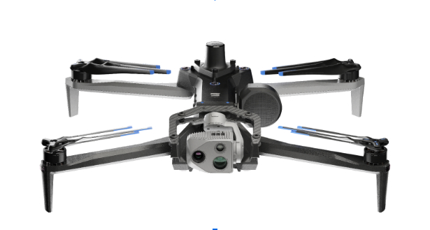
Autonomous drones, such as the Skydio X10 equipped with advanced visual and thermal sensors, are invaluable to industry leaders for their capability to provide instant condition reports of critical infrastructure. Frequent data capture throughout the lifecycle of construction projects allows for better adherence to design specifications and minimizes expensive rework, which often constitutes a significant portion of total project costs. For expansive inspections of bridges or utility sites, the Skydio and Trimble integration offers a comprehensive workflow, ensuring early detection of potential issues and preemptive action to prevent system failures.
Gagan Kanwar, Skydio’s Head of Technology Partnerships, emphasized that this collaboration unites two innovators in their fields to transform the way our physical world is digitized and mapped. The deepened product integration promises users of both Trimble and Skydio technology access to survey-grade accuracy in mapping tasks, thereby accelerating the journey from data collection to insight.
Aviad Almagor, Vice President of Technology Innovation at Trimble, also remarked on the integration’s significance. Incorporating Skydio drones into Trimble’s ecosystem enhances the platform’s overall capabilities, providing a comprehensive workflow from data collection to detailed analysis. This automated workflow caters to the needs of customers dealing with large datasets, maximizing the utility of this data through enhanced processing and quality control procedures.
Key advantages of the Skydio and Trimble partnership include:
- Automated Data Integration: The collaboration introduces an automated, API-based integration, enabling the effortless transition of drone-gathered imagery and metadata from Skydio Cloud to Trimble Industry Cloud. This feature expedites the transformation of reality-captured data into actionable insights, shortening the decision-making timeline.
- Survey-Grade Accuracy with Skydio X10: The cutting-edge Skydio X10 drone, when used with the RTK GPS attachment, will be fully compatible with Trimble’s GNSS receivers. This ensures that joint customers can achieve survey-grade precision in their mapping endeavors. Additionally, customers will have the option to perform PPK based corrections after flights, further enhancing accuracy.