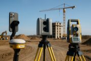
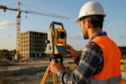
Surveying is becoming increasingly important across global construction, infrastructure and industrial technology, influencing how projects are visualised, coordinated, delivered and managed over time.
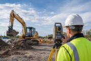
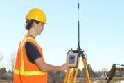
Kilmac Ltd. has taken delivery of six Trimble SPS720 total stations, six Trimble R780 GNSS smart antennas and six Trimble TSC710 data collectors running Trimble Siteworks...
The strategic agreement between Topcon Positioning Systems and GreenValley International signals a wider change in how geospatial technology is being developed and sold....
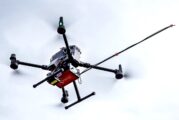
SPH Engineering has opened applications for the Global Drone Operations Awards 2026, an international recognition programme aimed at advanced drone work in industrial, sc...
A call for conference speakers rarely registers as commercial news, yet the agenda an event chooses to build tends to anticipate where procurement budgets and project spe...
Mining companies around the world continue to face mounting pressure to improve safety, productivity and operational consistency while working with increasingly complex f...
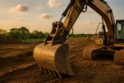
construction industry is facing a challenge that extends far beyond technology, sustainability or project delivery. Across the United States and many developed economies,...
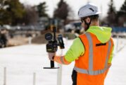
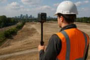
Location data has quietly become one of the most influential forces shaping modern infrastructure, transport networks, utilities, emergency response systems and urban pla...
The sixth edition of Geo Connect Asia 2026 opens in Singapore at a moment when infrastructure delivery is undergoing a profound digital shift. Hosted at the Sands Expo an...
The growing reliance on location intelligence across infrastructure, construction and transport is no longer a niche trend. It has become a core operational layer for how...
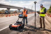
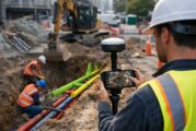
Modern infrastructure projects increasingly depend on accurate data, not only about what lies above ground but also about the hidden networks buried beneath the surface....
For years, high-resolution reality capture sat at the edge of construction workflows. Laser scanners were accurate but slow, mobile mapping systems were fast but complex,...
Across the global infrastructure sector, the most expensive problems are often the ones nobody can see. Utilities, highways agencies and contractors consistently face del...
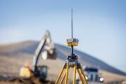
For decades, construction productivity has depended on one quiet assumption. Machines, rovers and layout crews can always see the sky. From open highways to farmland, sat...
Across the world, road agencies face a familiar dilemma. Networks are ageing, budgets are tightening, and the cost of deferred maintenance continues to climb. According t...
The global geospatial sector is entering a decisive phase. From digital twins and infrastructure resilience to AI driven analytics and satellite intelligence, location da...
Across the global construction and mining ecosystem, the conversation around digital transformation often circles back to a single sticking point. Organisations aren’t sh...
Looq AI has strengthened its position in the rapidly evolving world of ground-based reality capture, announcing seven new partnerships across North America, Europe, India...
At INTERGEO 2025 in Frankfurt, Topcon Positioning Systems is pivoting aggressively into the future of geomatics, unveiling a bold expansion of hardware and software tools...
Topcon Positioning Systems has unveiled a dedicated global business unit focused exclusively on geomatics, signalling a major shift in how the company approaches geospati...
In a move poised to reshape the landscape of rail and tunnel construction technologies, Topcon Positioning Systems and Amberg Technologies Ltd. have officially joined for...
Trimble has just turned up the dial on construction efficiency with the release of its Siteworks Machine Guidance Module, purpose-built for tilt bucket attachments. This...
Xona Space Systems, a trailblazer in advanced commercial satellite navigation, has announced a strategic collaboration with Trimble, a global leader in construction, geos...
Topcon Corporation and FARO Technologies have joined forces in a strategic agreement poised to transform the laser scanning industry. This collaboration is set to push th...
The rapid evolution of geospatial technology is reshaping industries across the globe, and Geo Connect Asia (GCA) 2025 is set to take centre stage in showcasing its trans...
In a bold move set to transform photogrammetry and high-precision positioning, Topcon Positioning Systems and Pix4D have announced a strategic partnership. This collabora...
Topcon Positioning Systems has unveiled its latest innovation, the HiPer XR GNSS receiver, poised to set new benchmarks in surveying, mapping, and construction applicatio...
In a bold move to modernise the construction landscape, Komatsu has merged Artificial Intelligence (AI) with its cutting-edge Smart Construction Edge platform, setting a...
Topcon Positioning Systems has announced its recertification as a Great Place To Work® in the United States of America and the addition of the accolade to its workplaces...
Trimble is set to attend Digital Construction Week and GEO Business taking place at London’s ExCel, with the global technology company set to bring its construction and s...
Topcon Positioning Systems has announced a new manufacturing facility will be built in Geisenheim, Germany, near Frankfurt, for the company’s Topcon Electronics operation...
Earthmoving digital solutions expert, Smart Construction, is preparing to unveil its latest product to champion digitalisation in the construction industry at Intermat 20...
Managing a construction project from planning stage to execution in the real world is replete with challenges. Whether a company is building a sprawling solar farm or lay...
In an era where technology’s evolution seems to outpace time itself, the construction industry is not left behind. Trimble has once again pushed the envelope with t...
Atwell has acquired BEI Engineering Group, LLC, doing business as Banks Engineering, a 90-person firm providing civil engineering, planning, and land surveying services....
In an era where technological advancements redefine boundaries, a pioneering study published on 10 November 2023 in the Journal of Remote Sensing is charting new territor...
Topcon Positioning Systems announces the launch of the LN-50 3D laser, the latest addition to the LN layout navigator family of instruments. Intended to be an affordable...
Skydio, the premier U.S. drone manufacturer, recognized for its autonomous flight technology, has announced a pioneering partnership with Trimble, a global leader in mapp...
HP Inc., announced full availability of HP SitePrint in the US, Canada, UK and Ireland following a successful Early Access Program with some of the biggest names in const...
ModalAI, Inc., a Blue UAS Framework manufacturer of autonomous drone and robot technology, announced today the availability of its smallest, smartest, and safest developm...
The CHCNav CGI+ 610 is a cutting-edge GNSS receiver designed to revolutionize the world of precise positioning. With advanced features, exceptional accuracy, and robust c...
This website uses cookies to improve your experience while you navigate through the website. Out of these, the cookies that are categorized as necessary are stored on your browser as they are essential for the working of basic functionalities of the website. We also use third-party cookies that help us analyze and understand how you use this website. These cookies will be stored in your browser only with your consent. You also have the option to opt-out of these cookies. But opting out of some of these cookies may affect your browsing experience.
Necessary cookies are absolutely essential for the website to function properly. These cookies ensure basic functionalities and security features of the website, anonymously.
Cookie
Duration
Description
cookielawinfo-checkbox-analytics
11 months
This cookie is set by GDPR Cookie Consent plugin. The cookie is used to store the user consent for the cookies in the category "Analytics".
cookielawinfo-checkbox-functional
11 months
The cookie is set by GDPR cookie consent to record the user consent for the cookies in the category "Functional".
cookielawinfo-checkbox-necessary
11 months
This cookie is set by GDPR Cookie Consent plugin. The cookies is used to store the user consent for the cookies in the category "Necessary".
cookielawinfo-checkbox-others
11 months
This cookie is set by GDPR Cookie Consent plugin. The cookie is used to store the user consent for the cookies in the category "Other.
cookielawinfo-checkbox-performance
11 months
This cookie is set by GDPR Cookie Consent plugin. The cookie is used to store the user consent for the cookies in the category "Performance".
viewed_cookie_policy
11 months
The cookie is set by the GDPR Cookie Consent plugin and is used to store whether or not user has consented to the use of cookies. It does not store any personal data.
Functional cookies help to perform certain functionalities like sharing the content of the website on social media platforms, collect feedbacks, and other third-party features.
Performance cookies are used to understand and analyze the key performance indexes of the website which helps in delivering a better user experience for the visitors.
Analytical cookies are used to understand how visitors interact with the website. These cookies help provide information on metrics the number of visitors, bounce rate, traffic source, etc.
Advertisement cookies are used to provide visitors with relevant ads and marketing campaigns. These cookies track visitors across websites and collect information to provide customized ads.