A Road Asset Lifecycle Management Long-Term Solution
Mobile mapping technology and AI-driven software expedite and improve roadway design and construction, while providing the data necessary for cost-effective, ongoing maintenance.
Across Europe, the issue of overdue maintenance on highways has reached crisis mode, with governments and their agencies struggling to keep roads and bridges safe. For example, large potholes and cracks have caused physical injuries to cyclists and damage to vehicles, and the public is dissatisfied with efforts to address the growing problem. The BBC reported the UK government committed an additional £200 million (US$251 million) to tackling potholes in 2023–24, but it is not a long-term solution.
The current approach of reactive maintenance results in excessive costs and greater environmental impacts without building a useful, sustainable infrastructure. As an alternative, populating a 3D digital twin model with accurate, up-to-date geospatial information forms a useful foundation for planning, operations, and construction. Proactive maintenance will help avoid costly temporary repairs and provide safer roads and bridges for everyone.
Leveraging Technology for End-to-End Workflows
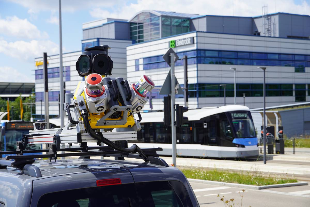
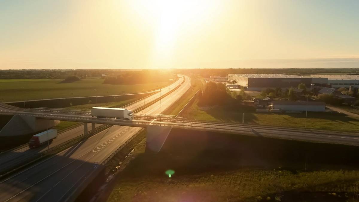
New software and hardware technology can be leveraged to increase efficiency and productivity in all stages of roadway design, construction, and maintenance. Advanced mobile mapping systems collect engineering-grade survey data while traveling at normal driving speeds, potentially covering hundreds of miles in a day. By comparison, traditional survey methods are more time consuming and require costly and inconvenient road closures to keep workers safe while operating terrestrial laser scanners and other manual equipment.
Field data capture software is tightly integrated with mobile mapping hardware to enable a seamless field-to-office workflow. In the office, artificial intelligence (AI) significantly speeds up the automated classification and feature extraction processes, which turn the point cloud data into meaningful information.
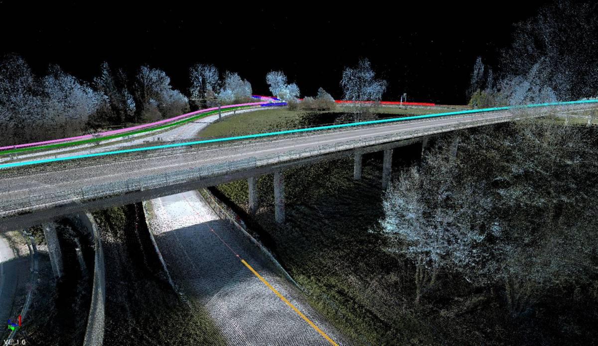
The processed data is incorporated into multiple models and used to perform many kinds of analysis, such as bridge deformation monitoring, crack and pothole detection, tunnel monitoring, and more. In the case of new construction, designs and supporting attribute information are used for the resulting physical construction and transmitted back to the field in the form of measurements and designs.
The rapidly evolving technology supports a continuous transfer of information along a physical-to-digital-to-physical continuum that enables better information sharing between stakeholders, faster identification of problems, and efficient use of resources. Faster collection of data and improved communication should help agencies work through their backlogs of maintenance issues while assisting with future planning and design.
AI Does the Heavy Lifting
Mobile mapping systems collect both high-density point clouds and imagery, with each data type requiring different AI techniques to extract information. Automated classification and feature extraction workflows produce the best output when based on a fusion of various AI techniques, including 3D and 2D deep learning.
Mobile mapping systems can collect hundreds of miles of data per day, making processing the highly detailed point clouds challenging. The ability of AI to process large amounts of data, recognize patterns, make predictions, and identify trends and risks goes far beyond human capabilities.
Streamlined workflows incorporating AI help avoid shifting the time saved in the field to tedious processing of high-volume data in the office. Training machines to perform time-consuming, repetitive activities frees up time for humans to focus on more complex tasks, such as analysis and decision making.
Pavement analysis is just one of the exciting areas where AI generates valuable results faster and more accurately than humans. An automated pavement condition inspection application identifies potholes, bumps, depressions, corrugation, rutting, and cracks from the mobile mapping data. The software then calculates a pavement condition score according to internationally recognized American Society for Testing and Materials (ASTM) standards.
When applied to mobile mapping data, the pavement analysis tool in Trimble Business Center (TBC) not only identifies the geographic location of problem areas, but also categorizes the type of issue and determines the degree of severity. Crews can then use Trimble SiteVision field software to visualize and assess the situation before traveling to the site and use Trimble Access to efficiently manage repairs in the field. Also, the pavement scores can be loaded into an asset management software like Trimble AgileAssets for prioritized maintenance. Widespread pavement analysis could support a proactive approach that allows treatment of small problems before they become critical.
Long-Term Strategy for Roads
Due to increasing costs and dissatisfaction associated with ineffective road repairs, agencies responsible for road construction and maintenance are under increasing pressure to develop long-term strategies to handle increased traffic and loads. Rather than patch and re-patch substandard infrastructure, rebuilding from the ground up with quality materials, followed by diligent maintenance, is generally accepted as the best approach going forward.
In response, the UK Government is implementing a Digital Roads program that leverages digital technology to improve the Strategic Road Network (SRN) and provide better service to its constituents. It is working with suppliers, contractors, institutions, and academia to establish an effective approach for digitizing the road infrastructure. Elements of the plan include parametric-based 3D models, including design specifications that can be compared to as-builts.
Meanwhile geospatial professionals are emphasizing the importance of a strong data interoperability environment between field software and office software to achieve efficient digital workflows. Advanced data collection methods, like mobile mapping systems, provide precise, feature-rich data, essential for various workflows such as automated crack detection, and integrated software creates a seamless path for transferring and processing data to extract information.
A Common Goal
An end-to-end digital lifecycle management strategy is attainable using the vast technological resources available today. Widespread use of mobile mapping and AI are steps in the right direction. Improving access to information throughout the infrastructure network can support achieving the common goals of safer travel, faster deliveries and enhanced customer experiences.
Article by Joe Blecha, marketing director for Trimble Geospatial responsible for software solutions, and Karl Bradshaw is a market manager for Trimble Geospatial responsible for mobile mapping.