Environmental Monitoring of Soil Moisture using Satellites
The quest to understand and monitor soil moisture – one of Earth’s most critical resources – has reached a new frontier with advances in satellite technology.
Soil moisture is fundamental to the water cycle, influencing everything from climate patterns to agricultural productivity and ecosystem health. Yet, obtaining accurate soil moisture data has long been a challenge, particularly in regions with complex terrains and diverse surface conditions. Traditional methods, such as microwave remote sensing, have struggled to deliver the fine-grained data necessary for effective monitoring.
In a significant breakthrough, a new approach using spaceborne Global Navigation Satellite System Reflectometry (GNSS-R) has emerged, offering improved accuracy and adaptability for soil moisture measurement. Published in Satellite Navigation on 2nd September 2024, the study by Huang et al. from the Chinese Academy of Sciences presents a cutting-edge model that tailors soil moisture retrieval to specific geographical regions, solving many of the issues faced by earlier methods.
Advanced Technology to Solve Old Problems
For years, scientists have grappled with the limitations of traditional soil moisture retrieval methods. Complex landscapes, varied climates, and the need for additional auxiliary data have all hampered efforts to monitor soil moisture with precision. With GNSS-R, the potential for more reliable and high-resolution data is tantalisingly close – but even this advanced technology has struggled with geographic variability.
Huang’s research team took on this challenge by creating a more sophisticated solution. Instead of relying on a one-size-fits-all model, they devised five distinct models tailored to different geographical grids. This customisation enables their method to adapt to the unique features of each region, reducing errors and improving correlation coefficients across the board. The study, funded by prominent scientific organisations in China, is a landmark in the ongoing quest to improve environmental monitoring through satellite technology.
How GNSS-Reflectometry Works
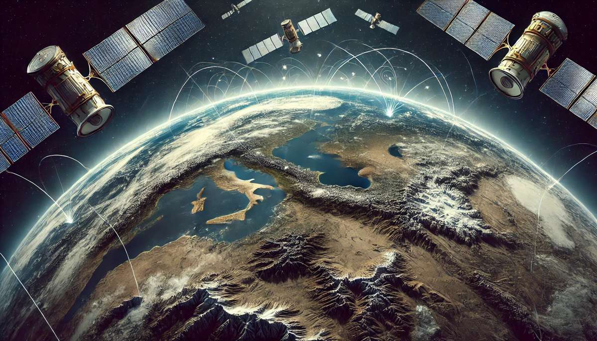
The GNSS-R method relies on signals from navigation satellites, such as those in the Global Navigation Satellite System (GNSS). When these signals reflect off the Earth’s surface, they carry valuable information about the conditions they encounter, including soil moisture levels. By analysing these reflected signals, scientists can retrieve data about the moisture content of the soil – but the process is not without complications. Variations in terrain, surface composition, and climate conditions can all affect the accuracy of the data.
To overcome these challenges, Huang et al. employed data from two satellite systems: the Cyclone Global Navigation Satellite System (CYGNSS) and Soil Moisture Active Passive (SMAP). By integrating information from these sources, the researchers were able to design their five distinct models, each tailored to specific types of terrain and climate conditions. The result is a method that reduces errors and improves accuracy, even in regions where traditional models have struggled.
Significant Improvements in Accuracy
One of the standout achievements of this study is the dramatic improvement in retrieval accuracy. The team used key performance metrics, such as the Root Mean Square Error (RMSE), to assess the effectiveness of their models. On average, the new method led to a 9.1% reduction in RMSE and a 22.7% improvement in correlation coefficients compared to previous approaches.
Dr. Fade Chen, the study’s corresponding author, commented on the implications of these findings: “Our research directly addresses the challenge of geographical variability in soil moisture retrieval. By tailoring models to specific regions, we’ve developed a method that not only enhances accuracy but also reduces reliance on ancillary data, making it a valuable tool for environmental and climate research.”
Indeed, this innovative approach has the potential to transform how soil moisture is monitored around the world, with applications across a range of industries.
Real-World Applications: From Agriculture to Disaster Management
The importance of accurately monitoring soil moisture cannot be overstated. In agriculture, for example, soil moisture levels are crucial to determining when and how much to irrigate crops. Inaccurate data can lead to water waste or poor crop yields, both of which can have serious consequences for food production and resource management. The model developed by Huang’s team offers a more precise way to track soil moisture, enabling farmers to optimise their irrigation strategies and improve productivity.
Beyond agriculture, the new model has applications in climate research, environmental monitoring, and disaster management. Accurate soil moisture data is essential for predicting weather patterns and understanding climate change, while in disaster management, it plays a key role in flood and drought response efforts. By providing more reliable data, this new approach can help policymakers and scientists respond to extreme weather events with greater accuracy and efficiency.
Additionally, the model’s adaptability across different terrains and climates makes it a valuable tool for regions that have historically been difficult to monitor. From mountainous landscapes to arid deserts, the model’s ability to tailor itself to specific conditions is a game-changer for global soil moisture assessment.
Reduced Dependence on Auxiliary Data
Another key advantage of the new method is its reduced dependence on auxiliary data. In previous models, soil moisture retrieval often required extensive supplementary information – such as land surface temperature or vegetation data – to achieve accurate results. Gathering this data is time-consuming and expensive, limiting the practicality of these models in many parts of the world.
By reducing the need for such data, Huang’s model makes soil moisture retrieval more accessible and cost-effective. This is particularly important for developing countries, where resources for environmental monitoring are often limited. With fewer data inputs required, the new model can be deployed more widely, helping to improve soil moisture monitoring in regions that have previously been underserved.
Future Prospects and Implications
The significance of this research goes beyond just improving soil moisture monitoring; it represents a step forward in satellite technology’s application to environmental science. As global populations grow and climate change accelerates, the need for sustainable agricultural practices and more accurate climate data has never been more urgent.
By offering a more precise and adaptable tool for soil moisture measurement, Huang and his team have made a meaningful contribution to the fight against climate change and the quest for sustainability.
Their research, funded by the Natural Science and Technology Planning Foundation of Guangxi, the National Natural Science Foundation of China, and the “Ba Gui Scholars” programme, is likely to have far-reaching impacts in the years to come.
As Dr Chen pointed out: “This method’s capacity to adapt to diverse global conditions represents a significant step forward in soil moisture monitoring and its application in real-world scenarios.” With further refinement and wider adoption, this approach could become the new gold standard in environmental monitoring.
