Esri, DevRev, Microsoft Fabric and the Future of Unified Spatial Intelligence
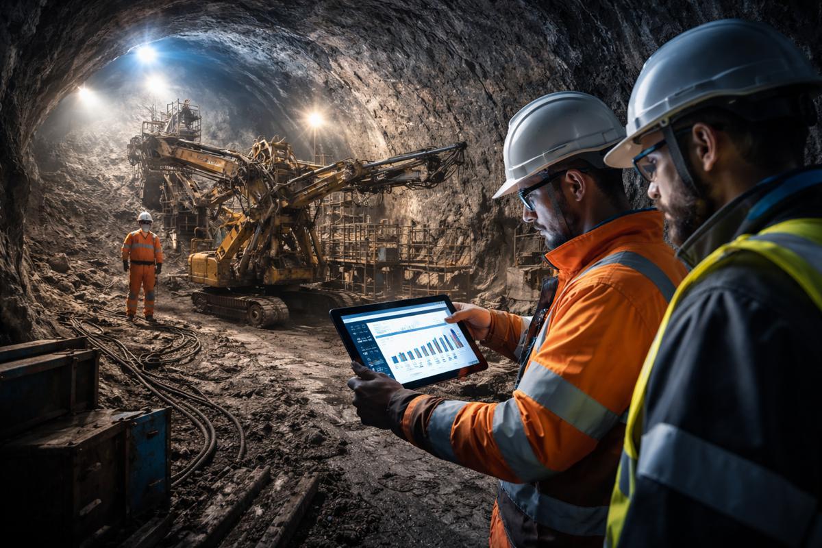
The construction, infrastructure, and wider industrial sectors are experiencing a surge in demand for clearer data visibility, more reliable forecasts, and faster decision-making. As projects become more digitally connected, organisations increasingly recognise the value of understanding not only what is happening but where it is happening. Spatial awareness, once considered the domain of GIS specialists alone, has become essential for data engineers, analysts, and executives attempting to track performance, manage assets, and respond to real-time conditions.
Modern enterprises are moving vast quantities of information across data lakes, analytics systems, and operational platforms. Bringing spatial insight directly into these environments has become a strategic priority, particularly when projects span multiple regions, stakeholders, and supply chains. The growing market need has pushed geospatial tools to integrate more deeply with AI-powered enterprise platforms.
Two major developments are now reshaping how organisations unify geospatial analysis with enterprise-grade AI. Esri, the global leader in location intelligence, has launched ArcGIS GeoAnalytics for Microsoft Fabric, alongside the public preview of ArcGIS Maps for Microsoft Fabric. At the same time, DevRev has introduced its AI-native integration between Computer, its intelligent digital teammate, and Microsoft Fabric. Combined, these advances signal a significant shift in how organisations capture, analyse, and act on their most complex geospatial and operational datasets.
Esri Brings Location Intelligence To Microsoft Fabric
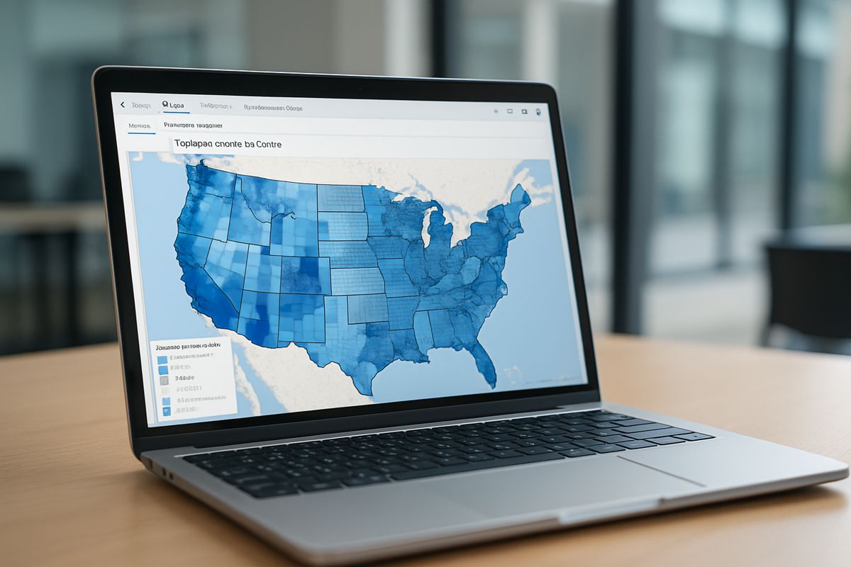
Esri’s newly announced ArcGIS GeoAnalytics for Microsoft Fabric is now generally available, marking a considerable expansion of spatial analytics capabilities within Microsoft’s data ecosystem. The integration allows organisations to apply advanced geospatial functions directly within their Fabric environment. Users working from Microsoft OneLake, Power BI, or their ArcGIS platform can move data more freely, perform high-speed analysis, and connect multiple systems into a seamless workflow.
Esri president Jack Dangermond described the significance of this milestone: “This integration makes some of Esri’s core capabilities accessible for data professionals directly from their Microsoft Fabric environment.” He continued by emphasising the longstanding collaboration between the two companies: “We are pleased to advance our long-standing strategic collaboration with Microsoft to help our shared customers unlock spatial insights and reveal unexplored patterns.”
The integration responds directly to the growing expectations of data scientists, analysts, and engineering teams that require spatial indexing, clustering, pattern detection, and proximity analysis inside familiar enterprise environments. GeoAnalytics for Fabric delivers exactly that. It reduces data movement, strengthens governance, and cuts down on time-consuming transfers between separate GIS and BI systems.
Empowering Scientists With High-Velocity Geospatial Analysis
One of the earliest adopters of ArcGIS GeoAnalytics for Microsoft Fabric has been the Met Office, the United Kingdom’s national weather and climate service. Their teams frequently work with large volumes of high-velocity observational data. This includes sensor readings, environmental metrics, radar feeds, and atmospheric models that must be interpreted and visualised with both scientific accuracy and operational urgency.
Richard Lawrence, principal fellow for technology at the Met Office, highlighted the impact of the new integration: “Whilst using Microsoft Fabric to process high velocity observation datasets, Met Office scientists used the ArcGIS GeoAnalytics [for Microsoft Fabric] functions to perform advanced geospatial analysis on the data.” He noted that the integration enabled types of analysis that had not previously been possible within their environment: “With the functionality built right into Microsoft Fabric, our scientists were able to easily perform analysis on this complex dataset that they had never performed before.”
This capability is critical for climate research, flood modelling, severe weather forecasting, and long-term environmental planning. By combining high-speed processing with spatial intelligence inside a unified platform, researchers can focus on insights rather than data orchestration.
ArcGIS Maps For Fabric Adds Visual Depth To Enterprise Data
Alongside GeoAnalytics, Esri has launched ArcGIS Maps for Microsoft Fabric into public preview. Available via the Fabric Workload Hub, this tool allows users to create interactive maps without leaving their existing workspace. By designing maps within familiar Microsoft interfaces, organisations can add contextual layers such as demographics, lifestyle data, infrastructure networks, land use, and environmental indicators.
This enriched view transforms how management teams interpret operational data. Patterns that remain hidden in tabular formats quickly become clear when displayed spatially. Trends, relationships, outliers, and growth hotspots reveal themselves, offering senior decision-makers a more intuitive understanding of project performance.
Microsoft’s Dipti Borkar, VP and GM of Microsoft OneLake and Fabric Ecosystem, noted the importance of this evolution: “Users can now access powerful GeoAnalytics functions running in Apache Spark on Fabric, enabling them to explore and unlock the full potential of geospatial intelligence with their authoritative ArcGIS data in OneLake.” She added that ArcGIS Maps for Fabric represents an even deeper level of integration between Esri’s tools and Microsoft’s analytics ecosystem.
With general availability planned for the near future, organisations can expect more advanced capabilities, better interoperability, and stronger support for enterprise governance models.
DevRev Extends AI-Native Intelligence Into Microsoft Fabric
While Esri focuses on spatial analysis, DevRev has taken a complementary approach by connecting its AI-native technologies to Microsoft Fabric. The company’s digital teammate, Computer, now integrates directly with Microsoft OneLake through DevRev’s patented Computer AirSync engine. The result is a unified data layer that strengthens enterprise workflows across customer support, analytics, and product development.
Dheeraj Pandey, DevRev’s co-founder and CEO, explained the significance of the collaboration: “Our integration with Microsoft Fabric represents a major step toward breaking down the barriers between enterprise data, analytics, and AI.” He highlighted the value of connecting Fabric datasets to DevRev’s knowledge graph: “By connecting data from Microsoft Fabric and Microsoft OneLake with DevRev’s AI-native knowledge graph, we’re giving organizations the ability to unify intelligence across multiple applications and every team, empowering both humans and AI agents to make faster, smarter decisions.”
The approach offers a single source of truth capable of powering real-time analytics, ticket resolution, predictive maintenance, resource allocation, and product roadmap decisions. DevRev’s integration complements Esri’s by adding a semantic, relationship-driven layer that correlates operational data with customer and product intelligence.
Enterprise Benefits: From Unified Analytics To Competitive Advantage
The combined value of ArcGIS GeoAnalytics, ArcGIS Maps for Fabric, and DevRev’s AI-native connectivity significantly strengthens Microsoft Fabric’s position as a central hub for enterprise intelligence. These integrations deliver several high-impact advantages.
- Unified Analytics: Organisations can blend geospatial, operational, customer, and product data into a consistent analytical framework. This supports better risk assessments, faster cycle times, and more accurate reporting across construction, infrastructure, logistics, and energy sectors.
- Enhanced AI Context: With cross-application awareness, AI agents can deliver contextually accurate insights that reflect real-world conditions and spatial relationships.
- Cross-Platform Workflows: By removing data silos, project teams can connect planning, support, engineering, and management workflows across multiple tools and departments.
- Investment Protection: Enterprises already committed to OneLake gain enhanced capabilities without rebuilding their entire data architecture.
- Competitive Differentiation: Microsoft-centric organisations gain an advantage by pairing advanced geospatial intelligence with AI-native reasoning, creating more resilient, data-driven operations.
Strengthening The Microsoft Ecosystem
Microsoft has continued to emphasise Fabric as a unified foundation for enterprise analytics. Integrations such as those from Esri and DevRev reinforce this strategy while highlighting Microsoft’s ambitions to create a complete platform that supports business intelligence, operational decision-making, and AI-enabled automation.
Dipti Borkar highlighted the shared vision: “By integrating Computer by DevRev with Microsoft OneLake, customers can infuse their enterprise data with powerful semantic information to generate deeper insights and accelerate AI initiatives.” She confirmed that the partnership aims to help organisations maximise their value from the Microsoft ecosystem.
The upcoming certified DevRev AirSync connector will soon appear as a native data source within Fabric, further strengthening Fabric’s growing footprint across industries.
A New Era Of Spatially Enabled Enterprise Intelligence
The convergence of geospatial analytics, AI-native data interpretation, and unified data lakes marks the next stage of digital transformation. For organisations operating in construction, infrastructure, logistics, energy, and manufacturing, the ability to see both the big picture and the specific location of challenges or opportunities is becoming essential.
Esri’s GeoAnalytics for Fabric, ArcGIS Maps for Fabric, and DevRev’s AI-native integration represent a powerful combination. Together, they enable enterprises to understand where events are happening, why they matter, and how teams should respond. This blend of spatial intelligence and contextual AI will pave the way for faster decision-making, stronger collaboration, and safer, more efficient project delivery.
As Microsoft expands Fabric’s capabilities and more partners introduce spatial and AI-native tools, the enterprise data landscape will continue to evolve. The organisations that embrace these capabilities now will be well placed to lead the next generation of digitally connected industries.