Scheimpflug Imaging Reimagined for Next Generation Infrastructure Sensing
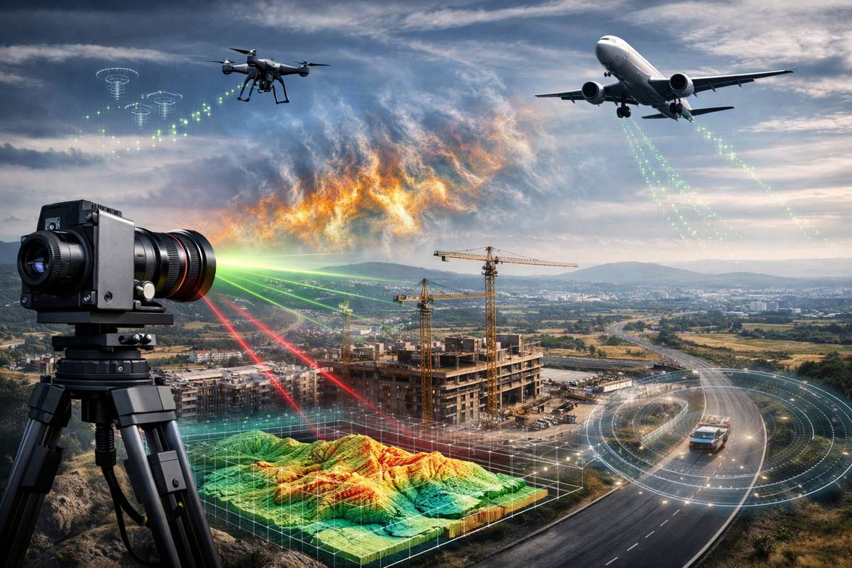
A century-old optical principle is quietly re-emerging as a credible contender in the race to redefine how infrastructure is measured, monitored and managed. Researchers at the Georgia Tech Research Institute are advancing the Scheimpflug technique into a modern sensing platform that could complement, and in some cases rival, established LiDAR systems across construction, transport and environmental monitoring.
At its core, the Scheimpflug principle is a geometric relationship between the lens plane, image plane and subject plane that allows sharp focus across a tilted field. Historically, it found use in photography and aerial reconnaissance. Today, however, it is being re-engineered into a computational sensing framework capable of extracting depth, motion and atmospheric data from standard camera systems. That shift matters. As infrastructure projects demand more frequent, lower-cost and data-rich surveying solutions, the industry is increasingly looking beyond conventional laser-based systems.
Researchers at GTRI are now translating this optical theory into practical sensing tools. Their work spans rangefinder camera development, advanced sensor integration and computational processing techniques designed to generate accurate spatial data. Crucially, these systems can operate both passively and alongside laser-based technologies, offering flexibility across a wide range of applications from construction site monitoring to airspace surveillance.
Briefing
- Scheimpflug imaging is being developed as a cost-effective alternative and complement to LiDAR for short- and medium-range sensing
- The technique enables rich data capture through camera-based systems rather than relying solely on laser time-of-flight measurements
- Applications include atmospheric turbulence monitoring, object tracking and infrastructure mapping
- Research is being led by GTRI with support from internal R&D and student-led innovation programmes
- Data fusion with existing sensing technologies is a key focus, enhancing accuracy and operational value
A Different Approach to Measuring the Built Environment
Unlike traditional LiDAR systems, which rely on emitting laser pulses and measuring their return time, the Scheimpflug technique derives spatial information through geometric relationships within an image. This fundamentally alters how data is captured and interpreted. Instead of discrete point clouds generated by laser reflections, camera-based systems provide dense visual information that can be processed into depth maps and motion analytics.
That distinction opens up new possibilities. In infrastructure environments where cost, deployment speed and data richness are critical, camera-based sensing can offer a compelling alternative. While LiDAR remains highly effective for long-range and high-precision applications, its hardware costs and energy requirements can limit scalability in certain use cases. Scheimpflug-based systems, by contrast, leverage relatively inexpensive imaging components combined with advanced computational models.
Nathan Meraz, a senior research scientist at GTRI, has been at the forefront of adapting the technique for modern sensing challenges. “The Scheimpflug technique is a complete alternative to time-of-flight (ToF) LiDAR, and we’re looking for everything we can do with it,” he explained. “It measures things differently, and since it’s a camera sensor, there’s a lot more information to process compared to a LiDAR signal. And there are also data fusion aspects.”
Unlocking New Capabilities Through Data Richness
One of the most significant advantages of Scheimpflug-based sensing lies in the volume and diversity of data captured. Traditional LiDAR systems generate highly accurate but relatively sparse datasets. Camera-based systems, on the other hand, capture continuous visual information that can be analysed for multiple parameters simultaneously.
This multi-dimensional data approach is particularly relevant for infrastructure monitoring. For example, in road and bridge inspection, a single imaging system could potentially assess surface conditions, detect structural anomalies and monitor environmental factors such as dust or atmospheric distortion. By combining geometric depth extraction with image analysis, engineers gain a more holistic understanding of asset performance.
The implications extend into transport systems as well. Monitoring atmospheric turbulence, for instance, is critical for both aviation safety and the performance of autonomous systems. Scheimpflug imaging can detect subtle variations in air density and movement, offering a new layer of situational awareness that traditional sensors may struggle to provide at comparable cost levels.
Bridging the Gap Between Passive and Active Sensing
A notable strength of the Scheimpflug approach is its flexibility in deployment. Unlike purely active systems such as LiDAR, which require energy-intensive laser emission, camera-based sensing can operate passively using ambient light. This reduces power consumption and simplifies integration into existing infrastructure.
However, the technology is not positioned as a direct replacement for LiDAR in all scenarios. Instead, researchers are exploring hybrid models where Scheimpflug imaging complements laser-based systems. By fusing data from both sources, it becomes possible to enhance accuracy, fill data gaps and improve resilience under challenging conditions such as fog, dust or variable lighting.
Data fusion is increasingly recognised as a cornerstone of next-generation infrastructure intelligence. Combining multiple sensing modalities allows systems to cross-validate information and maintain performance even when one sensor type is compromised. In this context, Scheimpflug imaging adds a valuable new dimension to the sensing ecosystem.
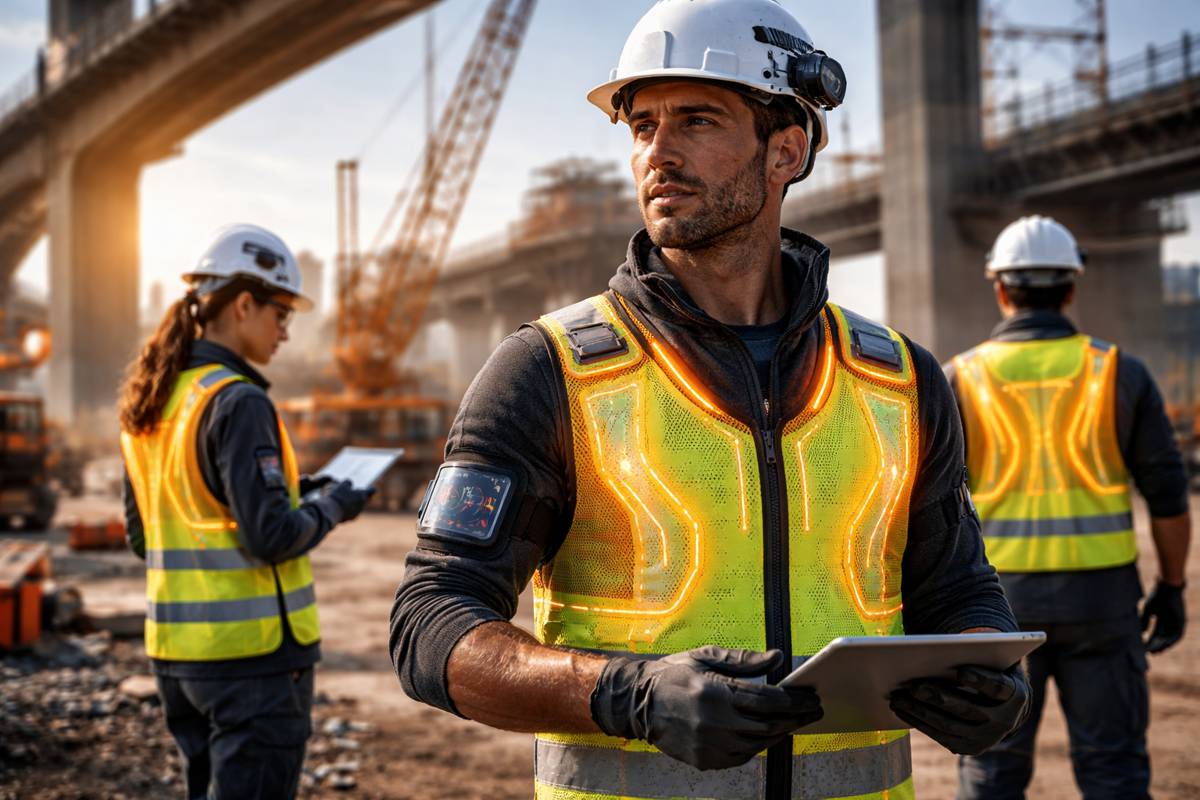
Practical Applications Across Construction and Transport
The potential applications of Scheimpflug-based sensing are broad and directly aligned with the evolving needs of the construction and infrastructure sectors. In site surveying, the technology could enable rapid, low-cost mapping of terrain and built assets, reducing reliance on expensive scanning equipment. For contractors managing large or remote projects, this offers a practical route to more frequent data collection and improved decision-making.
In transport infrastructure, the ability to track airborne objects and monitor environmental conditions has clear relevance. From managing drone traffic to assessing visibility and turbulence on highways and rail corridors, the technology provides new tools for safety and operational efficiency. It also aligns with the growing emphasis on digital twins, where continuous data streams feed into dynamic models of infrastructure systems.
Environmental monitoring represents another key area of interest. As climate change introduces greater variability into weather patterns, infrastructure operators need more granular data on atmospheric conditions. Scheimpflug imaging can contribute to this by providing detailed insights into air movement and particulate behaviour, supporting both short-term operational decisions and long-term planning.
Research Foundations and Academic Collaboration
The development of these applications is being driven by a combination of institutional research and student-led innovation. GTRI’s Independent Research and Development programme has provided the foundation for advancing the technology, while the GTRI Research Internship Program has brought fresh perspectives and additional capacity to the work.
The findings were presented at the SPIE Defense + Commercial Sensing Conference, highlighting the growing interest in alternative sensing technologies within both defence and commercial sectors. This crossover is significant. Technologies that prove effective in demanding environments often find rapid adoption in infrastructure applications, where reliability and performance are equally critical.
Academic collaboration also plays a key role in refining the computational models required for Scheimpflug imaging. Extracting meaningful data from complex image sets demands advanced algorithms and processing techniques. As machine learning and computer vision continue to evolve, the capabilities of camera-based sensing systems are expected to expand accordingly.
Cost, Scalability and Industry Adoption
From a commercial perspective, cost and scalability are likely to be decisive factors in the adoption of Scheimpflug-based systems. LiDAR technology, while highly capable, remains relatively expensive in terms of both hardware and operational requirements. For many infrastructure operators, particularly in emerging markets or cost-sensitive projects, this creates a barrier to widespread deployment.
Camera-based systems offer a more accessible entry point. By leveraging existing imaging technologies and focusing on software-driven innovation, Scheimpflug sensing has the potential to scale more rapidly. This aligns with broader industry trends towards digitalisation and the use of off-the-shelf components combined with advanced analytics.
That said, adoption will depend on demonstrating reliability and accuracy in real-world conditions. Infrastructure stakeholders are typically cautious when integrating new technologies into critical operations. Pilot projects, field trials and clear performance benchmarks will be essential in building confidence and driving uptake.
A New Layer of Intelligence for Infrastructure Systems
The re-emergence of the Scheimpflug principle as a modern sensing tool reflects a broader shift in how infrastructure is monitored and managed. Rather than relying on single, specialised technologies, the industry is moving towards integrated sensing ecosystems that combine multiple data sources and analytical approaches.
In this landscape, Scheimpflug imaging offers a distinctive contribution. Its ability to capture rich visual data, operate flexibly and integrate with existing systems positions it as a valuable addition to the infrastructure intelligence toolkit. While it may not replace LiDAR outright, it has the potential to reshape how and where sensing technologies are deployed.
As research continues and applications mature, the technology could play a role in making infrastructure monitoring more accessible, more detailed and more responsive to real-world conditions. For an industry grappling with ageing assets, climate pressures and the need for smarter decision-making, that represents a meaningful step forward.