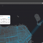
Citilabs leverages location data to create US wide analytics with pedestrian movements
Leading mobility analytics solution provider Citilabs, harnessing smart phone and mobile app data, today announced that its revolutionary population movement analytics platform, Streetlytics, now includes the first-of-its-kind pedestrian analytics dataset.
The Citilabs’ Streetlytics platform leverages information from billions of data points to measure and paint the most complete picture of the moving population providing hour-by-hour origin-destination movements, all streets directional road volumes for vehicles and pedestrians, and traveller demographics based on derived home locations.
With more people moving to cities, planners are increasingly challenged to develop city designs that consider people traveling by not only vehicles, but also walking and biking. They can only manage what they can measure, and though smart tracking devices are becoming more prevalent, they can’t be everywhere.
Additionally, out of home advertisers can understand who sees billboards and street furniture, retailers can understand who is walking in front of their stores, real estate professionals can understand where to develop, and autonomous vehicles can be better prepared for pedestrian traffic.
Streetlytics provides insights into when, where, why, and how people travel – identifying and understanding the trip patterns in our cities in terms of their origins and destinations and the flow of people and vehicles on roads, sidewalks and through mass transit systems.
“Streetlytics provides a comprehensive understanding of population movement – and that understanding now includes pedestrians.” said Citilabs CEO Michael Clarke. “We are excited to make this new data available for the first time to our clients and partners. It will be key to designing and optimizing the transportation solutions and cities of tomorrow.”


