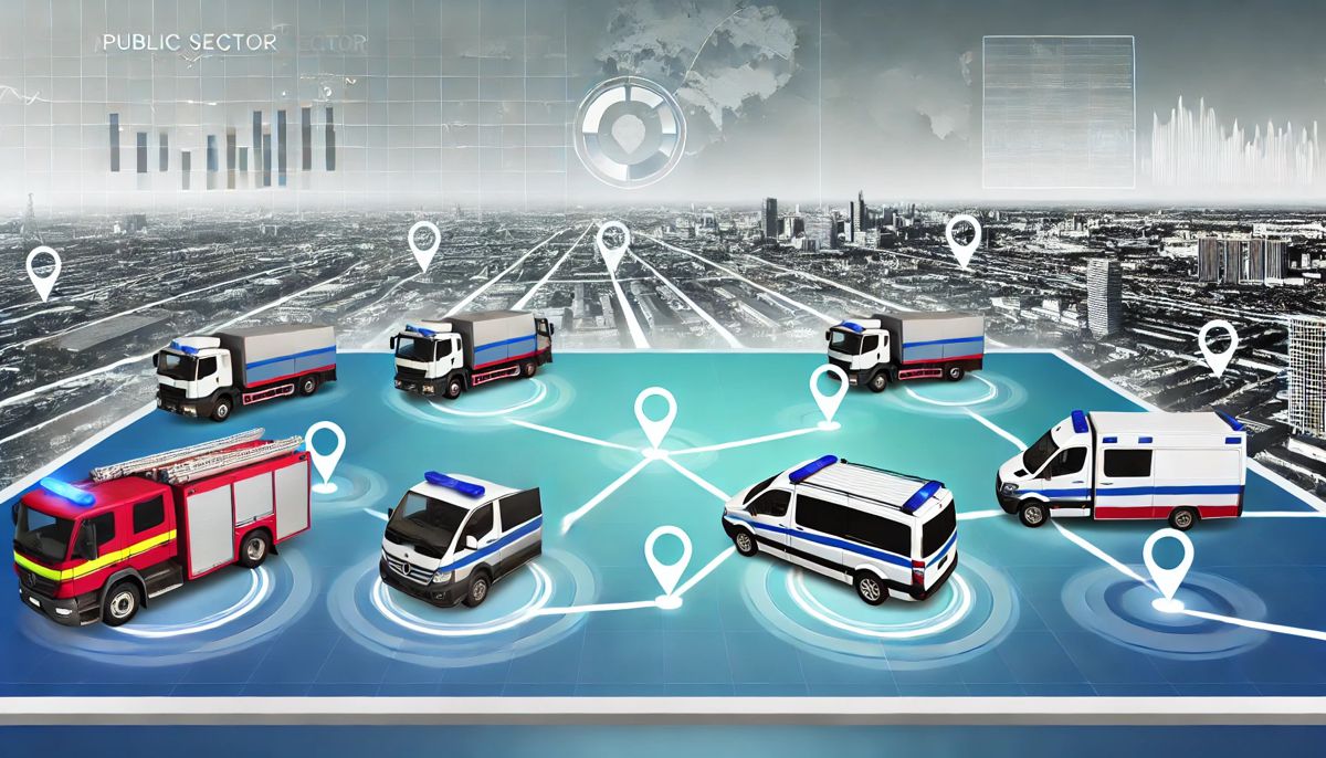
Samsara and Esri supercharge Public Sector Fleet Operations with Real-Time Integration
In the fast-paced world of public sector fleet operations, efficiency and accuracy are more critical than ever. Enter the ground-breaking partnership between Samsara Inc., a trailblazer in Connected Operations® Cloud technology, and Esri, the global frontrunner in geographic information system (GIS) software.
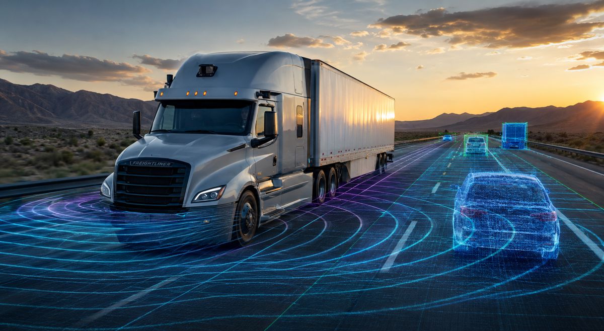
This new integration promises to supercharge fleet management for government agencies by combining real-time telematics data from Samsara with Esri’s cutting-edge ArcGIS® Velocity℠, creating a streamlined, insightful approach to public sector operations.
By integrating the power of Samsara’s telematics data with Esri’s robust geospatial tools, public sector agencies can finally shed the burdensome silos and outdated processes that often plague fleet management. Now, more than ever, operational transparency, efficiency, and safety are just a click away.
Managing Public Sector Fleets with Outdated Systems
Fleet operations for government bodies often face a dizzying array of challenges, not least of which is outdated or siloed data. These inefficiencies can create a cascade of issues, from slow decision-making to inaccurate reporting that hampers fleet management on all fronts.
Let’s be honest: managing fleet operations manually, across disparate systems, is a logistical nightmare. Trying to coordinate emergency response, service fleets, and maintenance operations without real-time data is like driving blindfolded. Poor visibility into fleet activity can lead to missed service targets, wasted resources, and ultimately, dissatisfied citizens.
But here’s where the Samsara-Esri partnership really shines. Their integrated solution empowers government agencies to monitor, analyse, and optimise fleet operations—all in real time.
A New Era for Public Sector Fleets
The integration of Samsara’s real-time telematics data into Esri’s ArcGIS Velocity allows users to ingest, visualise, and analyse a wealth of information instantly. This newfound visibility offers several key benefits, including:
- Enhanced Asset Recovery
The days of tracking down lost or stolen assets through tedious processes are over. Samsara’s geofencing and GPS tracking, combined with Esri’s spatial analytics, make asset recovery a seamless operation. Fleet managers can now quickly locate and recover assets with unprecedented accuracy.
- Improved Emergency Response
When every second counts, as it does in emergency response situations, fleet operators can’t afford delays. The integration delivers real-time location data that ensures vehicles reach their destinations faster. From fire trucks to snowploughs, government fleets can now respond to emergencies with greater precision and speed.
- Comprehensive Post-Event Reporting
Transparency is at the heart of public sector operations, and the ability to generate detailed post-event reports is a game-changer for fleet managers. Whether it’s a breakdown, accident, or routine check, having complete, accurate records supports better decision-making and fosters greater accountability.
Streamlining Operations: Bridging the Gap Between Data Silos
Siloed data is a common issue for many public sector organisations. Different departments often use isolated systems, leading to fragmented data that is hard to reconcile. But with the new Samsara and Esri integration, data silos become a thing of the past.
Thomas Fair, Director of Esri Partner Network, summarised the breakthrough well: “Our partnership with Samsara allows ArcGIS users to combine critical IoT data points with their geospatial system of record for a more complete view of fleet operations and management. By consolidating these insights, we’re empowering our users to make faster, more informed decisions and have a greater impact on the communities they serve.”
In essence, this partnership bridges the gap between IoT data and geospatial analytics, offering users a single, comprehensive view of their entire fleet’s operations. No more clunky systems. No more guesswork.
Why the Public Sector Needs Real-Time Data
Time is money—and in the public sector, time also equals safety and service quality. Whether it’s directing an ambulance to the scene of an emergency or scheduling routine vehicle maintenance, every decision benefits from real-time data. That’s exactly what this integration delivers.
Robert Williams, Director of Public Sector Partnerships at Samsara, hit the nail on the head when he said: “In government services, safety and efficiency are everything. From emergency dispatch to snow plow operations, every second counts.”
Governments at all levels are tasked with doing more with less. Real-time fleet insights not only improve operational efficiency but also enhance safety and service levels. Moreover, this technological boost isn’t just about today’s problems—it’s also about future-proofing fleet operations as IoT and AI continue to evolve.
A Closer Look at Samsara and Esri
For those not yet familiar, Samsara is a name synonymous with innovative fleet management solutions. The company’s Connected Operations® Cloud has redefined how organisations harness IoT data. With over 290 partner integrations and the largest open ecosystem for physical operations, Samsara stands as a key player in the global economy’s operational backbone.
Esri, meanwhile, has long been the gold standard in geospatial technology. Founded in 1969, the company has pioneered GIS software and location intelligence, helping organisations—from Fortune 500 companies to local councils—unlock the full potential of their data. Today, Esri’s technology is deployed in hundreds of thousands of organisations worldwide.
What This Means for Governments Everywhere
This integration is more than just a technical upgrade; it’s a strategic leap forward for government agencies across the globe. By adopting this real-time solution, they’re not just enhancing fleet efficiency—they’re positioning themselves as leaders in smart, data-driven public services.
Local councils, emergency services, and state agencies can now harness the combined power of Samsara and Esri to keep their operations agile, safe, and sustainable. Moreover, this isn’t just for the big players. With the integration being globally available, government agencies of all sizes can tap into this advanced technology.
Future Possibilities: More Than Just Fleets
While the focus of this integration is currently on fleet management, the potential applications extend far beyond that. Imagine using real-time data to optimise public transportation routes, predict road maintenance needs, or enhance urban planning initiatives. The possibilities are limitless when you combine IoT data with geospatial intelligence.
By providing governments with a single source of truth for their physical operations, this partnership opens the door to innovations that could reshape how public services are delivered.
Driving Innovation Forward
The Samsara and Esri integration is a powerful step toward the future of public sector fleet management. As governments worldwide grapple with the challenges of maintaining efficient, safe, and sustainable fleets, the ability to tap into real-time, actionable data will prove invaluable.
This partnership doesn’t just solve problems; it paves the way for smarter, faster, and more responsible public service. With both Samsara and Esri at the helm, the future of fleet management looks incredibly promising.