AI and Smarter Mapping to Transform Global Environmental Land Monitoring
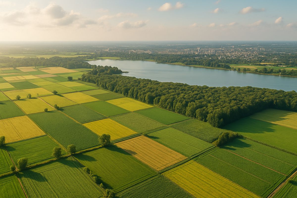
Accurate land cover mapping has become a linchpin for biodiversity protection, climate adaptation, precision agriculture, and sustainable land-use planning. Yet, despite tremendous leaps in satellite remote sensing, one stubborn truth remains: orbiting eyes alone cannot keep pace with the planet’s rapidly changing surface. Cloud cover obscures critical scenes, revisit cycles miss sudden shifts, and validation gaps persist.
In recent years, tools such as Dynamic World have accelerated update cycles. However, sudden environmental transitions, from flash floods to early snowfalls and seasonal wetland pulses, still slip through the cracks. Enter a new era, where ground-level camera networks and advanced AI models stand ready to plug the gaps and deliver near real-time environmental intelligence.
Breakthrough research from Tsinghua University
Researchers from Tsinghua University and partner institutions have pioneered a multimodal framework combining satellite imagery, near-surface camera feeds, and sophisticated AI segmentation. Published in the Journal of Remote Sensing in August 2025, the study outlines a transformative system capable of daily global land cover mapping.
The new FROM-GLC Plus 3.0 system, or FGP 3.0, leapfrogs previous solutions by improving accuracy, sharpening parcel boundaries, and, crucially, capturing abrupt land-use transitions. By reconstructing daily NDVI records using ground-based camera observations and pairing these with satellite data and the Segment Anything Model (SAM), the framework achieved an average accuracy of 70.52%.
It successfully detected events that legacy satellite-only systems missed, including snow accumulation across North America and wetland expansion in Europe. Such precision offers timely alerts for agriculture, disaster preparedness, ecological restoration, and climate resilience planning.
Satellite-only products often miss the rapid shifts that shape our environment: By fusing multimodal data with advanced AI models, FROM-GLC Plus 3.0 delivers daily, accurate insights at both global and parcel scales. This technology provides not only better environmental understanding but also practical support for agriculture, disaster preparedness, and sustainable land management.
Why near-surface cameras matter
The world is seeing an explosion of near-surface camera deployments, from agricultural field stations and environmental observatories to smart highways and municipal monitoring networks. These terrestrial perspectives capture vegetation dynamics, moisture changes, urban expansion, and snow or flood events in real-time.
However, translating camera imagery into consistent global intelligence has proven difficult. Perspective distortion, limited spatial footprints, and inconsistent metadata pose challenges. This study bridges those obstacles with automated spatial alignment, data fusion, and machine-learning-driven normalisation, creating dense NDVI time series that complement orbital data.
Three-layer intelligence
The system integrates three modules that operate across different spatial and temporal scales:
Annual mapping: Annual land cover maps combine:
- Sentinel-1 SAR
- Sentinel-2 multispectral data
- Near-surface camera observations
Automated spatial matching algorithms reconstruct daily vegetation indices, improving classification in mixed landscapes such as cropland-shrub mosaics.
Daily dynamic monitoring: Daily updates leverage migrated training samples and reconstructed imagery streams to detect land transitions on a 24-hour cycle. This enables early detection of phenomena often invisible to periodic satellite passes.
Parcel-level precision with SAM: The Segment Anything Model, deployed via the open-source samgeo toolkit, segments parcels with reduced noise and crisp boundaries.
Tests in China confirmed the model’s ability to track winter wheat and maize rotations at individual field scale. The result: clean, precise classifications stretching from regional to global footprints.
Real-world environmental intelligence: This isn’t just a technical exercise. The framework paves the path toward real-time global environmental awareness.
Key capabilities include:
- Deforestation and land degradation alerts
- Agricultural water stress and crop health monitoring
- Urban development and infrastructure expansion tracking
- Disaster warning for floods, droughts, wildfire burn scars, and snow events
- Biodiversity habitat monitoring and ecosystem restoration tracking
As climate and land pressures intensify, such systems shift from academic innovation to operational necessity.
Smarter land stewardship
The implications stretch far beyond academia. Policymakers, agribusiness leaders, land managers, conservation agencies, and disaster response teams stand to benefit from faster, sharper insight into changing landscapes.
Real-time land monitoring is no longer a distant dream. With planet-scale AI, affordable ground cameras, and continuous satellite fleets, global environmental intelligence is within reach.
A greener, data-smarter world
FORWARD-looking environmental technology is moving from pilot projects to real-world deployment. The marriage of near-surface sensing and AI segmentation will likely become a standard for land monitoring, complementing satellite constellations and drone networks.
As sensor networks expand and models mature, systems like FGP 3.0 will underpin climate resilience strategies, sustainable farming practices, and biodiversity conservation worldwide.