


GEO Business Unveils Dynamic Line-Up of Industry Speakers GEO Business 2025 is gearing up to take over Ex ...
-
GEO Business Unveils Dynamic Line-Up of Industry Speakers

GEO Business Unveils Dynamic Line-Up of Industry Speakers
-
Mapping the Future at Geo Connect Asia 2025

Mapping the Future at Geo Connect Asia 2025
-
Bentley and Google Revolutionising Infrastructure Inspections with AI Analytics

Bentley and Google Revolutionising Infrastructure Inspections with AI Analytics
-
Esri and ALERTCalifornia Deliver Real-Time Disaster Monitoring in ArcGIS
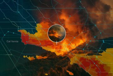
Esri and ALERTCalifornia Deliver Real-Time Disaster Monitoring in ArcGIS
-
Esri’s New Tool Paving the Way for Real-Time Road Closure Mapping

Esri’s New Tool Paving the Way for Real-Time Road Closure Mapping
-
Topcon and FARO Technologies Forge Strategic Alliance to Revolutionise Laser Scanning

Topcon and FARO Technologies Forge Strategic Alliance to Revolutionise Laser Scanning
-
Topcon and Pix4D Join Forces to Revolutionise Photogrammetry Solutions

Topcon and Pix4D Join Forces to Revolutionise Photogrammetry Solutions
-
Topcon Unveils HiPer XR GNSS Receiver for state-of-the-art Surveying
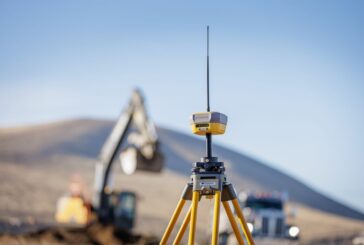
Topcon Unveils HiPer XR GNSS Receiver for state-of-the-art Surveying
-
Navigating the Future of Urban Living with Smarter Cities and Smarter Maps

Navigating the Future of Urban Living with Smarter Cities and Smarter Maps
-
TomTom and Esri Join Forces for Advanced Location Analytics

TomTom and Esri Join Forces for Advanced Location Analytics
-
How Spatial Data Science Is Revolutionising Data-Driven Decision-Making

How Spatial Data Science Is Revolutionising Data-Driven Decision-Making
-
Komatsu Powering Smart Construction with AI Edge Solution

Komatsu Powering Smart Construction with AI Edge Solution
-
The Power of Open Data Highway Mapping and Accessibility for US State DOTs

The Power of Open Data Highway Mapping and Accessibility for US State DOTs
-
Esri releases Third Edition of the beloved Designing Better Maps Guide

Esri releases Third Edition of the beloved Designing Better Maps Guide
-
TomTom and IVECO Paving the Future of Commercial Vehicle Navigation

TomTom and IVECO Paving the Future of Commercial Vehicle Navigation
-
Unlocking the Secrets of the Proton with a 3D Map of Matter’s Building Blocks

Unlocking the Secrets of the Proton with a 3D Map of Matter’s Building Blocks
-
SAM strengthens Geospatial Leadership with CSTi Acquisition

SAM strengthens Geospatial Leadership with CSTi Acquisition
-
Esri releases new books on Geospatial, Mapping and GIS Python Technologies

Esri releases new books on Geospatial, Mapping and GIS Python Technologies
-
Drones in Construction Transforming Site Management and Beyond

Drones in Construction Transforming Site Management and Beyond
-
Esri ArcGIS Online secures FedRAMP Moderate Authorization

Esri ArcGIS Online secures FedRAMP Moderate Authorization