Mapping is becoming increasingly important across global construction, infrastructure and industrial technology, influencing how projects are visualised, coordinated, delivered and managed over time.
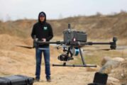
Aeva®, a leader in next-generation sensing and perception systems, today announced that NASA’s Kinematic Navigation and Cartography Knapsack (KNaCK) Instrument project, a...
Capturing and sharing life’s experiences today often requires multiple platforms and tools, which can result in disjointed storytelling. To serve creators’ ne...
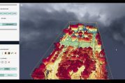
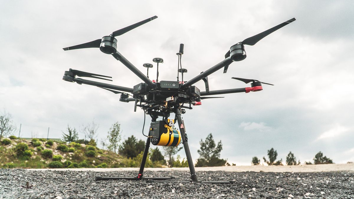
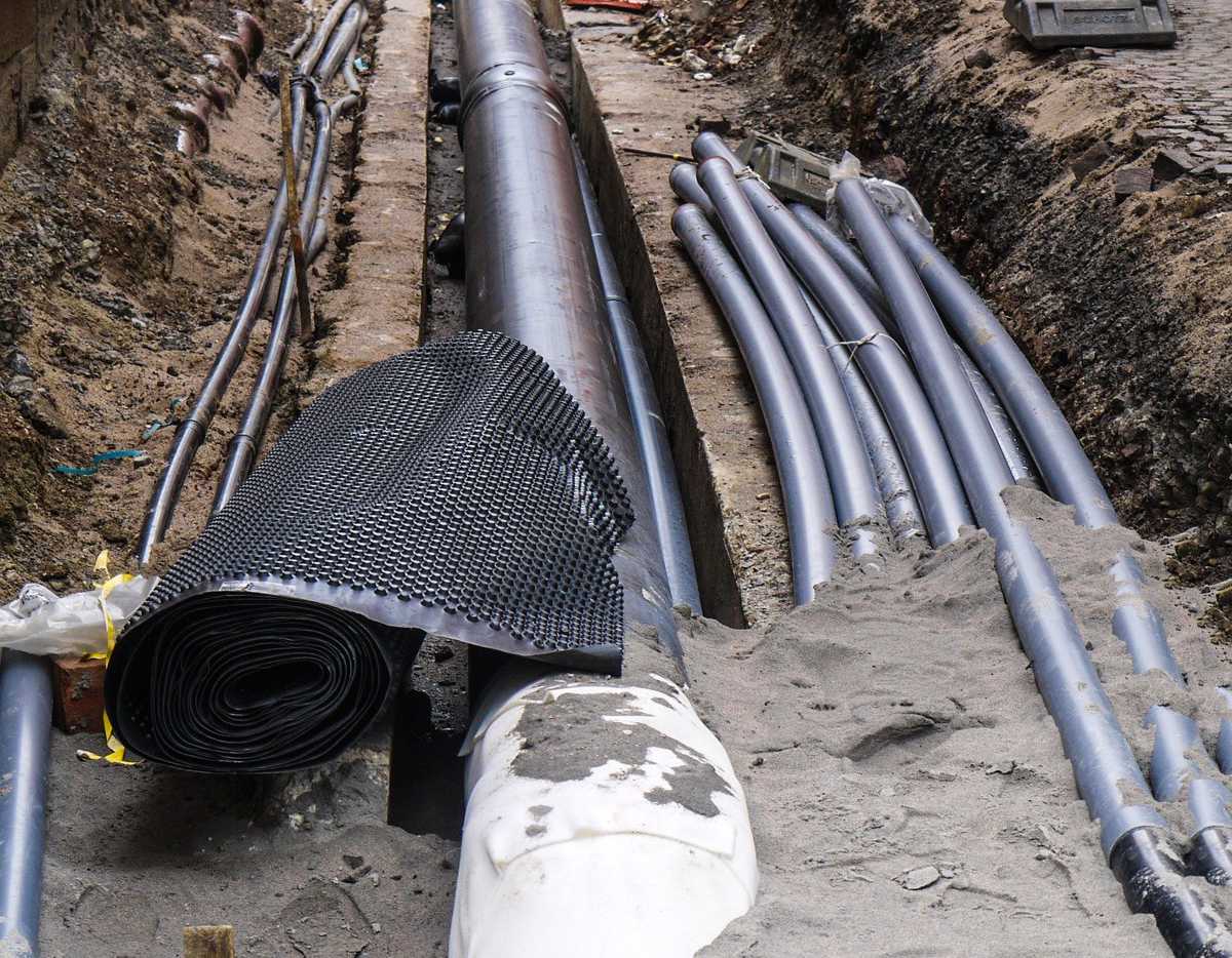
Subsurface utility mapping basically involves designing, assessing, and relocating utilities. It also involves the communication of utility mapping information to interes...
Governments and businesses across the world are pledging to adopt more sustainable and equitable practices. Many are also working to limit activities that contribute to c...
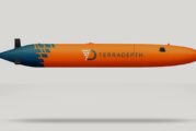
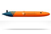
Terradepth, the world’s end-to-end ocean data system, announced the launch of Absolute Ocean today. AO is the company’s new cloud-based, browser-accessible ocean da...
An object hidden below ground has been located using quantum technology – a long-awaited milestone with profound implications for industry, human knowledge and nati...
RapidAir®, developed by the global air quality, energy and environment specialists, is the next generation dispersion modelling and policy support platform that enables u...
Getting to Know ArcGIS Pro 2.8 It’s never been easier to get data, but for many organizations it is still challenging to make sense of all of it. Putting data on a...
The global population grew by almost two billion people during the last 20 years—nearly 30 percent. Such growth is not evenly distributed over time or across space: the e...
Orbital Insight’s fusion of multi-sensor geospatial data and state-of-the-art algorithms has been helping customers address critical concerns for years—from determi...
Research published by the Webber Energy Group (WEG) at the University of Texas at Austin, and by The Ray, a non-profit studying technologies that can transform the transp...
Hexagon’s Geosystems division announced today that the HxGN Content Program now offers aerial imagery of England, Scotland and Wales at up to 12.5 centimetre resolu...
the global leader in data integrity, today announced the launch of MapInfo Pro v2021 – the newest release of its popular Geographic Information System (GIS) product. MapI...
Velodyne Lidar, Inc., today announced a multi-year agreement to provide its lidar sensors to TOPODRONE, which is based in Switzerland and develops affordable, high-precis...
The Ordnance Survey (OS) is inviting all developers, data scientists, designers and storytellers to participate in a two-day virtual hackathon on Wednesday 6 October and...
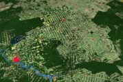
When a broadband network stretches across a 10,000-square-mile area that includes the rugged, rural terrain of Alaska, it can be a challenge to manage. Expanding that net...
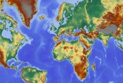
Esri, the global leader in location intelligence, today announced it is releasing a new high-resolution, 2050 global land cover map as part of the company’s Living Atlas....
Trimble has introduced the Trimble® MX50 mobile mapping system for asset management and mapping — a new addition to its established mobile mapping portfolio. This vehicle...
Esri, the global leader in location intelligence, today announced that in collaboration with federal agencies, it is opening up access to dozens of high-priority, high-de...
Esri, the global leader in location intelligence, today shared increased momentum with ArcGIS Field Maps, helping businesses transform how mobile workers perform duties t...
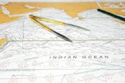
The Nippon Foundation-GEBCO Seabed 2030 Project has entered a technical cooperation agreement with the UK Hydrographic Office (UKHO), a world-leading centre for hydrograp...
Esri, the global leader in location intelligence, announced today that zooom productions, a marketing agency specializing in sports and lifestyle brands, is among the lat...
Esri, a global leader in location intelligence, today announced it is releasing for the first time ever a new high-resolution, 2020 global land cover map as part of the c...
Septentrio, a leader in high-precision GNSS/INS positioning solutions, and XenomatiX, provider of true-solid-state-LiDAR technology for autonomous applications and road m...
Across the United States, a large amount of forgotten burials of unmarked and lost graves exist. Geophysical techniques, including ground penetrating radar (GPR), are nee...
Velodyne Lidar, Inc. today announced Seabed B.V., which specializes in high quality equipment for offshore surveying and dredging, has selected Puck™ sensors for i...
Velodyne Lidar, Inc., today announced a multi-year agreement with AGM Systems LLC, which provides state-of-the-art hardware and software technology for the collection, pr...
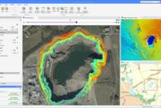
Terradepth, a disruptor in maritime data collection and use, has announced the successful completion of its Phase 1 trials. The test was executed at Lake Travis in Travis...
Esri, a global leader in location intelligence, today announced the launch of the ArcGIS Field Maps mobile app. An all-in-one app that uses data-driven maps to help mobil...
Esri, a global leader in location intelligence, and the United Nations (UN) Sustainable Development Solutions Network (SDSN) have launched the 2020 ArcGIS StoryMaps Compe...
There’s a smarter way to map and understand spaces, and it’s called the ZEB Go. The latest member of the ZEB family has arrived, bringing lower cost simultaneous localiza...
Velodyne Lidar today announced Kaarta Cloud® exclusively supports Velodyne’s lidar sensors. Kaarta’s new cloud-based application is a platform to process, store, and shar...
Velodyne Lidar, Inc. today announced two new generation YellowScan mobile mapping systems that use Velodyne’s lidar sensors to help achieve the high precision and accurac...
Accidental strikes on the myriad of underground pipes and cables in the UK cost the economy £1.2 billion a year. Workers who strike gas pipes and electric cables by mista...
Esri, a global leader in location intelligence, today announced a partnership with Facebook to release new OpenStreetMap (OSM)-ready datasets for use in building the map....
Trimble has announced that ProStar has joined Trimble’s GIS Business Partner Program. As part of the program, ProStar has implemented the Trimble® Precision SDK (So...
DJI, the world’s leader in civilian drones and aerial imaging technology, today launched an online reference to track events around the world when a drone helped rescue s...
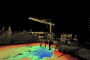
FARO Technologies, a global leader for 3D measurement, imaging and realization solutions for 3D Metrology, AEC, and Public Safety Analytics, today announced the release o...
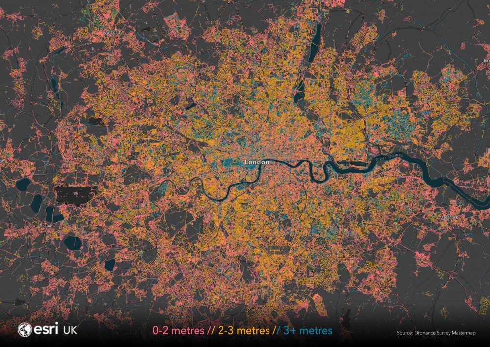
Spatial analysis by Esri UK has found that most pavements around the country are less than 3 metres wide, making it difficult for pedestrians to remain 2 metres apart and...
Over the last century, scientists have developed methods to map the structures within the Earth’s crust, in order to identify resources such as oil reserves, geothermal s...
This website uses cookies to improve your experience while you navigate through the website. Out of these, the cookies that are categorized as necessary are stored on your browser as they are essential for the working of basic functionalities of the website. We also use third-party cookies that help us analyze and understand how you use this website. These cookies will be stored in your browser only with your consent. You also have the option to opt-out of these cookies. But opting out of some of these cookies may affect your browsing experience.
Necessary cookies are absolutely essential for the website to function properly. These cookies ensure basic functionalities and security features of the website, anonymously.
Cookie
Duration
Description
cookielawinfo-checkbox-analytics
11 months
This cookie is set by GDPR Cookie Consent plugin. The cookie is used to store the user consent for the cookies in the category "Analytics".
cookielawinfo-checkbox-functional
11 months
The cookie is set by GDPR cookie consent to record the user consent for the cookies in the category "Functional".
cookielawinfo-checkbox-necessary
11 months
This cookie is set by GDPR Cookie Consent plugin. The cookies is used to store the user consent for the cookies in the category "Necessary".
cookielawinfo-checkbox-others
11 months
This cookie is set by GDPR Cookie Consent plugin. The cookie is used to store the user consent for the cookies in the category "Other.
cookielawinfo-checkbox-performance
11 months
This cookie is set by GDPR Cookie Consent plugin. The cookie is used to store the user consent for the cookies in the category "Performance".
viewed_cookie_policy
11 months
The cookie is set by the GDPR Cookie Consent plugin and is used to store whether or not user has consented to the use of cookies. It does not store any personal data.
Functional cookies help to perform certain functionalities like sharing the content of the website on social media platforms, collect feedbacks, and other third-party features.
Performance cookies are used to understand and analyze the key performance indexes of the website which helps in delivering a better user experience for the visitors.
Analytical cookies are used to understand how visitors interact with the website. These cookies help provide information on metrics the number of visitors, bounce rate, traffic source, etc.
Advertisement cookies are used to provide visitors with relevant ads and marketing campaigns. These cookies track visitors across websites and collect information to provide customized ads.