GSSI looks at using Ground Penetrating Radar for Cemetery Mapping
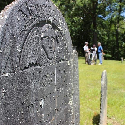
Across the United States, a large amount of forgotten burials of unmarked and lost graves exist.
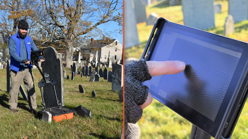
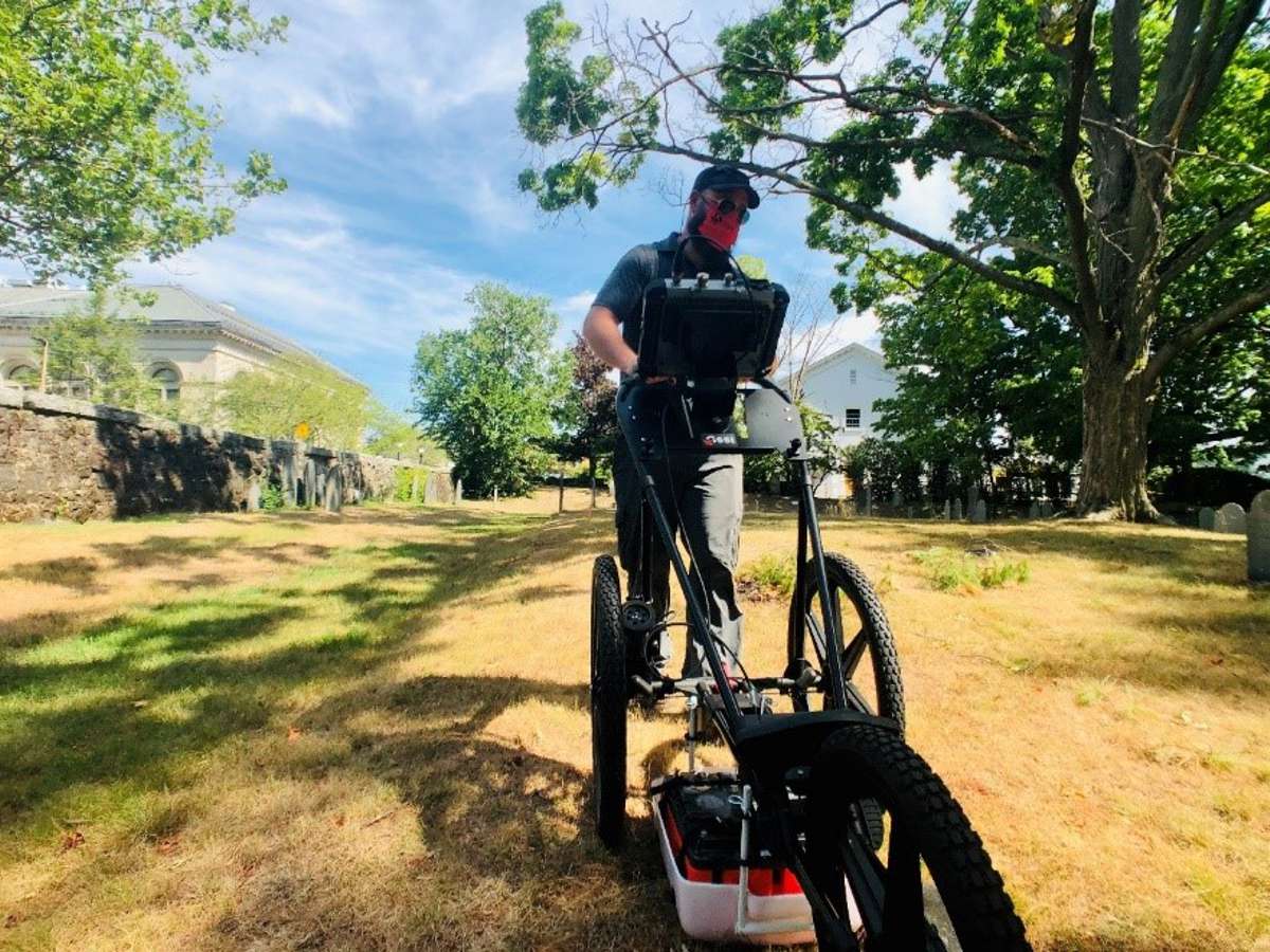
Geophysical techniques, including ground penetrating radar (GPR), are needed to non-destructively locate these burials in cemeteries and other locations. Cemetery mapping using GPR is gaining in popularity. Two-dimensional (2D) real-time evaluation of GPR profiles is quick and efficient, and especially useful for projects with time constraints or abundant obstacles in the survey area.
Lost graves stem from cemetery age and population growth
Historical cemeteries can go back hundreds of years. Over time, missing, fallen, or poorly placed headstones can complicate the assumed physical location of grave sites. The original documentation may be unavailable or unreadable, further leading to confusion. GPR service providers are increasingly being used to generate up-to-date burial maps or clear areas for new burials.
In addition, modern population growth has led to increased infrastructure and city sprawl. There are documented cases where contractors were given permission to build over forgotten burial grounds. In some cases a GPR investigation may be conducted to determine the existence of a cemetery, presence, or absence of burials, whether the graves have been disturbed, and factors related to relocation recommendations. In other cases, GPR may be used to evaluate graves overlooked during cemetery relocated due to urban expansion.
Three keys to successfully using GPR equipment
Those looking to use GPR equipment for cemetery mapping surveys should follow these best practices:
1. Know your GPR equipment and learn how best to use it in cemeteries
The first key to success is to determine the right type of equipment to use and get to know the equipment. Find white papers or posters that describe GPR methods for cemeteries and become familiar with how burials appear in GPR datasets.
In addition, consider specialized training from archaeologists or others on using GPR equipment for cemetery mapping. For example, GSSI offers GSSI Academy classes on cemetery mapping and equipment use.
2. Conduct pre-survey research
The best experience is hands-on practice. Consider reaching out to a local cemetery and ask permission to scan their grounds prior to conducting cemetery surveys as a service offering. Ask to be present when someone is digging a new grave. Research the age of the cemetery and how it may have been managed over time and then look at the existing marked graves in the cemetery to determine the direction and orientation of the graves. Ideally, the GPR should pass over burials perpendicular to their long axis (90 degrees).
Before beginning any cemetery mapping project, become familiar with local soil conditions, including soil composition and depth to bedrock/ledge. If you cannot see a representative soil profile, check out the USDA NCRS soil map and other online soil science resources.
3. Consider the variables
The quality of a GPR survey is greatly affected by soil conditions, weather, and the surrounding environment. Note these observances in your field notes and determine if other geophysical techniques can be used to compliment the GPR survey. Be especially cautious if the ground is saturated with water. If shoes squish when one walks over the site, consider returning once the water content has decreased. Look for large trees in the vicinity, signs of large rocks and animal burrows; these and other targets could generate false positive indicators of burials.
2D cemetery mapping using GPR
Two-dimensional (2D) real-time evaluation of GPR profiles is quick and efficient, and a common method for projects with time constraints or where there are abundant obstacles in the survey area.
The basic technique calls for collecting GPR profiles perpendicular to assumed burial orientation and identifying potential burial-related targets and associated soil disturbances. Not all burials (especially older ones) will exhibit a hyperbolic target due to decay of wood coffins, but there should be evidence of the grave shaft as a result of excavation and filling of the grave.
Water content is the single most important factor affecting GPR performance. Water slows down the GPR velocity, increases dielectric, and can mix with soil chemistry to increase conductivity levels. In high-dielectric conditions, hyperbolic targets are narrow and more difficult to see, reducing the chance of observing a burial target. Certain soil textures, like clay and silt, hold more water and may have inherently higher conductivity. High soil conductivity is like a lightning rod for GPR energy, whereby the GPR signal is dissipated into the ground and does not return to the antenna when reflected by a target or layer. This vastly reduces depth penetration, and in extreme cases may limit data collection to one or two feet below the surface.
Another soil-related factor is the presence of gravel, larger rocks, or boulders. Gravel can create clutter in the GPR profile, while cobbles and boulders create confusing hyperbolic targets. The disturbance in the ground from an animal burrow can also generate hyperbolas that would confuse a user when trying to locate burials.
The key to differentiating actual burials from false positives is to look beyond the targets and to evaluate the entire GPR profile. Rocks, roots, and animal burrows may appear as hyperbolic targets, but they usually will not have a soil disturbance above them. Burial targets must have an associated soil disturbance, and this might appear as broken soil layers or an anomalous area above the target. Roots and animal burials may extend across the project area for tens of feet, but a human burial will not. Marking potential targets with paint or pin flags will help visualize the length of targets and assist in ruling some of them out.
The choice of GPR antenna is of critical importance to the success of 2D cemetery mapping. Higher frequency antennas, like 900 MHz and 2700 MHz, may exhibit impressive resolution but cannot penetrate down to typical burial depths. Alternatively, lower frequencies greatly improve the depth of investigation, but they sacrifice resolution in the process. Since burials can be somewhat deeply buried, and they may not present large targets in profiles. People who are conducting a cemetery survey should use a 400 MHz or 350MHz HyperStacking® antenna to achieve the best results. These antennas provide the ideal interplay between depth and resolution and will provide adequate depth penetration without generating unwanted soil clutter in your data.
Another important factor is burial container material. Some wooden coffins may persist for a long time, but in most cases they will quickly collapse and erode away. In these cases, cemetery mappers will not be looking for the target, but rather the hole, or soil disturbance, that the target is/was in. Brick and concrete vaults last much longer and should be easier to locate. However, these containers are larger than wooden coffins and the top of the container may only be 1-2 feet below the surface; they can be easily missed if the survey is focused on depths of 4-6 feet. Lastly, one might encounter cemeteries where burials were previously exhumed. In this scenario the remains and container are removed, and all that is left is a filled-in excavation that is often larger than the original grave shaft.
Advantages and disadvantages of 2D data collecting
The advantages of 2D data collecting in a cemetery include speed of data collection, on the spot marking, and ease of data interpretation.
Speed of data collection
Since collection of 2D data does not require setting up a grid most of the time prepping the area is cut down or gone. Due to the speed of data collection while collecting a 2D file, one can easily prep out the area with a few passes around the location to scout for the best place to collect the survey.
On the spot marking
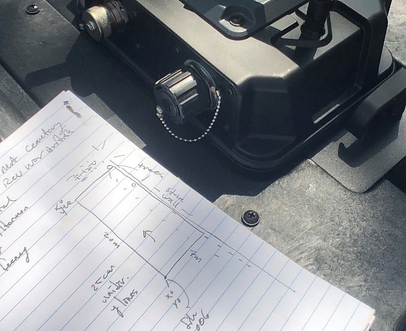
Spray paint and flags can be used to simply mark the possible grave location on the spot in the cemetery. When marking the possible target on the ground, also mark the spot in the notebook, along with notations of obstructions and possible graves. Make sure to take photographs of the landscape at the same time.
Data interpretation
It is easy to view 2D data on the screen and analyse the results on the spot. Unlike 3D data, 2D data collection does not require post processing to view the data.
Disadvantages of 2D data collection for cemetery mapping include interference that inhibits real-time interpretation, difficulty in differentiating targets, and the danger of incomplete coverage.
Interference
GPR data from cemeteries can inherit external noise, soil-related issues, and other unavoidable data problems that inhibit real-time interpretation. Continuous EM noise will generate horizontal noise bands that span soil disturbances and give the impression that soil layers are continuous, and proximity to the transmission source will compound this issue. Sporadic EM noise can generate a snowy or static overprint and obscure real data. Soil conditions create their own noise signatures, and usually these are exacerbated by certain clay varieties and overall water content. Salt, nitrates, calcium carbonate, and other chemical components will increase conductivity and reduce penetration depth while vastly reducing interpretive potential.
Differentiating targets
The equifinality of GPR reflections is also of concern, as targets and layers from completely different origins can be indistinguishable on GPR profiles. For example, rocks, roots, animal burrows, coffins, and other point sources all generate hyperbolic targets. Tree removal, pet burial, clandestine burials, utility trenches, and other ground disturbance all share similar characteristics and real-time interpretation of solitary GPR profiles can be quite difficult. To eliminate this data interpretation issue, look for the disturbances in the ground and the hyperbolic targets on the whole 2D GPR scan rather than each hyperbolic target.
Incomplete coverage
With 2D data collection, it is easy to skip over areas and not realize it since you do not have a grid that forces you to collect in straight lines and regular intervals.
Consider expanding into 3D locating
While 2D locating is fast and markable in the field, potential errors interpreting that data in the field could be minimized by also using three-dimensional (3D) data collection. 3D locating will maximize the data capabilities and achieve more certainty with post-processing the data.