
BlackSky partners with Esri for Dynamic Satellite Tasking for ArcGIS
BlackSky Technology and Esri have developed an integration that gives Esri’s global customer base access to BlackSky’s dynamic tasking services through ArcGIS Online.
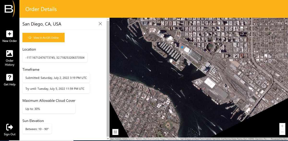
The companies have released a new cloud-based satellite tasking app called BlackSky Tasking. Designed for ArcGIS Online, the app allows Esri users to task a BlackSky satellite and have dynamic, on-demand imagery delivered directly into their ArcGIS Online organization.
“BlackSky Tasking for ArcGIS Online makes satellite tasking directly accessible to millions of ArcGIS Online users for the first time,” said Esri Corporate Director of Global Business Development Richard Cooke. “Upon order completion, images arrive within hours and are accessed directly in a user’s ArcGIS Online organization. They can immediately be leveraged using ArcGIS Image for ArcGIS Online to perform analytic workflows that provide analysis for informed decision making.”
“This partnership demonstrates BlackSky’s ability through our on-demand platform to enable our partners to make BlackSky hourly monitoring and dusk to dawn satellite imagery available to customers in the applications where they work. This is a significant advancement for our industry,” said BlackSky Chief Commercial Officer Amy Minnick. “By opening access to BlackSky’s Spectra AI tasking through our API integration, Esri users can incorporate BlackSky’s imagery directly into their current workflows by ordering imagery and having ready-to-use imagery delivered with very little training required.”
BlackSky Tasking is available in the Esri ArcGIS Marketplace. BlackSky’s high-revisit constellation and its underlying Spectra AI platform make it possible for users to seamlessly incorporate near real-time imagery into projects without additional processing or manipulation. The process is fully automated and once images arrive in a customer’s ArcGIS Online organization, they can immediately be used in other Esri apps.
BlackSky is a partner in the Esri Partner Network.