Revolutionized approach to Mapping is essential and unavoidable
The purpose of mapping has been to help people navigate around places in the physical world, something that has held true for centuries. But driving has evolved and, most importantly, cars and roads have evolved. As we enter an era of automation, standard road maps no longer serve us.
This is why a revolutionized approach to mapping is not only essential, it’s unavoidable. We need a paradigm change for how maps are built – and live maps are the solution to make that necessary impact to keep our roads safer.
The inescapable evolution
Consumer-facing applications have evolved into a digital and mobile-first experience. The world consumes TV and film on Netflix, as the days of reels, tapes, and DVDs are long gone. But maps largely remain the same as they were at the dawn of the golden maritime era, or even 600 BC. Map editions are still handled by curators, released every few months or years, and put, like books, on the shelves at the library.
There are over 8 billion people on this planet, with more than 1.3 billion vehicles. This has created a 10x higher traffic density than in the 1980s, 100x that of the 1940s, and 10,000x that of the 1910s. This continuous flow of people results in a continuous change in the roads.
Automatic Maps
Cartography remains a lengthy and costly curation effort, amassing volumes of data from field trips, geodesic stations, triangulation, aerial images, satellite imagery, as well as vehicle telemetry data. To this day, the base map of topology, semantics, and toponyms, as well as additional layers of information – such as speed limits, turn restrictions, etc.- are still mostly a manual editorial job. The cartographer works for months, or even years, to release a new edition of the map.
By the time a new map edition is released, the world has moved on, and the map is out of date. Map editions are getting released ever more often – from yearly to monthly, and even weekly. But despite the increasing frequency of releasing new editions, they are dead maps upon arrival.
Maps Are No Longer Needed for Driving
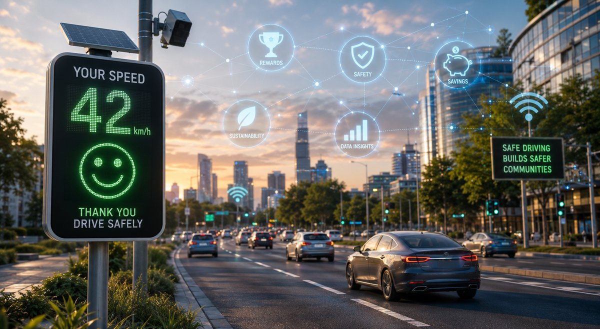
Dead maps are sufficient for humans to be able to navigate, as navigation is complementary – but not required – for executing a driving task. Advanced driver systems and autonomous vehicles need to navigate and drive in this world of change. And whereas advanced cars can navigate, just like humans do, in an acceptable way, to drive in complex environments requires access to a real-time stream of contextual information about the world around them:
- Context comes from sensors on the vehicle itself, which provide a range of protection up to 30- 100 meters range. Yet, that’s not enough, both because line of sight is limited (sensor range is constrained by the laws of physics) and no sensor is 100% reliable. Cars need to predict and learn how to avoid danger beyond the line of sight.
- Human drivers can easily deal with numerous situations, such as slightly invading the opposing lane when a stationary vehicle on the shoulder is partially blocking the lane, or driving counter-flow when a temporary cone – or a traffic officer – is channelling the traffic because of an accident. It will take decades for AVs to encode all these rules.
These are just two examples of continuous change in the map that humans are familiar with. Advanced driving systems, however, require support to augment the direct-range sensors, such as cameras, radar, LiDAR, etc., with the additional modality of the real-time stream of updates – beyond the line of sight.
To solve this, we need to change the paradigm – the basic underlying framework for how maps are built. The editorial process that cartographers go through to prepare the map editions is no longer optimal, and not even required when the world is continuously changing. Just like the driver of a tractor knows how to drive in the field, where there are no lanes or road signs, automatic driving vehicles (AVs and ADAS) don’t require a map to drive. The curated “dead” map is useful as an additional sensorial modality, but it’s not required.
Live maps are needed today, not a decade from now
Live maps provide a virtual sensorial modality beyond line of sight, one where cars cooperatively share with each other what’s happening around them. Some could say that live maps will only be required a decade from now, once AVs start to become mainstream. And once they become mainstream, they will be able to build such live maps. This is the view of some autonomous driving technology developers, but it is not aligned with the transition required while humans and robots share the road, nor does it take this into account for many automotive players.
These transitions won’t happen overnight, but will rather be an incremental change, where more and more assisted driving features enter the car, till one day the car achieves full autonomy. For these vehicles, whether in advanced L2 of autonomy or L3 and above, the risk of not knowing what’s ahead of them, what the real road is, what turns are allowed, and what lanes are blocked – is critical.
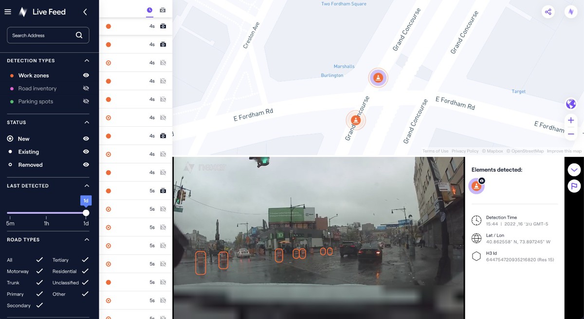
Starting today, without having to wait for a decade, we can start creating live maps for dangerous situations as they happen. Think of them as “live corner cases”, and acquiring intelligence about where unsafe incidents are happening, how they are happening, and what humans are doing.
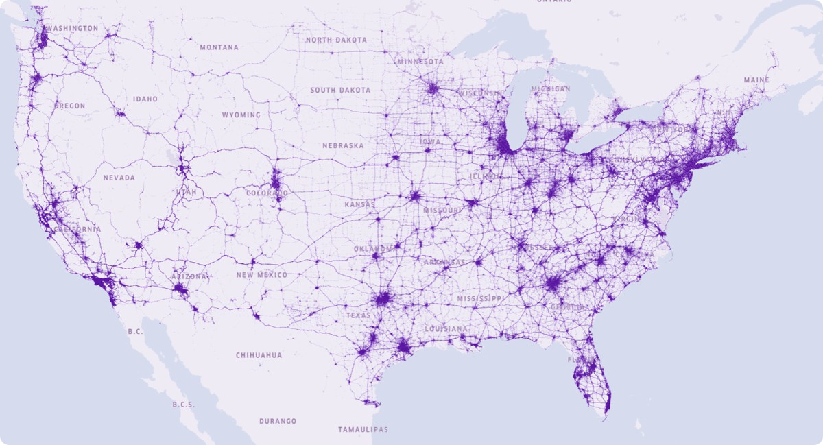
Mapping solutions are available that provide a streaming view of the road tiles ahead, where drivers can not only see the work zones that are obstructing lanes right now, but also the corresponding driving behaviour of humans (trajectories, drivable paths, acceleration, velocity, etc.). These behavioral maps are a true articulation of how live maps are already starting to make an impact today – keeping our roads safer.
Moving Forward
In the future, AI will continue to play a crucial role in the development of maps, allowing us to gather and analyse data in real-time to create more accurate and up-to-date maps. We can expect AI to continue to enhance the user experience through the creation of more immersive 3D maps, making navigation even easier and more enjoyable.
AI-powered maps will continue to improve in accuracy and functionality, making our lives much safer.
Article by Bruno Fernandez-Ruiz, CTO and cofounder of Nexar.