Large-scale Urban Building Function Mapping using web-based Geospatial Data
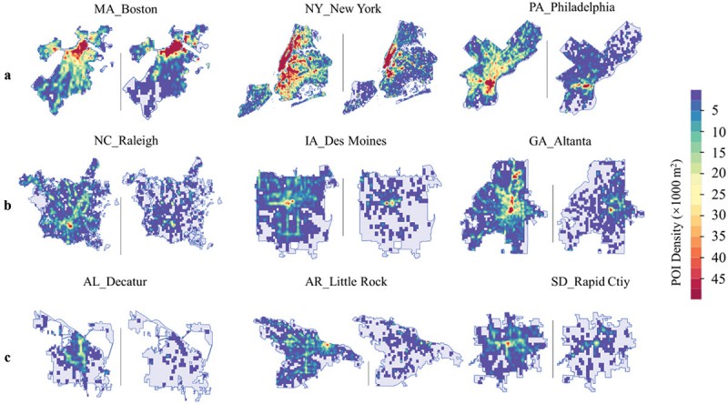
In a pioneering study published in Geo-spatial Information Science, a research group led by Yuyu Zhou from The University of Hong Kong developed an integrated framework that achieves 94% accuracy in mapping building functions across 50 U.S. cities using multi-source web-based geospatial data, offering potential for worldwide application.
The team utilized TripAdvisor.com and Google Maps as primary data sources due to their extensive coverage and dynamic updating features.
Highlights
- Broad Applicability: With the universal presence of Google Maps and TripAdvisor.com, this framework can potentially be applied to cities globally, offering a standardized method for urban building function mapping.
- Resource Efficiency: The study circumvents the expensive and tedious process of gathering social sensing datasets. Instead, it capitalizes on readily available online geospatial data, ensuring scalability and cost-effectiveness.
- Potential Extensions: The framework can further be utilized for a myriad of urban studies, from evaluating green spaces to assessing pedestrian exposure to environmental pollutants.
The research findings are promising. The proposed framework demonstrated an impressive average overall accuracy of 94% with a kappa coefficient of 0.63. While the study centred on U.S. cities, its potential for global application, especially in regions with data accessibility challenges, is immense.
Furthermore, as the digital footprint of cities grows, the researchers see opportunities to refine this approach. They recommend future endeavours to enhance mapping accuracy, especially in multi-functional buildings and in regions less covered by TripAdvisor.com and Google Maps.
This research provides a powerful tool for city planners, policy makers, and researchers, with the hope that the integrated framework becomes an essential asset in the global pursuit of sustainable, efficient, and inclusive urban spaces.