New approach developed for Aerial Geophysical Surveys
The team at Sanborn Geophysics ULC has been building electro-magnetic, radiometric, and magnetic airborne geophysical survey equipment for more than thirty years.
The latest designs make Sanborn Geophysics airborne survey systems among the most flexible choices for resource exploration and mapping operations. They can be used as standalone systems or in combination and are adaptable to a wide variety of terrain conditions, survey requirements, plane and helicopter installations, and budgets.
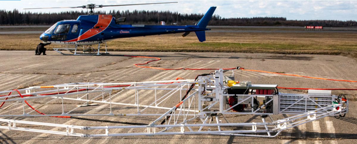
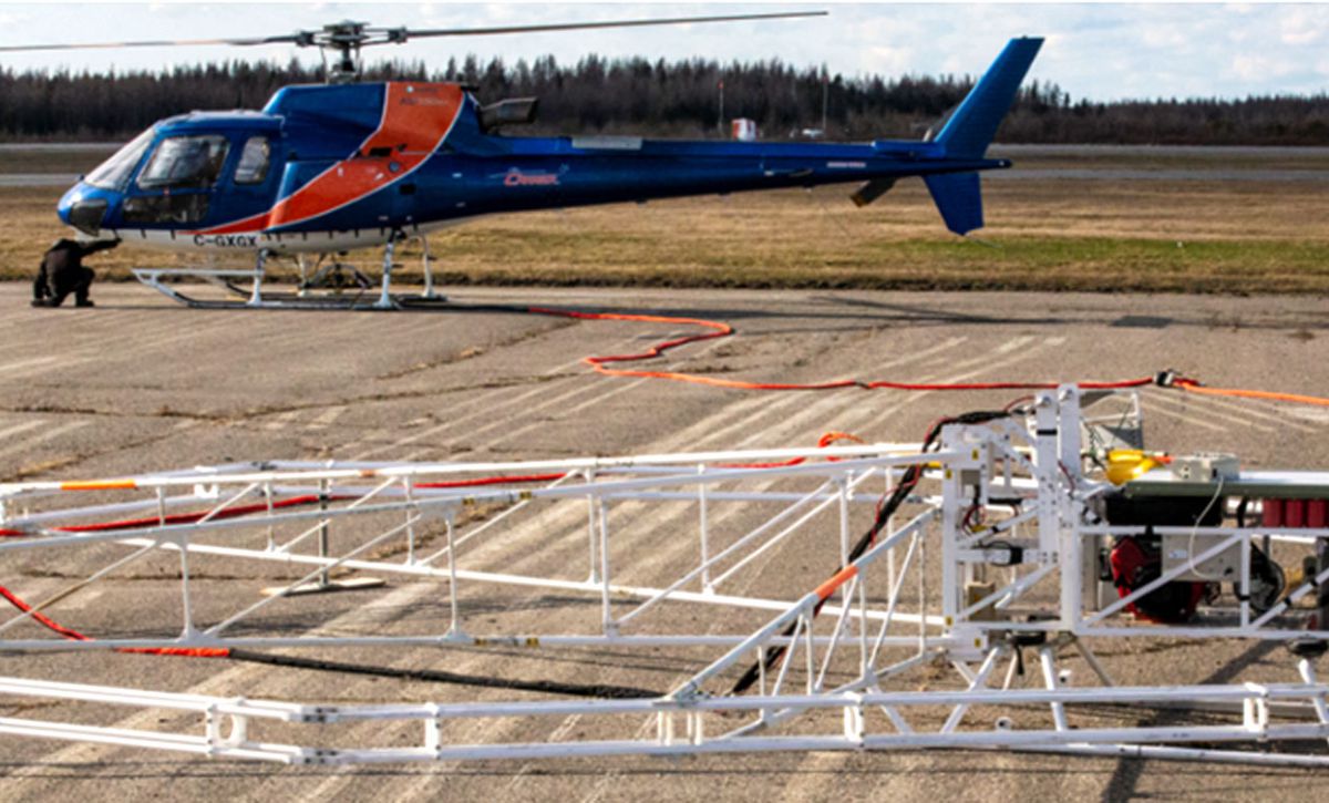
The Sanborn Geophysics helicopter-borne Time Domain Electromagnetic (TDEM) system supports minerals, metals, groundwater, and geological hazard mapping. The compact size of Sanborn Geophysics TDEM shortens the time for deployment and makes it suitable for all types of terrain. With a powerful transmitter, the TDEM supports 400+ meters depth penetration.
The Sanborn Geophysics Advanced Gamma Ray Spectrometer (AGRS) system for planes and helicopters supports geological mapping, uranium exploration, and radiation monitoring. The AGRS self-calibration feature eliminates the need for daily calibration with radioactive sources. The 2, 4, and 5 detector spectrometer options can be used alone or in combination to achieve survey accuracy in the most cost-effective manner. As a standalone unit the AGRS only requires a power supply and GPS data.
The Sanborn Geophysics Integrated Multi-Parameter Airborne Console (IMPAC) is a navigation and real-time data acquisition system that integrates MMS-8 magnetometer processing for geological structures and hazards mapping. The IMPAC is interoperable with third party systems, providing customers with the flexibility they need to integrate existing equipment or add system components.
Sanborn Geophysics is further distinguished by its expertise in airborne survey services. In addition to equipment sales and customer support, Sanborn Geophysics offers survey design, data acquisition, and data analysis services.
Through its parent company, The Sanborn Map Company Inc (Sanborn), Sanborn Geophysics offers a full range of ortho imagery, lidar, and hyperspectral imaging data products plus terrain, 2D and 3D modeling capabilities, making Sanborn Geophysics a one-stop-shop for integrated data collection and analysis.
“The complexity of airborne geophysical survey requires a sophisticated partner that understands the equipment, survey design, and analysis,” said Sandip Goswami, Managing Director, Sanborn Geophysics ULC. “Sanborn Geophysics is unique in its ability to provide customers a flexible and comprehensive approach to the airborne survey business.”