Esri and Microsoft Join Forces to Usher in a New Era of AI Geospatial Intelligence
In a move that’s set to shake up the landscape of geospatial technology, Esri has announced a deeper integration with Microsoft, leveraging the Azure OpenAI Service to embed intelligent capabilities into ArcGIS. This ground-breaking partnership aims to simplify complex spatial workflows and democratise access to geospatial insights for professionals across sectors.
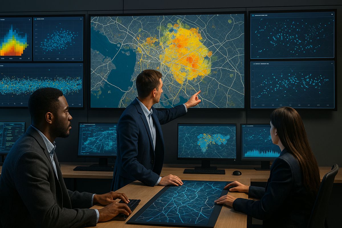
The collaboration isn’t just about streamlining processes; it’s about giving everyone the tools to understand the world spatially. With AI-powered tools integrated directly into ArcGIS, users can now query, analyse, and visualise location data using natural language, a game-changer for everyone from local councils to global enterprises.
“Our collaboration with Microsoft and the integration of Microsoft Azure OpenAI in Foundry Models into ArcGIS is a game-changer for geospatial technology,” said Jay Theodore, Esri’s Chief Technology Officer for AI and Enterprise Technologies. “By democratizing geospatial understanding, we are removing barriers and empowering users to unlock the full potential of location intelligence.”
Putting GeoAI to Work
GeoAI, the fusion of AI and geospatial data, is at the heart of this integration. By embedding over 90 pretrained deep learning models within the ArcGIS platform, Esri users now have access to sophisticated pattern recognition, change detection, and predictive analytics without needing to be data scientists.
Here’s how GeoAI is transforming operations across key industries:
- Public safety teams can use AI to anticipate traffic flow and optimise emergency response times.
- Environmental agencies can track land-use changes, detect deforestation, and monitor invasive species.
- Energy and utility companies are now better equipped to monitor infrastructure health remotely and in real-time.
- Insurance providers can expedite claims by integrating location-based damage assessment models.
These AI-enhanced capabilities aren’t just tools, they’re enablers. By automating routine geospatial analysis, organisations save time and gain deeper insights, which translates into faster and smarter decision-making.
Smart Assistants Within Reach
One of the standout features of this new integration is the AI assistant support baked into the ArcGIS suite. Whether you’re mapping flood zones, planning urban development, or curating environmental impact reports, these assistants can:
- Summarise complex datasets
- Generate recommendations
- Automate map and dashboard creation
- Write custom code for analysis workflows
They serve as expert co-pilots for GIS analysts, cutting through the noise and surfacing what matters most. Importantly, these tools are intuitive, lowering the barrier to entry for non-technical users.
ArcGIS for Teams: Where Collaboration Meets Intelligence
This integration has also made its way into the Microsoft 365 ecosystem through ArcGIS for Teams. Thanks to a declarative agent for Microsoft 365 Copilot, users can now tap into ArcGIS resources directly from Microsoft Teams, Outlook, or SharePoint.
With just a few keystrokes, users can:
- Search for authoritative maps and spatial apps
- Discover relevant geographic datasets
- Access both public and private organisational ArcGIS content
This kind of embedded intelligence dramatically enhances collaboration across departments, ensuring that spatial thinking becomes part of everyday workflows.
“It is not merely about technology integration but also about establishing a new benchmark for innovation in the geospatial field,” said Jason Graefe, CVP of Microsoft’s Worldwide ISV & Digital Natives team. “This collaboration aims to empower people and organisations worldwide by combining Esri’s leadership in geospatial technology with Microsoft’s expertise in cloud and AI.”
A Legacy of Innovation, Supercharged
Esri’s long-standing commitment to geospatial innovation dates back to its founding in 1969. Over the decades, it has helped shape the very fabric of modern spatial analysis. With clients spanning government agencies, Fortune 500 companies, universities, and NGOs, its global reach is undeniable.
Now, with the infusion of Microsoft’s AI horsepower, Esri’s ArcGIS platform becomes even more formidable. Backed by Azure’s compute capabilities and Foundry Models, users gain access to robust AI infrastructure that scales with demand.
Under the hood, this setup empowers real-time data processing, complex simulation modelling, and cloud-native scalability, ensuring that organisations—regardless of size—can benefit from powerful geospatial tools.
Looking Ahead: More Than Just Maps
Esri’s vision has always extended beyond cartography. This latest move cements its role as a leader in what it calls “location intelligence”—the ability to tie every decision, insight, or prediction back to a place on the map.
Whether it’s smart cities, climate resilience, supply chain management, or disaster response, spatial context is crucial. With AI in the driver’s seat, ArcGIS doesn’t just draw maps; it tells stories, solves problems, and empowers action.
Empowering the Future of Geospatial Intelligence
As AI continues to evolve, so too will its role in spatial analysis. Esri and Microsoft are betting that natural language interfaces, intelligent assistants, and real-time insights will redefine how organisations interact with the physical world.
The partnership brings a wealth of opportunity for industries looking to enhance their spatial thinking. More importantly, it levels the playing field—empowering even the smallest players to harness the power of geospatial data.
It’s not just the next chapter for GIS; it’s a whole new book.