


Orbital Insight now integrates with Esri ArcGIS Platform Orbital Insight's fusion of multi-sensor geospat ...
-
Orbital Insight now integrates with Esri ArcGIS Platform

Orbital Insight now integrates with Esri ArcGIS Platform
-
Innovation incubator Digital G and Esri China join forces on GIS AEC solutions

Innovation incubator Digital G and Esri China join forces on GIS AEC solutions
-
Esri and National League of Cities aim to reduce digital divide with Broadband pilot

Esri and National League of Cities aim to reduce digital divide with Broadband pilot
-
Esri mapping Solar Energy Hot Spots in partnership with The Ray

Esri mapping Solar Energy Hot Spots in partnership with The Ray
-
Esri brings Spatial Context to AEC Operations with release of ArcGIS GeoBIM

Esri brings Spatial Context to AEC Operations with release of ArcGIS GeoBIM
-
Esri delivers data-driven governance for Upper Egypt Local Development Program
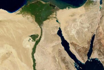
Esri delivers data-driven governance for Upper Egypt Local Development Program
-
Esri and National Geographic launch Storytelling Challenge to inspire Ocean Conservation

Esri and National Geographic launch Storytelling Challenge to inspire Ocean Conservation
-
Esri helps Matanuska manage 10,000 square mile broadband network in Alaska

Esri helps Matanuska manage 10,000 square mile broadband network in Alaska
-
Esri’s new book teaches Geographic Concepts through a South American Adventure

Esri’s new book teaches Geographic Concepts through a South American Adventure
-
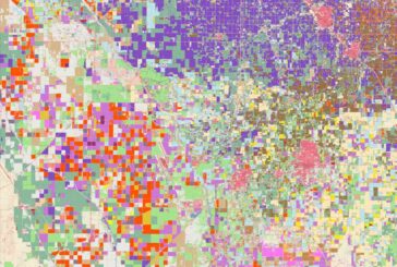
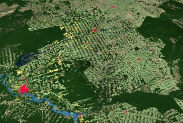
Esri releases new predictive Global Land Cover Map for 2050

Esri releases new predictive Global Land Cover Map for 2050
-
Esri Federal Geospatial Data now available to anyone online
Esri Federal Geospatial Data now available to anyone online
-
Esri ArcGIS Field Maps on iPhone and iPad improve mobile worker efficiency

Esri ArcGIS Field Maps on iPhone and iPad improve mobile worker efficiency
-
Esri’s new book is a Call to Action for Conservation
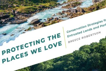
Esri’s new book is a Call to Action for Conservation
-
Red Bull X-Alps Competition Live Tracking App uses Esri ArcGIS Platform
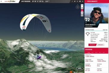
Red Bull X-Alps Competition Live Tracking App uses Esri ArcGIS Platform
-
Esri releases new Global Land Cover Map
Esri releases new Global Land Cover Map
-
Esri ArcGIS Platform chosen by Relive Outdoor Activity SaaS App

Esri ArcGIS Platform chosen by Relive Outdoor Activity SaaS App
-
Chamber of Geophysical Engineers of Turkey signs GIS training agreement with ESRI
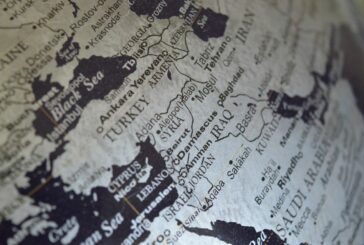
Chamber of Geophysical Engineers of Turkey signs GIS training agreement with ESRI
-
Esri partnering with International Community on GIS for Sustainable Development Goals

Esri partnering with International Community on GIS for Sustainable Development Goals
-
Esri and IBM tackle Climate Change with Call for Code Global Challenge

Esri and IBM tackle Climate Change with Call for Code Global Challenge
-
Symology, the highways asset management specialist wins Esri global partner award
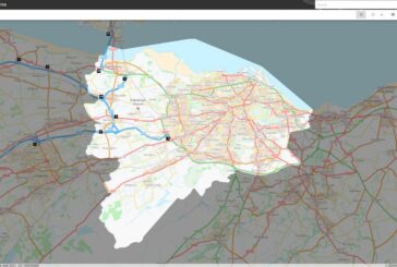
Symology, the highways asset management specialist wins Esri global partner award