


Esri enhances 3D GIS Workflows by integrating 3D Tiles into ArcGIS Organizations in national, state, and ...
-
Esri enhances 3D GIS Workflows by integrating 3D Tiles into ArcGIS

Esri enhances 3D GIS Workflows by integrating 3D Tiles into ArcGIS
-
Winners of the Esri 2023 ArcGIS Online Competition announced

Winners of the Esri 2023 ArcGIS Online Competition announced
-
Esri to provide Malta with GIS Technology and Training

Esri to provide Malta with GIS Technology and Training
-
Esri’s new ArcGIS Reality Software captures the World in 3D

Esri’s new ArcGIS Reality Software captures the World in 3D
-
Esri joins Overture Maps Foundation to build Interoperable Open Map Data

Esri joins Overture Maps Foundation to build Interoperable Open Map Data
-
Baron Weather empowering the Esri Partner Network with Weather Intelligence
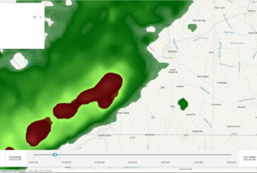
Baron Weather empowering the Esri Partner Network with Weather Intelligence
-
Exodigo and Esri partner to Improve Underground Mapping

Exodigo and Esri partner to Improve Underground Mapping
-
Esri and Digital Earth Africa partner to support Sustainable Growth

Esri and Digital Earth Africa partner to support Sustainable Growth
-
Esri initiative offers free Geospatial Software to Non-profits

Esri initiative offers free Geospatial Software to Non-profits
-
Esri releases latest edition of Online GIS Capabilities book

Esri releases latest edition of Online GIS Capabilities book
-
BlackSky partners with Esri for Dynamic Satellite Tasking for ArcGIS

BlackSky partners with Esri for Dynamic Satellite Tasking for ArcGIS
-
Esri announces free Online Course on Geospatial Software for AEC Projects

Esri announces free Online Course on Geospatial Software for AEC Projects
-
Esri launches Indoor Positioning Navigation System

Esri launches Indoor Positioning Navigation System
-
Italian Rail Agency recognised by ESRI for Modernizing Infrastructure

Italian Rail Agency recognised by ESRI for Modernizing Infrastructure
-
Esri StoryMaps brings sophisticated Mapping Technology to Storytelling

Esri StoryMaps brings sophisticated Mapping Technology to Storytelling
-
Esri UK annual GIS conference returns to QEII Centre in London

Esri UK annual GIS conference returns to QEII Centre in London
-
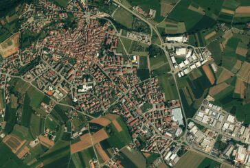
Esri updates Land-Cover Maps with new global datasets

Esri updates Land-Cover Maps with new global datasets
-
Esri’s new book helps Public Safety Agencies get started with GIS Technology

Esri’s new book helps Public Safety Agencies get started with GIS Technology
-
Esri releases guides for Location Analytics and Improving Map Aesthetics
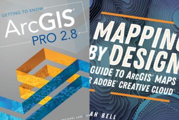
Esri releases guides for Location Analytics and Improving Map Aesthetics
-
Esri and WorldPop delivering updated Demographic Data for Policy Makers
Esri and WorldPop delivering updated Demographic Data for Policy Makers