






Central Asia Faces US$3.59 Billion in Landslide Exposure Across Critical Infrastructure
Roads account for more than US$3 billion of the infrastructure potentially exposed to landslides across Central Asia, according to a new analytical brief from the Eurasian Development Bank (EDB). The assessment identifies vulnerable transport corridors, mountain settlements and urban development areas where slope instability could damage essential infrastructure and interrupt regional connectivity.
Published on 21 October 2026, the EDB’s Landslide Risks in Central Asian Cities brief places potential direct losses at US$3.59 billion, with roads accounting for approximately 84% of the total. Railways represent a further US$382 million and buildings US$186 million, although damage to individual assets can also interrupt transport, electricity and water networks.
The figures are drawn from earlier regional modelling rather than recorded damage or a forecast of annual losses. They represent potential asset exposure under a modelled total-loss scenario, providing a starting point for examining where infrastructure investment and protective engineering may be needed.
Briefing
- The EDB identifies US$3.59 billion in potential direct landslide losses across Central Asia, based on earlier regional modelling.
- Roads account for US$3.02 billion, followed by railways at US$382 million and buildings at US$186 million.
- Areas requiring attention include parts of Tajikistan, Uzbekistan’s Tashkent–Osh corridor and the foothills around Almaty.
- Landslides in Nepal during September 2026 demonstrated how slope failures can interrupt bridges, power transmission and industrial electricity supplies.
- The EDB recommends integrated hazard mapping, tighter land-use controls, infrastructure monitoring and alternative transport connections.
Transport Corridors Carry the Greatest Exposure
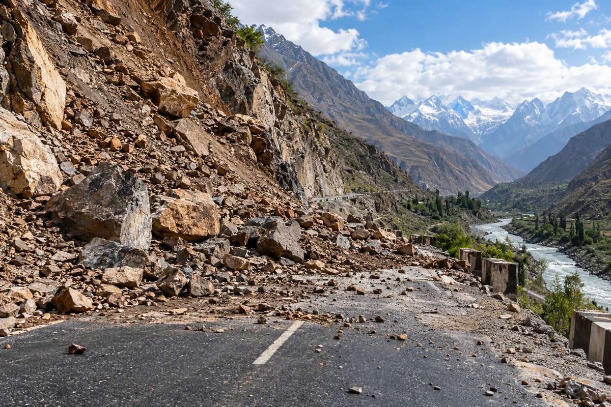
Central Asia’s geography makes transport infrastructure particularly vulnerable to slope instability. Mountain roads frequently follow river valleys, cross steep hillsides and negotiate terrain where alternative alignments are expensive or physically impractical. Railways face similar constraints, with embankments, cuttings, retaining structures and bridge approaches exposed to ground movement.
A landslide may bury a carriageway, undermine its supporting slope or damage a bridge approach, but the consequences can extend well beyond the cost of clearing debris and reconstructing the affected section. In mountain corridors with few alternative routes, even a relatively localised failure can interrupt freight movements, delay passenger transport and restrict access to communities.
Previous research has documented comparable vulnerabilities. A World Bank regional disaster risk assessment examined exposure to landslides, floods, avalanches and erosion across Central Asian transport networks. In Tajikistan, an earlier survey identified 331 hazardous locations along more than 2,000 kilometres of roads, while Kyrgyzstan’s mountainous Bishkek–Osh highway has experienced repeated landslide-related damage and interruptions.
These are longstanding engineering challenges. The difficulty lies in managing them across extensive networks where geological conditions, drainage performance, maintenance resources and traffic importance vary considerably. A relatively inexpensive local road may provide the only reliable connection to a settlement, while damage to a major freight corridor can disrupt commercial movements across several regions.
Vulnerable Areas Across Central Asia
The EDB identifies several concentrations of landslide susceptibility in Kazakhstan, Kyrgyzstan, Tajikistan and Uzbekistan, reflecting the region’s mountainous terrain, seismic activity and patterns of urban development.
In Tajikistan, the Ayni district and sections of Dushanbe feature among the areas requiring particular attention. Steep valleys and mountainous transport routes create difficult conditions for infrastructure maintenance and new construction, especially where settlements and roads occupy narrow strips of developable land.
In Uzbekistan, the assessment highlights Akhangaran district in the Tashkent Region and sections of the Tashkent–Osh corridor. Mountain crossings are particularly important to regional connectivity, and instability affecting road approaches, cuttings or supporting slopes can create substantial operational difficulties.
Kazakhstan’s exposure includes selected foothill areas around Almaty and the surrounding region, where development extends towards mountain terrain. Mountainous districts in Kyrgyzstan face similar challenges, with transport routes and settlements frequently located in valleys bordered by unstable slopes.
The locations identified are areas of susceptibility rather than predictions of where the next major landslide will occur. Engineering decisions still require site-specific geological investigation, groundwater assessment and an understanding of the infrastructure situated below potentially unstable ground.
When Slope Failure Spreads Across Infrastructure Networks
The EDB draws on landslides in Nepal between 24 and 27 September 2026 to demonstrate how a natural hazard can affect several infrastructure systems simultaneously.
According to the bank’s account, heavy rainfall triggered 304 landslides over four days. Thirty-one bridges and hundreds of homes were damaged, while 20 people died in landslides. The wider rainfall-related disaster claimed 27 lives.
The damage extended into the electricity network. In the Kali Gandaki corridor, collapsed transmission towers caused 12 hydropower plants with a combined capacity of 358 MW to be disconnected from the grid. Restrictions on electricity supplies subsequently affected industrial users, including facilities that had suffered no direct physical damage.
The sequence exposes a practical difficulty with assessing infrastructure assets independently. A bridge may remain structurally sound but become unusable because an adjoining road has failed. A hydropower station can survive a landslide yet be unable to deliver electricity following damage to transmission infrastructure. Water intakes, pipelines and access routes may be affected by the same slope movement, particularly where different networks share a narrow valley.
The Nepal disaster provides an example of actual infrastructure disruption rather than a direct comparison with the EDB’s modelled financial exposure across Central Asia.
Engineering for Unstable Slopes
Managing landslide exposure requires geotechnical investigation, drainage design, appropriate stabilisation measures and continuing maintenance. The engineering response depends on the mechanism of potential failure, the condition of the ground and the infrastructure that could be affected.
Where movement threatens an existing road, interventions may include retaining structures, rock anchors, soil reinforcement, slope regrading and improved surface or subsurface drainage. These measures address different failure mechanisms and are not interchangeable. A retaining wall may provide limited protection if instability extends beyond its foundations, while drainage improvements can be particularly effective where elevated groundwater pressure contributes to slope movement.
The Asian Development Bank has addressed these challenges in its guidance on climate adaptation for Central Asian transport infrastructure, published in December 2023 with particular attention to Uzbekistan. The guidance examines climatic stresses on transport assets and practical adaptation measures that can be incorporated into design, rehabilitation and maintenance programmes.
Rainfall intensity and duration can alter groundwater conditions and destabilise susceptible slopes, although the response depends heavily on geology, topography, vegetation and existing drainage. Earthquakes and snowmelt are also important triggers across Central Asia, requiring engineers to examine several possible causes of instability rather than relying on rainfall assessments alone.
Construction activity can further complicate these conditions. Excavation at the foot of a hillside, additional loading from buildings, altered drainage patterns and poorly controlled earthworks may increase the likelihood of ground movement. In narrow mountain valleys, the stability of land beyond a project’s immediate construction boundary can be just as relevant as the ground directly supporting the infrastructure.
Urban Development and Hazard Mapping
The EDB places considerable emphasis on preventing new exposure through better land-use planning. Its recommendations include restricting development on unstable slopes and floodplains, enforcing requirements within water protection zones and incorporating combined landslide, debris-flow and flood hazard maps into planning decisions.
Around expanding cities, pressure for residential, commercial and infrastructure development can push construction into increasingly difficult terrain. Land that appears suitable under normal conditions may become hazardous during prolonged rainfall or seismic activity, while development higher on a slope can alter runoff patterns affecting roads and properties below.
Integrated hazard mapping allows planners to examine how slope instability, river erosion, flooding and debris movement might interact across the same catchment. It also helps identify where additional site investigations are necessary before development consent or infrastructure design proceeds.
For existing settlements and transport routes, monitoring offers a complementary safeguard. Rainfall measurements, groundwater instruments, displacement sensors and satellite-based observations can help engineers identify changing conditions, provided that equipment is maintained and reliable warning thresholds are established.
The EDB also recommends evacuation routes and regular drills, particularly where communities depend on a limited number of roads. Warning systems have little practical value without procedures for closing threatened routes, informing residents and maintaining emergency access.
Investment Decisions and Network Resilience
Central Asian governments and development institutions have been investing in transport infrastructure resilience as climate-related hazards place increasing pressure on regional connections. The Asian Development Bank has previously highlighted the importance of strengthening road networks across a heavily landlocked region where alternative freight routes are often limited.
The EDB’s findings add further geographical and financial context, although the US$3.59 billion exposure estimate should not be interpreted as the amount required for protective engineering. Some locations may warrant substantial slope stabilisation works, while others could benefit from drainage maintenance, monitoring or tighter development controls. At particularly unstable sites, realigning infrastructure may offer a more durable solution than repeatedly repairing damage.
The economics of alternative routes are equally difficult. Constructing a second mountain crossing can involve extensive earthworks, bridges, tunnels and environmental constraints, making full network redundancy unrealistic in some locations. Emergency diversions, alternative crossings and arrangements for rapid access restoration may offer more practical protection against prolonged disruption.
For new infrastructure projects, the timing of geological assessment can determine whether risk is addressed through route selection and structural design or through remedial works after construction. Retrofitting stabilisation measures to an operating corridor frequently involves restricted access, traffic management and additional construction costs, particularly where the original alignment leaves little room for intervention.
The EDB’s own investment activities provide a wider setting for these considerations. Its programmes include the Eurasian Transport Network and Central Asian Water and Energy Complex, connecting sectors that can be affected simultaneously by natural hazards. The landslide brief does not announce a dedicated protection programme or identify a pipeline of construction contracts, but it provides information that infrastructure authorities and financiers can incorporate into future project assessments.
Roads dominate the estimated financial exposure, yet the most difficult losses may arise where a single failure interrupts several essential services. For the region’s infrastructure owners, the practical challenge is to establish which slopes present the greatest risk, which assets depend on them and where engineering intervention can deliver the most effective protection before a failure occurs.
Key Industry Questions
- How much infrastructure is potentially exposed to landslides in Central Asia? The EDB reports modelled direct losses of US$3.59 billion, comprising US$3.02 billion for roads, US$382 million for railways and US$186 million for buildings. The figure is an exposure scenario, not recorded damage or an annual loss forecast.
- Which Central Asian countries have particularly vulnerable infrastructure? The assessment identifies locations in Kazakhstan, Kyrgyzstan, Tajikistan and Uzbekistan, including mountain corridors, foothill settlements and areas surrounding major cities.
- Why do roads account for most of the estimated losses? Road networks extend across mountainous terrain, exposing embankments, cuttings, bridges and supporting slopes to ground movement. Their geographical coverage contributes to the high modelled asset exposure.
- What can engineers do to protect mountain roads against landslides? Measures include drainage improvements, retaining structures, slope regrading, soil reinforcement, rock anchoring and monitoring. The appropriate combination depends on local geological conditions and the likely failure mechanism.
- Can rainfall monitoring predict landslides? Rainfall measurements can support early warning systems where precipitation is a known trigger. Reliable warnings also depend on geological information, groundwater conditions, movement measurements and established response procedures.
- How do landslides affect infrastructure beyond the immediate failure area? Slope failures can interrupt roads, bridges, transmission lines, water supplies and emergency access. The loss of a critical connection may affect facilities that have suffered no direct physical damage.
- Should landslide risk influence new transport corridor alignments? Yes. Early geological assessment helps engineers compare alternative routes, stabilisation requirements, construction costs and long-term maintenance exposure.
- Does the EDB’s US$3.59 billion estimate represent the cost of making infrastructure safe? No. It represents modelled potential direct asset losses under specified assumptions. Risk reduction costs require separate engineering investigations, project assessments and economic analysis.
Strategic Takeaways
- Road infrastructure represents the greatest identified exposure. Transport corridor assessments should be central to regional landslide risk management.
- Geotechnical investigations can influence long-term project costs. Early identification of unstable slopes creates opportunities to adjust alignments and structural design before construction.
- Infrastructure networks cannot always be assessed independently. Damage to transport links or transmission infrastructure can interrupt services well beyond the immediate landslide area.
- Protective engineering requires site-specific decisions. Drainage, stabilisation, monitoring and infrastructure realignment address different risks and carry different costs.
- Exposure estimates are a starting point for investment planning. Detailed geological investigation and economic appraisal are needed before potential losses can be translated into prioritised projects.