







From Mapping Assets to Managing Operations as Mobile GIS Evolves
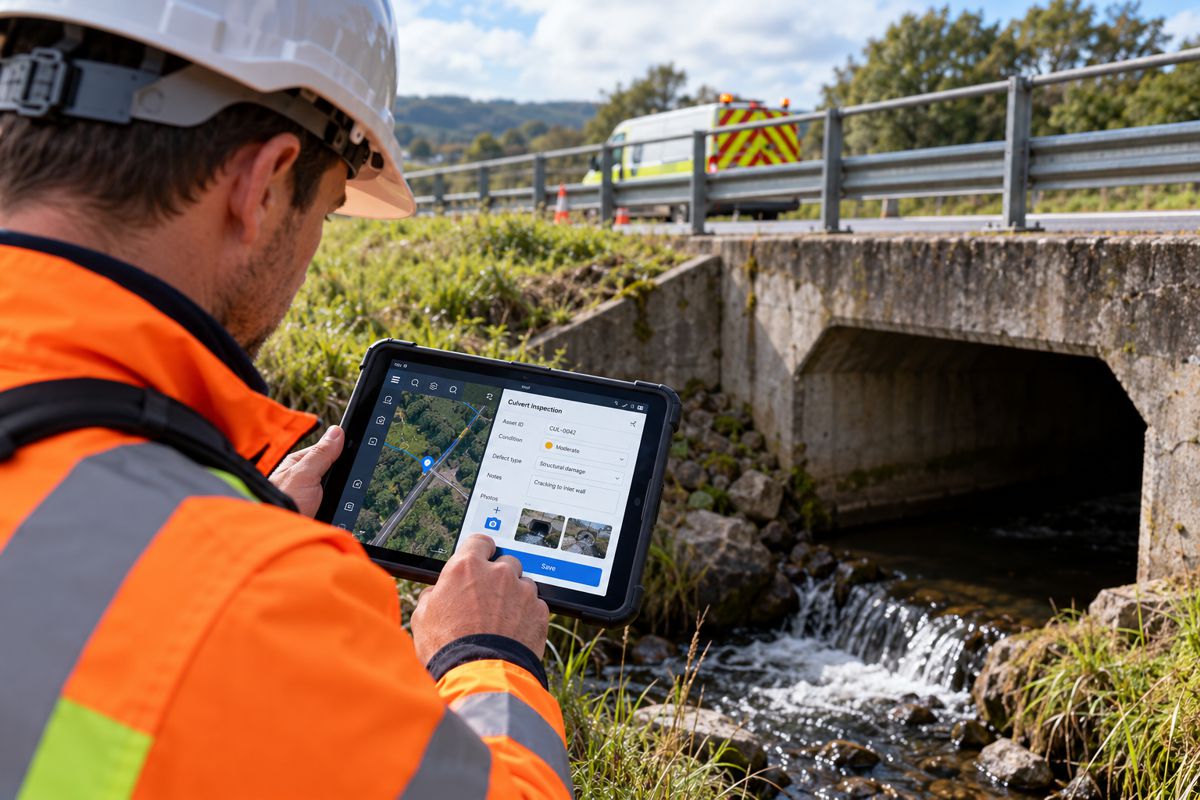
A highway maintenance technician inspecting a damaged culvert may have immediate access to its location, previous inspection records and photographs through a mobile GIS application. Recording a new defect is relatively straightforward, but getting that information into the maintenance system, raising the appropriate work order and updating the asset register can still involve several separate applications.
Geographic information systems have made considerable progress in bringing infrastructure data into the field, although the processes surrounding that information have not always developed at the same pace. Utilities, transport authorities and contractors increasingly need applications that support the work itself, from initial inspection through to maintenance planning and reporting.
Cam Barnard, Product Director at VertiGIS, argues that mobile GIS development is moving towards this challenge, connecting geographic information with the operational procedures and enterprise systems responsible for maintaining infrastructure assets. The question facing many organisations is how to make the information collected by field personnel available for subsequent work without unnecessary delays, duplication or administrative intervention.
Briefing
- Mobile GIS is expanding beyond mapping and asset data collection towards guided field operations and integrated workflows.
- Disconnected inspection, maintenance and enterprise applications can introduce duplicate data entry and administrative delays.
- Infrastructure owners are increasingly interested in connecting field activity with asset management, work orders and compliance processes.
- Offline functionality, synchronisation and interoperable data services remain important technical requirements.
- AI-assisted field operations will depend on reliable asset information, structured procedures and appropriate validation.
Connecting Mapping with Maintenance Workflows
The practical demands of infrastructure inspection extend considerably beyond locating an asset and entering observations against its record. A technician examining a highway drainage system may need to review previous maintenance work, document sediment accumulation or structural damage, assign a condition rating and determine whether a further intervention is necessary.
The map provides the location and geographic context, while the inspection record captures what the technician finds. Completing the wider process may involve consulting maintenance standards, notifying another department or initiating work through an enterprise asset management platform. Where these activities rely on separate systems, information can be entered more than once or passed to office-based personnel for further processing.
Barnard identifies this fragmentation as an increasingly important constraint on field productivity.
“The gap between the complexity of field work and the capabilities of field applications is a defining challenge in mobile GIS. Workers often operate under significant time pressure, in unfamiliar environments and within critical infrastructure. Every unnecessary click, menu, or application switch creates additional friction, and increases the risk of mistakes, delays, and inconsistencies.”
These difficulties become more pronounced when infrastructure owners use external contractors for inspection, maintenance and repair. A highway authority might maintain the central asset register while several service providers carry out condition surveys, emergency works and planned maintenance. Each organisation requires access to relevant information, but their responsibilities, reporting requirements and permissions are not necessarily the same.
Barnard describes the emerging approach as process-centric GIS, in which the application supports a defined operational activity rather than concentrating primarily on access to geographic information. An inspection workflow can use an asset’s classification, history and condition to determine which questions must be answered, which measurements are required and what action follows when a defect exceeds an established threshold.
During a bridge inspection, for example, the recorded condition of a structural component could determine whether additional photographs, measurements or specialist review are required before the inspection can be completed. The application might then route the record for approval or initiate a maintenance request according to the asset owner’s procedures.
“The goal is to bring together spatial data, business logic, workflow guidance, and operational context within a single environment tailored to the task.”
Embedding procedures into field applications can help organisations maintain consistent records across large inspection programmes, particularly where work is distributed among employees and contractors with varying levels of experience. It can also reduce dependence on individuals remembering every administrative requirement associated with a particular task.
There are limits to how far procedures can be standardised. Inspectors still need the freedom to record unusual conditions, question inconsistent information and escalate problems that fall outside predefined categories. A workflow built around excessive mandatory fields or rigid decision trees may create as much frustration as the disconnected applications it was intended to replace.
Integrating Field Records with Enterprise Systems
A technician attending a failed pumping station may have the equipment’s location and surrounding network displayed on a GIS map, while its maintenance history sits in an asset management platform and replacement parts are recorded in an inventory system. Once the repair is complete, the work order must be closed and the relevant asset records updated, potentially across several different databases.
This division of responsibility is common in infrastructure organisations, where specialist applications have accumulated over many years. Geographic information systems manage spatial relationships, while enterprise platforms handle maintenance schedules, financial records, equipment histories and operational instructions. Replacing all these applications with a single system is neither necessarily practical nor desirable.
The challenge is allowing them to exchange information reliably while preserving clear responsibility for individual records. An inspection may originate in a mobile application, but the approved condition rating might belong in the asset register, with the resulting maintenance instruction managed through a separate work order platform.
Different systems also need to agree on asset identifiers and the status of completed work. Without that consistency, a defect recorded in the field can become detached from the maintenance activity intended to resolve it, or an asset’s condition history may remain unchanged after repairs have been completed.
Interoperability standards provide part of the technical foundation. The Open Geospatial Consortium’s OGC API – Features standards define methods for accessing geographic features through web interfaces, allowing compatible systems to retrieve spatial information without relying entirely on proprietary data exchange mechanisms. Additional capabilities depend on the standards and implementations involved.
The availability of standardised geographic data does not automatically resolve business processes or record ownership. An infrastructure owner still needs to establish which application maintains the authoritative asset record, how information is validated and what happens when conflicting changes are received.
These questions become more complicated when field personnel cannot maintain a continuous connection to the organisation’s systems.
Working Without Reliable Connectivity
Road maintenance teams, utility engineers and construction surveyors regularly encounter locations where mobile connectivity is unreliable or unavailable. Tunnels, remote infrastructure corridors and underground facilities present obvious difficulties, but temporary coverage problems can also interrupt work in otherwise well-connected areas.
Offline capability has consequently become an established part of mobile GIS. Applications such as Esri ArcGIS Field Maps allow supported geographic information to be stored on a device, enabling personnel to view maps and capture field updates while disconnected. Those changes can subsequently be synchronised with the relevant services when connectivity returns.
For straightforward data collection, this can be relatively manageable. Integrated workflows introduce further complications because other personnel may continue working with the same asset records while a device remains offline.
Two inspectors might independently update the condition of an asset, or a maintenance team could complete a repair before an earlier inspection record has been synchronised. Both records may be legitimate, but simply transferring the latest information risks obscuring the order in which the work occurred.
The handling of such conflicts depends on the software and synchronisation configuration. Esri’s documentation, for example, describes editing arrangements in which later synchronised changes can overwrite earlier updates, while other configurations offer different controls. Infrastructure organisations need to understand the behaviour of their chosen systems before relying on offline workflows for operationally sensitive records.
Preserving inspection histories, identifying conflicting updates and preventing incomplete information from triggering inappropriate actions may require additional application logic or approval procedures. The appropriate approach will vary according to the nature of the assets and the consequences of an incorrect record.
For a routine roadside inventory, a delayed update might be inconvenient. In an electrical distribution network or a pressurised utility system, uncertainty over the current operating condition of an asset could have more serious consequences.
Data Quality and the Prospects for AI
Artificial intelligence is creating further interest in the relationship between GIS, operational workflows and enterprise data. Potential applications include identifying inspection anomalies, supporting predictive maintenance and retrieving relevant procedures for field personnel.
An asset management system might combine previous inspections, equipment operating data and environmental conditions to identify assets requiring closer examination. A field application could present a technician with the relevant maintenance history or identify an inconsistency between a new observation and the information already held against an asset.
Such applications depend on reliable data and sufficient context to interpret it correctly.
Barnard argues that structured workflows and trusted operational information will become increasingly important as organisations begin applying AI to field activities.
“Organisations seeking to apply generative AI, predictive maintenance, and operational analytics in the field will require structured workflows and trusted operational data. Without consistent processes, AI has little reliable context from which to generate meaningful recommendations.”
Infrastructure records often contain inconsistencies accumulated over many years. Information may have been imported from legacy databases, entered under different inspection standards or maintained by successive contractors using incompatible classifications.
An asset’s location might be accurately mapped while its condition history remains incomplete. Equipment identifiers may differ between systems, and inspection categories can change over time. Bringing these records into a common environment does not automatically make them suitable for automated analysis.
Structured field procedures can improve the consistency of new information, although historical records may still require reconciliation and validation. The quality of an inspection also depends on the technical judgement behind it, rather than simply whether every field in a digital form has been completed.
AI recommendations introduce an additional question of responsibility. Suggesting a maintenance priority for routine vegetation clearance carries a different level of risk from assessing structural deterioration or identifying a fault in a critical pipeline.
Organisations will need to establish where automated recommendations are appropriate, what evidence supports them and which decisions require professional review. The closer such systems move towards directing operational activity, the more consequential those controls become.
The Economics of Integrated Field Operations
The financial case for integrated mobile GIS depends heavily on the scale of an organisation’s operations and the extent of its existing systems.
A highway authority conducting tens of thousands of inspections each year could spend considerable administrative time transferring records between applications, checking submissions and creating maintenance requests. Reducing that work may justify substantial investment in integration and workflow development.
A smaller municipal maintenance department with a relatively modest inspection programme faces a different calculation. The cost of connecting specialist applications, maintaining interfaces and training personnel could outweigh the savings achieved by automating occasional administrative tasks.
Software licensing is only part of the expenditure. Organisations may need to configure inspection procedures, reconcile asset identifiers, develop application interfaces and adapt established maintenance processes. Changes to regulations, contracts or inspection standards can also require subsequent modifications.
Long-term ownership of infrastructure information deserves particular attention. Roads, bridges and utility networks remain in service for decades, frequently outlasting the software used to manage them. An asset owner may change maintenance contractors or enterprise systems several times during the operational life of its network.
Where inspection histories and workflow records become dependent on proprietary application structures, transferring that information to a replacement platform can be difficult. Open data formats, documented interfaces and accessible record histories can reduce some of these difficulties, although they do not eliminate migration costs or the need to preserve the meaning of historical information.
The effectiveness of integration is better assessed through actual operational performance than through the number of software functions available. Inspection completion times, delays between identifying defects and issuing work orders, duplicate records and repeat site visits can all provide useful evidence when measured against the organisation’s existing procedures.
A technically sophisticated system that adds administrative work or requires extensive manual correction may deliver little improvement over the applications it replaces.
GIS as Part of Infrastructure Operations
Mobile GIS has already changed how infrastructure organisations locate assets, document conditions and maintain geographic records. Connecting those capabilities with operational workflows and enterprise applications is a more involved undertaking, particularly where established systems have developed independently over many years.
For infrastructure owners, the next stage of development will depend as much on the systems surrounding the map as on the geographic information itself. Inspection records, maintenance instructions and asset updates must move reliably between field personnel and the applications responsible for managing the network.
Organisations with extensive spatial databases may find that the larger challenge is connecting those records to the everyday work of maintaining their infrastructure.
Key Industry Questions
- What is process-centric GIS? Process-centric GIS combines geographic information with operational procedures, business rules and task management. It enables field personnel to complete defined activities, such as inspections and maintenance reporting, using workflows connected to relevant asset information.
- How does mobile GIS improve infrastructure maintenance? Mobile GIS gives maintenance personnel access to asset locations, inspection histories and geographic information on site. When integrated with maintenance systems, it can also support work orders, condition assessments and reporting.
- What is the difference between mobile GIS and enterprise asset management? Mobile GIS provides geographic information and location-based field capabilities. Enterprise asset management systems maintain asset histories, maintenance schedules, work orders and associated operational records. Integration allows information to pass between the two.
- Can mobile GIS operate without an internet connection? Yes. Applications with offline functionality can store geographic information locally and support data collection while disconnected. Synchronisation transfers supported changes when connectivity returns, although conflict handling depends on the application’s configuration.
- Why is GIS interoperability important for infrastructure owners? Infrastructure organisations commonly operate multiple specialist systems. Interoperability allows compatible applications to exchange geographic information and supports more consistent asset records without requiring every function to reside in one platform.
- How can AI be used in mobile GIS? Potential applications include detecting inspection anomalies, supporting maintenance prioritisation and retrieving relevant operational guidance. Reliable results depend on suitable data, structured procedures and appropriate validation.
- What are the main challenges of integrating field operations with enterprise systems? Common difficulties include inconsistent asset identifiers, incompatible data structures, conflicting updates, access permissions and establishing which system maintains the authoritative record.
- How should infrastructure organisations assess mobile GIS investment? Relevant measures include field task completion times, administrative processing costs, duplicate records, data correction rates and delays between inspections and maintenance activity. Integration, training and ongoing support costs also need to be considered.
Strategic Takeaways
- Integrated workflows can reduce the administrative work between inspection and maintenance. The benefits depend on the volume and complexity of an organisation’s field operations.
- Clear ownership of asset records is essential. Integration requires reliable identifiers, validation procedures and rules for handling conflicting information.
- Offline functionality must extend beyond storing maps. Infrastructure applications need dependable synchronisation and appropriate controls for updates made without connectivity.
- Standardised procedures can improve inspection consistency without replacing professional judgement. Field personnel must still be able to identify and escalate exceptional conditions.
- Long-term access to infrastructure data deserves attention during procurement. Asset records may need to remain usable through several generations of software and maintenance contracts.