


TomTom and Esri Join Forces for Advanced Location Analytics In an era where location intelligence is pivo ...
-
TomTom and Esri Join Forces for Advanced Location Analytics

TomTom and Esri Join Forces for Advanced Location Analytics
-
How Spatial Data Science Is Revolutionising Data-Driven Decision-Making

How Spatial Data Science Is Revolutionising Data-Driven Decision-Making
-
Komatsu Powering Smart Construction with AI Edge Solution

Komatsu Powering Smart Construction with AI Edge Solution
-
Topcon’s Topnet Live Service Now Spans Western USA and Hawaii

Topcon’s Topnet Live Service Now Spans Western USA and Hawaii
-
The Power of Open Data Highway Mapping and Accessibility for US State DOTs

The Power of Open Data Highway Mapping and Accessibility for US State DOTs
-
Esri releases Third Edition of the beloved Designing Better Maps Guide

Esri releases Third Edition of the beloved Designing Better Maps Guide
-
Samsara and Esri supercharge Public Sector Fleet Operations with Real-Time Integration

Samsara and Esri supercharge Public Sector Fleet Operations with Real-Time Integration
-
Bentley Systems acquires Cesium to transform 3D Geospatial Technology

Bentley Systems acquires Cesium to transform 3D Geospatial Technology
-
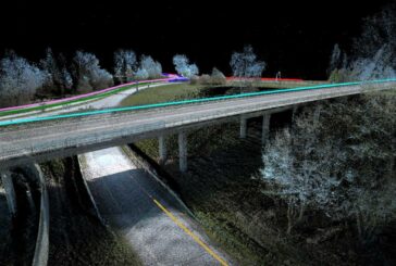
Using GIS to make Highways Safer and tackle Truck Blow-Over Crashes

Using GIS to make Highways Safer and tackle Truck Blow-Over Crashes
-
Esri ArcGIS Online secures FedRAMP Moderate Authorization

Esri ArcGIS Online secures FedRAMP Moderate Authorization
-
Celebrating Mapping and 25 years of GIS Day

Celebrating Mapping and 25 years of GIS Day
-
East Asian Mapping Project Illuminates 280 Million Buildings

East Asian Mapping Project Illuminates 280 Million Buildings
-
Esri announces new edition of ArcGIS Pro Book
Esri announces new edition of ArcGIS Pro Book
-
TomTom signs long-term Location Technology agreement with Microsoft

TomTom signs long-term Location Technology agreement with Microsoft
-
Assets of VeriDaaS acquired by The Sanborn Map Company
Assets of VeriDaaS acquired by The Sanborn Map Company
-
MATT3R transforming Tesla Cameras with AI into Smart Dashcams

MATT3R transforming Tesla Cameras with AI into Smart Dashcams
-
Ground-breaking Field Instrument enables Lava Flow Mapping
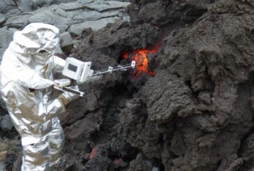
Ground-breaking Field Instrument enables Lava Flow Mapping
-
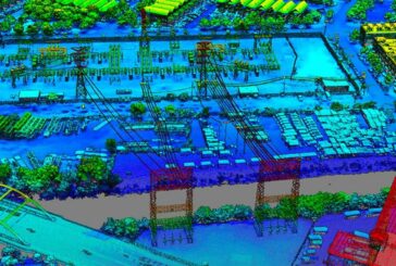
A Road Asset Lifecycle Management Long-Term Solution
A Road Asset Lifecycle Management Long-Term Solution
-
Bentley Systems and Worldsensing to integrate Topcon GNSS Technology

Bentley Systems and Worldsensing to integrate Topcon GNSS Technology
-
Leica Geosystems unveils Leica TerrainMapper-3

Leica Geosystems unveils Leica TerrainMapper-3