GIS data solutions for the Nevada Department of Transportation
The Nevada Department of Transportation (NDOT) oversees 5,400 miles of highway and over 1,000 bridges, and is responsible for the planning, construction, operation, and maintenance of the state highway system. Given the breadth of this infrastructure, collecting data, and communicating information to the public about the state’s roads and bridges is critical to NDOT’s mission.
However, until recently, the state lacked a comprehensive, public-facing method of communicating geospatial data about its highway system, including traffic records and road ownership. “It was the wild west of sharing data,” said Chad Foster, GIS analyst in NDOT’s IT division. “Some divisions were placing static copies of data on their respective web pages and some divisions were still handling GIS data requests manually. There were no standards or organization.”
To correct this, NDOT tasked the engineering and technology firm Timmons Group with updating the department’s GIS platform.
“The organization found itself sharing many datasets and GIS-related files to the public, but in a way that was less than ideal,” said Brian Kingery, GIS solutions architect for Timmons Group. “They needed a path forward to publicize authoritative and up-to-date content about their data and initiatives.”
Matt McCracken, geospatial transportation lead at Timmons Group, noted that while certain datasets were available on NDOT’s agency website, the data might be available for download in wildly different formats, some of which could be challenging for users without GIS experience. “There was just no conformity across the agency,” he added. “We needed a way to share our data with the public without creating a burden on GIS data stewards.”
To create a sense of cohesion and openness in a platform meant to be easily accessible for all, Timmons Group turned to ArcGIS Hub, a cloud-based offering for data organization made to facilitate exactly the kind of modernization NDOT’s platform needed.
Constructing the NDOT GeoHub
Beginning in April 2020, when NDOT identified the need for an updated GIS portal, Timmons Group’s GIS transportation team built the framework of a website based on NDOT’s original execution.
“We wanted to create an interactive, ArcGIS-based website connected directly to authoritative content the NDOT staff is curating,” said Kingery.
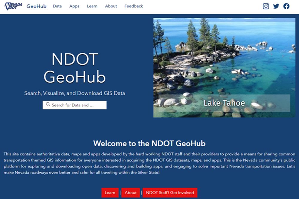
The answer was the NDOT GeoHub, a public-facing website that showcases the agency’s content to a variety of users, including stakeholders, private residents, and NDOT partners.
“The main task was to come up with a solution that would allow for content to be shared to the public,” Kingery added. “Working with the IT team at NDOT, we provided a way for authoritative content to be curated by various workgroups internally while providing the data pipeline to share that content to the public.”
Plenty of information existed on NDOT’s original platform, so sifting through data to determine what should migrate to the new site was crucial to give all users access to up-to-date data and information. The IT division held meetings with data owners, stewards, and management across NDOT divisions to introduce the idea of sharing content with the public through an internal portal environment. Individual divisions would manage the language, while the IT division would control the data and content.
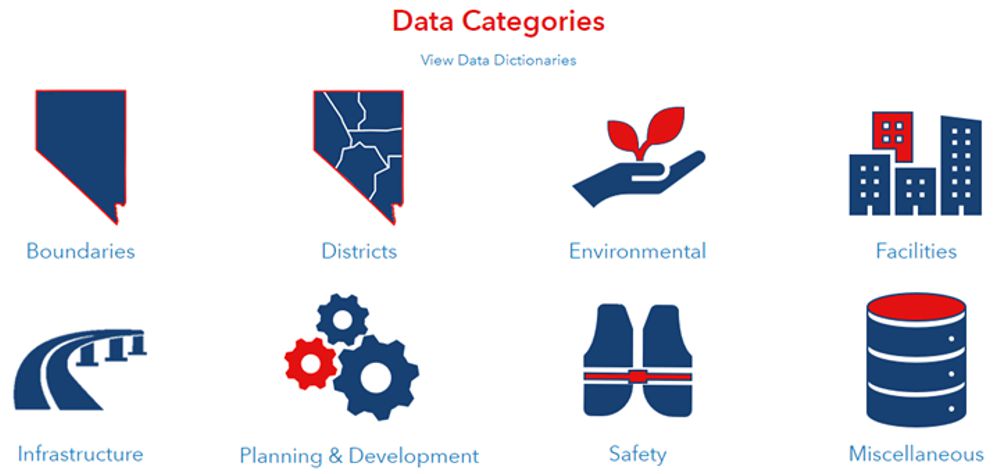
To flesh out the website, the team established specific categories for sitewide data. NDOT staff and their data providers developed the data in each category as a means for sharing common transportation-themed GIS information for all site visitors. Boundaries, districts, environmental, infrastructure, and other data categories are listed on the home page of the GeoHub for ease of access and transparency. Each category allows users to further refine the data with filters like layers, document type, tags, and date uploaded or modified.
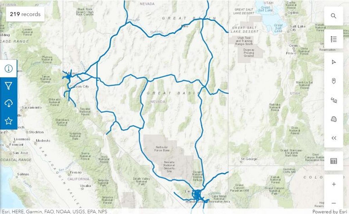
“You can download key datasets that NDOT wanted to showcase,” said Kingery. The GeoHub also includes road maps, dashboards, and ArcGIS StoryMaps stories, all directly from the agency. “And in this application, they are fully interactive,” he added.
Geospatial Benefits for All
The site represents NDOT’s mission of coordinating, guiding, and assisting the development of GIS technology for the agency through up-to-date content and ease of accessibility for consumers. Equally important, however, was ease of use for NDOT staff interacting with their agency’s data.
“We wanted to empower the NDOT IT division to be able to be advocates and act as the webmasters for this website,” said Kingery. “That way they can connect with division representatives to assist in the curation and promotion of content.”
In addition to NDOT’s data, users can engage with GIS support staff for each division of NDOT. NDOT staff, Nevada residents, and partners alike can conduct their own research within each division. “Our goal is to have every division represented on our GeoHub,” said Foster.
NDOT divisions whose data is not fully integrated in the GeoHub are represented by placeholder links, so users are aware of what information is to come.
“Being able to have those tools at your hands takes the burden off NDOT staff to fulfill potentially hundreds of requests for data,” Kingery said. “When a user can go to the website regardless of their intent and have open searchability and discover the data to help answer their own questions—that helps the agency’s staff.”
The nearly 100 pages—and growing—that comprise the NDOT GeoHub promote transparency for the public, staff, and NDOT stakeholders, leading to more deliberate interactions with the people most affected by the data. Any individual with an interest in familiarizing themselves with NDOT’s GIS plans and capabilities can do so with only a few clicks. Visitors can also share their opinions with the agency directly via the Feedback tab on the navigation bar.
Kingery and the rest of the Timmons Group team emphasized that not only was ArcGIS Hub the best solution for this project, but also that this kind of data organization and communication is more important now than ever in expanding and streamlining an organization’s digital footprint.
“This is a repeatable approach that can be handled at all scales of an organization that wants to showcase its initiatives, whether it’s data or a specific project,” said Kingery.
As fewer over-the-counter interactions occur between state residents and their DOT representatives, sites like the NDOT GeoHub are invaluable to the way organizations manage relationships with their users.
“Local governments and other organizations have similar challenges,” said Kingery. “Hub is one of the tools across the ArcGIS [system] that has helped us create a solution to meet the need.”
Article by Lillian Minix and Benjamin J. Smith. Originally published on ArcGIS Hub.