






Looq AI Brings Handheld 3D Mapping to Trimble’s West Coast Dealer Network
Looq AI has expanded the distribution of its handheld 3D mapping technology across the western United States through new agreements with BuildingPoint Pacific and SITECH NorCal. Announced at Trimble Dimensions 2026 in Las Vegas, the partnerships bring Looq’s ground-based photogrammetry platform into established construction technology and surveying sales networks serving California, Oregon and Washington.
The San Diego company has developed a camera-based method of collecting detailed spatial information without using terrestrial LiDAR scanners or aerial drones. Its approach combines handheld imaging, satellite positioning and automated photogrammetric processing to produce measurable 3D point clouds and survey imagery. For engineering and infrastructure teams already using Trimble software, the technology offers another collection method that can feed into familiar processing and design workflows.
Briefing
- Looq AI has appointed BuildingPoint Pacific and SITECH NorCal as reseller partners across the US West Coast.
- The qCam handheld imaging system combines photogrammetry, GNSS positioning and AI-assisted processing without using LiDAR.
- Looq claims field capture can be up to ten times faster than conventional methods in suitable applications.
- Trimble Business Center compatibility is complemented by direct exports to Trimble Connect, although some viewing functions require additional licensing.
- Applications include underground utilities, topographic mapping, infrastructure documentation and post-disaster recovery.
Ground-Based Photogrammetry for Infrastructure Surveys
Survey teams have several established methods for recording existing conditions, ranging from total stations and GNSS rovers to terrestrial laser scanning, vehicle-mounted mapping equipment and drone photogrammetry. Each has strengths and limitations determined by the site, required accuracy, available access and the information needed for design or construction.
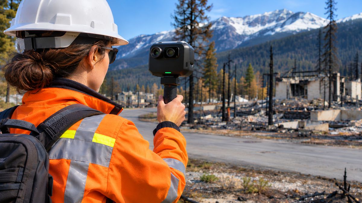
Looq’s technology platform occupies a position between conventional point-by-point surveying and more equipment-intensive reality capture. An operator walks through a site carrying the company’s qCam imaging system, recording overlapping photographs while integrated GNSS and inertial sensors provide positioning information. The captured material is subsequently processed into georeferenced spatial datasets that can be examined and measured in the office.
The camera uses 20-megapixel imaging with a 270° horizontal and 150° vertical field of view. Its integrated GNSS system supports post-processing corrections, while the equipment is designed for outdoor deployment with IP67-rated protection against dust and water ingress. Unlike laser scanning, the resulting three-dimensional geometry is reconstructed from photographic imagery rather than direct laser distance measurements.
Processing takes place through Looq’s qAI cloud platform, which uses photogrammetric algorithms to reconstruct point clouds and produce orthomosaic imagery. The company’s qApp software provides tools for inspecting the results, measuring features and extracting information for subsequent engineering work. Surveyors can also use its qSurvey functionality to prepare CAD-ready points and linework.
The published technical specifications describe GNSS positioning accuracy of approximately 3–5 cm and relative precision below 1 cm under suitable conditions. These figures should not be interpreted as guaranteed accuracy across every point in a completed survey. Looq’s own testing describes relative point-cloud accuracy of approximately 5–10 mm and global positioning accuracy of around 3–5 cm RMS under favourable conditions with appropriate correction data. Actual deliverable accuracy depends on satellite reception, positioning corrections, ground control and the quality-control procedures applied to the survey.
Working Within Established Trimble Systems
The distribution agreements are supported by Looq’s compatibility with Trimble Business Center, which surveying and geospatial professionals use to process observations, manage spatial data and prepare engineering deliverables.
Looq has also introduced direct exports to Trimble Connect. According to their technical guidance, users can transfer processed point clouds, orthographic imagery and capture tracks into Trimble Connect project folders without first downloading and manually uploading the files. Supported formats include LAZ point clouds, GeoTIFF imagery, E57 point clouds where available, and GeoJSON tracks.
The procedure requires a Trimble account with the appropriate project permissions, and Looq identifies an additional licensing consideration. Opening point clouds within Trimble Connect requires Trimble’s Reality Capture add-on, which is licensed separately from the Looq platform. The integration therefore simplifies data transfer, but the available viewing and processing functions still depend on the customer’s Trimble software configuration.
Compatibility with established applications is particularly relevant to survey practices that have invested in equipment, software licences and established production procedures. New collection technology must eventually provide information that can be checked, processed and delivered in formats suitable for design, construction or asset management.
Dominique Meyer, CEO of Looq AI, described the company’s approach: “The future of reality capture is not simply about collecting more data. It is about using AI to transform the physical world into accurate, structured information that can move directly into the systems where decisions are made.”
The integration also supports mixed surveying methods, allowing information gathered through handheld photogrammetry to be used alongside conventional observations and other spatial datasets. Such workflows remain subject to the usual requirements for coordinate control, accuracy verification and consistency between survey sources.
Field Productivity and Survey Economics
Looq reports that its platform can achieve up to ten times faster field data capture in suitable applications. The figure is a company performance claim rather than a universal improvement over conventional surveying, and the comparison depends on the survey method being replaced, site conditions and the information required.
One example involves AJ Surveying, which uses the platform to collect topographic information for underground utility projects in wildfire-prone, drone-restricted and otherwise challenging environments. According to results supplied by Looq, the surveying company achieved 60% faster project turnaround and a 43% reduction in survey costs.
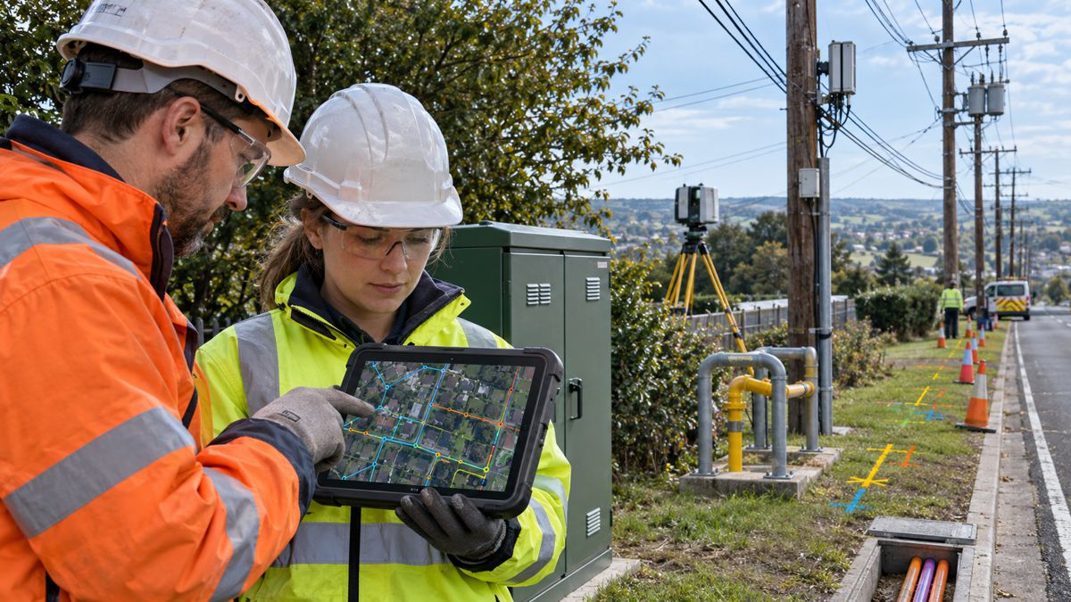
An image-based capture can record a wide range of visible site features during one operation, allowing surveyors to examine and measure additional details afterwards without necessarily returning to the location. That can be useful for utility corridors, roadside infrastructure and existing-condition surveys where engineers may subsequently require information that was not identified in the original fieldwork specification.
The approach also changes how some survey activities are organised. Rather than selecting and measuring every feature individually while on site, an operator can collect overlapping imagery across the accessible area and leave part of the interpretation and measurement work to the processing stage. This does not remove the need for survey judgement, particularly where features are obscured, control is inadequate or the required accuracy exceeds what the reconstructed data can reliably provide.
Field collection time is only one component of survey cost. Data upload, cloud processing, quality assurance, feature extraction and final drawing preparation must also be considered when comparing methods. A shorter visit to the site will not necessarily produce an equivalent reduction in total project expenditure, although the AJ Surveying results suggest substantial savings are achievable in selected applications.
Infrastructure Mapping After the Jasper Wildfire
Canadian engineering and surveying company McElhanney provides another example of the technology’s application. The company has adopted Looq for mapping and topographic surveys, incorporating the resulting information into Trimble Business Center.
Following the devastating 2024 wildfire in Jasper, Alberta, McElhanney used the system to capture four downtown areas in approximately four hours. According to Looq, the work supported Parks Canada’s property-boundary restoration activities, providing updated spatial information in an environment where existing conditions had been substantially affected by the disaster.
After a major wildfire, engineering teams may need current records of roads, structures, property features and other visible infrastructure before restoration planning can proceed. Existing mapping may no longer adequately describe the affected environment, while access restrictions and safety considerations can complicate conventional surveying.
Handheld collection offers a relatively compact means of documenting accessible areas, particularly when substantial amounts of visible information must be recorded before conditions change again. The imagery and reconstructed geometry can then be reviewed by engineering teams away from the affected site, reducing the need for repeated visits to inspect individual features.
The reported four-hour collection period demonstrates the speed of field documentation in this particular deployment. It does not represent the time required to complete every element of the subsequent survey deliverables, including processing, verification and boundary interpretation.
Where Camera-Based Mapping Has Limitations
Photogrammetry has limitations that differ from those of terrestrial laser scanning and conventional survey instruments. The reconstruction process depends on identifying common features across overlapping images, meaning that lighting, surface texture and visibility affect the quality of the resulting geometry.
Looq’s technical guidance on unsupported capture environments, updated in October 2026, identifies poor GNSS reception, low-light conditions, dense vegetation and featureless surfaces as potential problems. Full indoor surveys are not currently a supported application, although short captures in GNSS-denied areas may be possible when they begin and end where satellite reception is strong.
The guidance also identifies difficulties with moving water, reflective surfaces, poor weather and inadequate image overlap. Operators are advised to maintain separation from nearby objects and avoid excessive movement that could introduce motion blur. Dense vegetation and uniform surfaces can be especially troublesome because the reconstruction algorithms require identifiable features that appear consistently across successive images.
There are practical limits to individual collection sessions. Looq currently supports captures lasting between one and 40 minutes, with 20–30 minutes identified as an ideal duration. Longer areas or corridors must therefore be planned around these operating parameters, rather than assuming an uninterrupted capture can continue indefinitely.
Road and infrastructure surveys frequently involve conditions that challenge photographic reconstruction, including relatively featureless paved surfaces, roadside vegetation, restricted access and changing weather. Conventional total stations, GNSS observations and laser scanning remain necessary where the site geometry, accuracy requirements or available control make image-based reconstruction unsuitable.
Expanding Through Regional Technology Dealers
BuildingPoint Pacific serves California, Oregon and Washington as an authorised Trimble distribution partner, supplying technology across design, construction and building operation. SITECH NorCal provides construction technology, machine control and site positioning equipment to contractors and infrastructure customers across Northern California, Oregon and Southern Washington.
Both businesses are associated with Peterson Technology Group and have existing relationships with customers using Trimble hardware and software. Adding Looq to their portfolios gives those customers access to a ground-based mapping system through suppliers already familiar with positioning equipment, digital construction workflows and local support requirements.
For smaller survey practices, the availability of demonstrations, training and technical assistance can influence equipment decisions as much as the published specifications. New surveying methods must be assessed against existing instruments and software, particularly when they introduce different collection procedures and processing requirements.
The agreements also expand Looq’s commercial reach without requiring the company to establish an equivalent direct sales and support operation across the region. Financial terms, sales targets and minimum purchasing commitments have not been disclosed.
From Site Capture to Engineering Information
Looq’s software development extends beyond the production of photographic surveys and point clouds. Its platform includes tools for classifying and extracting information about infrastructure assets, while the qPole application is designed to create connected records of utility poles that can support engineering analysis, inspections and network management.
Potential applications include documenting overhead utility networks, identifying visible infrastructure features and preparing spatial information for topographic surveys and asset inventories. These functions depend on the quality of the underlying data and the ability to extract accurate information from reconstructed geometry, rather than simply producing visually detailed 3D models.
The West Coast distribution agreements will expose the technology to a wider range of surveying and infrastructure applications, from utility corridors and transport projects to site development and asset management. Looq has reported strong results from selected customers, but performance across different environments will depend on capture conditions, accuracy requirements and the amount of processing needed to produce the finished deliverable.
The practical test for the expanded dealer network will be how consistently those results can be reproduced across commercial projects. Survey companies evaluating the platform will be looking at the completed work, including field time, processing, checking and final documentation, rather than capture speed alone.
Key Industry Questions
- What is the Looq AI Platform? It is a ground-based spatial mapping system combining a handheld photogrammetry camera, GNSS positioning, cloud processing and software for inspecting and extracting engineering information from reconstructed 3D datasets.
- Does Looq use LiDAR technology? No. Its qCam system captures photographic imagery and uses photogrammetric processing to reconstruct three-dimensional geometry rather than measuring distances with laser pulses.
- How accurate is Looq’s handheld mapping system? Looq reports GNSS positioning accuracy of approximately 3–5 cm and relative point-cloud accuracy of approximately 5–10 mm under favourable conditions. Completed survey accuracy depends on corrections, control, site conditions and verification.
- Can Looq data be used in Trimble Business Center? Yes. Looq supports Trimble Business Center workflows, including importing point clouds, orthographic imagery and survey information for subsequent processing and drafting.
- Does Looq integrate directly with Trimble Connect? Yes. Its documented export function transfers supported spatial datasets into Trimble Connect project folders. Opening point clouds within Trimble Connect requires Trimble’s separate Reality Capture add-on.
- What infrastructure applications are suitable for handheld photogrammetry? Applications include topographic surveys, utility corridors, roadside infrastructure, existing-condition mapping and outdoor asset documentation where adequate photographic coverage and positioning can be achieved.
- Can handheld photogrammetry replace terrestrial laser scanning? It can provide an alternative for some survey tasks, but does not eliminate the need for laser scanning or conventional instruments. The appropriate method depends on required accuracy, geometry, environmental conditions and project deliverables.
- What affects the quality of photogrammetric survey data? Image overlap, surface texture, available light, GNSS reception, ground control and processing procedures all influence the quality and reliability of reconstructed information.
- How does Looq reduce surveying costs? Its principal potential saving is reduced field collection time, with additional efficiencies possible through remote measurement and automated processing. Overall savings depend on the complete workflow, including checking and preparing final deliverables.
Strategic Takeaways
- Established distribution supports adoption: Regional dealers provide a route to demonstrations, training and technical assistance for survey teams evaluating unfamiliar equipment.
- Integration has licensing considerations: Direct Trimble Connect exports simplify data transfer, although point-cloud viewing requires the appropriate Trimble Reality Capture licence.
- Accuracy must be assessed at deliverable level: Published GNSS and relative precision figures do not replace project-specific quality control and verification.
- Capture speed is application-dependent: Reported productivity improvements need to be assessed against field conditions, processing requirements and the cost of completed survey deliverables.
- Asset information extends the application: Extracting measurable infrastructure features from reconstructed geometry provides opportunities beyond photographic documentation, particularly in utility mapping and asset management.