


Celebrating Mapping and 25 years of GIS Day On November 20, 2024, the world will come together to celebra ...
-
Celebrating Mapping and 25 years of GIS Day

Celebrating Mapping and 25 years of GIS Day
-
East Asian Mapping Project Illuminates 280 Million Buildings

East Asian Mapping Project Illuminates 280 Million Buildings
-
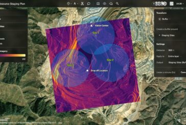
Revolutionising Spatial Analytics with Esri, Microsoft and IBM

Revolutionising Spatial Analytics with Esri, Microsoft and IBM
-
TomTom signs long-term Location Technology agreement with Microsoft

TomTom signs long-term Location Technology agreement with Microsoft
-
Assets of VeriDaaS acquired by The Sanborn Map Company

Assets of VeriDaaS acquired by The Sanborn Map Company
-
MATT3R transforming Tesla Cameras with AI into Smart Dashcams

MATT3R transforming Tesla Cameras with AI into Smart Dashcams
-
Green Mapping Project boosting Biodiversity on England’s Road Network
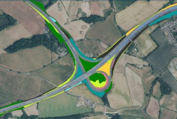
Green Mapping Project boosting Biodiversity on England’s Road Network
-
Delta.g accelerating commercialisation of Gravity Sensors for Underground Mapping

Delta.g accelerating commercialisation of Gravity Sensors for Underground Mapping
-
Ground-breaking Field Instrument enables Lava Flow Mapping
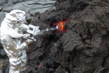
Ground-breaking Field Instrument enables Lava Flow Mapping
-
New approach developed for Aerial Geophysical Surveys
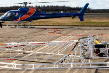
New approach developed for Aerial Geophysical Surveys
-
Leica Geosystems unveils Leica TerrainMapper-3

Leica Geosystems unveils Leica TerrainMapper-3
-
Sanborn Map Company unveils Enhanced Image Analyst Application
Sanborn Map Company unveils Enhanced Image Analyst Application
-
MIT creating Agricultural Maps with AI and Satellite Data

MIT creating Agricultural Maps with AI and Satellite Data
-
Maxar Intelligence wins Precision3D Data contract from NGA

Maxar Intelligence wins Precision3D Data contract from NGA
-
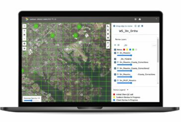
Large-scale Urban Building Function Mapping using web-based Geospatial Data

Large-scale Urban Building Function Mapping using web-based Geospatial Data
-
National Geographic MapMaker launched by Esri and National Geographic Society

National Geographic MapMaker launched by Esri and National Geographic Society
-
Felt 2.0 hailed as the most powerful tool for Professional Map Making
Felt 2.0 hailed as the most powerful tool for Professional Map Making
-
Smart Robots revolutionise Nuclear Radiation Mapping
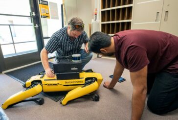
Smart Robots revolutionise Nuclear Radiation Mapping
-
3D Mapping and AI-based monitoring could help prevent Urban Ground Collapse
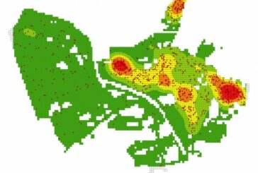
3D Mapping and AI-based monitoring could help prevent Urban Ground Collapse
-
Precisely joins Overture Maps Foundation to power Global Open Map Dataset

Precisely joins Overture Maps Foundation to power Global Open Map Dataset