Singapore Tests a National Positioning Layer for Autonomous Machines
Singapore already possesses one of the expensive foundations needed for large-scale machine navigation: a detailed three-dimensional representation of the physical environment.
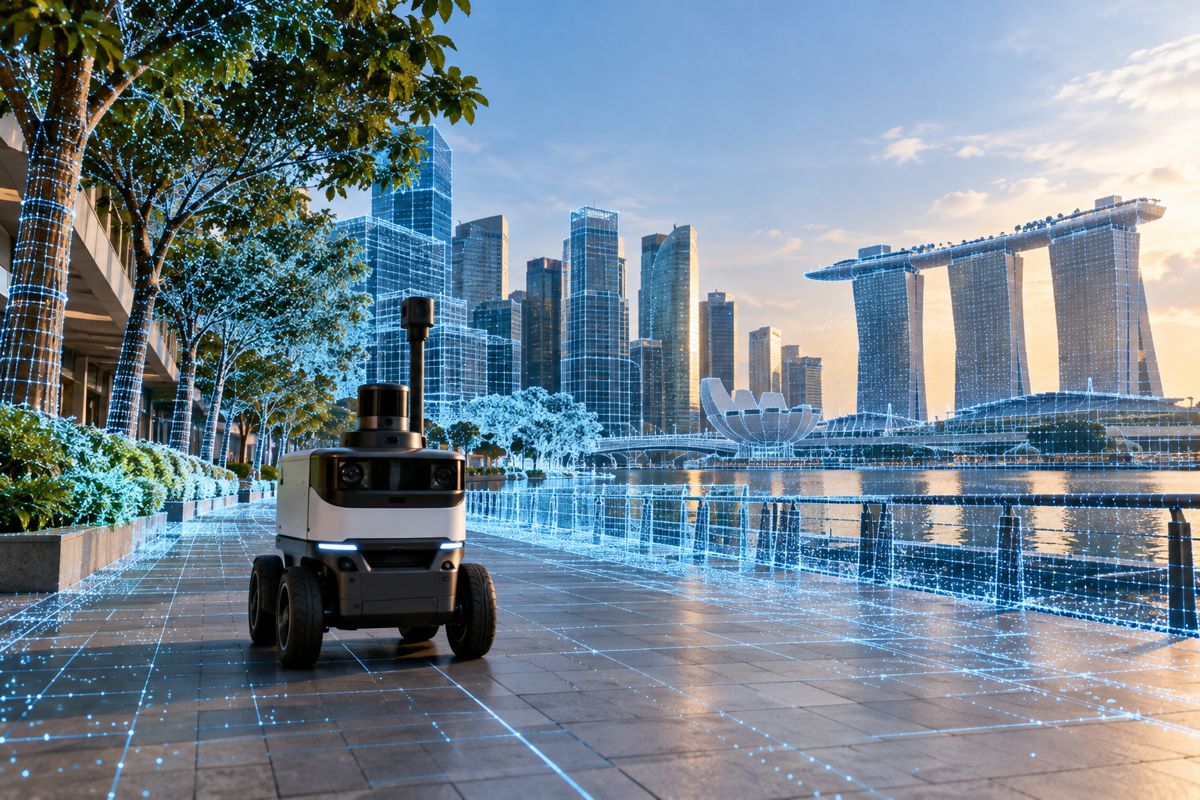
Now the Singapore Land Authority and Niantic Spatial are examining whether that existing national mapping infrastructure can become something more operational. Under a memorandum of understanding, the two organisations will evaluate the feasibility of creating Singapore’s first national Visual Positioning System map, allowing cameras on robots, vehicles and other devices to determine where they are and how they are oriented by recognising the world around them.
The distinction from conventional satellite positioning is substantial. GPS and other Global Navigation Satellite Systems can establish geographic position, but accuracy can deteriorate around tall buildings, indoors and in other obstructed environments. Visual positioning instead compares what a camera can see against a previously mapped representation of the location.
If the Singapore work succeeds, the more interesting result may be how that reference map is created. Rather than systematically scanning streets specifically for the positioning system, Niantic Spatial intends to investigate whether the Singapore Land Authority’s existing aerial imagery and nationwide 3D point clouds can provide much of the data required. Mapping originally created for human planning, surveying and government operations could become positioning infrastructure for machines.
Briefing
- Singapore Land Authority and Niantic Spatial have signed an MOU to investigate a national Visual Positioning System.
- The project will examine whether existing authoritative aerial imagery and nationwide 3D point clouds can support visual localisation.
- VPS uses camera imagery and computer vision to estimate a device’s position and orientation relative to a mapped environment.
- Potential applications include autonomous robots, smart infrastructure, urban operations, emergency response and location-based digital services.
- The project remains a feasibility exercise and no nationwide operational VPS deployment has yet been announced.
From Coordinates to Position and Orientation
Positioning a machine is more complicated than putting a dot on a map. An autonomous robot needs to know where it is, which direction it faces and how its immediate surroundings relate to its stored understanding of the environment. Niantic Spatial’s VPS technology uses visual information together with device sensors and mapped reference data to calculate this relationship.
Its current VPS2 system distinguishes between coarse and precise localisation. Coarse localisation can combine GPS, magnetometer information, local augmented-reality tracking and cloud-based geopositioning. Precise localisation uses a previously processed VPS map to determine a full six-degree-of-freedom pose, covering three-dimensional position together with roll, pitch and yaw.
Niantic Spatial says mapped environments can support near centimetre-level localisation, although actual performance depends on the available map, operating environment and localisation mode. Lighting, visibility, camera quality and the availability of recognisable environmental features can all affect the ability of a vision-based system to establish its position.
Singapore offers an unusually demanding environment in which to test that capability. Dense development, high-rise buildings, covered spaces and complex infrastructure create many situations where satellite positioning can be degraded, while simultaneously providing buildings, façades and other physical features that computer-vision systems can potentially recognise.
Building on Singapore’s 3D Map
The Singapore Land Authority has spent more than a decade developing the country’s national 3D mapping capability. Its National 3D Mapping Programme began in 2014 with a comprehensive aerial survey covering Singapore’s main island and offshore islands, with further nationwide aerial mapping exercises following in 2019 and 2024.
According to SLA, the programme now involves 12 government agencies, with the resulting information used for applications including urban planning, infrastructure management, flood modelling and aviation safety. Singapore also operates OneMap, its authoritative national mapping platform, bringing together detailed geospatial information for government, businesses and the public.
The Niantic Spatial collaboration therefore starts from an unusually mature dataset. SLA maintains authoritative high-resolution mapping information including aerial imagery and nationwide 3D point clouds. The feasibility study will examine whether these datasets can be combined with Niantic Spatial’s computer vision and visual positioning technology to create the reference layer against which machines can localise themselves.
Niantic Spatial Chief Executive Inhi Cho Suhm, said: “Singapore has some of the richest geospatial data of any country in the world. This pilot tests whether we can turn that national investment into infrastructure machines can use to navigate safely, but without the cost of scanning a city street by street. If we can prove that here, it’s a blueprint for what trustworthy physical AI looks like at national scale.”
His reference to avoiding street-by-street scanning identifies one of the difficulties of scaling visual positioning. A localisation system can perform impressively within a carefully mapped building, factory or small urban district. Extending that capability across an entire city requires a much larger and continuously maintained reference environment.
Singapore provides an opportunity to find out how much of that mapping work has effectively already been done.
Reusing National Geospatial Infrastructure
Visual positioning relies on identifying features in live camera imagery and matching them against a known visual or three-dimensional map. Once enough features correspond, the system can estimate the camera’s pose relative to that reference environment.
A national mapping agency starts from a different direction. Its datasets are produced to establish authoritative representations of terrain, buildings, roads and other physical features rather than primarily to help a robot recognise its surroundings. The Singapore project will test how readily those datasets can be adapted for machine localisation.
Aerial imagery and point clouds that are excellent for surveying or city modelling are not automatically sufficient for ground-level visual positioning. Viewpoints differ, streets change, vegetation grows, façades are altered and temporary objects appear and disappear. A positioning system also needs sufficiently distinctive and current features to match what a camera observes against its reference map.
The practical question is how much of Singapore’s existing geospatial investment can be reused directly and how much additional capture, processing and updating would still be required. A high level of reuse could substantially reduce the work involved in extending VPS beyond individual sites and into much larger operating environments.
Positioning Autonomous Machines
The immediate applications extend beyond augmented reality. Robots operating in public environments need dependable localisation to navigate between known points and relate sensor observations to a common map. The same principle applies to autonomous inspection equipment, drones, intelligent infrastructure systems and potentially vehicles operating where satellite positioning is unreliable.
A shared positioning layer could also allow different machines and digital systems to refer to the same physical location. A robot, an infrastructure asset database and an inspection application become considerably more useful when each understands the same object or position within a common spatial reference.
Emergency services and city operators could potentially use similar capabilities where precise localisation within complex built environments is required, although the Singapore programme is currently exploring possible applications rather than announcing operational services.
SLA Chief Executive Calvin Phua described the authority’s datasets as the starting point for that investigation: “SLA’s authoritative and comprehensive geospatial datasets provide a strong foundation for innovation. Through this collaboration, we will explore how combining these trusted national datasets with advanced positioning technologies can enable next-generation applications and deliver tangible benefits.”
Autonomous systems eventually need more than visually plausible models. Infrastructure operators and public authorities need confidence in coordinate systems, provenance, updates and the relationship between digital information and physical assets. Singapore already maintains much of that institutional mapping layer.
Keeping the Machine Map Current
A national VPS would also create a maintenance problem. Cities do not remain visually static: buildings are demolished and constructed, roads are realigned, trees mature, signs change and construction sites temporarily alter large sections of the streetscape. A reference map used by machines therefore has a different operational requirement from a conventional map that can tolerate some delay between physical change and database update.
Niantic Spatial’s documentation acknowledges that localisation quality depends on map coverage, visible environmental features and operating conditions. Its systems use anchors and updated localisation to maintain the relationship between a device and a mapped environment rather than assuming that an initial position remains permanently correct. At national scale, maintaining the underlying reference information becomes part of the infrastructure itself.
Singapore’s existing approach provides one possible foundation. SLA’s National 3D Mapping Programme has already moved through repeated nationwide aerial surveys rather than treating the country’s 3D model as a finished product. Whether those update cycles are sufficient for machine localisation, or need to be supplemented by more frequent terrestrial data, is one of the practical questions that a national VPS programme would eventually have to address.
There are also questions around data governance and access. Camera-based localisation involves information moving between devices, mapping services and potentially cloud infrastructure. Niantic Spatial’s developer documentation notes that its VPS services can process camera imagery and location-related information, so any national-scale implementation involving public-sector geospatial infrastructure would need clearly defined arrangements covering data handling, security and access. The MOU does not establish how those questions would be resolved.
Mapping for Machines
For most of its history, national mapping has ultimately been produced for people. Surveyors established boundaries, engineers used coordinates, planners studied land and buildings, while drivers followed road maps and, later, navigation systems translated geographic information into instructions.
Autonomous machines introduce another kind of user. A robot cannot interpret a city in quite the same way as a person looking at a map. It needs a continuous mathematical relationship between its sensors, position, orientation and a digital representation of the physical environment.
Singapore has already invested in creating an unusually detailed national geospatial model. Niantic Spatial and SLA are now testing whether that model can become part of the machinery that allows autonomous systems to operate within the city itself.
The outcome is not yet a national VPS. The agreement is explicitly an exploration of technical feasibility and potential applications. If existing authoritative national mapping can be adapted into reliable visual positioning infrastructure without rebuilding the country as a separate machine-navigation map, Singapore could provide a practical model for governments already sitting on large volumes of high-quality geospatial data.
The next generation of national maps may therefore have an audience that never looks at them at all.
Key Industry Questions
- What is a Visual Positioning System? A VPS uses camera imagery, computer vision and mapped reference information to estimate the position and orientation of a device relative to its physical surroundings.
- How is VPS different from GPS? GPS calculates geographic position from satellite signals. Visual positioning identifies features in the surrounding environment and compares them with mapped reference data. The technologies can complement each other.
- Why could VPS be useful in cities? Tall buildings and other structures can obstruct or reflect satellite signals, reducing GNSS accuracy. A visual system can use recognisable physical features in the built environment as an additional positioning reference.
- Has Singapore decided to build a nationwide VPS? No. The agreement between Singapore Land Authority and Niantic Spatial is a feasibility study examining the technology and potential applications.
- What mapping data does Singapore already have? SLA maintains authoritative national geospatial information including aerial imagery and nationwide 3D point clouds. Its National 3D Mapping Programme has conducted nationwide aerial mapping exercises in 2014, 2019 and 2024.
- Why could existing 3D mapping reduce VPS deployment costs? If existing point clouds and imagery contain enough suitable information for visual localisation, less dedicated ground-level scanning may be required. Establishing how much existing information can actually be reused is one of the technical questions in the Singapore study.
- Could construction and infrastructure operators use this technology? Potential applications include autonomous inspection, robotics, asset localisation and infrastructure operations, particularly where precise positioning is required or satellite signals are unreliable. No specific Singapore construction deployment has yet been announced under the MOU.
- Does visual positioning always provide centimetre accuracy? No. Niantic Spatial says its VPS can provide near centimetre-level localisation in suitably mapped environments, but performance depends on mapping coverage, localisation mode, environmental conditions and the visual information available to the device.
Strategic Takeaways
- Singapore’s existing national 3D mapping programme could provide much of the underlying reference information required for machine localisation.
- Reusing authoritative government geospatial datasets could reduce the dedicated mapping required for large-area VPS deployment.
- Visual positioning complements GNSS by providing position and orientation from the physical environment, particularly in complex or obstructed locations.
- Maintaining a machine-readable spatial map may require different update frequencies and data-management practices from conventional national mapping.
- The project provides a practical test of whether national geospatial infrastructure developed for planning and surveying can also support autonomous machines.