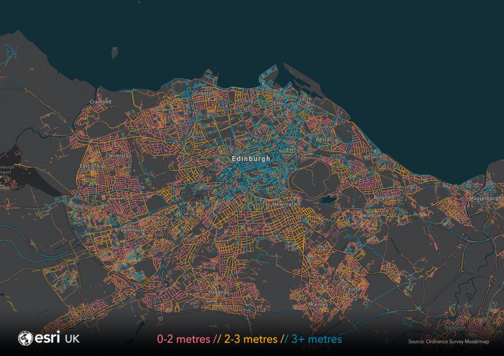
Esri UK’s map of pavement widths helps local authorities with social distancing plans
Spatial analysis by Esri UK has found that most pavements around the country are less than 3 metres wide, making it difficult for pedestrians to remain 2 metres apart and follow government guidelines for social distancing.
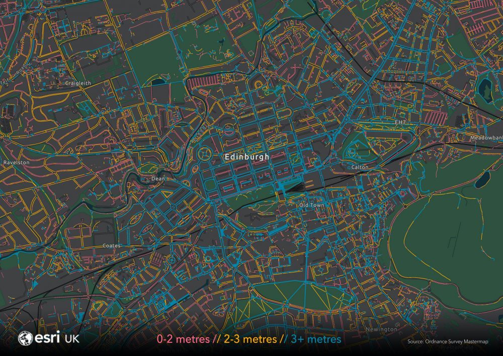
Using measurements from Ordnance Survey, Esri UK has created a map of all pavement widths, discovering that only 30% of Great Britain’s pavements are at least 3 metres wide, 36% are between 2-3 metres and 34% are less than 2 metres wide.
Esri UK, the mapping and spatial analytics company, has released the new map data for free to help the public sector and other organisations respond to government guidelines for social distancing, as councils adapt their infrastructure to make walking safer for the public. Over 30 local authorities are using the new pavement map to date, including Glasgow City Council, Stirling Council and Dover District Council.
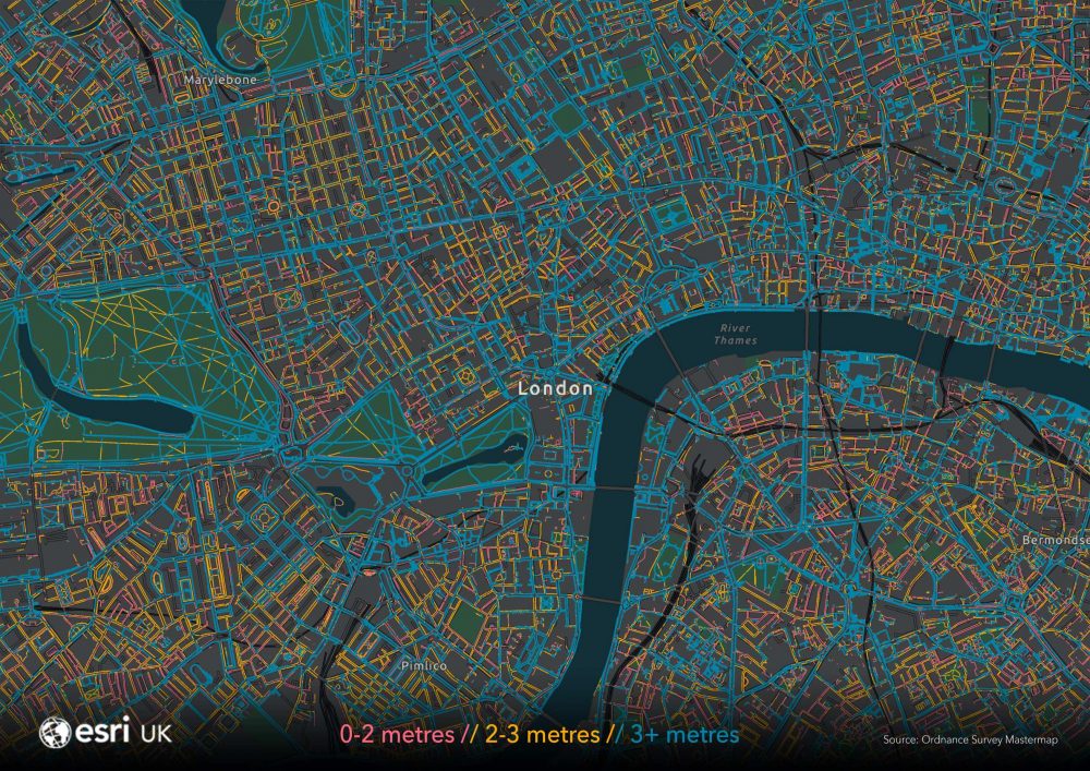
The map is part of Esri UK’s COVID-19 Disaster Response Programme, created to provide any organisation with new mapping and analytical capabilities for free, to help manage their response to the pandemic.
Local authorities, for example, are using Esri’s mapping and analysis tools to help adjust their service provision, map vulnerable communities, deploy volunteers and communicate with citizens.
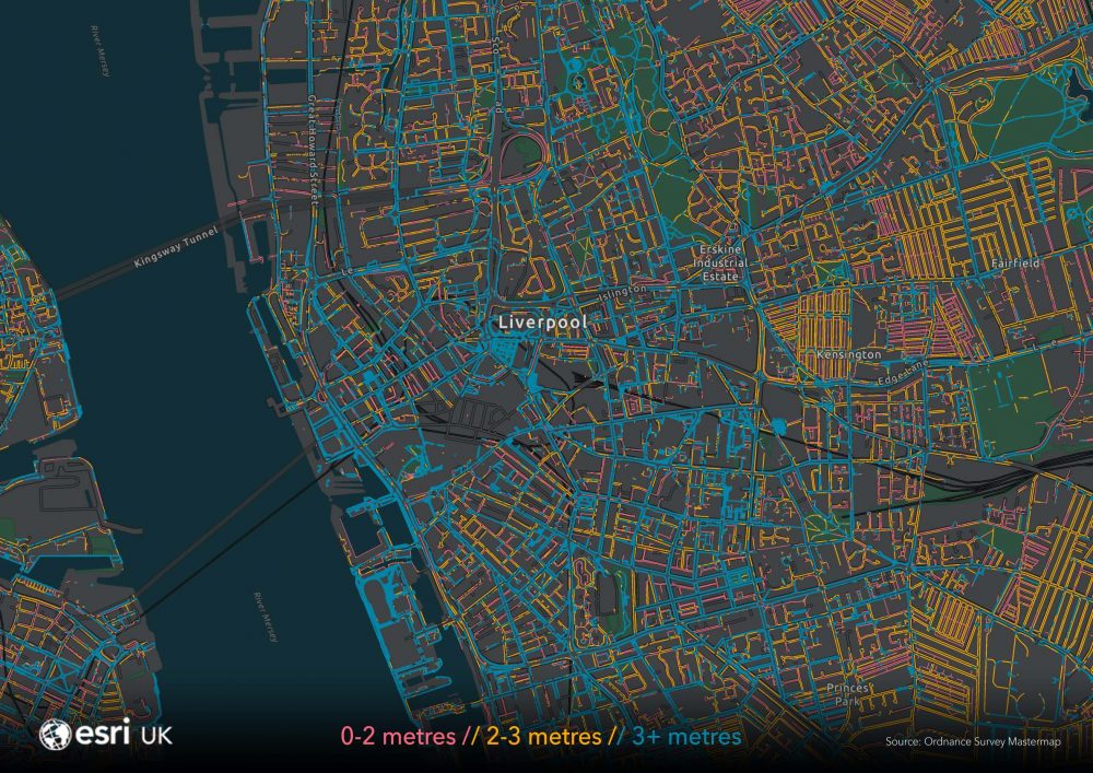
“The pavement map is designed to help local authorities and related organisations prioritise their efforts, to ensure the safety of the public, as lockdown restrictions are being gradually eased,” said Paul Clarke, head of Esri UK’s Government practice. “By giving them an instant view of the situation they’re faced with, the map reduces the time needed to manually measure pavements and not rely on records which may be out of date. Easy access to current pavement width data will help all councils make faster decisions with greater certainty and ensure walking is as safe as possible.”
Esri UK has made its ArcGIS software free to use along with a huge free data repository, the COVID-19 Data Hub, with over 80 different types of carefully selected, authoritative location data, including Coronavirus cases, health, infrastructure and population. New data is continually being added to equip local authorities with valuable insights as the situation evolves over time.
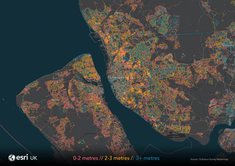
Local authorities and related organisations can access the map here.
The map is free to use from Esri UK as part of its Disaster Response Programme. Esri UK are able to provide the OS MasterMap free to Local Authorities as the data is covered by the PSGA agreement (Public Sector Geospatial Agreement). The data can also be made available free to the private sector, via the Ordnance Survey Mapping for Emergencies programme.
How it was done
Esri UK created the new interactive map using its ArcGIS mapping software, using the latest MasterMap Topography Layer® from Ordnance Survey (OS).
OS MasterMap Topography Layer® is the most detailed and accurate view of Great Britain’s landscape – from roads to fields, buildings, trees, fences, paths and more. Using its GIS software, ArcGIS Pro, Esri UK extracted all the pavements and applied different colours to identify different widths. Blue represents pavements of 3+ metres; orange shows widths between 2-3 metres and red denotes pavements of less than 2 metres wide.