


Ground Penetrating Radar GPR
A digital design and information management term used in infrastructure planning, modelling and delivery.
Ground Penetrating Radar Explained
Ground Penetrating Radar is a key term within bim & design technology, where it is used across construction, infrastructure, transport and industrial project delivery. In practical terms, it helps describe how work is planned, specified, delivered, measured or maintained on real sites and assets. Understanding ground penetrating radar is useful because the same language is often shared by contractors, designers, suppliers, asset owners, public authorities and investors.
Within Highways.Today’s Dictionary, ground penetrating radar should be read as part of the wider vocabulary of design, modelling, survey, geospatial, digital engineering and project information management terms. It may appear in technical specifications, tender documents, project reports, equipment guides, safety plans, design models, maintenance schedules or news articles. Exact requirements can vary by country, project type, contract form, standard and manufacturer, so readers should always check the relevant local guidance, drawings, regulations and professional advice before relying on the term for design, procurement or operational decisions.
Articles Featuring Ground Penetrating Radar
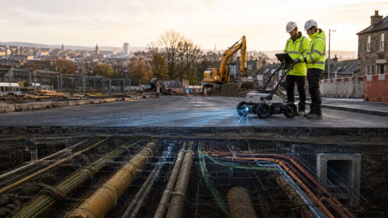 Exodigo Expands Subsurface Portfolio to Claim the Underground Data Layer
18th July 2026
Exodigo Expands Subsurface Portfolio to Claim the Underground Data Layer Exodigo’s decision to widen its product portfolio into four integrated…
Exodigo Expands Subsurface Portfolio to Claim the Underground Data Layer
18th July 2026
Exodigo Expands Subsurface Portfolio to Claim the Underground Data Layer Exodigo’s decision to widen its product portfolio into four integrated…
 Autonomous Sensor Workflows are Redrawing Infrastructure Drone Surveying
16th July 2026
The Drone Was Never the Point Autonomous Sensor Workflows are Redrawing Infrastructure Drone Surveying For most of the past decade,…
Autonomous Sensor Workflows are Redrawing Infrastructure Drone Surveying
16th July 2026
The Drone Was Never the Point Autonomous Sensor Workflows are Redrawing Infrastructure Drone Surveying For most of the past decade,…
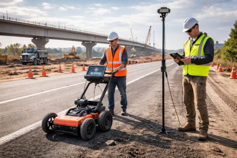 Topcon And GSSI Integrate Ground Penetrating Radar With GNSS Mapping
4th March 2026
Topcon And GSSI Integrate Ground Penetrating Radar With GNSS Mapping Modern infrastructure projects increasingly depend on accurate data, not only…
Topcon And GSSI Integrate Ground Penetrating Radar With GNSS Mapping
4th March 2026
Topcon And GSSI Integrate Ground Penetrating Radar With GNSS Mapping Modern infrastructure projects increasingly depend on accurate data, not only…
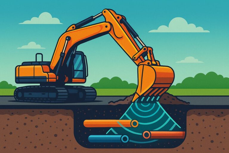
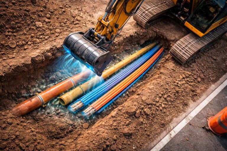 Top 5 Technologies for Preventing Underground Utility Strikes
2nd March 2026
Top 5 Technologies for Preventing Underground Utility Strikes Underground utility strikes remain one of the most persistent and costly risks…
Top 5 Technologies for Preventing Underground Utility Strikes
2nd March 2026
Top 5 Technologies for Preventing Underground Utility Strikes Underground utility strikes remain one of the most persistent and costly risks…
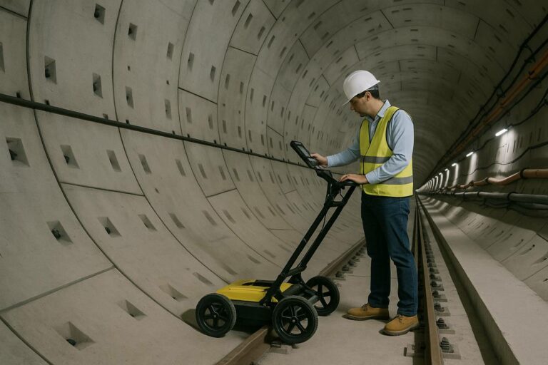 GPR Mapping to Unlock the Secrets of Steel Fibre Reinforced Tunnel Linings
13th September 2025
GPR Mapping to Unlock the Secrets of Steel Fibre Reinforced Tunnel Linings As global cities grow denser and surface land…
GPR Mapping to Unlock the Secrets of Steel Fibre Reinforced Tunnel Linings
13th September 2025
GPR Mapping to Unlock the Secrets of Steel Fibre Reinforced Tunnel Linings As global cities grow denser and surface land…
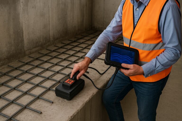 Smart Concrete Testing with GPR and Deep Learning to Transform Rebar Detection
13th September 2025
Smart Concrete Testing with GPR and Deep Learning to Transform Rebar Detection Reinforced concrete has been the backbone of modern…
Smart Concrete Testing with GPR and Deep Learning to Transform Rebar Detection
13th September 2025
Smart Concrete Testing with GPR and Deep Learning to Transform Rebar Detection Reinforced concrete has been the backbone of modern…
 RodRadar Expands LDR Excavate™ Bucket Range for Major Infrastructure Projects
12th August 2025
RodRadar Expands LDR Excavate™ Bucket Range for Major Infrastructure Projects RodRadar, the company behind the pioneering Live Dig Radar® (LDR)…
RodRadar Expands LDR Excavate™ Bucket Range for Major Infrastructure Projects
12th August 2025
RodRadar Expands LDR Excavate™ Bucket Range for Major Infrastructure Projects RodRadar, the company behind the pioneering Live Dig Radar® (LDR)…
 GSSI and Hamm Introduce RealTime Density Scan for Asphalt
29th April 2025
GSSI and Hamm Introduce RealTime Density Scan for Asphalt In a ground-breaking partnership set to reshape the future of road…
GSSI and Hamm Introduce RealTime Density Scan for Asphalt
29th April 2025
GSSI and Hamm Introduce RealTime Density Scan for Asphalt In a ground-breaking partnership set to reshape the future of road…


Editorial Note
The Highways.Today Dictionary is maintained as an editorial reference resource for construction, infrastructure, transport and industrial technology professionals. Definitions are intended to support understanding, discovery and research, and may be expanded over time as the Dictionary evolves into a broader illustrated industry reference.