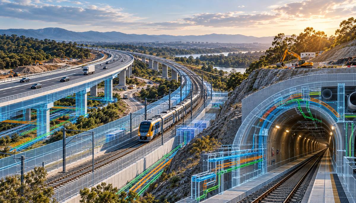
Exodigo Expands Subsurface Portfolio to Claim the Underground Data Layer
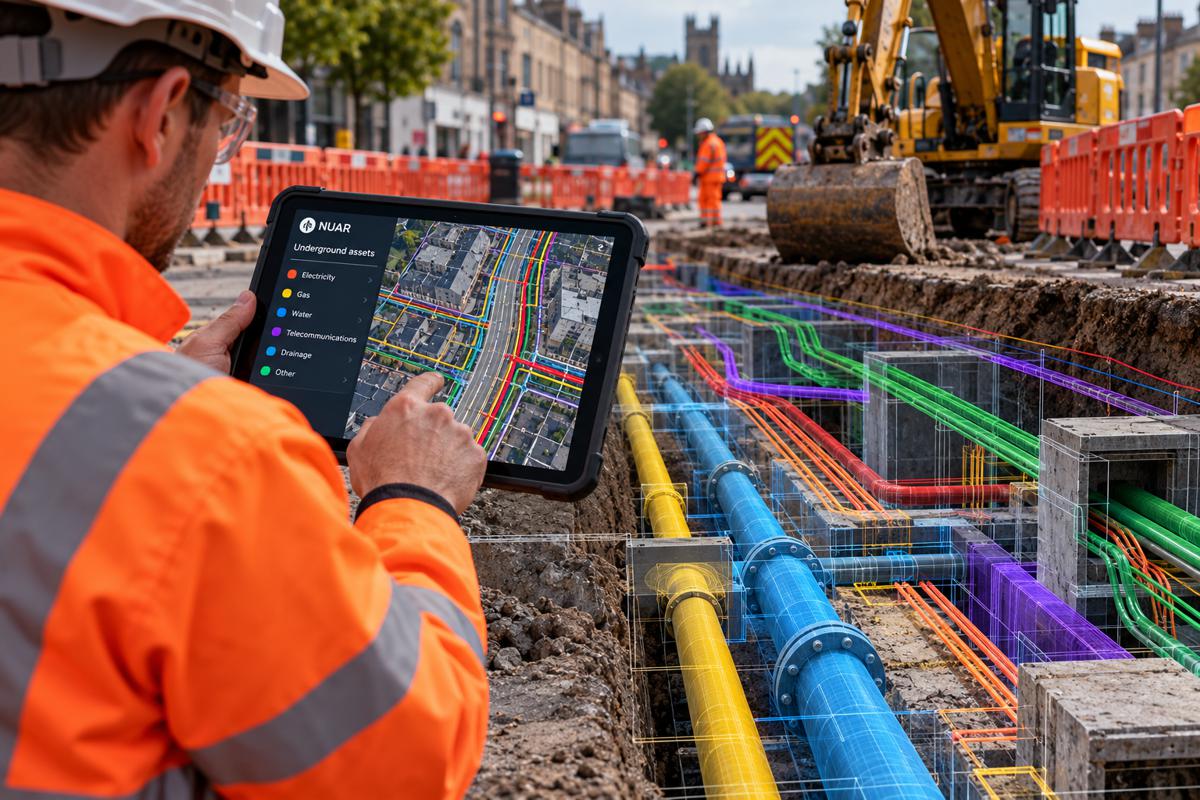
Exodigo’s decision to widen its product portfolio into four integrated solution categories reads less like a routine product update and more like a statement of intent. The company built its reputation on Subsurface Utility Engineering, using multi-sensor scanning and artificial intelligence to map buried pipes and cables with a precision that traditional locating rarely achieves.
With this expansion, announced in early July, it is repositioning itself as a full-lifecycle engineering business that intends to sit with infrastructure owners from the first day of planning through to utility relocation and construction. The distinction matters commercially, because it moves Exodigo out of a crowded survey-and-locate services market and towards ownership of something far more valuable, namely the continuous underground data layer that every downstream decision on a capital project depends upon.
The underground has always been the least understood and most expensive variable in infrastructure delivery. Records are incomplete, decades out of date or simply wrong, and the cost of discovering that during excavation is measured in stopped work, redesign, contractual claims and, too often, injury. Any organisation that can turn that uncertainty into a reliable, reusable digital asset stands to capture value that currently leaks out of projects through strikes, rework and delay.
Exodigo’s four new categories are designed precisely around that leakage, aggregating existing records before anyone reaches the site, scanning the ground with engineering-grade accuracy, converting the results into design-ready models, and then carrying that intelligence into the relocation work that so often dictates a programme’s critical path.
The timing sharpens the strategic reading. The expansion arrives roughly a year after a substantial funding round that repriced the company, and only months after it secured a cooperative procurement contract in Texas and launched a rail-specific offering at a major technology show. Taken together, these developments point to a category that is consolidating quickly, where the winners will be defined not only by sensing accuracy but by how much of the project lifecycle they can credibly absorb.
Briefing
- Exodigo has expanded from Subsurface Utility Engineering into four integrated categories: Remote Data Intelligence, On-Site Reality Capture, AI Engineering and Utility Relocation Services, available immediately across transportation, utilities, energy, digital infrastructure, real estate and public-sector projects in North America, Europe and Israel.
- The move repositions the company as a full-lifecycle provider rather than a survey vendor, aiming to convert fragmented planning, site investigation, design and relocation activities into a single source of truth that follows a project from concept to construction.
- It follows a 96 million US dollar Series B in July 2025 that roughly doubled the company’s valuation, reported at around 700 million US dollars, and lifted total funding raised since 2021 above 200 million US dollars.
- Underground utility damage costs the United States an estimated 30 billion US dollars a year, while Federal Highway Administration and Purdue research has found that subsurface utility engineering returns around 4.62 US dollars for every dollar spent.
- Recent milestones, including a Texas cooperative procurement contract and a rail-focused launch at CES 2026, signal that procurement access and lifecycle coverage, not sensing technology alone, are becoming the decisive competitive battleground.
The Commercial Logic of Moving Upstream
The strategic case for the expansion rests on a simple observation about where money is lost on infrastructure projects. Cost and schedule risk is created early, during planning and design, but it is usually paid for late, during construction, when options have narrowed and change is at its most expensive.
Jeremy Suard, Co-Founder and Chief Executive of Exodigo, framed the logic directly, arguing that “The biggest risks on infrastructure projects are created long before construction begins,” and adding that “The earlier project teams understand what’s underground, the more opportunities they have to improve design, avoid conflicts, reduce costs, and keep projects on schedule. We’ve expanded our solutions so customers can engage us wherever they are in the project lifecycle, while delivering the greatest value when we’re involved from the very beginning.” That final point is the commercial thesis of the entire release, because it reframes the company from a subcontractor called in for a survey to a partner embedded from the outset.
The numbers behind that argument are stark. The Common Ground Alliance estimates that excavation damage to underground utilities costs the United States around 30 billion US dollars a year once repairs, downtime, claims and legal exposure are counted, with close to 200,000 damage events reported across the United States and Canada in 2024.
The Federal Highway Administration and Purdue University have long put the return on subsurface utility engineering at roughly 4.62 US dollars for every dollar invested, one of the more favourable ratios in the entire risk-management toolkit available to project owners. Exodigo’s new Remote Data Intelligence category, anchored by its ExoInfo product, targets the very earliest point in that chain, using AI to gather and reconcile utility records, engineering documents, permits, satellite imagery and land data into analysis-ready intelligence before a single sensor reaches the ground.
The commercial appeal is that it lets owners price and design out risk while it is still cheap to do so, rather than absorbing it as a change order once crews are mobilised.
Turning Fragmented Workflows Into a Single Source of Truth
What distinguishes the announcement from a straightforward menu of services is the deliberate connection between the four categories. Planning, site investigation, engineering and utility relocation have traditionally been treated as separate contracts, often with different suppliers, different data formats and no shared record, so intelligence gathered at one stage rarely survives intact to the next.
Exodigo is selling the opposite proposition, in which each category can be bought individually or stitched into a continuous workflow that carries a single, improving picture of the underground from concept through to construction. For infrastructure owners managing multi-year capital programmes, that continuity is the point, because it is the handoffs between disciplines where assumptions get lost and where the most costly surprises are seeded.
The On-Site Reality Capture category is where the company extends furthest beyond its original remit. Alongside utility mapping, it now covers foundation mapping, geotechnical mapping and targeted validation, pushing Exodigo’s non-intrusive sensing into ground conditions, soil and rock properties that sit well outside conventional SUE practice.
That reach into geotechnical intelligence was flagged as a priority when the company raised its Series B, and it matters because geotechnical uncertainty rivals utility uncertainty as a driver of tunnelling, foundation and earthworks risk. The AI Engineering category then does the conversion work, moving from data to execution through design validation, utility design and horizontal directional drilling design, while its digitisation and modelling tools produce engineering-grade 2D and 3D maps and digital twins, and a 2D-to-3D transformation service rebuilds legacy drawings into usable models.
Utility Relocation Services close the loop by helping owners build reliable relocation cost estimates and coordinate stakeholders, addressing an activity that frequently sits on a project’s critical path and can determine whether a scheme is delivered on time.
Capital and the Race to Own the Underground
The expansion cannot be read in isolation from the money now flowing into the category. In July 2025 Exodigo closed a 96 million US dollar Series B, co-led by early backers Zeev Ventures and Greenfield Partners with participation from existing and new investors, taking total funding past 200 million US dollars since the company launched in 2021 and, according to Israeli business reporting, roughly doubling its valuation to around 700 million US dollars.
That is a considerable war chest for a company of fewer than 400 staff, and part of it was explicitly earmarked for research into geotechnical risk products of the kind now surfacing in the portfolio. Investors are, in effect, funding a move from mapping services towards a broader engineering platform, and the pricing reflects a belief that the addressable opportunity is far larger than conventional utility locating.
Estimates of that opportunity vary widely and should be read with care. The market for conventional utility-mapping and locating services is a relatively modest professional-services segment, whereas Oren Zeev of Zeev Ventures has framed the wider underground-mapping opportunity at around 500 billion US dollars, arguing that accurate subsurface knowledge could save tens of billions across fast-growing industries.
The gap between those two figures is essentially the prize Exodigo is chasing, and it is not alone in chasing it. Rivals such as 4M Analytics, which compiles public utility records into an AI-driven map and has raised around 45 million US dollars, along with established locating and ground-penetrating radar specialists and a cluster of geospatial and digital-twin platforms, are all pressing on adjacent parts of the same problem. The competitive question is no longer who can detect a buried cable, but who can own the trusted data layer that owners, engineers and contractors all build upon.
Procurement Becomes the Decisive Battleground
For all the emphasis on sensing and AI, the more revealing recent development may be how Exodigo is winning access to public buyers. In March 2026 the company secured a cooperative contract with the Texas Department of Information Resources, giving state, regional and local agencies, and eligible entities in other states through an interstate programme, a pre-approved route to buy its GIS and digital surveying services without running a lengthy bid process.
Procurement friction has historically slowed the adoption of new infrastructure technology, so a vehicle that lets a transit authority or public works department engage a vetted supplier quickly is a genuine commercial lever. It also aligns neatly with the deployment of federal capital under the Infrastructure Investment and Jobs Act, where the pressure to spend efficiently rewards suppliers who can be onboarded without delay.
The client roster behind that push is already substantial. Exodigo has said that more than 50 transit agencies, departments of transportation, municipalities and utilities rely on its work, a list that includes Amtrak, the California High-Speed Rail Authority, Florida and Kansas departments of transportation, LA Metro, Sound Transit and National Grid, with additional transit programmes at agencies such as SEPTA and Houston METRO.
The company has reported providing subsurface intelligence to de-risk more than 75 billion US dollars of federal, state and local infrastructure investment in a single year, executing scans across 18 states and serving three of the largest United States transit agencies and four of the ten largest utilities. That base gives it something competitors struggle to replicate quickly, namely a growing library of real-world subsurface data and a reference list credible enough to shorten the sales cycle with cautious public owners.
Standards, Reliability and the Trust Problem
Underpinning the entire proposition is the question of whether the data can be trusted enough to design and build against. The discipline is governed in the United States by the American Society of Civil Engineers standard ASCE 38-22, which classifies utility information into four quality levels running from records-based estimates at Quality Level D up to physically verified positions at Quality Level A.
Crucially, the standard treats subsurface utility engineering as a professional process rather than a single technology, which means the value of any AI-driven map ultimately rests on how reliably it maps to those recognised quality levels and on the engineering judgement wrapped around it. As Exodigo extends into foundation and geotechnical intelligence, it takes on an even higher reliability bar, because ground-condition data feeds directly into structural and tunnelling design where errors carry serious consequences.
International adoption of comparable frameworks strengthens the case for standardised, high-quality subsurface data as a global market rather than a United States phenomenon. Countries including Canada, Australia and the United Kingdom have developed their own standards for classifying and verifying buried-utility information, and the British specification PAS 128 performs a broadly similar role for detection and verification work in that market.
Exodigo’s own recent moves suggest it is preparing for that wider stage, having introduced a rail-specific subsurface mapping solution at CES 2026 alongside its first deployment with Israel Railways, and having positioned geotechnical risk reduction as a core research priority. For owners weighing adoption, the reassuring signal is that the company is building towards recognised engineering standards rather than around them, which is what allows subsurface intelligence to move from a useful survey into a defensible basis for design.
Where the Underground Market Goes Next
The clearest way to read this expansion is as an early move in the consolidation of a fragmented market into a smaller number of lifecycle platforms. The commercial gravity in subsurface work is shifting away from one-off surveys and towards continuous, reusable data assets that follow a project from planning to construction, and Exodigo is betting that owners will increasingly prefer a single accountable partner over a chain of disconnected specialists.
If that bet is correct, the suppliers who thrive will be those who combine accurate sensing with engineering credibility, procurement access and the ability to keep subsurface data alive across a programme rather than delivering it once and walking away.
For infrastructure owners, engineering firms and contractors, the practical implication is that underground intelligence is becoming a strategic procurement decision rather than a line item on a survey schedule. The organisations that build subsurface data into their earliest planning, and that choose partners capable of carrying it through design and relocation, stand to convert a persistent source of overruns into a source of competitive advantage.
With billions in public capital still to be deployed and damage costs stubbornly high, the pressure to see the ground before breaking it will only intensify, and the market for reliable underground intelligence looks set to expand well beyond the specialist niche in which it began.
Key Industry Questions
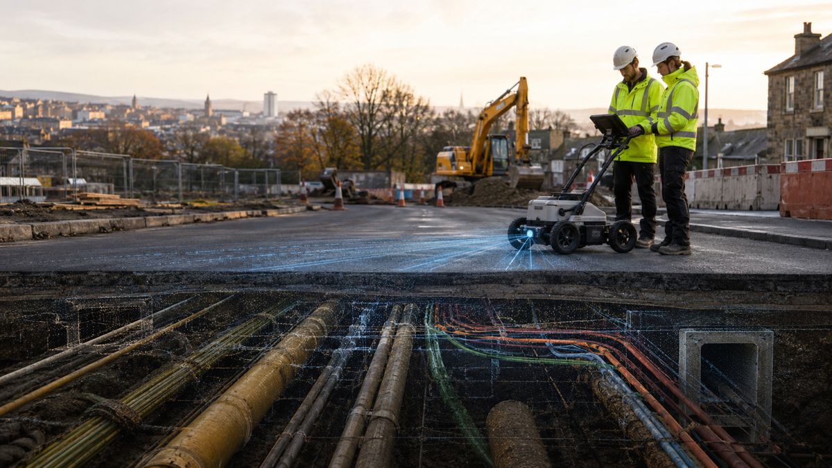
- What is subsurface intelligence and how does it differ from traditional utility locating? Traditional utility locating typically uses a single detection method to mark the approximate position of a buried line at the point of excavation. Subsurface intelligence, as practised by companies such as Exodigo, combines multiple non-intrusive sensors, artificial intelligence and existing records to build a georeferenced picture of what lies underground, often before crews mobilise. The aim is to reveal the fuller network rather than a single line, and to deliver the result as an engineering-grade 2D or 3D map that supports design decisions. The commercial difference is significant, because it shifts the work from reactive marking during construction to proactive risk management during planning and design, where changes are far cheaper to make.
- How much do underground utility strikes actually cost the industry? Estimates converge on a societal cost of around 30 billion US dollars a year in the United States once repairs, downtime, claims, regulatory fines and lost productivity are counted, drawing on data compiled by the Common Ground Alliance. Close to 200,000 damage events were reported across the United States and Canada in 2024. Individual strikes can cost anywhere from a few thousand dollars to tens of thousands, and the human toll is serious, with hundreds of deaths and thousands of injuries recorded over the past two decades. Set against those figures, subsurface utility engineering has been shown to return roughly 4.62 US dollars for every dollar spent, which is why accurate underground data is increasingly treated as risk mitigation rather than optional survey work.
- Why is Exodigo expanding beyond utility mapping into geotechnical and foundation work? Geotechnical and foundation uncertainty rivals utility uncertainty as a driver of cost and schedule risk, particularly on tunnelling, bridge and heavy civil projects where ground conditions dictate design. By extending its non-intrusive sensing into soil and rock characterisation, Exodigo can address a second major category of underground risk with the same platform and, in principle, the same site visit. The expansion also reflects where its investors directed capital, having funded geotechnical risk research through the 2025 Series B. Commercially, covering more of the underground picture increases the value of each engagement and makes the company harder to displace, because owners gain a single dataset spanning utilities, foundations and ground conditions rather than commissioning separate studies.
- What does the four-category structure mean for how owners buy these services? The structure is designed to be modular, so an owner can engage Exodigo for a single stage, such as early records intelligence, or combine categories into a continuous workflow that runs from planning through relocation. That flexibility lowers the barrier to a first engagement while creating a clear path to deeper involvement over a project’s life. For procurement teams, it also changes the conversation from buying a one-off survey to buying an ongoing data relationship. The strategic risk for buyers is lock-in, since value accrues to the supplier that owns the continuous record, so owners will want clarity on data ownership, formats and interoperability with their existing GIS and design environments.
- How does AI-generated subsurface data align with engineering standards such as ASCE 38-22? ASCE 38-22 classifies utility information into four quality levels, from records-based estimates through to physically verified positions, and treats subsurface utility engineering as a professional process rather than a single tool. AI-driven mapping does not replace that framework, it must map into it, which means the reliability of any output is judged against recognised quality levels and the engineering judgement applied to it. For adoption, this is the crux of the trust question, because owners and their engineers need confidence that a machine-assisted map can be depended upon for design. Suppliers that clearly tie their deliverables to established quality levels and standards of care are better placed to move subsurface intelligence from a helpful input into a defensible design basis.
- Who are Exodigo’s main competitors and how is the market structured? The market spans several overlapping groups. Records-focused platforms such as 4M Analytics compile public utility data into AI-enhanced maps, established locating and ground-penetrating radar firms provide field detection and verification, and a broader set of geospatial and digital-twin platforms address adjacent parts of the workflow. Exodigo’s differentiation rests on combining dense multi-sensor scanning with AI analysis and engineering services across a wider slice of the project lifecycle. The competitive dynamic is shifting from detection accuracy alone towards lifecycle coverage, procurement access and the ability to maintain a trusted, reusable data layer, which favours suppliers with capital, recognised standards alignment and a credible reference base of public-sector deployments.
- What role does public procurement play in the adoption of subsurface intelligence? Procurement friction has historically slowed the uptake of new infrastructure technology, so access to streamlined buying routes is a genuine commercial advantage. Exodigo’s cooperative contract with the Texas Department of Information Resources illustrates the point, giving public agencies a pre-approved path to engage its services without a lengthy competitive bid, and extending that access to eligible entities in other states. This matters most where federal capital under the Infrastructure Investment and Jobs Act is being deployed at pace, since owners under pressure to spend efficiently reward suppliers who can be onboarded quickly. Increasingly, the ability to win and use these procurement vehicles may prove as decisive as the underlying technology in determining which providers scale.
Strategic Takeaways
- The competitive centre of gravity in subsurface work is moving from one-off surveys towards ownership of a continuous underground data layer, and the suppliers who capture that layer across planning, design and relocation will be positioned to consolidate a fragmented market.
- Underground intelligence is becoming a strategic procurement decision rather than a survey line item, so owners who embed it in the earliest planning stages, where a favourable 4.62-to-1 return applies, stand to convert a persistent source of overruns into competitive advantage.
- Modular, lifecycle-spanning offerings create clear value for buyers but also raise the prospect of supplier lock-in, making data ownership, standard formats and interoperability with existing GIS and design systems essential points to negotiate before engagement.
- Extending sensing into geotechnical and foundation conditions widens the addressable risk that a single platform can manage, but it also raises the reliability bar, keeping alignment with recognised standards such as ASCE 38-22 central to whether AI-assisted maps can serve as a design basis.
- Procurement access and lifecycle coverage, backed by substantial venture capital and a credible public-sector reference base, are emerging as the decisive competitive factors, which points towards further consolidation as capital-rich platforms absorb adjacent specialists.