The Drone Was Never the Point
Autonomous Sensor Workflows are Redrawing Infrastructure Drone Surveying
For most of the past decade, the commercial drone story was a story about aircraft. Better cameras, longer flights, larger batteries and steadier gimbals defined what buyers cared about, and the headline capability was aerial imagery that once demanded a helicopter or a scaffold. That framing is now quietly out of date.
The evidence on show at the JBUAS Sensors Open Days, a two-day field event run in the UK by JB Unmanned Aerial Systems alongside its technology partner SPH Engineering, pointed to a very different centre of gravity. The interesting engineering is no longer in the airframe at all. It sits in the mission-planning software directing each flight and in the growing catalogue of specialist sensors slung beneath the aircraft.
That shift matters to the construction and infrastructure sector for a practical reason rather than a technological one. Owners of highways, railways, pipelines, reservoirs and transmission corridors are not short of assets to inspect, and they are increasingly short of the money, the labour and the working windows needed to inspect them the traditional way.
A drone that can fly an identical route month after month, swap its payload from radar to magnetometer to echo sounder, and deliver engineering-ready data straight into a digital model changes the calculation. It turns aerial survey from an occasional expense into a repeatable operational capability, and it is that repeatability, rather than any single sensor, that is reshaping how survey work is bought, planned and delivered.
Briefing
- The competitive frontier in commercial drone surveying has moved from the aircraft to the software and sensors it carries, with mission planners such as UgCS and onboard integration hardware such as SkyHub turning standard enterprise drones into repeatable engineering survey systems.
- One airframe can now carry ground-penetrating radar, magnetometers, electromagnetic induction sensors, methane detectors, gamma-ray spectrometers and hydrographic echo sounders, changing role from one day to the next and reshaping the economics of owning a survey fleet.
- Repeatable autonomous missions feed directly into BIM, GIS and digital-twin platforms, moving infrastructure surveying away from one-off snapshots and towards continuous condition monitoring and predictive maintenance.
- UK regulation is moving in step, with UK SORA having replaced the Operational Safety Case in April 2025, CAA Decision No. 60 taking effect on 1 October 2026, and the regulator’s CAP 3182 roadmap targeting routine BVLOS operations by 2027.
- Analysts value the global drone inspection and monitoring market at roughly USD 18 billion to 20 billion in 2026, with construction and infrastructure among the fastest-growing end uses.
One Aircraft, Many Payloads and a New Survey Economics
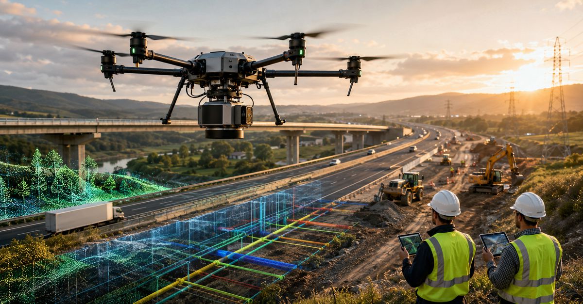
The commercially significant idea running through the current generation of drone survey systems is modularity. A single aircraft, most commonly a heavy-lift enterprise platform such as the DJI M350 RTK or the newer M400, can be reconfigured for an entirely different engineering task simply by exchanging its payload and its mission profile.
The same drone that inspects a highway structure in the morning can map buried utilities beneath a housing site in the afternoon, then survey reservoir sediment or screen a pipeline for methane later in the week. What holds the arrangement together is not the airframe but the common layer of flight planning, positioning and data management that stays constant while the sensors change.
For survey organisations, this rewrites the purchasing logic. Rather than buying a dedicated platform for each discipline, a contractor can invest in one airborne system and expand its service range by adding payloads as demand appears. SPH Engineering, the Latvian firm behind UgCS and the SkyHub onboard computer and a supplier active in more than 150 countries, has built its business around exactly this premise, and its UK partner JBUAS operates a dedicated 7,500 square metre test and training centre in South Holland, Lincolnshire, where buyers can trial integrations before committing.
The effect is to lower the barrier to entry for advanced geophysical and environmental surveying, and to let smaller firms compete for work that once required specialist crews and bespoke instrumentation. It also reduces technology risk, because investment in the flight-management backbone is protected even as individual sensors are upgraded or retired.
Repeatable Missions and the Rise of the Living Dataset
The deeper commercial value of autonomous surveying lies in what happens after the aircraft lands, and specifically in the fact that the same mission can be flown again with almost no variation. Software such as UgCS allows a survey to be planned in a three-dimensional environment before anyone reaches site, with flight lines that follow the terrain automatically, hold a constant sensor height above ground or water, and repeat an identical route on demand.
Onboard, SkyHub synchronises positioning, timing and sensor output into a single georeferenced dataset, recording to standard formats such as SEG-Y and NMEA and removing much of the human variation that used to creep into manual flying. Repeatability, in this context, becomes as valuable as raw accuracy.
That capability changes the character of infrastructure data itself. By flying the same corridor at scheduled intervals, an owner can measure earthworks progression, track vegetation encroachment on a safety corridor, and detect subtle movement in an embankment long before it becomes a visible defect. Instead of commissioning a one-off survey after deterioration appears, asset managers build a continuous historical record that feeds directly into Building Information Modelling, Geographic Information Systems and digital-twin platforms.
The survey stops being a snapshot and becomes a living dataset, and it is precisely this continuity that underpins the move from reactive repair towards genuine predictive maintenance. Analysts tracking the drone bridge inspection niche, for example, attribute its rapid expansion partly to rising demand for digital twins and government-funded infrastructure programmes, a signal that owners increasingly value data that accumulates rather than data that expires.
Seeing Beneath the Surface
Some of the most consequential progress is happening below ground, where the cost of getting it wrong is highest. Ground-penetrating radar has traditionally meant pushing a cart-mounted system across a carriageway or open ground, a method that is effective but slow, physically demanding and often dependent on lane closures. Airborne GPR, flown at a carefully controlled height using terrain-following systems, offers a way to investigate buried utilities, pavement layers, voids and archaeological remains across difficult or inaccessible terrain without putting people on live infrastructure.
It is unlikely to displace every terrestrial survey, but where access is restricted, vegetation is dense or ground conditions are hazardous, it extends the range of situations in which reliable subsurface data can be gathered.
GPR is only one instrument in a widening geophysical toolkit taking to the air. Fluxgate and total-field magnetometers, including systems from specialists such as SENSYS, locate buried metallic objects, archaeological features and unexploded ordnance by measuring tiny disturbances in the Earth’s magnetic field, and airborne deployment lets them cover large sites far faster than a ground team while holding consistent altitude and positioning.
Electromagnetic induction sensors extend the picture further by transmitting a field into the ground and reading the response, yielding information about conductivity, buried metal and changing subsurface conditions that is particularly valuable for utility mapping and contaminated-land assessment.
For construction, the commercial logic is straightforward, because knowing what lies beneath a site before breaking ground reduces the risk of costly strikes, redesigns and programme delays.
Measuring the Invisible: Environmental Sensing Takes Flight
As infrastructure projects face closer environmental scrutiny, drones are proving as useful for what they can measure in the air as for what they reveal underground. Airborne methane detection has become one of the fastest-growing applications, with tunable diode laser analysers such as the Pergam Falcon series allowing operators to screen landfill sites, pipeline corridors, wastewater plants and industrial facilities from a safe stand-off distance.
Rather than sending personnel into potentially hazardous areas with handheld instruments, an operator can produce a concentration map that localises emission sources quickly and safely, supporting both leak management and emerging reporting obligations. The safety and compliance dimensions here are commercial as much as ethical, because they touch directly on regulatory exposure and operational risk.
Radiometric surveying is following a similar path from specialist niche to practical tool. Gamma-ray spectrometers mounted beneath a drone measure naturally occurring radioelements in soils and sediments, providing information relevant to geological investigation, environmental assessment and mineral exploration that was once confined largely to manned aircraft.
Lighter airborne systems now make it economic to survey much smaller sites, opening applications across civil engineering and land development. Taken together, methane screening and radiometric mapping illustrate a broader change in what an infrastructure survey is expected to deliver, extending it beyond recording what can be seen towards capturing invisible characteristics of a site that increasingly shape planning decisions and long-term sustainability.
Surveying Water Without the Survey Boat
Water has always been among the most expensive and awkward environments to survey. Reservoirs, canals, flood channels and ports typically demand specialist vessels, trained crews and cooperative weather before any measurement can begin, and shallow or environmentally sensitive locations can rule out a boat entirely. Drone-mounted echo sounders are changing that equation for a meaningful share of hydrographic work.
Single and dual-frequency systems can measure channel depth, reservoir capacity and sediment accumulation while flying low above the surface, with integrated GNSS positioning and attitude correction feeding dedicated hydrographic software that produces bathymetric models fit for engineering analysis.
The practical gains extend beyond depth measurement. Onboard behaviours such as True Terrain Following, which holds a constant height above an uneven or reflective surface, and point-based descent modes that briefly lower a sensor to the water make it possible to operate in shallow ponds, weed-covered waterways and deeper reservoirs where sediment must be tracked accurately.
Water sampling systems add a further dimension by collecting physical samples remotely from rivers, lakes and reservoirs, letting environmental specialists combine laboratory analysis with aerial mapping while keeping personnel away from hazardous water. For flood management authorities, water companies and port operators facing tight budgets and demanding safety standards, the combination of lower survey cost and reduced exposure is a compelling one.
Regulation Is Catching Up With Capability
None of this scales without a regulatory framework that can keep pace, and the UK picture has moved substantially in the past eighteen months. In April 2025 the Civil Aviation Authority retired the Operational Safety Case approach and replaced it with UK SORA, the Specific Operations Risk Assessment, a structured method that steps through ground risk, air risk and the assurance level required before allocating safety objectives and mitigations.
The direction of travel is away from broad operational restriction and towards evidence-based assessment of individual missions, which is exactly the environment in which sophisticated autonomous survey work can flourish. From 1 October 2026, CAA Decision No. 60 refines that framework further, adopting updated compliance guidance aligned with the international JARUS SORA 2.5 methodology and setting out clearer pathways for operators to demonstrate that a flight is safe.
The bigger prize sits slightly further out. Current rules generally require a pilot to keep the aircraft in sight, which caps the length of corridor that can be surveyed in a single mission, but the CAA’s CAP 3182 roadmap sets an explicit ambition to make routine beyond visual line of sight operations a normal part of UK aviation by 2027, supported by maturing detect-and-avoid and electronic conspicuity technologies and by dedicated guidance for infrastructure corridor work.
Alongside these changes, the regulatory baseline has tightened, with the drone registration threshold dropping from 250 grams to 100 grams from January 2026, new Remote ID requirements and a UK class-mark system now in force. For owners of linear assets that run for hundreds of kilometres, the ability to inspect long sections autonomously without repeated take-offs and landings represents perhaps the single largest productivity opportunity of the coming decade.
Artificial Intelligence Becomes the Interpretation Layer
If autonomous flight has transformed data collection, the next transformation is likely to be in interpretation. A great deal of infrastructure inspection still depends on experienced engineers manually reviewing imagery, point clouds and geophysical outputs to find defects, an approach that becomes slower and more expensive as datasets grow into terabytes.
Machine-learning models are already being trained to detect pavement deterioration, identify structural cracks, classify vegetation and flag anomalies within large geospatial datasets, and similar techniques are beginning to appear for geophysical data, recognising patterns that may indicate buried infrastructure or changing ground conditions.
The realistic near-term role is assistance rather than replacement. AI is well suited to the first pass, rapidly narrowing thousands of files down to the handful of locations that merit a specialist’s attention, while engineering judgement and accountability stay with people. Combined with repeatable autonomous flights and cloud-based processing, this points towards inspection workflows in which aircraft gather data, platforms clean and align it, and algorithms surface the changes that matter before an engineer is back at a desk. The value is not in generating more information, which the sector has never lacked, but in converting it quickly into decisions.
Proof From the Field
The strongest argument for autonomous surveying comes not from technology demonstrations but from real projects, and archaeology has become an instructive proving ground because survey quality there often determines whether development can proceed on schedule. Presentations at the event highlighted work comparing traditional terrestrial methods with airborne magnetic mapping at Wroxeter Roman City in Shropshire, one of the most intensively surveyed archaeological landscapes in Britain, to show how aerial workflows can cover large areas rapidly while still producing datasets detailed enough to identify buried features.
A separate planning case involved a heavily overgrown development site where dense vegetation, protected habitats and tight timescales made conventional investigation difficult, and where aerial geophysical survey gave planners the archaeological information they needed while minimising ground disturbance.
The principles transfer directly to mainstream infrastructure. Highway widening schemes, new housing, renewable energy projects and utility corridors routinely encounter the same access constraints, environmental considerations and planning pressures, and the ability to collect comprehensive geophysical data without extensive excavation carries obvious commercial and environmental advantages.
What these examples demonstrate is that autonomous sensing has moved beyond research trials into everyday problem-solving for planners, surveyors and asset owners, extending the surveyor’s toolkit rather than replacing the discipline.
Where the Real Constraints Still Lie
For all the momentum, autonomous drone surveying has not dissolved the need for professional judgement, and an honest account of the technology has to acknowledge where the friction remains. Payload weight is the most persistent practical limitation, because every additional kilogram of sensor reduces endurance and affects flight performance, forcing survey designers to balance capability against flight time, weather and site logistics.
GPR illustrates the trade-off neatly, since flying lower improves signal quality but holding a constant height over uneven terrain demands highly accurate terrain-following and careful mission planning, while gas surveys depend on wind and atmospheric conditions and hydrographic flights require stability over reflective water. Each application needs a tailored approach rather than a single universal recipe.
The second constraint is one of interpretation rather than collection. As drones generate ever larger volumes of imagery, point clouds and geophysical measurements, the risk is not a shortage of data but a shortage of actionable answers, and without robust processing pipelines, quality assurance and experienced analysis those datasets can quickly overwhelm a project.
This is why software has become at least as important as hardware, with automated workflows now expected to remove noise, apply positional corrections and deliver outputs that drop cleanly into CAD, GIS and BIM environments. The measure of a good survey is no longer how much it captured, but how quickly it tells an engineer where the buried services run, whether an embankment has moved, or how much sediment a reservoir has gained.
The Platform Beneath the Propellers
Infrastructure owners are being asked to do more with less at a moment when networks are ageing, maintenance budgets are stretched and expectations around resilience and sustainability keep rising. Better information, delivered faster and at lower cost than traditional survey methods can manage, is central to meeting that challenge, and autonomous drone workflows are emerging as a serious part of the answer.
By combining intelligent mission planning with specialist sensors, precise positioning and increasingly capable data processing, they let engineers understand assets in ways that were previously impractical or prohibitively expensive, from what lies beneath the surface to how a site is changing over time.
The conceptual shift is the part worth holding on to. The industry is learning to see drones not as flying cameras or isolated inspection tools but as adaptable engineering platforms, with the airframe reduced to the vehicle that carries the real capability into the field. As mission planning, specialist sensing and digital asset management grow more tightly connected, and as regulation opens the door to longer autonomous missions, the lines between aerial surveying, environmental monitoring and asset management will continue to blur.
For a sector under constant pressure to improve productivity while maintaining what it already owns, that integration could prove as consequential as satellite positioning, laser scanning and mobile mapping were before it.
Key Industry Questions
- Do autonomous drone surveys replace traditional surveyors? No, and the more accurate description is that they extend what survey teams can reach. Autonomous workflows take on the dangerous, repetitive and inaccessible parts of a survey, such as flying live highway embankments or shallow water, while leaving interpretation, validation and engineering judgement with qualified professionals. The clearest gains appear where ground access is constrained by vegetation, traffic, terrain or safety risk. Rather than removing roles, the technology tends to shift a surveyor’s time from data collection towards analysis and decision-making, and it lets smaller firms offer geophysical, hydrographic and environmental services that once demanded specialist crews and dedicated instrumentation.
- What sensors can a single survey drone carry? A modern integration platform is designed for exchangeable payloads, so one aircraft can carry very different instruments on different days. Common options include ground-penetrating radar for subsurface investigation, magnetometers and electromagnetic induction sensors for buried metal and utilities, methane detectors for pipeline and landfill screening, gamma-ray spectrometers for soil and sediment characterisation, and echo sounders for bathymetric surveys. Water sampling systems and thermal or LiDAR payloads extend the range further. The aircraft itself changes little between missions, because the flight-planning, positioning and data-management software stays constant while the sensor and mission profile change, which is the feature that reshapes the economics of owning survey equipment.
- How does repeatability improve infrastructure maintenance? Repeatability turns a survey from a one-off snapshot into a continuous record. Because autonomous software can fly an identical route at scheduled intervals, holding the same sensor height and line spacing, successive datasets become directly comparable. That lets asset managers detect gradual change, such as embankment movement, sediment build-up or vegetation encroachment, well before it becomes a visible defect. Fed into BIM, GIS and digital-twin platforms, these repeated surveys build a historical baseline that supports predictive maintenance, allowing intervention to be scheduled on evidence rather than after failure. For owners of long linear networks, that shift from reactive repair to planned, data-led maintenance is where much of the cost saving is realised.
- What does UK SORA mean for commercial drone operators? UK SORA, the Specific Operations Risk Assessment, is the framework that replaced the Operational Safety Case in April 2025 for higher-risk work in the Specific category. It requires operators to assess ground risk, air risk and the assurance level of their operation, then apply proportionate mitigations, moving the regulator away from broad restrictions towards evidence-based approval of individual missions. From 1 October 2026, CAA Decision No. 60 updates the supporting guidance and aligns it with the international JARUS SORA 2.5 methodology, offering clearer compliance pathways. In practice, operators should expect more structured documentation, engage early with recognised assessment bodies, and treat compliant insurance and current authorisations as business-critical rather than optional.
- When will beyond visual line of sight surveys become routine in the UK? The CAA’s CAP 3182 roadmap sets an explicit ambition for routine beyond visual line of sight, or BVLOS, operations to become a normal part of UK aviation by 2027, though this depends on enabling technologies and airspace arrangements maturing on schedule. BVLOS matters because current rules generally require a pilot to keep the aircraft in sight, which limits how much of a corridor can be surveyed in one mission. Detect-and-avoid systems and electronic conspicuity are the key technical dependencies, alongside dedicated guidance for infrastructure corridor operations. For owners of highways, railways, pipelines and transmission lines running for hundreds of kilometres, routine BVLOS is the single change most likely to deliver a step improvement in survey productivity.
- How does airborne survey data reach BIM and digital-twin platforms? Integration is deliberately built into the workflow rather than bolted on afterwards. Onboard hardware synchronises sensor output with positioning and timing and records to standard formats, so data arrives georeferenced rather than requiring manual alignment. Processing software then removes noise, applies positional corrections and generates engineering-ready outputs that drop into CAD, GIS and BIM environments. Because missions are repeatable, each new survey can be layered onto previous ones within the same digital model, letting engineers examine surface models, subsurface investigations, environmental readings and hydrographic data side by side. The quality of a digital twin ultimately depends on the quality and consistency of the data populating it, which is where repeatable autonomous surveys add most value.
- What are the main limitations construction firms should plan for? Two constraints deserve early attention. The first is payload weight, because heavier sensors reduce flight endurance and affect performance, so survey design has to balance sensor capability against flight time, weather and site logistics, and each application carries its own conditions, from terrain-following accuracy for radar to wind sensitivity for gas surveys. The second is data handling, since drones can generate enormous volumes of information that become a liability without robust processing, quality assurance and skilled interpretation. Firms should invest in the software and expertise that turn raw capture into clear answers, verify that data integrates with existing systems, and treat experienced operators and analysts as essential rather than incidental to the outcome.
- How large is the market, and where is investment heading? Independent analysts place the global drone inspection and monitoring market at roughly USD 18 billion to 20 billion in 2026, with forecasts pointing to strong double-digit annual growth through the end of the decade, though estimates vary by scope and methodology. Construction and infrastructure sit among the fastest-growing end uses, alongside energy, utilities and oil and gas. The clearer investment signal is qualitative: value is migrating from airframes towards software, sensor integration and data analytics, and towards service-led models that sell outcomes rather than equipment. For investors and procurement teams, the durable advantage is likely to lie with providers whose flight-management and data platforms let customers adopt new sensors without replacing their entire system.
Strategic Takeaways
- Value in drone surveying is shifting decisively from the aircraft to the software, sensor integration and data platforms around it, so procurement and investment decisions should weight the flight-management and analytics backbone more heavily than the airframe.
- Repeatable autonomous missions are what unlock predictive maintenance, because comparable datasets flown at intervals feed digital twins and reveal gradual change before failure, turning surveying from a periodic cost into a continuous asset-management capability.
- Modular payloads change fleet economics, allowing one aircraft to serve subsurface, environmental and hydrographic work, which lowers the barrier to entry and lets smaller contractors compete for advanced geophysical surveys.
- Regulation is now an enabler rather than a brake, with UK SORA, Decision No. 60 from October 2026 and the CAP 3182 target of routine BVLOS by 2027 opening longer autonomous inspections of linear assets, provided operators invest early in compliance and documentation.
- The next competitive frontier is interpretation, where AI-assisted analysis of large survey datasets will separate providers who can deliver fast, decision-ready answers from those who simply capture more data.