


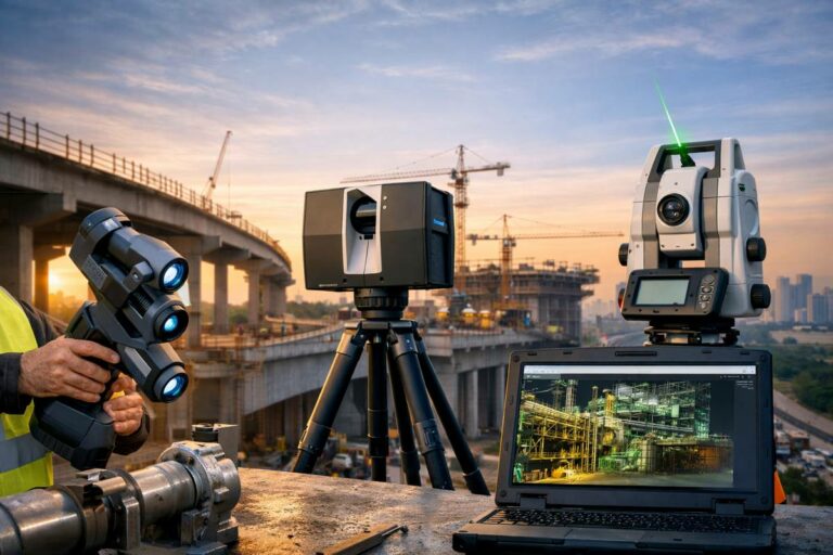
Reality Capture
A digital design and information management term used in infrastructure planning, modelling and delivery.
Reality Capture Explained
Reality Capture is a key term within bim & design technology, where it is used across construction, infrastructure, transport and industrial project delivery. In practical terms, it helps describe how work is planned, specified, delivered, measured or maintained on real sites and assets. Understanding reality capture is useful because the same language is often shared by contractors, designers, suppliers, asset owners, public authorities and investors.
Within Highways.Today’s Dictionary, reality capture should be read as part of the wider vocabulary of design, modelling, survey, geospatial, digital engineering and project information management terms. It may appear in technical specifications, tender documents, project reports, equipment guides, safety plans, design models, maintenance schedules or news articles. Exact requirements can vary by country, project type, contract form, standard and manufacturer, so readers should always check the relevant local guidance, drawings, regulations and professional advice before relying on the term for design, procurement or operational decisions.
Articles Featuring Reality Capture
 Geo Week 2027 Submissions Open as Reality Capture Moves Centre Stage
17th June 2026
Geo Week 2027 Submissions Open as Reality Capture Moves Centre Stage A call for conference speakers rarely registers as commercial…
Geo Week 2027 Submissions Open as Reality Capture Moves Centre Stage
17th June 2026
Geo Week 2027 Submissions Open as Reality Capture Moves Centre Stage A call for conference speakers rarely registers as commercial…
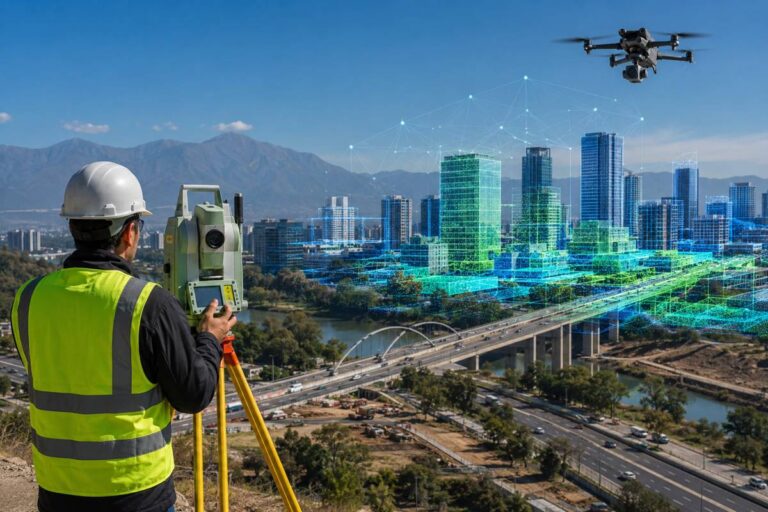
 How Geospatial Survey Choices Decide Design Certainty On Site
16th June 2026
How Geospatial Survey Choices Decide Design Certainty On Site When a major scheme kicks off, the decisions that end up…
How Geospatial Survey Choices Decide Design Certainty On Site
16th June 2026
How Geospatial Survey Choices Decide Design Certainty On Site When a major scheme kicks off, the decisions that end up…
 GEO Business Maps the Future of Infrastructure Intelligence
7th May 2026
GEO Business Maps the Future of Infrastructure Intelligence Location data has quietly become one of the most influential forces shaping…
GEO Business Maps the Future of Infrastructure Intelligence
7th May 2026
GEO Business Maps the Future of Infrastructure Intelligence Location data has quietly become one of the most influential forces shaping…
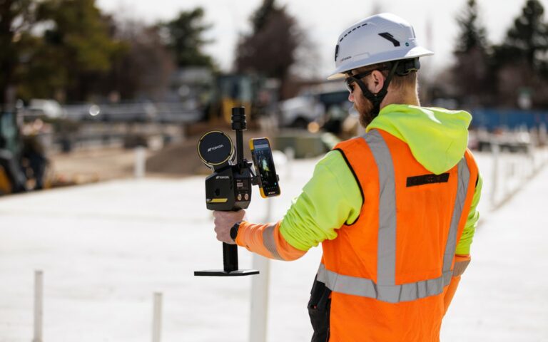 Topcon CR S1 Brings Everyday Reality Capture to Infrastructure Workflows
18th February 2026
Topcon CR S1 Brings Everyday Reality Capture to Infrastructure Workflows For years, high-resolution reality capture sat at the edge of…
Topcon CR S1 Brings Everyday Reality Capture to Infrastructure Workflows
18th February 2026
Topcon CR S1 Brings Everyday Reality Capture to Infrastructure Workflows For years, high-resolution reality capture sat at the edge of…
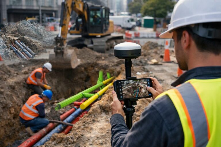 From Trenches to Digital Twins as Field Reality Capture Enters the Enterprise GIS
18th February 2026
From Trenches to Digital Twins as Field Reality Capture Enters the Enterprise GIS Across the global infrastructure sector, the most…
From Trenches to Digital Twins as Field Reality Capture Enters the Enterprise GIS
18th February 2026
From Trenches to Digital Twins as Field Reality Capture Enters the Enterprise GIS Across the global infrastructure sector, the most…
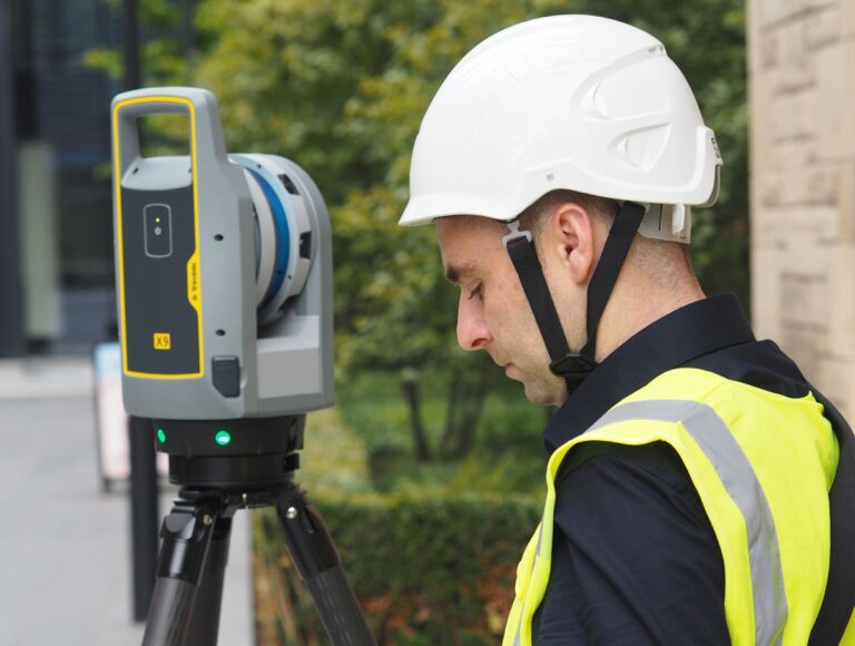
 FARO CREAFORM and FARO INSIGHT Redefine Measurement and Scanning
25th January 2026
FARO CREAFORM and FARO INSIGHT Redefine Measurement and Scanning In construction, manufacturing, infrastructure maintenance and public safety, there’s one shared…
FARO CREAFORM and FARO INSIGHT Redefine Measurement and Scanning
25th January 2026
FARO CREAFORM and FARO INSIGHT Redefine Measurement and Scanning In construction, manufacturing, infrastructure maintenance and public safety, there’s one shared…
 Building the Future with Trimble’s 2026 Industry Outlook
6th October 2025
Building the Future with Trimble’s 2026 Industry Outlook In the ever-evolving world of construction, few sectors are growing as rapidly,…
Building the Future with Trimble’s 2026 Industry Outlook
6th October 2025
Building the Future with Trimble’s 2026 Industry Outlook In the ever-evolving world of construction, few sectors are growing as rapidly,…
 Topcon Elevates Geomatics with New Global Business Structure
1st October 2025
Topcon Elevates Geomatics with New Global Business Structure Topcon Positioning Systems has unveiled a dedicated global business unit focused exclusively…
Topcon Elevates Geomatics with New Global Business Structure
1st October 2025
Topcon Elevates Geomatics with New Global Business Structure Topcon Positioning Systems has unveiled a dedicated global business unit focused exclusively…


Editorial Note
The Highways.Today Dictionary is maintained as an editorial reference resource for construction, infrastructure, transport and industrial technology professionals. Definitions are intended to support understanding, discovery and research, and may be expanded over time as the Dictionary evolves into a broader illustrated industry reference.