How Geospatial Survey Choices Decide Design Certainty On Site
When a major scheme kicks off, the decisions that end up costing the most are rarely the ones that feel weighty at the time. Budgets are stretched, programmes are tighter still, and the choices made in those opening weeks tend to get waved through as housekeeping.
Matthew McQuillian, digital measured surveys lead at Egis UK, has put his finger on one of those quiet make-or-break calls. In a recent commentary, he makes the case that the way geospatial surveys are specified and bought at the very start of a job carries far more weight than the industry usually admits.
His point is refreshingly plain. Surveys capture the geometry of land and existing structures, turning a messy real-world site into accurate spatial data that early assessment, design and compliance all lean on. They pin down the physical constraints a team has to work within, and they set the reference point for nearly everything that follows. Get that foundation right and the rest of the project has something solid to stand on. Treat it as a box-ticking exercise, and the cracks tend to surface later, usually on site, and usually when they’re painful to put right. As McQuillian frames it, surveys are, in reality: “a key part of project strategy, with many downstream risks influenced by decisions made at this early stage.”
Briefing
- Geospatial survey procurement is often run as an administrative step, yet it quietly shapes design certainty and project risk from day one.
- Design-related errors are a dominant source of rework, and rework typically swallows a meaningful slice of total project cost.
- Schemes involving existing assets carry higher inherent risk, so reliable as-built information matters most exactly where it’s hardest to capture.
- Buying the right level of accuracy for the intended use, rather than the cheapest scan available, is what keeps data trustworthy across the project lifecycle.
- Professional standards and clear accountability, including chartered membership, separate dependable survey work from a generic data dump.
Where The Money Quietly Leaks Away
The commercial case for taking surveys seriously starts with rework, and the numbers aren’t kind. Industry estimates commonly put rework at somewhere around 4 to 6% of total project costs, with broader studies clustering between roughly 4 and 10% depending on how it’s measured. The bigger eye-opener is where it comes from. By one widely cited analysis, up to 70% of all rework in construction can be traced back to engineering and design-related errors, and almost 80% of cost deviations on projects relate to design rather than activity on site. In other words, a lot of expensive trouble is baked in long before anyone picks up a tool, and faulty or ill-suited base information is a prime culprit.
Scale that up and the picture gets sobering. In the UK alone, the Get It Right Initiative has estimated that errors cost the construction industry around £5 billion a year. Not all of that traces back to a survey, of course, but a surprising share of redesign and coordination grief starts with a reference point that wasn’t quite what the design team assumed. When the geometry is off, or when its limitations were never spelled out, every discipline that builds on it inherits the problem. A few thousand pounds saved at procurement can quietly turn into a six-figure headache once steel is being fabricated and services are being routed against data that doesn’t hold up.
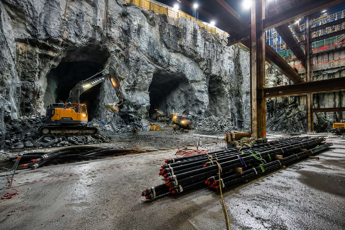
Existing Assets Are Where The Risk Really Bites
If there’s one setting where survey decisions earn their keep, it’s work involving existing structures. Brownfield sites, refurbishments, retrofits and infrastructure upgrades all share the same awkward truth: you’re designing against something that’s already there, often poorly documented, sometimes decades old, and rarely built exactly as the original drawings claimed. McQuillian singles out these projects for good reason, noting that risk is inherently higher when reliable information is the main thing standing between a team and nasty surprises mid-build.
That’s precisely where a well-scoped reality capture survey pulls its weight. Laser scanning, drone surveys and structural monitoring can turn a tangle of existing conditions into something a design team can actually coordinate around. But the value only holds if the brief matched the job. Capture too little detail, or at the wrong accuracy, and the clash you didn’t see coming becomes a change order. Capture the right things, with the constraints written down in black and white, and the team can get on with detailed, interdependent work without second-guessing the ground beneath it. On complex existing-asset schemes, that clarity is worth more than almost any efficiency saved at the buying stage.
Buying Accuracy That Matches The Job
Here’s the snag that trips up plenty of otherwise careful teams. Survey data captured for an early feasibility look gets quietly reused months later for detailed design or construction setting-out, without anyone revisiting whether it was ever accurate enough for that purpose. McQuillian flags this directly, and it’s a familiar story across the sector. Different stages need different levels of precision, and information that was perfectly fit for an initial assessment can mislead badly once it’s pressed into a role it was never scoped for. Small discrepancies that didn’t matter at concept stage can trigger redesign, delay and added cost once work reaches site, often dwarfing whatever was saved up front.
The professional framework has actually moved to help with this. The RICS standard Measured Surveys of Land, Buildings and Utilities, now in its third edition and reissued in 2024, introduced the idea of a survey accuracy band, designed around scale-independent metadata and digital data handling rather than a single drawing scale. That shift lets clients and surveyors agree, in writing, how accurate the data needs to be and how it can legitimately be used. Define that clearly at procurement, and the survey keeps doing its job all the way through delivery. Leave it vague, and you’re trusting luck that nobody asks the data to do more than it was built for.
Standards, Membership And Who Carries The Can
Accuracy on paper means little without accountability behind it, which is why professional standing sits at the heart of sensible procurement. Commissioning surveyors who belong to recognised bodies such as the Royal Institution of Chartered Surveyors gives a buyer assurance that the work lands within established technical and ethical frameworks, and that there’s a competent professional answerable for it. That matters when data underpins decisions worth millions. A cheap deliverable from an unaccountable source can look identical to a robust one right up until the moment it fails a team on site.
There’s a softer, and arguably more valuable, part to this too. Experienced survey professionals don’t just turn up and measure. They help define what actually needs measuring in the first place, and they set out the limitations of the result in plain language so the wider team applies it correctly. The relevant RICS guidance is explicitly written both for surveyors acting in an advisory capacity and for clients drawing up their own specifications, which tells you something about where the value sits. That early steer, getting the brief right and naming the caveats, is often every bit as important as the point cloud itself.
Better Kit, Wider Variation
Technology has made high-quality capture faster, cheaper and more accessible than ever, and that’s largely a good-news story. Laser scanning, photogrammetry and GNSS-based methods now bring a level of detail that would have been fanciful a generation ago, and Egis and Thomas & Adamson, like many firms, have invested heavily in bringing that capability in-house. The catch is that a lower barrier to entry has also widened the gap between outputs. Two surveys badged the same way can differ enormously in rigour, completeness and reliability.
That variation is exactly why professional oversight has become more important, not less, as the kit has improved. When anyone with a scanner can produce something that looks polished, the discipline of knowing what good looks like, and being able to specify and check it, is what protects the buyer. Sophisticated tools don’t remove the need for judgement; they raise the stakes on getting the specification and the scrutiny right.
A Strategic Call, Not A Box To Tick
Pull the threads together and survey procurement stops looking like a preliminary chore and starts looking like what it is, a decision that shapes design certainty, project risk and ultimately the cost and programme outcome of the whole job. As the sector leans ever harder on cost efficiency and programme predictability, the early calls carry disproportionate influence over whether a scheme runs smoothly or lurches from one surprise to the next.
McQuillian’s argument deserves an audience well beyond the survey community, because the people who feel the consequences are the designers, contractors, investors and asset owners further down the line. Scope it properly, buy the right accuracy from accountable professionals, and you hand the design team a foundation they can build on with confidence. Skip that thinking to shave a line off an early budget, and the bill tends to arrive later, with interest. For an industry that says it wants certainty, the cheapest survey is rarely the one that delivers it.