Geo Week 2027 Submissions Open as Reality Capture Moves Centre Stage
A call for conference speakers rarely registers as commercial news, yet the agenda an event chooses to build tends to anticipate where procurement budgets and project specifications travel next.
Geo Week, North America’s flagship gathering for geospatial and mapping technology, has opened submissions for its 2027 programme, and the topics it is prioritising read less like a survey of an academic discipline and more like a checklist of the tools reshaping how roads, bridges and utilities are planned, delivered and maintained. For asset owners, contractors and the consultancies that advise them, the shape of that programme is a useful leading indicator of which capabilities will move from pilot to standard practice over the next two years.
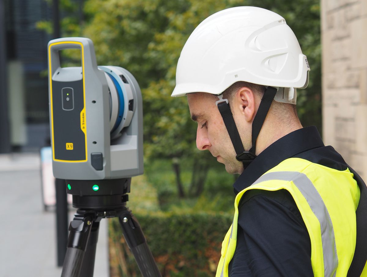
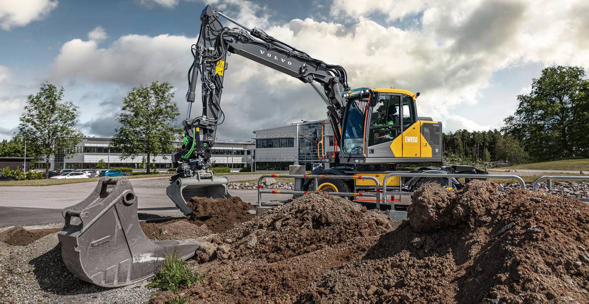
The context behind that signal is a sector that has changed faster than its profile suggests. Lidar, photogrammetry, point cloud processing and digital twins have moved out of the specialist surveying corner and into the core of infrastructure decision-making, a shift accelerated in the United States by federal funding that pushed departments of transportation to adopt 3D capture for inspection and design.
Where surveys were once milestone events, the falling cost of mobile lidar and handheld scanning has made near-continuous reality capture realistic for trained site staff rather than dedicated survey crews. A programme that foregrounds highways agencies, asset management and field-ready workflows is therefore tracking real budget movement, not theoretical interest, which is what makes the 2027 line-up worth reading closely before the submission window closes.
Briefing
- Geo Week 2027 runs from 23 to 25 February at the Salt Palace Convention Center in Salt Lake City, Utah, with the Call for Speakers closing on Friday 17 July 2026.
- Three co-located tracks, run by Geo Week, ASPRS and the Reality Capture Network, share a single full conference pass, with accepted talks matched to a host by content fit.
- The topic list leans heavily towards built-environment priorities, including highways and DOTs, asset management and inspection, digital twins and virtual design and construction.
- Emerging methods flagged for submissions include AI and machine learning, SLAM and mobile mapping, point cloud processing and Gaussian splatting.
- Geo Week sits within Diversified’s technology portfolio alongside GEO Business and Digital Construction Week in the UK, pointing to a more connected transatlantic event calendar.
What the call is asking for, and how the three tracks fit together
The submission brief is deliberately broad, inviting practitioners, project leaders and innovators to bring case studies built on lidar, imagery, reality capture, photogrammetry and related technologies. Organisers have framed the value proposition around hands-on experience rather than vendor positioning, a distinction that matters for an audience tired of demonstrations that work only under ideal conditions.
Carla Lauter, senior content manager at Geo Week News, set out the emphasis plainly, noting: “The most impactful sessions at Geo Week come from practitioners who are doing the work — people who’ve dealt with real challenges and found ways to move forward.” The framing is a clear steer towards reproducible workflow lessons over aspirational keynotes.
Structurally, the event continues to operate as three programmes under one roof. Submissions are routed to sessions hosted by Geo Week, the American Society for Photogrammetry and Remote Sensing, or the Reality Capture Network, depending on where the content fits, while a full conference pass grants access across all three tracks. That arrangement matters commercially because it places ASPRS’s scientific and certification heritage, with more than 7,000 members worldwide, alongside RCN’s built-environment focus and Geo Week’s broader trade-show reach.
Lauter underlined that the organisers are looking for range as much as seniority, adding: “We want to hear from professionals at every level — by submitting a Geo Week proposal you can help shape the direction of the industry.” For consultancies and technology suppliers, that breadth turns a single accepted talk into visibility across surveying, remote sensing and reality-capture communities at once. Registration opens in September, leaving a clear runway between the speaker deadline and the wider attendee push.
A topic list weighted towards built-environment delivery
The most telling element of the announcement is not the call itself but the subjects on offer. Highways and DOTs, asset management and inspection, infrastructure, virtual design and construction, and digital twins all feature as named tracks, and their prominence reflects how far geospatial data has embedded itself into the infrastructure lifecycle.
The operational logic is straightforward. Bridge and pavement inspection generate dense point clouds that engineers can compare against original design models within hours, surfacing deterioration that periodic visual checks miss, and in a US network where tens of thousands of bridges carry structurally deficient ratings, faster and more accurate condition data has a direct safety and capital-planning value. A conference that gives these workflows their own billing is responding to where agencies are already spending.
Alongside the applied tracks sits a cluster of methods that defines the technical frontier. AI and machine learning applied to point cloud processing is the connective tissue, automating feature extraction from datasets too large to interrogate by hand, while SLAM and mobile mapping reduce the skill and time barrier to capturing complex sites. Field-to-finish workflows address the persistent gap between collecting spatial data and turning it into something an operations team can act on, a problem that has limited the return on many digital twin investments.
The inclusion of Gaussian splatting, a comparatively recent technique for reconstructing and rendering 3D scenes from captured imagery, signals that the visualisation layer is advancing as quickly as the sensing layer. Read together, the topic mix charts a move away from snapshot surveys towards continuously usable spatial records, which is precisely the transition handheld multi-sensor scanners and edge-processed lidar have been enabling across construction sites over the past year.
Salt Lake City, Silicon Slopes and a transatlantic portfolio
The 2027 edition is also the first since Geo Week relocated from Denver, and the choice of Salt Lake City is a strategic statement rather than a logistical one. The region anchors the so-called Silicon Slopes, a corridor of more than a thousand technology firms, and organisers have positioned the move to tap a fast-growing geospatial workforce and a dense ecosystem of mapping professionals across public agencies, utilities and engineering practices.
Workforce development appears on the topic list in its own right, which is a candid acknowledgement that the constraint on geospatial adoption is increasingly skills rather than hardware. For policymakers and large employers, the talent pipeline question is as material as any sensor specification.
The event’s place within Diversified’s portfolio adds a further layer of relevance for international readers. The same group runs GEO Business and Digital Construction Week in the United Kingdom, along with Commercial UAV News and its expo, which means the Salt Lake City programme effectively shares a strategic axis with events many European infrastructure professionals already attend.
That alignment matters because the technologies under discussion, from mobile lidar and BIM-integrated reality capture to AI-driven point cloud analytics, are being adopted on broadly parallel tracks either side of the Atlantic. A topic accepted at Geo Week is therefore likely to surface in London a few months later, giving the North American call an outsized influence on the wider conversation about how spatial data underpins delivery, transparency and asset management.
What asset owners, suppliers and investors should take from it
For the people doing the work, the immediate calculation is simple enough. Submitting a proposal costs little beyond preparation time, yet an accepted session offers a platform across three established communities and a chance to set the terms of debate on workflows that are still consolidating.
Highways agencies and contractors gain agenda-setting influence over the case studies their peers will treat as reference points, while vendors and consultancies secure visibility that is harder to buy through the trade-show floor alone. The discipline of distilling a real project into a teachable session also tends to clarify a firm’s own thinking about what reality capture is actually delivering on the ground.
For investors and procurement leads, the signal sits in the weighting. When a flagship event devotes named tracks to DOT applications, asset inspection, AI-driven point cloud processing and digital twins, it is mapping where capital and specification are converging, and that mapping is worth more than any single product launch.
The practical dates anchor the opportunity, with submissions closing on 17 July, registration opening in September and the conference itself running across three days from 23 February 2027. Anyone with a defensible field result and an interest in shaping how geospatial technology is bought and deployed has a narrow window to put it forward.