SPH Engineering Launches 2026 Global Drone Operations Awards
SPH Engineering has opened applications for the Global Drone Operations Awards 2026, an international recognition programme aimed at advanced drone work in industrial, scientific and engineering settings. On its surface this is a competition. Read against the state of the sector, it is closer to an attempt to codify how professional drone operations are actually delivering value on complex sites.
The Latvian firm, founded in Riga in 2013 and now working with customers and partners across more than 150 countries, has spent a decade building the flight software and sensor integrations that let commercial drones do far more than take photographs. The Awards extend that work into different territory, gathering field-proven methods that usually stay locked inside client reports and project files.
The timing reflects a shift in the questions that infrastructure owners, contractors and researchers are asking. For much of the past decade the debate centred on whether drones could map a site or capture an image at all, and that argument has largely been settled. What matters now is whether aerial data can be trusted to inform expensive and time-critical decisions, from where to sink a borehole to whether a pipeline is leaking.
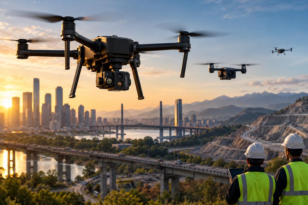
SPH Engineering chief executive Alexey Dobrovolskiy framed the transition, observing that “Drones are no longer just cameras in the sky.” In demanding industrial environments, he added, they are “becoming professional tools for collecting data that directly supports business and operational decisions.” The Awards are built around that premise, and around the observation that many of the strongest examples of this work remain invisible outside the teams that carried it out.
Briefing
- SPH Engineering has opened applications for the Global Drone Operations Awards 2026, targeting advanced drone operations in industrial, scientific and engineering environments.
- Four categories anchor the programme: Mining and Exploration, Oil and Gas, Construction and Engineering, and Academia and Research.
- Submissions will be judged on technical complexity, data quality, innovation, operational execution, business outcomes and measurable impact.
- Finalists and winners gain industry visibility, with winners invited to a celebration event in Budapest in October 2026 focused on sharing field-proven workflows.
- The programme arrives as the construction drone market scales quickly and regulators move towards routine beyond-visual-line-of-sight operations, raising the value of standardised, repeatable methods.

Four Sectors Where Aerial Data Now Carries Commercial Weight
The 2026 programme concentrates on four fields: Mining and Exploration, Oil and Gas, Construction and Engineering, and Academia and Research. The selection is not arbitrary. Each is a setting where field teams are routinely asked to collect high-confidence data in places that are remote, hazardous or expensive to reach, and where a better workflow can cut risk, sharpen data quality and shorten the distance between fieldwork and a decision.
For construction and engineering in particular, that description now covers a widening set of tasks, including progress monitoring, earthwork volume calculations, corridor mapping for linear projects and the survey work that underpins design and handover.
Grouping these sectors together also reflects how the economics of aerial data have changed. On a live construction site, a repeatable drone survey can replace slower manual methods and reduce the number of people working near moving plant or unstable ground. In mining and exploration, the same logic applies to open-pit surveys and stockpile measurement, where accuracy feeds directly into production and reporting.
Oil and gas brings a harder safety dimension, since inspecting tanks, flare stacks and pipeline corridors from the air keeps crews away from confined spaces and pressurised systems. Academic and research work sits slightly apart, yet it often pioneers the sensor techniques that later become standard practice on commercial sites, which is why SPH Engineering has kept it in the frame.
Beyond Mapping: The Sensors Doing The Heavy Lifting
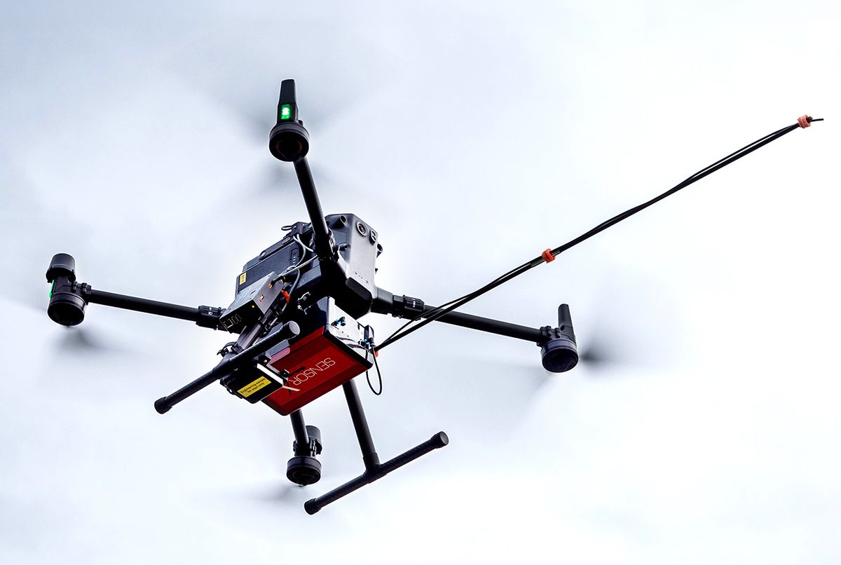
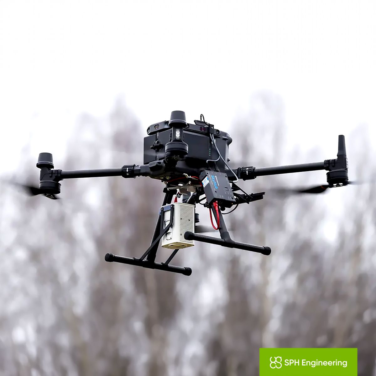
The Awards are explicitly aimed at operations that move past visual records into more advanced workflows, using specialised sensors, integrated systems and complex field execution to produce measurable outcomes. That distinction matters because it points to where the technical value now sits. SPH Engineering’s own portfolio illustrates the direction of travel, combining its UgCS flight-planning software with payloads such as ground-penetrating radar, magnetometers, echo sounders and LiDAR.
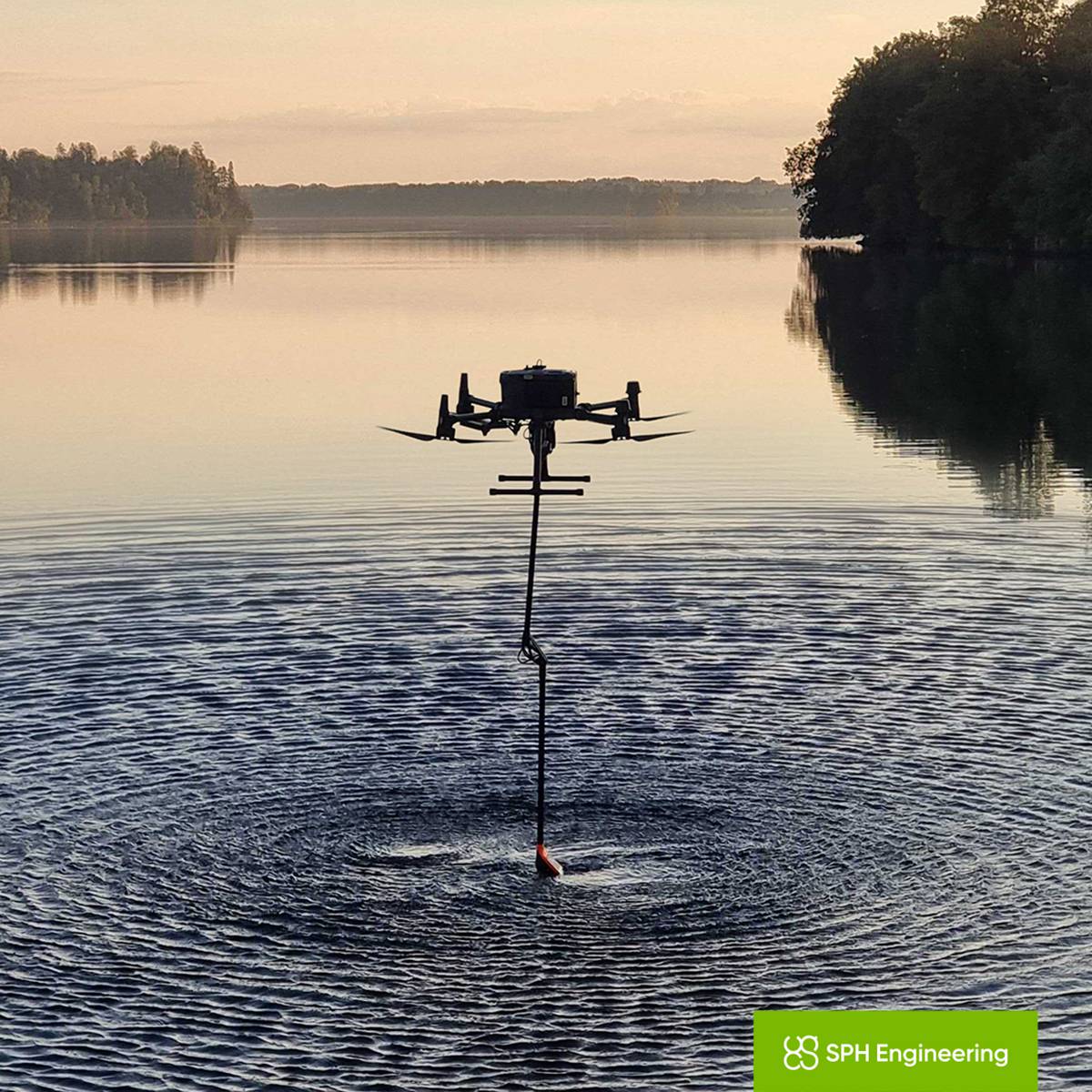
These are not imaging tools in any conventional sense. Ground-penetrating radar and magnetometers read what lies beneath the surface, helping locate buried utilities or metallic infrastructure before excavation begins, while drone-mounted echo sounders survey ponds, tailings dams and retention basins without putting a boat or a person on the water.
What separates a credible operation from an impressive demonstration is repeatability, and this is where integrated systems earn their place. Collecting clean geophysical or bathymetric data depends on flying consistent lines at a controlled height above ground, then georeferencing and logging the results so they can be trusted and repeated.
SPH Engineering’s recent UgCS 6.0 release leaned into exactly this problem, automating the alignment of survey sub-areas and adding tools intended to standardise data collection at the point of capture rather than in weeks of post-processing. The judging criteria for the Awards mirror that emphasis, weighting technical complexity and data quality alongside operational execution and measurable business impact, rather than rewarding novelty for its own sake.
A Market Growing Faster Than Its Standards
The commercial backdrop helps explain why a recognition programme built around workflows has arrived now. Estimates for the construction drone market vary between research houses, but the trajectory is consistent. One widely cited forecast puts the sector at around 5.9 billion US dollars in 2026, rising to roughly 10.6 billion by 2034, with North America the leading region.
The broader commercial drone market is larger again, measured in the tens of billions and expanding at double-digit rates on most estimates. Growth on that scale draws in operators of very different capabilities, from seasoned survey firms to newcomers still finding their feet, which widens the gap between best practice and routine practice.
Alongside the raw expansion, the centre of gravity is shifting from hardware towards data and services. Analysts increasingly describe the value migrating into software platforms, recurring data subscriptions and managed inspection programmes, a model often labelled drone-as-a-service. That shift rewards operators who can deliver consistent, decision-grade outputs rather than one-off flights, and it puts a premium on documented, transferable methods. An awards programme that turns strong individual projects into shared reference points speaks directly to that need.
Dobrovolskiy positioned the initiative in those terms, saying the company wants to “recognize the teams proving what advanced drone workflows can achieve, and help more industries understand the value of these methods.”
Regulation Moves Towards Routine Operations
The regulatory environment is moving in a direction that makes standardised operations more valuable rather than less. In the United States, the Federal Aviation Administration has proposed a framework, known as Part 108, intended to replace the current patchwork of individual waivers for beyond-visual-line-of-sight flights with a scalable, performance-based system.
The proposed rule was published in August 2025, drew a very large volume of comments and had part of its record reopened in early 2026, with a final rule anticipated during the year, though the exact timing remains subject to the FAA’s process. Canada, for its part, introduced comprehensive beyond-visual-line-of-sight rules in late 2025, giving operators there an earlier route to scaled missions.
The significance for construction and infrastructure is straightforward. Beyond-visual-line-of-sight approval is what turns drone inspection of pipelines, power lines, railways and long road corridors from a series of short, line-of-sight hops into genuinely long-range, repeatable missions. As that capability normalises, the emphasis moves from the individual pilot towards the operating organisation, its procedures and its ability to prove safe, consistent performance.
It also reshapes the workforce, with industry observers expecting demand for data analysts to outpace demand for pilots as flights become more automated. In that setting, field-proven workflows and clear evidence of measurable outcomes stop being a nicety and start to look like a procurement requirement.
Turning Field Wins Into Shared Reference Points
Selected finalists and winners will receive industry recognition and visibility across drone, geospatial and industrial technology audiences, with winners invited to a celebration event in Budapest in October 2026. The decision to build the programme around a gathering matters as much as the recognition itself.
The stated purpose of the event is to let practitioners exchange field-proven workflows, share lessons from complex operations and discuss the practices that can move advanced methods from isolated success stories into wider adoption. For a sector where much of the hardest-won knowledge sits inside confidential project files, a structured venue for that exchange is a practical contribution rather than a ceremonial one.
For infrastructure owners, contractors and investors, the wider signal is about maturity. A market that produces credible awards, judged on operational execution and measurable impact rather than flying hours or camera resolution, is a market beginning to hold itself to consistent standards.
SPH Engineering has an obvious commercial interest in encouraging that shift, since its business depends on complex, sensor-led operations becoming mainstream. Even so, the underlying logic holds regardless of who convenes the conversation.
As aerial data works its way deeper into how projects are surveyed, monitored and handed over, the operators who can demonstrate repeatable, decision-grade results are the ones most likely to win the work, and programmes that surface those methods help the rest of the industry catch up.
Key Industry Questions
- What are the SPH Engineering Global Drone Operations Awards 2026? They are an international recognition programme run by SPH Engineering, a Latvian drone technology developer, to spotlight advanced drone operations that solve complex field challenges in industrial, scientific and engineering settings. Rather than rewarding equipment or flying skill in isolation, the programme focuses on operations that use specialised sensors, integrated systems and demanding field execution to produce measurable results. Applications for the 2026 edition are now open. The stated aim is to bring high-quality drone work, which often stays buried in client reports and research documents, into wider industry view, and to help define what professional drone operations can deliver beyond routine mapping and imaging. Winners will be celebrated at an event in Budapest in October 2026.
- Which sectors can enter, and why were those four chosen? The 2026 programme covers four categories: Mining and Exploration, Oil and Gas, Construction and Engineering, and Academia and Research. SPH Engineering selected them because each involves collecting high-confidence data in environments that are remote, hazardous or costly to access, where better workflows can reduce risk, improve data quality and speed up decision-making. Construction and engineering teams increasingly use drones for progress monitoring, volume calculations and corridor mapping. Mining relies on them for pit surveys and stockpile measurement, while oil and gas uses them to inspect tanks and pipelines without exposing crews to confined or pressurised environments. Academia and research often develops the sensor techniques that later move into commercial practice, which is why it sits alongside the industrial categories.
- How will submissions be judged? An expert jury will assess entries against six criteria: technical complexity, data quality, innovation, operational execution, business outcomes and measurable impact. The balance is deliberate. It rewards projects that combine difficult field conditions with clean, trustworthy data and a demonstrable result, rather than technology used for its own sake. In practice this favours operations where the workflow can be explained, repeated and tied to a concrete outcome, such as a safer inspection, a faster survey or a decision that would otherwise have required slower or riskier methods. The emphasis on measurable impact reflects a broader industry move towards treating drone data as decision-grade evidence rather than supporting imagery, and it sets a higher bar than many earlier drone competitions.
- What separates an advanced drone operation from routine mapping? Routine mapping typically produces orthomosaics or photogrammetric models from a camera payload. Advanced operations go further, using sensors that capture information a camera cannot. Ground-penetrating radar and magnetometers read beneath the surface to locate buried utilities or metallic infrastructure, echo sounders survey water bodies such as ponds and tailings dams, and LiDAR builds precise three-dimensional point clouds through vegetation. The difficulty lies less in the sensor than in the execution, since useful geophysical or bathymetric data depends on flying consistent lines at controlled heights and georeferencing the results reliably. Integrated flight-planning and payload-management systems exist to make that repeatable. The Awards are aimed squarely at this category of work, where field discipline and data integrity matter as much as the hardware.
- How does the FAA’s proposed Part 108 rule affect construction and infrastructure drone work? Part 108 is a proposed United States framework to normalise beyond-visual-line-of-sight flights, replacing today’s case-by-case waivers with a standardised, performance-based system. For construction and infrastructure this is significant, because beyond-visual-line-of-sight approval is what turns inspection of pipelines, power lines, railways and long road corridors into genuinely long-range, repeatable missions rather than short line-of-sight hops. The proposed rule was published in 2025 and its record was partly reopened in early 2026, with a final rule expected during the year, though timing remains subject to the FAA’s process. A central shift is the move from individual pilot responsibility towards organisational accountability, requiring documented procedures and proven safety performance. That raises the value of standardised, well-evidenced workflows of the kind the Awards aim to surface.
- What is drone-as-a-service, and why does it matter for procurement? Drone-as-a-service describes a model in which organisations buy aerial data and analysis as an outsourced service rather than building and running an in-house drone programme. It matters for procurement because it lets construction firms, utilities and infrastructure owners access specialised capabilities, such as LiDAR mapping, ground-penetrating radar or bathymetric surveys, without the capital cost of equipment or the burden of training and compliance. SPH Engineering itself has moved in this direction, launching a marketplace that connects project owners with vetted local drone operators. For buyers, the shift places a premium on providers who can demonstrate consistent, decision-grade outputs and transferable methods. Recognition programmes that document proven workflows give procurement teams a clearer basis for judging which operators can be trusted with critical data.
- What do construction firms actually gain from drone surveys beyond photographs? The practical gains are measurable and operational. Repeatable drone surveys support progress monitoring, earthwork volume calculations and topographic mapping that would otherwise take longer and expose more staff to hazards near moving plant or unstable ground. Sensor payloads extend the value further, with ground-penetrating radar locating buried services before excavation, magnetometers identifying underground metallic infrastructure, and echo sounders measuring retention basins and ponds. Consistent aerial data also feeds digital models used for project control and handover. The financial case rests on faster fieldwork, fewer people in hazardous positions and higher-confidence data feeding into decisions. As beyond-visual-line-of-sight operations become routine, the same drones can cover longer corridors and larger sites, strengthening the return on a well-run programme.
- When and where is the awards event, and what do winners receive? Selected finalists and winners will receive industry recognition and visibility among drone, geospatial and industrial technology audiences. Winners will also be invited to a celebration event in Budapest, Hungary, in October 2026. The gathering is designed as a working exchange rather than a purely ceremonial occasion, giving practitioners a venue to share field-proven workflows, discuss lessons from complex operations and debate the practices that can move advanced drone methods into wider adoption. For entrants, the value lies partly in exposure to peers, clients and potential partners across the sectors the programme covers, and partly in having a difficult project independently assessed against clear technical and commercial criteria. Applications for the 2026 edition are open now.
Strategic Takeaways
- The competitive edge in drone services is shifting from hardware ownership towards repeatable, decision-grade workflows, and buyers will increasingly reward operators who can prove consistent, transferable methods.
- Advanced sensor payloads such as ground-penetrating radar, magnetometers and echo sounders are extending drone value into subsurface and underwater data that directly informs excavation, inspection and site-planning decisions.
- Beyond-visual-line-of-sight regulation, led by the FAA’s proposed Part 108 and Canada’s earlier rules, is set to move accountability from individual pilots to operating organisations, making documented procedures a procurement consideration rather than a formality.
- As drone flights automate, workforce demand is tilting towards data analysts over pilots, a shift infrastructure owners and service firms should factor into hiring and training now.
- Industry recognition judged on measurable outcomes signals a maturing market, and the standards it sets are likely to influence how future aerial-data contracts are specified and awarded.