Vantor’s WorldView 3D Turns the Map into a Live Operating Layer
For as long as engineers, planners and commanders have relied on maps, the map has behaved like a fixed reference point: surveyed once, trusted for years, and quietly falling out of step with a world that never stops moving.
Vantor’s launch of WorldView 3D is a direct challenge to that assumption. The company can now task a satellite and return an updated three-dimensional terrain model of almost anywhere on Earth within 24 hours of collection, with delivery frequently closer to six. A 3D map that refreshes in hours rather than months stops being a historical document and starts functioning as an operational layer that humans, autonomous systems and physical AI can all act on with confidence.
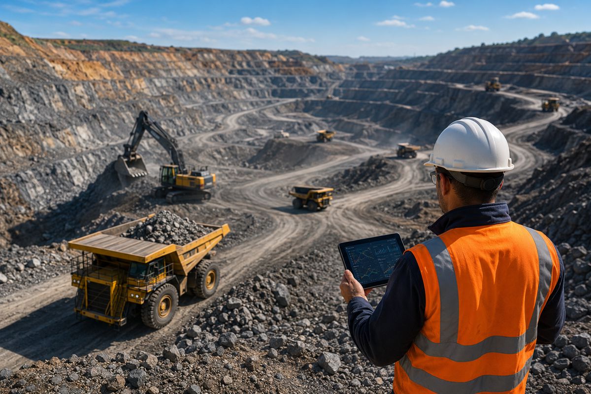
That shift lands squarely in the middle of several trends already reshaping construction, transport and industrial technology. Large civil projects, disaster-response agencies, mining operators and defence planners all depend on an accurate model of the ground, yet the physical world is changing faster than traditional survey cycles can keep pace with. Conflict, flooding, landslides, reservoir drawdown and rapid urban expansion can render a static model obsolete within weeks.
For decades the only remedy has been aircraft and drone collection programmes that are expensive to run, slow to mobilise and difficult to scale across remote, hazardous or contested terrain. WorldView 3D closes that gap from orbit, and in doing so reframes what infrastructure owners and operators can reasonably expect to know about the ground beneath their assets.
Briefing
- WorldView 3D delivers updated 3D terrain within 24 hours of collection, often in around six, from a single satellite pass anywhere on Earth.
- Two products are offered: Rapid 3D at 50 cm-class resolution and 4 m accuracy, and HD 3D at 15 cm resolution and 3 m accuracy in all dimensions.
- The service draws on a pre-existing 3D spatial foundation covering more than 100 million square kilometres mapped to GPS-level accuracy.
- HD 3D can be bought on a project basis or through change-based refresh subscriptions, shifting satellite terrain towards a recurring, monitoring-led model.
- The product extends Vantor’s Tensorglobe platform and targets GPS-denied autonomy, tactical operations, intelligence analysis, disaster response and digital mapping.
Why the Refresh Rate Matters More Than the Resolution
Resolution has long been the currency of the Earth-observation industry, and Vantor still competes on it. The more consequential metric here, though, is currency of information — how recently the model reflects reality. A terrain dataset that is technically precise but two years old can mislead a bridge designer, a flood modeller or an autonomous haul truck just as easily as a low-resolution one.
By compressing the interval between an event on the ground and an updated model in the hands of an analyst, Vantor is attacking the latency problem that has quietly limited the usefulness of 3D geospatial data across civil and defence markets alike.
The company frames this as delivering the “operational terrain”, a continuously updated three-dimensional view of the physical world that both people and machines can read. That framing matters commercially because it repositions satellite data away from a one-off deliverable and towards a living service. An infrastructure operator monitoring a corridor, a reservoir or a construction footprint no longer buys a single snapshot; it subscribes to a terrain layer that stays current as conditions evolve. The distinction sounds subtle, but it changes procurement, budgeting and the entire relationship between the data provider and the asset owner.
Two Products, One Shift in How Terrain Is Bought
The commercial architecture of WorldView 3D is arguably its most telling feature. Vantor has split the line into two offerings pitched at different mission economics. Rapid 3D is built for speed and situational awareness: a single satellite pass yields updated terrain within 24 hours at 50 cm-class resolution and 4 m accuracy in every dimension, accessed through the Vantor Hub.
HD 3D trades some of that immediacy for fidelity, delivering detailed models at 15 cm resolution and 3 m accuracy for missions where fine detail justifies a longer production cycle. It is available globally on a project basis, and, crucially, through change-based refresh subscriptions for customers who need to watch terrain and infrastructure evolve over time.
That subscription option is where the infrastructure relevance sharpens. Change-based refresh reframes 3D terrain as monitoring-as-a-service rather than a capital purchase, aligning the offering with how asset owners increasingly think about data. A dam authority, a port, a rail corridor operator or a large-site contractor can, in principle, keep a current model of its footprint without commissioning a fresh aerial survey each time.
The wider aerial surveying and mapping sector has been moving towards exactly this kind of recurring, monitoring-led revenue as digital-twin adoption accelerates, and Vantor is now applying the model at orbital scale and global reach. For remote or hazardous sites where mobilising an aircraft or drone team is costly and slow, the economics could prove compelling.
The Constellation and AI Doing the Heavy Lifting
None of this speed is possible without the hardware and software stack sitting behind it. Vantor’s WorldView Legion constellation, six high-resolution satellites launched in three pairs between May 2024 and February 2025, dramatically increased how often the company can revisit a given point, up to roughly 15 times a day for the most rapidly changing areas. Frequent revisits are the raw material for rapid updates: without them, a promise of terrain within hours would be impossible to keep.
The full constellation is capable of collecting more than six million square kilometres of imagery per day, giving Vantor the collection headroom to task specific areas on demand without starving its other commitments.
The second ingredient is an AI-powered production pipeline that automates the photogrammetry once handled painstakingly by human analysts. Machine-learning models stitch fresh imagery into accurate 3D models at a speed and scale that manual production could never match.
The third is Vantor’s trusted 3D spatial foundation, a pre-existing high-accuracy map spanning more than 100 million square kilometres at GPS-level accuracy. Rather than rebuilding a model from scratch on every tasking, WorldView 3D fuses new imagery with that foundation, which is what compresses processing time from weeks to hours.
The combination of dense revisit capacity, automated production and a deep reference archive is difficult to replicate, and it is the real moat behind the headline delivery figures.
What It Means for Construction, Infrastructure and Disaster Response
Beyond the defence language of the launch, the civil applications are immediate and substantial. A vivid illustration accompanied the announcement: a WorldView 3D Rapid model of the Hoover Dam collected on 28 June 2026 showed noticeably reduced water levels against terrain captured a few years earlier. That single example captures the value proposition for infrastructure owners — the ability to quantify physical change at an asset without dispatching a survey crew, and to do so on a cadence that keeps pace with drought, subsidence, erosion or construction progress. For flood modellers, reservoir managers and coastal-defence planners, a terrain layer that refreshes in hours is directly actionable rather than merely informative.
The timing aligns with a broader digitalisation wave across the built environment. Analysts tracking the infrastructure resilience digital-twin market have valued it at roughly $9.4 billion in 2025 and projected it towards $38.7 billion by 2034, growth underpinned by ageing infrastructure stock, climate risk and government resilience programmes such as the US Infrastructure Investment and Jobs Act, the EU Recovery and Resilience Facility and Japan’s long-term maintenance commitments.
Digital twins are only as trustworthy as the terrain and asset data feeding them, and platforms from the likes of Bentley Systems, Dassault Systèmes and Siemens increasingly ingest satellite-derived 3D content. A source of current, accurate, globally available terrain slots neatly into that stack, giving twin operators a way to keep their virtual replicas anchored to physical reality. For disaster response, where an accurate post-event model can shape evacuation, routing and reconstruction decisions within the first critical days, the case is even more direct.
Autonomy, Physical AI and Life Beyond GPS
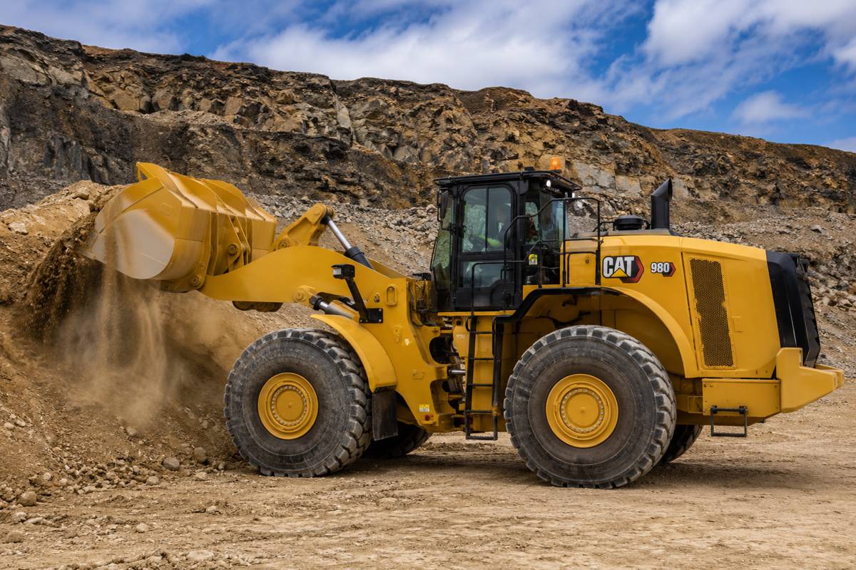
One of the most strategically important applications is enabling autonomy where satellite navigation cannot be trusted. Drones, ground robots and autonomous vehicles can navigate by comparing what their onboard sensors observe against a stored high-fidelity 3D terrain model, extracting position without any reliance on GPS or GNSS signals. This matters well beyond the battlefield. Autonomous mining fleets, construction machinery and inspection drones increasingly operate in environments — deep pits, dense urban canyons, tunnels, jammed or degraded signal zones — where satellite positioning is unreliable. A current, accurate terrain reference is the foundation on which vision-based navigation is built, and it is precisely the layer WorldView 3D is designed to keep fresh.
Vantor has been assembling partnerships around this thesis. Its collaboration with Niantic Spatial targets a unified air-to-ground visual positioning system for operations in GPS-denied settings, while earlier work with Anduril applied its terrain data to a mixed-reality command-and-control system.
Peter Wilczynski, Chief Product Officer at Vantor, tied the product directly to this direction of travel. “WorldView 3D sets a new standard for how customers maintain command of the ground truth and decision advantage in a fast-changing world,” he said. “From command and control to autonomous systems operating in GPS-denied environments, many of today’s most complex missions require current, accurate 3D terrain. With WorldView 3D, customers can update the specific areas they care about, including remote and contested areas where traditional aircraft collection is limited, with unmatched speed and scale. This is the future of spatial intelligence.”
The same principle that guides a drone through a contested valley can guide an autonomous loader through a quarry, which is why the physical-AI framing travels so readily into industrial markets.
A Rebranded Maxar Bets on Software and Sovereignty
WorldView 3D also needs to be read as a statement of corporate strategy. Vantor is the rebranded Maxar Intelligence, spun out in October 2025 when the former Maxar Technologies — taken private by Advent International in a $6.4 billion deal — split its intelligence and spacecraft-manufacturing arms into separate companies, the latter now operating as Lanteris. The rebrand was explicitly about repositioning: away from being perceived as a satellite-imagery vendor and towards being a spatial-intelligence software company that happens to own a constellation. Tensorglobe, the platform WorldView 3D extends, is the centrepiece of that pivot, orchestrating tasking, fusion, production, analysis and delivery across space, air and ground sensors.
The competitive backdrop is intensifying. Airbus Defence and Space, with its Pléiades Neo satellites, and Planet Labs both contest the high-resolution and monitoring markets, while the whole sector rides a wave of demand from governments seeking sovereign intelligence capabilities. Vantor is leaning into that trend, having signed a memorandum of understanding with Rheinmetall to advance sovereign spatial intelligence for Germany and other European nations, and having partnered with Google to bring Earth AI models into Tensorglobe for classified environments. The company’s longer game is a fivefold improvement in revisit rates through two next-generation constellations — Pulse, aimed at persistent monitoring and expected to begin launching as soon as 2027, and the 20 cm-class Vantage satellites being developed with BAE Systems for deployment towards the end of the decade.
Vantor CEO Dan Smoot has framed that expansion in blunt terms: “Vantage and Pulse usher in a new era of space-based intelligence—it’s the first time that governments and businesses can get both detailed imaging and real-time monitoring from a single commercial system,” he said. “That fundamentally changes how intelligence is generated and used.”
The Live Map Era Takes Shape
Taken together, WorldView 3D signals where the geospatial industry is heading: value migrating from raw pixels towards the ability to deliver current, decision-grade terrain on demand. The static basemap, refreshed on multi-year cycles, is giving way to a living layer that updates at something closer to the speed of change on the ground.
For construction and infrastructure, that promises fewer blind spots on remote sites, faster damage assessment after disasters, better-anchored digital twins and a firmer foundation for the autonomous systems now entering yards, mines and corridors. The defence market will drive the early revenue, as it usually does with dual-use space technology, but the civil dividends are neither incidental nor distant.
The open questions are practical ones. Adoption will hinge on how the change-based refresh subscriptions are priced against established aerial survey contracts, how cleanly the 3D outputs integrate with the BIM and digital-twin platforms engineers already use, and whether the six-hour delivery ambition holds up consistently across the awkward geographies where it matters most.
What is no longer in doubt is the direction. Once terrain can be refreshed from orbit within a day, the expectation across infrastructure, transport and industrial technology quietly resets, and the map, for the first time, starts keeping up with the world it describes.

Key Industry Questions
- How does WorldView 3D differ from a traditional aerial or drone survey? The core difference is speed, scale and reach rather than raw accuracy. Aerial and drone surveys can deliver very high precision, but they require mobilising crews and aircraft, which is costly and slow, and often impractical across remote, hazardous or contested terrain. WorldView 3D tasks an existing satellite constellation to return an updated 3D model within 24 hours, often around six, from a single pass anywhere on Earth. For most infrastructure monitoring this is fast enough to track meaningful change without a site visit. Aerial methods retain an edge for the very highest local fidelity, but for wide-area, repeatable, globally accessible terrain refreshed on a short cadence, the orbital approach offers a scalability that ground-based collection cannot match.
- What accuracy can construction and engineering teams actually expect? Vantor offers two tiers. Rapid 3D provides 50 cm-class resolution with 4 m accuracy in all dimensions, suited to situational awareness, change detection and planning across large areas. HD 3D delivers 15 cm resolution and 3 m accuracy for missions needing finer detail. These figures place satellite-derived terrain in a useful band for corridor planning, reservoir monitoring, disaster assessment and feasibility work, though the tightest engineering tolerances for detailed design will still often call for ground survey or LiDAR. The practical value lies in maintaining a current, consistent model across an entire asset or region, then commissioning higher-precision local survey only where the design phase demands it, rather than resurveying everything repeatedly.
- Can this data feed directly into digital twins and BIM workflows? That integration is the intended use. Digital twins depend on terrain and asset data that stays anchored to physical reality, and platforms from Bentley Systems, Dassault Systèmes and Siemens increasingly consume satellite-derived 3D content. A regularly refreshed terrain layer gives twin operators a way to keep their virtual replicas current without repeated field campaigns. The infrastructure resilience digital-twin market is expanding quickly, valued at around $9.4 billion in 2025 and projected towards $38.7 billion by 2034, so demand for reliable feeder data is rising. The practical questions for adopters concern format compatibility and how cleanly WorldView 3D outputs slot into existing BIM environments, which teams should test against their own toolchains before committing.
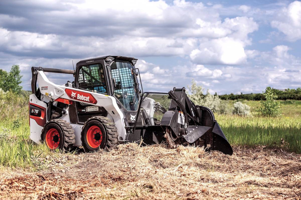
- Why does GPS-denied navigation matter for construction and mining? Autonomous machinery increasingly operates where satellite positioning is unreliable — deep open pits, tunnels, dense urban sites and areas with signal interference. Vision-based navigation offers an answer: an autonomous vehicle or drone compares what its sensors see against a stored 3D terrain model to determine position without GPS or GNSS. That approach only works if the reference terrain is accurate and current, which is exactly what WorldView 3D aims to maintain. The same capability Vantor markets for defence autonomy applies to autonomous haul trucks, loaders and inspection drones in industrial settings. As construction and mining automation advances, a dependable, up-to-date terrain reference becomes a foundational input rather than an optional extra.
- How is WorldView 3D priced, and does it change how terrain data is bought? Rapid 3D is accessed through the Vantor Hub, while HD 3D is available globally on a project basis or through change-based refresh subscriptions. The subscription model is the significant shift: it reframes 3D terrain as an ongoing monitoring service rather than a one-off purchase. For asset owners this aligns with a broader move towards monitoring-as-a-service, where a current model of a site or corridor is maintained continuously instead of commissioned repeatedly. Vantor has not published headline prices, so the real test is how these subscriptions compare against established aerial survey contracts for a given asset. For remote or hazardous sites where mobilising crews is expensive, the recurring orbital model could prove more economical as well as faster.
- What is Vantor, and how does it relate to Maxar? Vantor is the rebranded Maxar Intelligence. The former Maxar Technologies was taken private by Advent International in a $6.4 billion deal, then split in October 2025 into two independent companies: Vantor, which handles spatial intelligence and owns the WorldView constellation, and Lanteris, formerly Maxar Space Systems, which builds spacecraft. Both remain Advent portfolio companies. The rebrand marked a deliberate pivot from being seen as a satellite-imagery provider towards positioning as a software-driven spatial-intelligence company, anchored by its Tensorglobe platform. For customers, existing WorldView imagery services continue under the new name, while the product roadmap has broadened towards autonomy, monitoring and AI-driven production rather than imagery sales alone.
- How reliable is the promised six-hour delivery in practice? The 24-hour figure is the committed benchmark, with delivery often closer to six hours depending on tasking, satellite pass timing and location. Speed depends on the constellation’s revisit frequency, which reaches around 15 times a day for priority areas, and on the AI production pipeline that automates 3D model generation. The pre-existing spatial foundation covering more than 100 million square kilometres accelerates processing because new imagery is fused with an existing model rather than built from scratch. Delivery times will realistically vary with geography, cloud cover and demand, so prospective users in awkward or frequently clouded regions should validate performance for their specific areas of interest rather than assuming the fastest quoted figure everywhere.
- Which sectors are likely to adopt this first, and who benefits later? Defence and intelligence will drive early revenue, as is typical for dual-use space technology, given the direct value of current 3D terrain for command and control, autonomy and analysis. Civil adoption is likely to follow through disaster-response agencies, which gain the most from rapid post-event models, and infrastructure operators managing dams, ports, rail corridors and large construction footprints. Mining and heavy-civil contractors running autonomous fleets stand to benefit as vision-based navigation matures. Mapmakers and digital-twin providers form another natural market, using the terrain as a feeder layer. The pace of civil uptake will depend on pricing, integration with existing engineering platforms and how convincingly the monitoring-subscription model displaces conventional survey commissioning.
Strategic Takeaways
- The competitive frontier in Earth observation is shifting from resolution to currency of information; a terrain model refreshed within hours is worth more operationally than a sharper one that is years out of date.
- Change-based refresh subscriptions reframe 3D terrain as monitoring-as-a-service, and infrastructure owners should weigh recurring orbital coverage against the cost and delay of repeated aerial survey mobilisation for remote or hazardous assets.
- Current, globally available satellite terrain strengthens the data foundation beneath digital twins and BIM workflows, making it a strategic input for a resilience twin market forecast to approach $38.7 billion by 2034.
- Vision-based, GPS-denied navigation is becoming a foundational capability for autonomous mining and construction fleets, and a dependable, up-to-date terrain reference is the layer that makes it viable.
- Vantor’s pivot from Maxar imagery vendor to spatial-intelligence platform, backed by next-generation Pulse and Vantage constellations, signals that the sector’s long-term value will sit in software and continuously updated intelligence rather than in raw pixels.