






Turning GIS Investment into Better Infrastructure Asset Management
A highway authority may know the location of every bridge, drainage culvert and retaining wall across its network, yet still struggle to establish when an asset was last inspected, what maintenance has been completed or whether the records held by different departments agree. Geographic information systems have made infrastructure increasingly visible, but the information associated with those assets is not always as accessible or reliable as the maps on which they appear.
For organisations responsible for roads, utilities, railways and other critical infrastructure, modernising GIS is becoming as much an exercise in improving established working practices as upgrading software. Bringing decades of asset records together, connecting field personnel with central databases and establishing a consistent picture of network condition can be considerably more demanding than installing a new platform.
Andy Berry, CEO of VertiGIS, believes organisations need to concentrate more closely on the operational benefits they expect from these investments: “The real challenge is connecting those investments to measurable business outcomes.”
A modern platform may offer cloud access, mobile applications and sophisticated analytical capabilities, but those improvements have limited practical value if engineers continue searching through disconnected records or maintenance teams must enter the same information into several systems.
Briefing
- GIS modernisation is increasingly concerned with improving infrastructure maintenance, inspection and asset management rather than simply replacing technology.
- Legacy databases, inconsistent asset identifiers and incomplete records remain significant barriers to effective geospatial information management.
- Salesforce research published in July 2026 found that 61% of surveyed field service organisations reported limited access to relevant customer information for mobile workers.
- Mobile GIS applications can support on-site inspections, asset updates and offline data collection, subject to appropriate configuration and synchronisation.
- The ISO 55000 family of standards provides a framework for connecting asset information with organisational objectives and long-term performance.
The Problem with Legacy Infrastructure Records
Infrastructure organisations rarely operate with a single, consistent record of their physical assets. Information accumulates over decades, often reflecting successive generations of technology, changes in departmental responsibilities and the different requirements of engineers, surveyors and maintenance teams.
A highway authority might maintain the geographic location of a drainage system in GIS, store its maintenance history in a separate asset management application and retain the original construction drawings in a document repository. Inspection findings may be recorded elsewhere, leaving personnel to assemble information from several sources before determining what work is required.
Replacing one of those systems does not necessarily resolve the underlying fragmentation. A modern mapping application may provide faster access to an asset’s location while leaving unresolved discrepancies in identifiers, inspection records or maintenance histories. If departments continue maintaining different versions of the same information, the problems simply become more visible through newer software.
Data quality is therefore central to Berry’s assessment of GIS modernisation. Engineers and maintenance personnel need confidence that the records they retrieve correspond to the asset in front of them and accurately reflect its current condition.
For road networks, this might mean confirming that a drainage culvert is recorded in the correct location, that an inspection report references the appropriate bridge or that recently completed repairs have been incorporated into the asset register. Utilities face similar difficulties with underground cables, pipelines and connections, particularly where historical plans no longer reflect subsequent modifications.
Consolidating these records can involve extensive technical work. Historical surveys may lack geographic precision, asset classifications may differ between databases and some structures may have been altered repeatedly without corresponding changes to their documentation. Improving the information often requires reviewing how it is collected, who is responsible for maintaining it and how discrepancies are identified and corrected.
Connecting GIS with Asset Management Standards
The wider discipline of asset management offers a useful framework for evaluating geospatial investment, particularly where infrastructure must be operated and maintained over several decades.
ISO 55000:2024 establishes the principles and terminology of asset management, including the relationship between organisational objectives, asset performance and the value derived from assets throughout their life cycles. The accompanying ISO 55001 standard sets requirements for an asset management system, while ISO 55013:2024 provides guidance on managing data assets in support of asset management objectives.
These standards do not prescribe a particular GIS platform or software architecture. Instead, they provide a basis for considering whether an organisation has the information, processes and responsibilities needed to make informed decisions about its assets.
An extensive digital inventory of bridges, retaining walls, road surfaces and drainage networks may be valuable, but it becomes more useful when connected to inspection programmes, condition assessments, maintenance planning and longer-term investment decisions.
The information requirements are not necessarily the same for every asset. A bridge engineer may need structural inspection histories and details of previous repairs, while a drainage maintenance team may be more concerned with access locations, pipe dimensions, blockage reports and cleaning schedules. Bringing these different requirements into a coherent information environment calls for more than a comprehensive digital map.
The underlying records must be sufficiently accurate and current for the work being undertaken, with appropriate controls over how changes are made. This becomes particularly demanding where several organisations share responsibility for operating, inspecting or maintaining the same infrastructure.
Bringing Asset Information into the Field
Field operations provide one of the clearest opportunities to establish whether GIS modernisation is improving everyday infrastructure management.
Engineers and inspectors have traditionally relied on combinations of printed drawings, paper forms, photographs and information downloaded from office systems before visiting a site. These arrangements can remain effective for relatively straightforward tasks, although difficulties arise when records are incomplete, assets have been modified or observations collected in the field must subsequently be entered into another application.
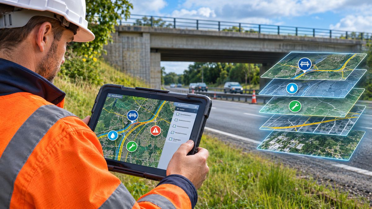
Mobile GIS allows personnel to retrieve mapped assets and associated records while on site, recording inspection findings directly against the relevant location. Depending on the application, these records can include photographs, condition assessments, equipment details and maintenance observations, with updates subsequently incorporated into enterprise systems.
Capturing information against an established asset record can help improve consistency and reduce duplicate administrative work. It can also make recent observations available to colleagues responsible for planning maintenance or assessing network condition, provided the underlying systems are connected and records are synchronised correctly.
The difficulty of getting information to field personnel extends beyond infrastructure management. Research published by Salesforce found that 61% of surveyed field service organisations reported limited access to the relevant customer information needed by mobile workers.
The research, based on responses from 2,317 field service professionals across nine countries, also found that only 16% of organisations reported having their field and back-office technology united on a single platform. Although the survey examines field service operations more broadly rather than GIS-specific infrastructure management, it offers a useful indication of how fragmented information systems can affect personnel working away from the office.
For a road maintenance team, having reliable access to previous inspection findings, repair histories and asset locations can reduce the time spent establishing the condition of a structure before work begins. Where new observations are captured digitally, the same information can become available to asset managers without being transcribed from handwritten notes or separate reports.
Managing Infrastructure Beyond Network Coverage
Mobile access introduces additional technical considerations for organisations operating across extensive or remote infrastructure networks.
Highway maintenance crews, railway inspectors and utility engineers cannot always rely on continuous connectivity. Rural locations, tunnels, underground facilities and isolated installations may provide limited mobile coverage, making applications that depend entirely on a live connection unsuitable for some operations.
Offline GIS functionality can address these conditions by allowing selected maps and asset records to be downloaded before personnel enter the field. Inspection findings and other changes can then be retained locally until a connection becomes available.
Esri’s documentation for offline data collection with ArcGIS Field Maps describes workflows for collecting and editing road and highway information while disconnected from enterprise systems. Its technical guidance also addresses the complications that can arise when route information changes between the original download and subsequent synchronisation.
Those complications are particularly relevant to linear infrastructure, where asset locations may be referenced to a route, road section or measured position rather than a standalone geographic point. Changes to the underlying network can affect how records collected offline are reconciled with the current database.
Synchronisation therefore requires more than transferring files when a device reconnects. Organisations need procedures for validating changes, handling conflicting updates and preventing information from being unintentionally overwritten, especially where several personnel may be working with related asset records.
The appropriate arrangements depend on the GIS platform, the type of infrastructure and the operational requirements of the organisation. A simple condition inspection may require relatively little information, while maintenance involving changes to network geometry or asset relationships can demand more extensive validation.
Measuring the Results of GIS Investment
Establishing whether GIS modernisation has improved infrastructure operations requires a clearer understanding of how work was undertaken before the investment.
Berry argues that organisations should identify the operational problems they want to address and establish suitable performance measures before implementation begins. This provides a basis for evaluating results against actual working practices rather than relying exclusively on project milestones, such as completing a software migration or introducing a new application.
For an infrastructure operator, relevant measures could include the time required to locate asset records, the proportion of inspections completed digitally, the number of incomplete records or the administrative effort involved in transferring field observations into maintenance systems.
A highway authority might compare how long inspectors spend preparing for routine bridge inspections before and after the introduction of mobile access. It could also examine whether improved records reduce repeat visits caused by missing information or whether maintenance findings reach planning teams more quickly.
Such assessments need care. Changes in productivity may also reflect staffing levels, inspection workloads, weather conditions, network deterioration or alterations to working procedures unrelated to the GIS platform. Establishing a credible baseline and comparing equivalent activities will provide a more useful assessment than attributing every improvement to the technology.
The financial benefits can also emerge over different periods. Reduced data entry and faster retrieval of records may produce measurable administrative savings relatively quickly, while improvements in asset condition information and long-term maintenance planning can take considerably longer to assess.
Where infrastructure owners are responsible for assets with service lives extending over several decades, the quality and continuity of information may be as important as immediate efficiency gains. However, better records should not automatically be equated with lower maintenance expenditure. Their value depends on how effectively they support the decisions that follow.
Introducing Technology Through Established Workflows
Large-scale modernisation programmes can become difficult when several established processes are changed simultaneously. Staff may be expected to learn unfamiliar applications while continuing to meet inspection schedules, respond to defects and maintain essential services.
Berry favours introducing improvements through activities that personnel already undertake, allowing the benefits and shortcomings of new systems to become apparent during normal operations.
“When teams can see a clear improvement in their day-to-day responsibilities, adoption becomes significantly easier to achieve.”
A highway maintenance organisation might begin with a single inspection workflow, allowing engineers to retrieve existing records, capture observations and submit reports through a mobile application. Testing the process with a defined group of assets would provide an opportunity to identify inaccurate information, unsuitable inspection forms, connectivity problems and unnecessary administrative steps before expanding the deployment.
This approach can also reveal differences between how a process is documented and how it actually operates. Inspectors may have developed practical methods for dealing with incomplete records, unusual assets or recurring problems that are poorly represented in existing information systems. Understanding those practices can help avoid introducing software that makes established tasks more cumbersome.
Personnel responsible for creating and using records have different requirements. An inspector may need a straightforward method of recording defects during a site visit, while an asset manager requires consistent information that can be analysed across an entire network. A system designed solely around one of those perspectives may create difficulties for the other.
Training and clear responsibilities remain important, particularly where changes made in the field become part of the permanent asset register. Users need to understand what information is required, how it should be recorded and who is responsible for correcting errors or resolving inconsistencies.
There are limits to what can be established through a small deployment. A workflow that performs well within one maintenance team may need substantial modification before it can support several asset classes or integrate with other enterprise applications. Nevertheless, phased implementation provides opportunities to resolve problems while the operational consequences remain manageable.
A More Reliable Basis for Infrastructure Decisions
Roads, bridges, pipelines and railway structures may remain in service for generations, accumulating inspection findings, maintenance histories and modifications throughout their working lives. The information used to manage them must remain understandable and accessible despite changes in technology, personnel and organisational responsibilities.
Modern GIS platforms can help maintain that continuity by connecting geographic records with the broader information required for infrastructure management. Mobile applications extend access into the field, while more consistent data structures can make it easier to compare asset condition and maintenance requirements across extensive networks.
The information still needs to be interpreted by people familiar with the infrastructure and the conditions in which it operates. A digital inspection record cannot establish whether a structural defect has been assessed correctly, and a comprehensive asset inventory does not determine which maintenance intervention should take priority when budgets are constrained.
Those judgements depend on the experience of engineers, the reliability of supporting records and the processes used to turn inspection findings into maintenance decisions.
For organisations considering further GIS investment, examining how existing information is collected and used may be a more productive starting point than evaluating another generation of software capabilities. An accurate asset record that can be retrieved, updated and relied upon throughout an infrastructure network will retain its usefulness long after the application originally used to create it has been replaced.
Key Industry Questions
- What is GIS modernisation in infrastructure asset management? GIS modernisation involves improving the geographic information systems, data structures and workflows used to manage physical infrastructure. It can include replacing legacy software, integrating databases, improving asset records and introducing mobile access for field personnel.
- How does GIS improve infrastructure maintenance? GIS connects asset locations with inspection findings, condition assessments and maintenance histories. This allows engineers and maintenance teams to retrieve relevant information geographically and record work against the correct assets.
- Why do legacy databases create problems for infrastructure owners? Historical systems often use different asset identifiers, classifications and record structures. Missing information, inaccurate locations and disconnected maintenance records can make it difficult to establish a consistent picture of infrastructure condition.
- Can mobile GIS applications work without internet access? Yes. Appropriately configured applications can provide offline access to downloaded maps and asset information, allowing personnel to collect records that are synchronised when connectivity becomes available. Capabilities vary between platforms and configurations.
- How should organisations measure the return on GIS investment? Possible measures include reduced information retrieval time, lower administrative effort, improved record completeness and faster inspection reporting. Assessments should use reliable baseline information and account for changes in operating conditions.
- How does ISO 55000 relate to GIS asset management? ISO 55000 establishes principles for managing assets and deriving value from them. GIS can support these objectives by providing geographic and operational information, although the standard does not require organisations to adopt a particular GIS platform.
- What is the difference between GIS and an enterprise asset management system? GIS primarily manages and analyses geographically referenced information, while enterprise asset management systems typically support activities such as maintenance planning, work orders and life-cycle management. Integrating the two can connect asset locations and condition records with operational maintenance processes.
- What are the main challenges of implementing mobile GIS? Common challenges include poor underlying data quality, unreliable connectivity, integration with existing systems, synchronisation conflicts, user training and ensuring that digital workflows suit field operating conditions.
- Should organisations modernise their GIS infrastructure in stages? Phased implementation can allow organisations to test applications against established workflows, resolve data problems and evaluate operational benefits before expanding deployment. The appropriate approach depends on the complexity of existing systems and the dependencies between them.
Strategic Takeaways
- Data quality determines usefulness: Investment in modern GIS platforms cannot compensate for inaccurate locations, inconsistent asset identifiers or incomplete maintenance records.
- Field operations offer measurable opportunities: Mobile access can reduce duplicate recording, simplify inspections and improve the flow of information between maintenance teams and central systems.
- Integration requires operational discipline: Offline working, synchronisation and shared asset records need clear responsibilities and appropriate data validation procedures.
- Performance improvements require evidence: Baseline measurements and comparable operating conditions are essential when assessing the financial and operational benefits of GIS investment.
- Infrastructure information must remain usable over time: Long-term asset management depends on maintaining reliable records through successive changes in technology, personnel and organisational structures.