ArcGIS is becoming increasingly important across global construction, infrastructure and industrial technology, influencing how projects are visualised, coordinated, delivered and managed over time.
Esri, the global leader in location intelligence, today announced that its partner, GPS fleet management firm Track Star, is entirely rebuilding its automatic vehicle loc...
Esri, a global leader in location intelligence, today announced the launch of the ArcGIS Field Maps mobile app. An all-in-one app that uses data-driven maps to help mobil...
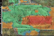
Esri has announced two major capabilities in Site Scan for ArcGIS that will enable governments and critical infrastructure organizations to meet hardware and software reg...
Esri, the global leader in location intelligence, today announced the publication of a new book by popular geographic information system (GIS) technology author Pinde Fu,...
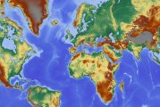
Esri, a global leader in location intelligence, today announced the acquisition of nFrames, a technology company that develops SURETM, an industry-leading imagery and lid...
Esri, the global leader in location intelligence, today announced that it will be making its software available to Women in GIS (WiGIS). The company is offering WiGIS mem...
This website uses cookies to improve your experience while you navigate through the website. Out of these, the cookies that are categorized as necessary are stored on your browser as they are essential for the working of basic functionalities of the website. We also use third-party cookies that help us analyze and understand how you use this website. These cookies will be stored in your browser only with your consent. You also have the option to opt-out of these cookies. But opting out of some of these cookies may affect your browsing experience.
Necessary cookies are absolutely essential for the website to function properly. These cookies ensure basic functionalities and security features of the website, anonymously.
Cookie
Duration
Description
cookielawinfo-checkbox-analytics
11 months
This cookie is set by GDPR Cookie Consent plugin. The cookie is used to store the user consent for the cookies in the category "Analytics".
cookielawinfo-checkbox-functional
11 months
The cookie is set by GDPR cookie consent to record the user consent for the cookies in the category "Functional".
cookielawinfo-checkbox-necessary
11 months
This cookie is set by GDPR Cookie Consent plugin. The cookies is used to store the user consent for the cookies in the category "Necessary".
cookielawinfo-checkbox-others
11 months
This cookie is set by GDPR Cookie Consent plugin. The cookie is used to store the user consent for the cookies in the category "Other.
cookielawinfo-checkbox-performance
11 months
This cookie is set by GDPR Cookie Consent plugin. The cookie is used to store the user consent for the cookies in the category "Performance".
viewed_cookie_policy
11 months
The cookie is set by the GDPR Cookie Consent plugin and is used to store whether or not user has consented to the use of cookies. It does not store any personal data.
Functional cookies help to perform certain functionalities like sharing the content of the website on social media platforms, collect feedbacks, and other third-party features.
Performance cookies are used to understand and analyze the key performance indexes of the website which helps in delivering a better user experience for the visitors.
Analytical cookies are used to understand how visitors interact with the website. These cookies help provide information on metrics the number of visitors, bounce rate, traffic source, etc.
Advertisement cookies are used to provide visitors with relevant ads and marketing campaigns. These cookies track visitors across websites and collect information to provide customized ads.