


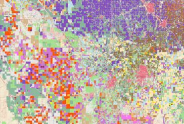
Esri updates Land-Cover Maps with new global datasets Governments and businesses across the world are ple ...
-
Esri updates Land-Cover Maps with new global datasets

Esri updates Land-Cover Maps with new global datasets
-
VertiGIS acquires EDP in Sweden to expand GIS solutions into the Nordic Market

VertiGIS acquires EDP in Sweden to expand GIS solutions into the Nordic Market
-
EyeVi Technologies to rewrite the road maintenance playbook after $2m investment

EyeVi Technologies to rewrite the road maintenance playbook after $2m investment
-
Esri’s new book helps Public Safety Agencies get started with GIS Technology

Esri’s new book helps Public Safety Agencies get started with GIS Technology
-
Esri releases guides for Location Analytics and Improving Map Aesthetics
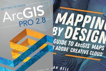
Esri releases guides for Location Analytics and Improving Map Aesthetics
-
Esri and WorldPop delivering updated Demographic Data for Policy Makers
Esri and WorldPop delivering updated Demographic Data for Policy Makers
-
Orbital Insight now integrates with Esri ArcGIS Platform

Orbital Insight now integrates with Esri ArcGIS Platform
-
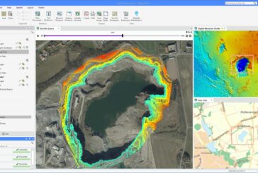
Topcon technology brings race track back to life at Porsche’s new Experience Centre

Topcon technology brings race track back to life at Porsche’s new Experience Centre
-
GIS and Digital Twins are Crucial Building Blocks for Renewing US Infrastructure

GIS and Digital Twins are Crucial Building Blocks for Renewing US Infrastructure
-
Innovation incubator Digital G and Esri China join forces on GIS AEC solutions

Innovation incubator Digital G and Esri China join forces on GIS AEC solutions
-
Esri and National League of Cities aim to reduce digital divide with Broadband pilot

Esri and National League of Cities aim to reduce digital divide with Broadband pilot
-
Hexagon HxGN Content Program now includes England, Scotland and Wales

Hexagon HxGN Content Program now includes England, Scotland and Wales
-
New MapInfo Pro release powers decision-making with critical location-based context
New MapInfo Pro release powers decision-making with critical location-based context
-
Tetra Tech awarded $49m Coastal Geospatial Contract by NOAA

Tetra Tech awarded $49m Coastal Geospatial Contract by NOAA
-
Esri helps Matanuska manage 10,000 square mile broadband network in Alaska

Esri helps Matanuska manage 10,000 square mile broadband network in Alaska
-
Esri’s new book teaches Geographic Concepts through a South American Adventure

Esri’s new book teaches Geographic Concepts through a South American Adventure
-
Esri releases new predictive Global Land Cover Map for 2050

Esri releases new predictive Global Land Cover Map for 2050
-
Esri Federal Geospatial Data now available to anyone online
Esri Federal Geospatial Data now available to anyone online
-
Bentley Systems’ Seequent acquires Aarhus GeoSoftware
Bentley Systems’ Seequent acquires Aarhus GeoSoftware
-
Esri ArcGIS Field Maps on iPhone and iPad improve mobile worker efficiency

Esri ArcGIS Field Maps on iPhone and iPad improve mobile worker efficiency