Top 5 Technologies for Preventing Underground Utility Strikes
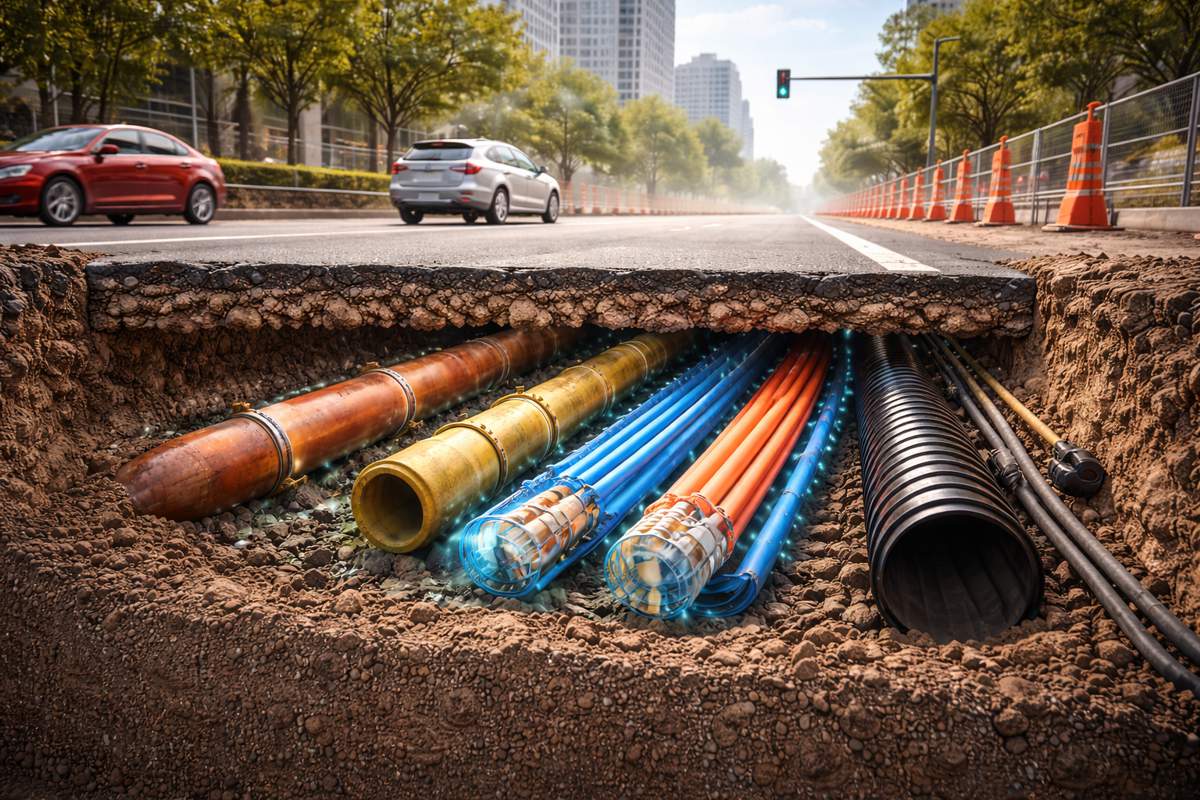
Underground utility strikes remain one of the most persistent and costly risks in construction. Despite decades of safety campaigns, improved regulations, and widespread use of pre-excavation surveys, incidents involving buried gas lines, electrical cables, fiber optics, and water mains continue to disrupt projects worldwide.
The challenge is not awareness. Most contractors understand the consequences of a strike: safety hazards, emergency shutdowns, regulatory fines, repair costs, insurance claims, schedule overruns, and reputational damage. The issue lies in the gap between planning and execution. Technologies traditionally used to detect underground utilities are heavily front-loaded, focused on what is known before excavation begins, while the majority of strikes occur during active digging, when assumptions meet reality.
Understanding Why Utility Strikes Still Happen
Before examining specific technologies, it is important to understand why underground utility strikes remain common even on well-managed projects.
Missing, Incomplete or Inaccurate Records
Many underground utilities were installed decades ago, long before modern documentation standards existed. Records may be outdated, missing, or simply wrong. Even when digital maps exist, they often represent approximations rather than precise locations.
Site Conditions Change
Utilities shift over time due to soil movement, erosion, previous construction activity, or repairs that were never properly documented. What may have been accurate may no longer reflect current conditions.
Limitations of Surface Markings
Paint markings and flags degrade quickly, are easily disturbed by weather or equipment traffic, and rely on crews correctly interpreting them throughout the project lifecycle.
Human Interpretation Under Pressure
Most detection technologies still depend on professionals and human interpretation, reading scan outputs, maps, or markings. Under tight schedules and operational pressure, misinterpretation becomes more likely.
Lack of Real-Time Feedback
Once excavation begins, most traditional detection tools are no longer active. Crews are effectively operating blind beneath the surface, relying on trust in prior data, which is often missing and unreliable.
These realities explain why prevention strategies are increasingly shifting away from static pre-project locating towards continuous, real-time awareness during excavation.
Top Technologies for Preventing Underground Utility Strikes in 2026
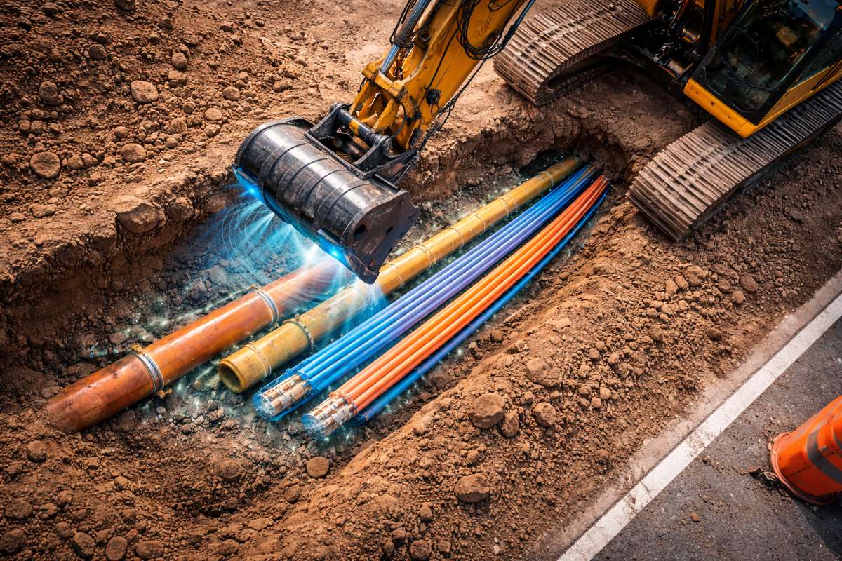
1. RodRadar – Real-Time GPR Integrated within Excavation Equipment
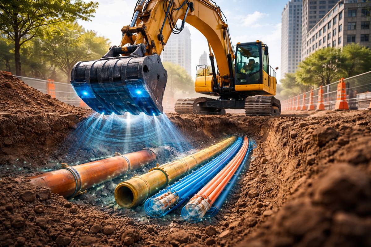
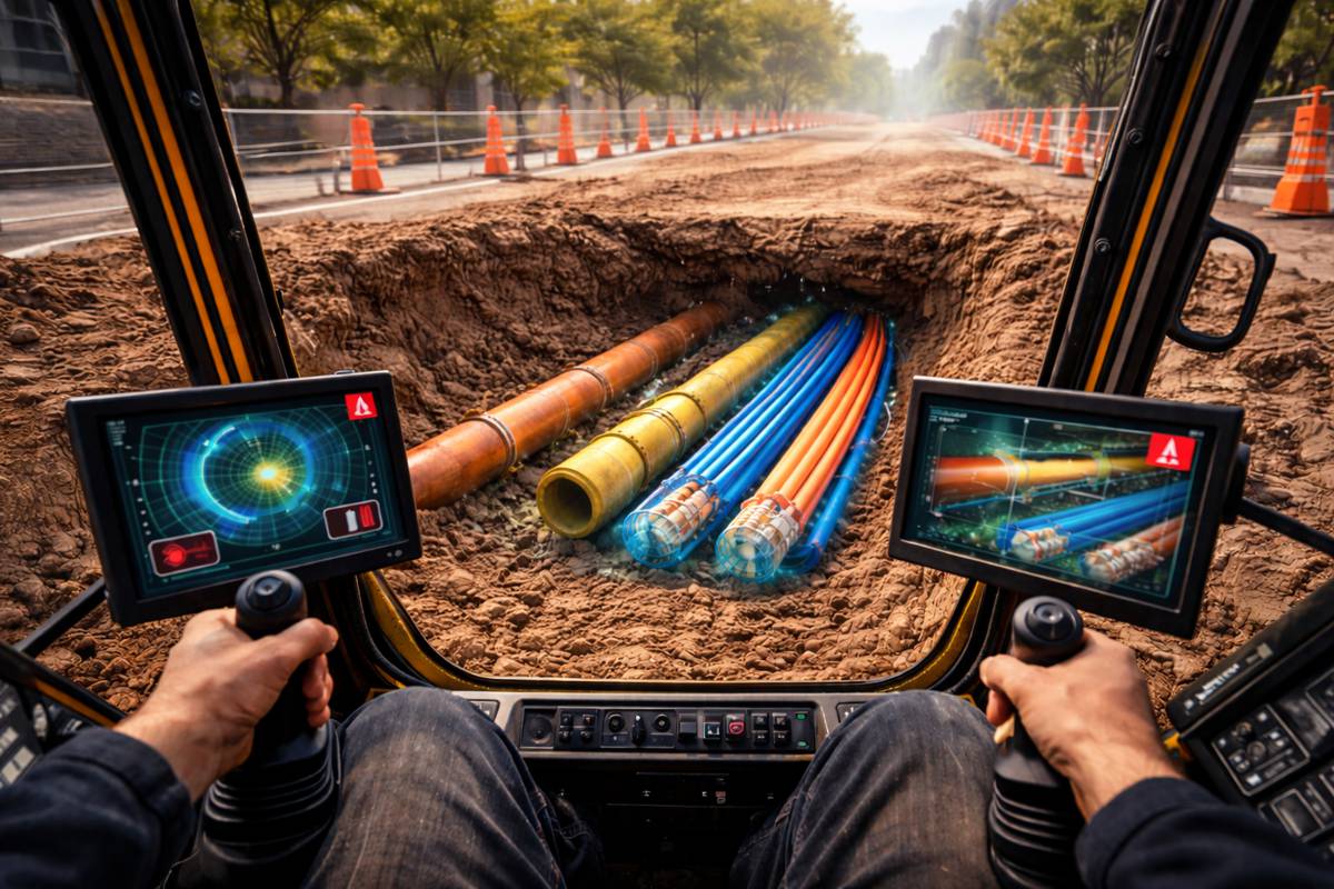
RodRadar represents the most significant shift in underground utility strike avoidance in recent years because it fundamentally changes when detection happens. Instead of limiting detection to the planning phase, using limited locating systems, RodRadar embeds its Live Dig Radar® technology directly into the excavator bucket, enabling continuous subsurface scanning while digging is actively taking place.
This distinction is critical. The highest risk of utility strikes occurs during excavation, not during planning or site surveys. RodRadar addresses this risk directly by transforming excavation equipment into an active real-time sensing and providing this risk instantly and directly to the operator at the Excavator Cab.
How It Works in Practice
RodRadar’s Live Dig Radar® sensors are mounted directly onto the excavator bucket, scanning the soil beneath the excavator bucket’s unique antennas. As the bucket approaches buried utilities, the system alerts to anomalies consistent with pipes, cables, or conduits and triggers real-time, easy-to-understand, actionable alerts for the operator.
Instead of relying on memory of markings or limited and usually unreliable utility data, the operator receives immediate alerts while digging.
2. Electromagnetic (EM) Utility Locators
Electromagnetic locators are among the most widely deployed utility detection tools worldwide. They function by inducing or detecting electromagnetic signals along conductive utilities such as metal pipes and electrical cables.
How It Works in Practice
EM systems are mostly used, capable of detecting only conductive utilities, and form the backbone of most public “call before you dig” services. They are relatively fast to deploy and well understood by field crews, but can not detect plastic and other non-metallic infrastructure.
Their strengths include:
- Good accuracy for metallic utilities
- Established workflows and standards
- Broad regulatory acceptance
3. Ground-Penetrating Radar (GPR) Pre-Excavation Surveying
Pre-excavation GPR scanning remains one of the most valuable tools for understanding subsurface conditions before digging begins. These systems are typically deployed as cart-mounted or handheld units operated by trained technicians who scan the site and interpret subsurface reflections to identify potential utilities.
How It Works in Practice
GPR is capable of detecting both metallic and non-metallic utilities, making it more versatile than electromagnetic methods. It is especially useful in environments where plastic pipes, fiber optics, or unknown installations may be present. Scan is performed during pre project only, and once completed a GPR specialist will analyze the results and generate the map of detected utilities, based on the initial scan data. [missing limitations….]
GPR also supports:
- Early identification of complex underground layouts
- Improved planning and excavation sequencing
- Reduced reliance on incomplete utility records
4. Vacuum Excavation (Soft Digging)
Vacuum excavation reduces strike risk not through detection, but through controlled soil removal. By using pressurized air or water to loosen soil and vacuum it away, utilities can be exposed without mechanical force.
How It Works in Practice
This approach is particularly useful in high-risk zones where utilities are known or suspected to exist. It allows crews to visually confirm utility locations before proceeding with mechanical excavation. Despite expensive cost, and significant investment in equipment and sludge removal.
Advantages include:
- Minimal risk of direct contact damage
- Visual confirmation of utility position
- Regulatory acceptance in sensitive zones
5. Utility Mapping with GIS and BIM Integration
Digital utility mapping platforms integrate historical records, survey data, and as-built documentation into centralized GIS or BIM systems. These tools improve coordination and long-term asset management.
How It Works in Practice
Underground utilities are notoriously difficult to document accurately. Maps often contain approximations, assumptions, or outdated and missing information. Without live validation, digital models cannot guarantee strike prevention.
When accurate, digital maps support:
- Better planning and design decisions
- Reduced rework across project phases
- Improved handover and documentation
Why Real-Time Detection Is Becoming the Industry Standard
The evolution of underground utility strike prevention mirrors trends seen in other high-risk industries. The aviation, manufacturing, and energy sectors have shifted from procedural safeguards to real-time monitoring systems that reduce reliance on human memory and assumptions.
Construction is following the same trajectory. As projects become denser, schedules tighter, and tolerance for incidents lower, technologies that provide continuous subsurface awareness during excavation are redefining best practice.
Static detection methods will continue to play an important role in planning. However, prevention strategies that end when excavation begins leave a critical gap in risk mitigation. Real-time, equipment-integrated technologies close that gap.